Block
From the record
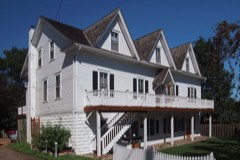
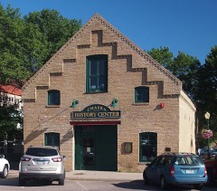
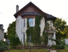
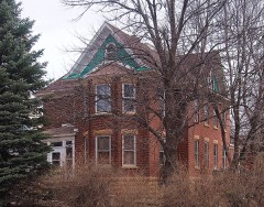
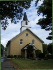
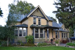
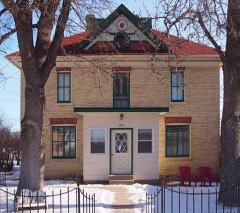
35 National Register listings published here.
Sources: the National Register database, National Park Service
44 topographic sheets cover 28 settlements here, and 35 properties are on the National Register of Historic Places.
35 National Register listings published here.
Sources: the National Register database, National Park Service
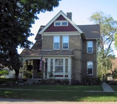
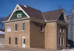
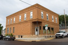
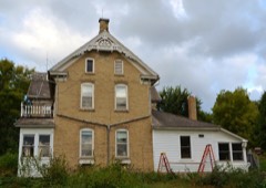
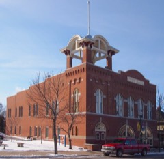
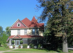
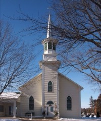
Every property in this county listed on the National Register of Historic Places, with the year it was listed and the federal nomination document.
Every wildfire the federal occurrence database records inside this county: 12 of them, burning about 391 acres. 2 started naturally and none was recorded as arson. Each settlement page carries the fires within five miles of it.
| Reported cause | Fires |
|---|---|
| Recreation and ceremony | 6 |
| Equipment and vehicle use | 4 |
| Natural | 2 |
The five largest, by the area the report gives. None of them was recorded as arson.
| Date | Cause | Size | Reported by | Name on the report |
|---|---|---|---|---|
| 20 October 2003 | Equipment and vehicle use | 200 acres | Minnesota Department of Natural Resources | BENTON TOWNSHIP FIRE |
| 11 April 2010 | Recreation and ceremony | 85 acres | Minnesota Department of Natural Resources | not named |
| 25 November 2007 | Equipment and vehicle use | 52 acres | Minnesota Department of Natural Resources | not named |
| 2 October 2006 | Equipment and vehicle use | 52 acres | Minnesota Department of Natural Resources | not named |
| 12 August 2004 | Recreation and ceremony | 1.0 acres | Minnesota Valley National Wildlife Refuge | RAPIDS LAKE 1 |
| 25 May 2012 | Natural | under an acre | Minnesota Valley National Wildlife Refuge | CHASKA |
| 21 August 2008 | Recreation and ceremony | under an acre | Minnesota Valley National Wildlife Refuge | RAPIDS |
| 12 July 2014 | Equipment and vehicle use | under an acre | Minnesota Valley National Wildlife Refuge | CARVER CREEK FIRE |
Every settlement page carries the fires within five miles of it - see the settlement index below.
The NOAA Storm Events Database holds 480 reports for this county, causing 3 deaths, 191 injuries and about $122,970,530 in recorded property damage. Each settlement page carries the reports that name it.
| Kind of event | Reports |
|---|---|
| Thunderstorm Wind | 199 |
| Hail | 191 |
| Heavy Rain | 27 |
| Tornado | 26 |
| Flash Flood | 17 |
| Funnel Cloud | 9 |
| Flood | 7 |
| Lightning | 4 |
The most serious of them, by death, then injury, then recorded damage. The accounts are quoted exactly as the forecast office filed them.
| When | Event | Place named | Harm | What the report says |
|---|---|---|---|---|
| May 1965 | Tornado (F4) | not stated | 3 killed, 87 hurt, $25,000,000 | no account filed |
| May 1965 | Tornado (F2) | not stated | 100 hurt, $25,000,000 | no account filed |
| May 1998 | Thunderstorm Wind | Chaska | 2 hurt, $9,200,000 | Roof torn off building injuring 2. South wall of building center blown out. Damage estimate for entire county. Estimated windspeed. |
| June 1999 | Lightning | Carver | 1 hurt | Man slightly injured by bolt, taken to local hospital for observation. |
| July 1997 | Thunderstorm Wind | Young America | 1 hurt | Barn collapse. Trailer home moved 20 feet. Woman inside trailer received minor injuries. Numerous trees down. Estimated windspeed. |
| May 1965 | Tornado (F4) | not stated | $25,000,000 | no account filed |
| June 2001 | Hail | Waconia | $15,000,000 | Fell on the north side of Lake Waconia. Damage total is for all wind and hail damages in Carver County between 1620 and 1640. |
| June 2014 | Flood | Chanhassen | $9,200,000 | Several sources in Carver County compiled a summary of flood related damages and locations for the flood of June 2014. More than 30 local and county roads were closed due to flooding, including the communities of Chaska, Mayer, Hollywood, Camden, Dahlgren, Young America, Laketown and Watertown. ||The Spring Creek levee failed in Carver. It caused significant mud slides affecting five private properties. In Cologne, 3 private residents had basement flooding. In Victoria, 6-8 homes had flooded basements. In Waconia, 4 homes had flooded basements. ||There were numerous county parks closed and several area lakes had no wake zones due to high water levels. ||During the height of the flooding, all river crossings along the Minnesota River were closed. |
| May 1998 | Thunderstorm Wind | Victoria | $5,000,000 | Windows broken. Trees blown down. Partial structural damage to building. Scattered areas damaged to wind driven hail. Estimated windspeed. Damage estimate for entire county. |
| June 1983 | Tornado (F1) | not stated | $2,500,000 | no account filed |
| June 1983 | Tornado (F1) | not stated | $2,500,000 | no account filed |
| July 2010 | Hail | Watertown | $1,500,000 | Several trained spotters reported numerous dime, up to baseball size hail from north of Watertown, southeast to the southeast part of Watertown. Damage was extensive to crops and homes throughout the area. |
| August 2020 | Hail | Victoria | $500,000 | Numerous sources from social media pictures, to trained spotters and official NWS observations, reported and measured very large hail for nearly 40 minutes from Victoria, eastward to the Carver, Hennepin County line. This includes some of the smaller communities between the two towns. ||The largest hailstone was measured at 2.75 inches in diameter and fell near Victoria. Two inch hail was measured at the NWS office. Due to the large hail size and almost a continuous line of storms redeveloping in the same areas, many roofs and cars were damaged. |
| May 2001 | Hail | Chanhassen | $500,000 | Dozens of homes and vehicles damaged. |
| June 2012 | Thunderstorm Wind | New Germany | $300,000 | North of the city of New Germany, severe straight-line winds caused damage to five sheds, with two completely destroyed. In addition, three corn bins were damaged, one turned over, one was wrapped around a tree, and one damaged by another falling on it. |
| July 2015 | Tornado (EF1) | New Germany | $250,000 | A storm survey indicated that an EF-1 tornado touched down in Hollywood Township in Carver County. The tornado spun up seven miles west-southwest of Watertown and continued east-northeast to two miles west-southwest of Watertown. The most damage occurred as the tornado crossed Vega Avenue where numerous trees were snapped and some minor structural damage was found. An apple orchard was also damaged with this tornado. There was a private weather station that measured a 99 mph wind gust before it blew off the roof. The path length was 5.1 miles long with a maximum wind speed of 105 mph. |
| July 2011 | Thunderstorm Wind | New Germany | $250,000 | One half of a large barn was blown down southwest of New Germany, between County Road 30 and 33. In addition, several large trees were blown down near the same area. |
| March 2010 | Flood | East Union | $240,000 | Flood waters along the Minnesota River near Jordan, closed the bridge on Old County Road 45, or County Road 9. Monetary costs were based on FEMA, State, and Local assistance which includes the following categories; debris removal, emergency protective measures, road systems and bridges, water control facilities, and parks. |
| August 2017 | Lightning | Victoria | $200,000 | A home in Chanhassen, Minnesota was severely damaged after a fire broke out in the attic. It was caused by a lightning strike and happened on the 4000 block of Leslie Curve just before 12:30 a.m. LST. Fire officials said the heavy rain made it difficult to put the fire out. No one was hurt. |
| July 2015 | Thunderstorm Wind | Waconia | $100,000 | A severe squall line that moved from east to northeast across northern Carver County produced a significant swath of tree and power line damage across the city of Waconia. Several of the trees were over 12 inches in diameter. One tree landed on a car and destroyed it. Due to the significant damage to power lines, the power in Waconia was out for several hours. |
| July 2015 | Thunderstorm Wind | New Germany | $100,000 | A roof was blown off a house on Vega Avenue, south of New Germany. |
| June 2013 | Flash Flood | New Germany | $100,000 | Several county roads in Hollywood, Camden, and Watertown Townships were closed due to flood waters running over the roadways. Many of these roads remained closed for several days due to repairs. |
| June 2002 | Flash Flood | Northwest Portion | $100,000 | Four to six inches of rain closed numerous roads, including State Highway 25 2 miles northwest of Watertown. This highway, and ten other county and township roads, were closed several days for repairs. Mapes Creek in Watertown flooded, resulting in numerous flooded basements in the Ortloff Addition. Two other cities in northwest carver County that were hit with flooding include New Germany and Hamburg. |
| August 2012 | Tornado (EF0) | Norwood | $62,000 | A weak tornado touched down and moved northeast for a little more than one mile to 44.81784W, 93.97340N. It then turned slightly and moved east-northeast until dissipation. Corn and several dozen trees were damaged as the tornado mostly moved over fields. An old barn along County Road 33 was blown down, killing 12 cows. |
| August 2020 | Tornado (EF0) | Waconia | $50,000 | An NWS Survey indicated a brief EF-0, which was also observed by people nearby. The tornado touched down just off shore on the western edge of Reitz Lake, and moved inland. It caused damage to a boat lift, boat, and several trees before dissipating just north of Airport Road. |
| May 2015 | Hail | Chanhassen | $40,000 | Two inch diameter hail was reported just south of the National Weather Service Office and produced siding damage. After a survey of the houses, approximately 5-10 homes sustained minor damage. |
| April 2002 | Thunderstorm Wind | Waconia | $35,000 | Roof of old city hall partially peeled back. Few trees down. |
| May 2022 | Thunderstorm Wind | Cologne | $25,000 | There were multiple trees and power lines blown down near Cologne. |
| September 2019 | Tornado (EF0) | Watertown | $25,000 | A NWS Storm Survey determined an EF0 tornado developed east of Watertown near County Road 20, and moved southeast into Hennepin County, north of Timber Creek Golf Course. Most of the damage was consistent with EF0 damage with numerous trees blown down or uprooted along its path. The path length in Carver County was 1.3 miles, with a maximum width of 90 yards. The tornado was also confirmed by the MPX radar in real time given the Tornado Debris Signature sampled by the radar. |
| May 2018 | Thunderstorm Wind | Watertown | $25,000 | A roof was blown off a barn west of Watertown. In addition, several trees and power lines were blown down in Watertown. One power pole was blown down on a car and damaged it. |
| March 2012 | Thunderstorm Wind | Carver | $25,000 | Severe wind gusts caused a roof of a gas station to blow down in Carver, Minnesota. The damage was confined to gas pumps and a metal roof. |
| June 2012 | Thunderstorm Wind | Norwood | $25,000 | Numerous large trees were uprooted. |
| August 1988 | Tornado (F0) | not stated | $25,000 | no account filed |
| May 1985 | Tornado (F1) | not stated | $25,000 | no account filed |
| August 2021 | Thunderstorm Wind | Victoria | $20,000 | A pontoon boat was flipped over and docks were damaged on Lake Minnewashta. In addition, several large trees were blown down. |
| May 2022 | Thunderstorm Wind | Chanhassen | $10,000 | There were several trees and power lines blown down in Chanhassen. |
| August 2022 | Thunderstorm Wind | Norwood Young America | $5,000 | Several large trees were blown down in the Norwood, Young America area. |
| May 2022 | Thunderstorm Wind | Mayer | $5,000 | Roof damage in Mayer was noted on a social media post. |
| July 2019 | Thunderstorm Wind | Norwood Young America | $5,000 | A large tree was blown over, and fell onto an apartment building causing some structural damage in Norwood/Young America. |
| August 2016 | Thunderstorm Wind | Norwood Young America | $5,000 | There were several trees blown down, two on power lines, and one on a cable/telephone line. The debris was blocking two streets in Norwood Young America. |
| June 2010 | Thunderstorm Wind | Chanhassen | $5,000 | A power pole was blown down near the Junction of County Road 61, and Stoughton Avenue in Chanhassen, Minnesota. |
| June 1968 | Tornado (F0) | not stated | $2,500 | no account filed |
| May 1964 | Tornado (F0) | not stated | $2,500 | no account filed |
| August 2021 | Thunderstorm Wind | Waconia | $2,000 | A 12 inch diameter tree was snapped at its base north of Waconia. |
| July 2013 | Thunderstorm Wind | Norwood Young America | $2,000 | Power poles were blown down near Highway 5 and Tacoma Avenue. |
| June 2012 | Thunderstorm Wind | Bongards | $2,000 | Several large tree limbs were blown down, one caused damage to a telephone pole. |
| August 2021 | Thunderstorm Wind | Chanhassen | $1,000 | There was a social media picture of a large tree that was snapped near the Chanhassen library. |
| May 2012 | Flash Flood | Young America | $1,000 | Two rounds of heavy rainfall caused a culvert on Salem Avenue, one half mile south of Highway 212 to washout and close for a period of time. |
| August 2022 | Thunderstorm Wind | Victoria | $500 | Several large tree branches were blown down around Victoria. |
| June 1983 | Tornado (F0) | not stated | $30 | no account filed |
| August 2025 | Hail | Victoria | - | Hail was continuous for roughly 3 minutes and the average size of the hail was 1 inch in diameter. The largest hail stone was 1.25 inches in diameter. |
| June 2025 | Hail | Waconia | - | NWS Employee reported half dollar sized hail in Waconia. |
| June 2025 | Hail | Victoria | - | A lot of hail up to ping pong size in Victoria. |
| June 2025 | Hail | Waconia | - | NWS employee reported 3.25 inch hail in Waconia. |
| July 2025 | Thunderstorm Wind | Mayer | - | Report of a 12-inch diameter tree snapped at the base. A MNDOT RWIS station located one mile to the NE of the storm report site recorded a 60-mph wind gust. |
| July 2025 | Thunderstorm Wind | Waconia | - | A thunderstorm wind gust knocked a tree down just north of Hwy 5 on the east side of Waconia. |
| July 2025 | Thunderstorm Wind | Waconia | - | Report of a large tree down at the Carver County Fairgrounds. |
| June 2025 | Tornado (EF0) | Assumption | - | A shed and an old barn collapsed. Many dozens of trees were broken. The maximum estimated wind speed was 80 mph. |
| June 2025 | Tornado (EF0) | Bongards | - | The tornado mostly crossed fields, but did hit a couple stands of trees, breaking large branches. The maximum estimated wind speed was 70 mph. |
| June 2025 | Tornado (EF0) | Bongards | - | This tornado broke or uprooted dozens of trees. It hit one farm, damaging several outbuildings. Roof panels were removed, the door was blown off a large shed, and other damage was noted per drone imagery. The drone imagery also helped indicate the location of some of the tree damage. An old barn also collapsed. The start of the tornado was estimated based on a distant view from drone video. The maximum estimated wind speed was 85 mph. |
The Survey's mineral resources record lists 2 workings inside this county. 1 still produces and 1 is closed or unrecorded. Each settlement page carries the workings within five miles of it.
| Commodity | Workings |
|---|---|
| Sand and Gravel, Construction | 1 |
| Clay | 1 |
The least common of them first, because a county's hundredth gravel pit says nothing its first ten did not.
| Where | Site | Commodity | Status | Recorded |
|---|---|---|---|---|
| Carver County Clay Deposit | Clay | Occurrence | ||
| Mueller Sand and Gravel Pit No 1 | Sand and Gravel, Construction | Producer |
Named settlements recorded in the Geographic Names Information System, each with the topographic sheets covering it. Villages, hamlets and abandoned places alike. Each is shown with the nearest named watercourse or landform and the survey quadrangle it falls on.
Dahlgren township · 55315 · On Silver Creek · Jordan West quadrangle
11 sheets, 1953 to 1985
Young America township · 55368 · Norwood quadrangle
11 sheets, 1953 to 1985
No longer a settlement
Young America township · 55397 · Norwood quadrangle
11 sheets, 1953 to 1985
No longer a settlement
The vanished settlements of Carver County: the places named above that are no longer on the map.