 Block
Amiret, Minnesota
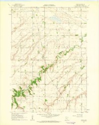
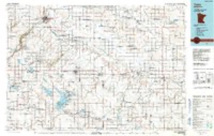
9 topographic sheets cover this place, the earliest surveyed in 1953 and the latest in 1986. It stands in Amiret Township. It lies in ZIP code area 56175. The Survey maps it on the Amiret quadrangle. It stands 1,273 feet above sea level.
Topographic sheets covering this place
6 surveys from 9 printed sheetsMatched by testing this settlement's coordinate against the published boundary of every sheet in the United States Geological Survey's historical collection. Each opens the scanned sheet at the Survey.
- 1953 USGS New Ulm quadrangle1:250000, 3 printings
- 1957 USGS New Ulm quadrangle1:250000
- 1958 USGS New Ulm quadrangle1:250000
- 1962 USGS Amiret quadrangle1:24000
- 1967 USGS New Ulm quadrangle1:250000
- 1986 USGS Tracy quadrangle1:100000, 2 printings




In the county-history sources
5,123 words on this townshipAn Illustrated History of Lyon County, Minnesota, published 1912 names this settlement in its chapter on Amiret Township. These are the passages that mention it, exactly as the scans read.
The township which is now designated Amiret dates its existence from March 17. 1S74. when the County Board, upon the petition of Horace N. Randall and others, authorized its citizens to organize. For several years the precinct bore the name Madison, but in 1879, by legislative act. its name was changed to Amiret, to correspond with the name of the village within its boundaries.29 The first town meeting was held at the store of William Coburn April 7. 1874. S. S. Truax, J. H. Williams and H. N. Randall were judges of the election then held and William Coburn was clerk.
Passage source: An Illustrated History of Lyon County, Minnesota, published 1912.
A compact, neat appearing little village is Amiret, twelve miles southeast of Marshall on the Northwestern railroad. It is on the northeast quarter of section 19. Amiret township. Here are grouped a number of stores, shops and elevators, enterprises that go to make up a trading point for the convenience of the surrounding farmingpopulation.
Passage source: An Illustrated History of Lyon County, Minnesota, published 1912.
The plans of the railroad company regarding the location of a station in the vicinity of the future village of Amiret were rather indefinite. A sidetrack for the unloading of supplies was laid in 1872, when the railroad was being constructed, on the S. S. Truax farm, the northwest quarter of section 32, about a mile and a half from the present village. There seems to have been the promise that a station would be located farther north, for in the late summer of 1S72 William Coburn erected a store building there and engaged in business. Within a very short time he moved the building to Saratoga Station (section 32). In July, 1872, a postoffice, named Coburg in honor of the pioneer storekeeper, was established with Mr. Coburn as postmaster.25
Passage source: An Illustrated History of Lyon County, Minnesota, published 1912.
Machine-read from a century-old scan, so expect the errors a machine makes: misspelled names, dropped words, stray characters.
Read the whole chapter on Amiret Township - it names this place 11 more 11 times.
Fires near this place
1 since 2012Regional context, not property-specific evidence. The federal wildfire occurrence database lists 1 fire within 5 miles of Amiret in 2012, burning about 30 acres in total. None started naturally. 1 was recorded as arson. Distance is straight-line from the map coordinates, so a fire counted here may appear on a neighbouring settlement's page as well.
| Reported cause | Fires |
|---|---|
| Arson/incendiarism | 1 |
The most recent of them, most recent first, with the day each was reported and the service that recorded it.
| Date | Cause | Size | Reported by | Name on the report |
|---|---|---|---|---|
| 4 December 2012 | Arson/incendiarism | 30 acres | Minnesota Department of Natural Resources | not named |
Settlements close enough to share some of these fires:
Storms near this place
17 since 2002Regional context, not property-specific evidence. The National Weather Service names Amiret in 17 storm reports between 2002 and 2022: 12 hail, 4 thunderstorm wind, 1 tornado. No death or injury is recorded in these reports. Each account below is quoted exactly as the forecast office filed it, from the NOAA Storm Events Database, and each date opens the federal record of that event.
| When | Event | Place named | Harm | What the report says |
|---|---|---|---|---|
| July 2011 | Thunderstorm Wind | Amiret | $200,000 | Thunderstorm winds damaged several homes and at least one barn, including parts of roofs torn off and shingles blown away. The winds also caused widespread tree damage, including trees up to 2 1/2 feet in diameter snapped off. Additional damage was done to roofs and siding of homes and other structures by falling trees and tree debris. Several grain bins were destroyed. The winds blew down power poles and lines, causing a power outage. |
| August 2022 | Hail | Amiret | - | Crop damage is an estimate from insured losses. Information provided by the United States Department of Agriculture. |
| June 2016 | Thunderstorm Wind | Amiret | - | Thunderstorm winds damaged the top of a grain elevator. |
| June 2013 | Tornado (EF0) | Amiret | - | A brief tornado caused no reported damage. |
| May 2012 | Hail | Amiret | - | Hail was accompanied by estimated 40 mph wind gusts. |
| June 2012 | Hail | Amiret | - | Large hail caused an unknown amount of crop damage. The hail was driven by estimated 60 mph wind gusts. |
| June 2012 | Thunderstorm Wind | Amiret | - | Thunderstorm winds caused tree damage. The winds were accompanied by large hail. |
| June 2017 | Hail | Amiret | - | no account filed |
| June 2017 | Hail | Amiret | - | no account filed |
| July 2010 | Hail | Amiret | - | no account filed |
| July 2010 | Hail | Amiret | - | no account filed |
| July 2010 | Hail | Amiret | - | no account filed |
| May 2002 | Hail | Amiret | - | no account filed |
| May 2002 | Hail | Amiret | - | no account filed |
| May 2002 | Thunderstorm Wind | Amiret | - | no account filed |
| May 2002 | Hail | Amiret | - | no account filed |
| July 2002 | Hail | Amiret | - | no account filed |
Nearest settlements
The eight closest, with where each one stands in the county. Distances are straight-line, computed from the Geographic Names Information System coordinates.
| Map | Place | Distance | Sheets |
|---|---|---|---|
| Tracy | 7.1 miles | 9 | |
| Dudley | 7.5 miles | 10 | |
| Garvin | 7.7 miles | 10 | |
| Village Park | 9.0 miles | 11 | |
| Garvin Park | 10.2 miles | 11 | |
| Marshall | 10.2 miles | 11 | |
| Balaton | 10.9 miles | 10 | |
| Lynd | 11.3 miles | 9 |
Elsewhere
Matched on this settlement's Geographic Names Information System number rather than its name, so it cannot be a different place of the same name in another state.
| Wikipedia article on Amiret | An encyclopaedic summary. Its text is share-alike, so it is linked here rather than copied. |
| Wikidata item Q19600160 | The structured record the population and elevation above come from. Public domain (CC0). |
Provenance
This settlement is recorded in the Geographic Names Information System as feature 639330. The sheet list is computed by point-in-boundary test against the United States Geological Survey's historical topographic inventory. Both are works of the United States government and carry no copyright under 17 U.S.C. 105.
Wildfire. Short, Karen C. 2022. Spatial wildfire occurrence data for the United States, 1992-2020 [FPA_FOD_20221014]. 6th Edition. Fort Collins, CO: Forest Service Research Data Archive. https://doi.org/10.2737/RDS-2013-0009.6 Collected with United States Government funding and usable without additional permissions or fees.
Storms. NOAA National Centers for Environmental Information, Storm Events Database https://www.ncei.noaa.gov/stormevents/ A work of the United States government, no copyright under 17 U.S.C. 105. Narratives are quoted verbatim from the National Weather Service report and are not edited or summarised.