 Block
Tracy, Minnesota
9 topographic sheets cover this place, the earliest surveyed in 1953 and the latest in 1986. It stands in Tracy City. It lies in ZIP code area 56175. The Survey maps it on the Tracy East quadrangle. 2,076 people lived here at the 2020 count. It stands 1,391 feet above sea level.
On record in Tracy
Buildings and businesses the archive holds for this place. Each opens its own page, with the source record it came from.
On the National Register 2 records
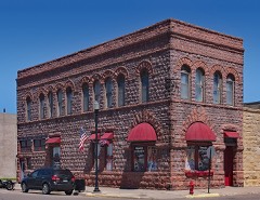 First National Banklisted 1982
- Tracy Municipal Building and Armorylisted 2023
Population over time
2 figuresTracy fell from 2,163 to 2,076 between 2010 and 2020. These are the recorded population figures Wikidata holds for this place, reached through the Geographic Names Information System number this page is keyed on rather than by name, so they belong to this place and not to another of the same name. Most are census counts, but not all are: an early figure may be a founding or settlement estimate, and an estimate published within five years of a census is left out. The change column is computed, and is left blank where more than 20 years separate a figure from the one before it, because a gap that long is not a change between two counts.
| Year | People | Change |
|---|---|---|
| 2010 | 2,163 | |
| 2020 | 2,076 | -87 (-4%) |
Topographic sheets covering this place
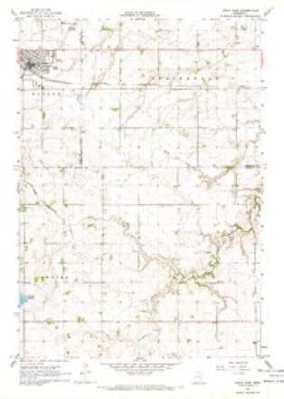
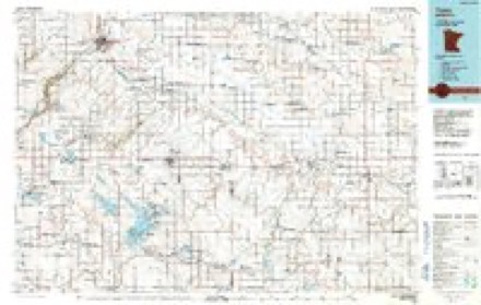
6 surveys from 9 printed sheetsMatched by testing this settlement's coordinate against the published boundary of every sheet in the United States Geological Survey's historical collection. Each opens the scanned sheet at the Survey.
- 1953 USGS New Ulm quadrangle1:250000, 3 printings
- 1957 USGS New Ulm quadrangle1:250000
- 1958 USGS New Ulm quadrangle1:250000
- 1967 USGS New Ulm quadrangle1:250000
- 1967 USGS Tracy East quadrangle1:24000
- 1986 USGS Tracy quadrangle1:100000, 2 printings




In the county-history sources
7,513 words on this townshipAn Illustrated History of Lyon County, Minnesota, published 1912 names this settlement in its chapter on Tracy City. These are the passages that mention it, exactly as the scans read.
Tracy is a prosperous and progressive city and presents an attractive appearance. It has broad streets, lined with substantial business houses and handsome residences. As a business point Tracy takes high rank, because of its favorable location as regards trade territory. All the improvements to be found in Minnesota towns of its size are in Tracy. It has an excellent waterworks system, electric light plant, good schools and churches.
Passage source: An Illustrated History of Lyon County, Minnesota, published 1912.
While Tracy was not founded until 1875, we may go back of that date several years to get at the beginning of its history. When the Winona & St. Peter railroad was constructed in 1872 there was apparently no thought of planting a village where Tracy was later built, and the only station established in Lyon county at that time was Marshall. But a country postoffice named Summit (which the Tracy office succeeded) was located on the line of the road just over the line in Redwood county, one and one-half miles east of the future city, of Tracy. The office was established in 1872 and Levi Montgomery was the postmaster, conducting it at his farm home. Summit postoffice was operated there until moved to Tracy in the spring of 1875.
Passage source: An Illustrated History of Lyon County, Minnesota, published 1912.
During the first half of the seventies quite a number of homesteaders located in Monroe township and there was also quite a flourishing settlement on Lake Shetek, only a short distance south of the site of Tracy. In the spring of 1875 the Winona & St. Peter Railroad Company, which had come into possession of section 23 by grant, laid out the village and named it Tracy, in honor of a director of the Chicago & Northwestern Railroad Company.
Passage source: An Illustrated History of Lyon County, Minnesota, published 1912.
Machine-read from a century-old scan, so expect the errors a machine makes: misspelled names, dropped words, stray characters.
Read the whole chapter on Tracy City - it names this place 58 more 58 times.
Storms near this place
25 since 1999Regional context, not property-specific evidence. The National Weather Service names Tracy in 25 storm reports between 1999 and 2025: 11 hail, 7 thunderstorm wind, 4 flash flood, 2 lightning. No death or injury is recorded in these reports. Each account below is quoted exactly as the forecast office filed it, from the NOAA Storm Events Database, and each date opens the federal record of that event.
| When | Event | Place named | Harm | What the report says |
|---|---|---|---|---|
| April 2002 | Thunderstorm Wind | Tracy | $20,000 | Thunderstorm winds caused tree and roof damage. |
| June 2001 | Thunderstorm Wind | Tracy | $10,000 | Thunderstorm winds destroyed a store front. |
| August 2000 | Lightning | Tracy | $5,000 | Lightning struck an electrical pole at a car dealership, starting a small fire in the electrical meter. The lightning also caused slight damage to an adjoining grocery store. |
| July 1999 | Hail | Tracy | $5,000 | no account filed |
| September 2005 | Lightning | Tracy | $1,000 | Lightning struck a transformer at the back of a food store, causing a local power outage which lasted for 10 hours. Volunteers moved perishable refrigerated and frozen food into ice trucks and a freezer trailer, avoiding spoilage of over $100,000 worth of food. |
| August 2025 | Thunderstorm Wind | Tracy | - | Six to eight inch diameter tree limbs downed by thunderstorm winds. |
| August 2025 | Flash Flood | Tracy | - | Widespread flooding occurred in Tracy between Rowland Street and Front Street and from S 1st Street to S 4th Street, which required pumping of water. |
| October 2023 | Hail | Tracy | - | The ground was covered by nickel to quarter size hail. |
| July 2018 | Flash Flood | Tracy | - | Significant water reported over roads and into yards. Report received via social media. Rainfall of 5.77 inches was reported in Tracy. |
| June 2016 | Thunderstorm Wind | Tracy | - | Thunderstorm winds caused tree damage, including a large tree blown down. |
| July 2016 | Flash Flood | Tracy | - | Heavy rain caused flash flooding of streets, forcing the fire department to barricade the flooded streets. |
| August 2010 | Thunderstorm Wind | Tracy | - | Thunderstorm winds caused tree damage, including several branches blown down. |
| August 2010 | Thunderstorm Wind | Tracy | - | Thunderstorm winds caused tree damage, including several branches blown down. |
| June 2007 | Tornado (EF0) | Tracy | - | A tornado caused no reported damage as it moved northwest for about a half mile in open country. The tornado was photographed from a position several miles to the west. |
| June 2005 | Flash Flood | Tracy | - | Heavy rain caused flooding of numerous roads. |
| September 2005 | Hail | Tracy | - | Large hail covered the ground. |
| July 2002 | Thunderstorm Wind | Tracy | - | Thunderstorm winds caused tree damage, including branches blown down. |
| July 2002 | Hail | Tracy | - | Large hail caused an unknown amount of crop damage. |
| August 2023 | Hail | Tracy | - | no account filed |
| May 2022 | Hail | Tracy | - | no account filed |
| May 2012 | Hail | Tracy | - | no account filed |
| May 2012 | Hail | Tracy | - | no account filed |
| June 2011 | Hail | Tracy | - | no account filed |
| July 2002 | Hail | Tracy | - | no account filed |
| July 2002 | Hail | Tracy | - | no account filed |
Nearest settlements
The eight closest, with where each one stands in the county. Distances are straight-line, computed from the Geographic Names Information System coordinates.
| Map | Place | Distance | Sheets |
|---|---|---|---|
| Amiret | 7.1 miles | 9 | |
| Garvin | 7.4 miles | 10 | |
| Balaton | 13.4 miles | 10 | |
| Dudley | 13.8 miles | 10 | |
| Village Park | 16.1 miles | 11 | |
| Garvin Park | 17.2 miles | 11 | |
| Marshall | 17.3 miles | 11 | |
| Lynd | 17.8 miles | 9 |
Elsewhere
Matched on this settlement's Geographic Names Information System number rather than its name, so it cannot be a different place of the same name in another state.
| Wikipedia article on Tracy | An encyclopaedic summary. Its text is share-alike, so it is linked here rather than copied. |
| Wikidata item Q1924419 | The structured record the population and elevation above come from. Public domain (CC0). |
Provenance
This settlement is recorded in the Geographic Names Information System as feature 653262. The sheet list is computed by point-in-boundary test against the United States Geological Survey's historical topographic inventory. Both are works of the United States government and carry no copyright under 17 U.S.C. 105.
Storms. NOAA National Centers for Environmental Information, Storm Events Database https://www.ncei.noaa.gov/stormevents/ A work of the United States government, no copyright under 17 U.S.C. 105. Narratives are quoted verbatim from the National Weather Service report and are not edited or summarised.