 Block
Bechyn, Minnesota
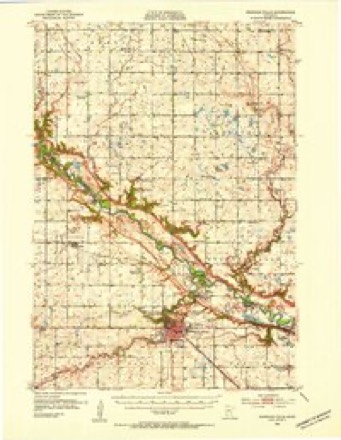
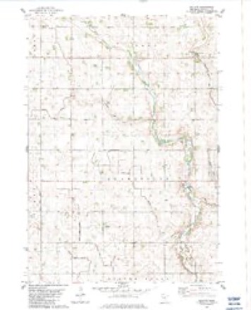
11 topographic sheets cover this place, the earliest surveyed in 1952 and the latest in 1986. It stands in Henryville Township. It lies in ZIP code area 56283. The Survey maps it on the Bechyn quadrangle. It stands 1,063 feet above sea level.
Topographic sheets covering this place
7 surveys from 11 printed sheetsMatched by testing this settlement's coordinate against the published boundary of every sheet in the United States Geological Survey's historical collection. Each opens the scanned sheet at the Survey.
- 1952 USGS Redwood Falls quadrangle1:62500, 2 printings
- 1953 USGS New Ulm quadrangle1:250000, 3 printings
- 1957 USGS New Ulm quadrangle1:250000
- 1958 USGS New Ulm quadrangle1:250000
- 1967 USGS New Ulm quadrangle1:250000
- 1983 USGS Bechyn quadrangle1:24000
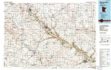
- 1986 USGS Montevideo quadrangle1:100000, 2 printings




In the county-history sources
4,677 words on this townshipThe History of Renville County, Minnesota, published 1916 names this settlement in its chapter on Henryville Township. These are the passages that mention it, exactly as the scans read.
Henryville township embraces township 114-35. It is bounded on the north by Troy township, on the east by Norfolk township, on the south by Beaver Falls township, and on the west by Flora township. The hamlet of Bechyn is included within its boundaries and is located in the southwestern part.
Passage source: The History of Renville County, Minnesota, published 1916.
Henryville township was organized March 16, 1871, and the first election held March 28, 1871, at the home of Robert Nicholson. The following officers were chosen: Supervisors. John Swoboda (chairman), James Holden and F. M. Carlson; clerk and assessor, T. H. Barkey; treasurer, L. G. Moore: justices. Joseph Sharp and James Greeley; constables, Henry Seely and David Smith; overseers of roads, James Holden and F. M. Carlson. The present officers are: Supervisors, Charles W. Chroup (chairman). Frank Trochlil and Fred W. Kugelin; clerk, Lloyd Trochlil. The town meetings are held at the village of Bechyn.
Passage source: The History of Renville County, Minnesota, published 1916.
Machine-read from a century-old scan, so expect the errors a machine makes: misspelled names, dropped words, stray characters.
Mines and quarries near this place
3 within 5 milesRegional context, not property-specific evidence. The federal mineral resources record lists 3 workings within 5 miles of Bechyn: 2 producers, 1 occurrence. 2 still produce. What was taken out: Sand and Gravel, Construction, Aluminum, Iron, Silica, Titanium, Water, Free. Distance is straight-line from the map coordinates, so a quarry counted here may appear on a neighbouring settlement's page as well.
| Where | Site | Commodity | Status | Recorded |
|---|---|---|---|---|
| Minnesota River Valley Clays | Aluminum, Iron, Silica, Titanium, Water, Free | Occurrence | ||
| Bartel Pit and Mill | Sand and Gravel, Construction | Producer | ||
| Serbus Mill | Sand and Gravel, Construction | Producer |
Storms near this place
17 since 1997Regional context, not property-specific evidence. The National Weather Service names Bechyn in 17 storm reports between 1997 and 2025: 7 hail, 4 heavy rain, 3 thunderstorm wind, 1 flood. No death or injury is recorded in these reports. Each account below is quoted exactly as the forecast office filed it, from the NOAA Storm Events Database, and each date opens the federal record of that event.
| When | Event | Place named | Harm | What the report says |
|---|---|---|---|---|
| July 2011 | Thunderstorm Wind | Bechyn | $1,000,000 | A long-lived and complex storm moved into western Renville County around 346 PM CST, and caused considerable damage to outbuildings, a few homes, crops and trees across a wide area of the county. Based on the damage reports and radar imagery, wind speeds were likely sustained above 70 to 90 mph, for 10 to 15 minutes in any given location as the storm traversed the county. Crop damage has been estimated at nearly 20,000 acres destroyed in Renville County alone. |
| March 2010 | Flood | Bechyn | $335,000 | County Road 21, near the Minnesota River was closed due to flooding. There was also an ice jam east of this area where several county roads closed. Monetary costs were based on FEMA, State, and Local assistance which includes the following categories; debris removal, emergency protective measures, road systems and bridges, and water control facilities. |
| July 2018 | Flash Flood | Bechyn | $250,000 | Several rounds of very heavy rainfall caused flash flooding to occur in Renville county. The worst areas were in the southern and central 1/3 of the county. Over 50 township and county roads affected. The most concentrated area was south of Highway 4, between County Road 6 and U.S. Highway 71. |
| July 2011 | Tornado (EF1) | Bechyn | $15,000 | An EF-1 tornado continued along a path across western Renville County, and moved approximately 1.5 miles before dissipating near the intersection of 740th Avenue and 240th Street. Several trees were uprooted as it moved into Renville County. Total path length through Redwood, Yellow Medicine and Renville Counties was 19.75 miles. |
| June 2025 | Hail | Bechyn | - | Lots of nickel to quarter size hail north of Morton. |
| August 2025 | Thunderstorm Wind | Bechyn | - | County dispatch reported a large tree down blocking the road. This was a delayed report, with time being estimated from radar. |
| July 2019 | Heavy Rain | Bechyn | - | There was a measured rainfall report of 3.15 inches near Bechyn. |
| July 2018 | Heavy Rain | Bechyn | - | A measured rainfall report of 4.32 inches fell west of Bechyn in 24 hours. |
| August 2017 | Heavy Rain | Bechyn | - | A Department of National Resources rain gauge measured 8.57 inches in 24 hours. |
| August 2016 | Heavy Rain | Bechyn | - | A trained spotter measured 7.12 inches of rain near Bechyn. |
| August 2009 | Hail | Bechyn | - | Several trained spotters reported quarter to golf ball size hail. |
| October 1997 | Thunderstorm Wind | Bechyn | - | Shed damage and broken windows. |
| June 2010 | Hail | Bechyn | - | no account filed |
| June 2005 | Hail | Bechyn | - | no account filed |
| August 2001 | Hail | Bechyn | - | no account filed |
| June 1999 | Hail | Bechyn | - | no account filed |
| June 1999 | Hail | Bechyn | - | no account filed |
Nearest settlements
The eight closest, with where each one stands in the county. Distances are straight-line, computed from the Geographic Names Information System coordinates.
| Map | Place | Distance | Sheets |
|---|---|---|---|
| Beaver Falls | 4.9 miles | 13 | |
| Morton | 8.4 miles | 12 | |
| Olivia | 9.8 miles | 10 | |
| Danube | 9.8 miles | 9 | |
| Renville | 12.0 miles | 9 | |
| Bird Island | 12.5 miles | 10 | |
| Franklin | 13.4 miles | 12 | |
| Sacred Heart | 17.4 miles | 9 |
Elsewhere
Matched on this settlement's Geographic Names Information System number rather than its name, so it cannot be a different place of the same name in another state.
| Wikipedia article on Bechyn | An encyclopaedic summary. Its text is share-alike, so it is linked here rather than copied. |
| Wikidata item Q30594131 | The structured record the population and elevation above come from. Public domain (CC0). |
Provenance
This settlement is recorded in the Geographic Names Information System as feature 639844. The sheet list is computed by point-in-boundary test against the United States Geological Survey's historical topographic inventory. Both are works of the United States government and carry no copyright under 17 U.S.C. 105.
Mines and quarries. USGS Mineral Resources Data System (MRDS) https://mrdata.usgs.gov/mrds/ A work of the United States government, no copyright under 17 U.S.C. 105.
Storms. NOAA National Centers for Environmental Information, Storm Events Database https://www.ncei.noaa.gov/stormevents/ A work of the United States government, no copyright under 17 U.S.C. 105. Narratives are quoted verbatim from the National Weather Service report and are not edited or summarised.