 Block
Sacred Heart, Minnesota
9 topographic sheets cover this place, the earliest surveyed in 1953 and the latest in 1986. It stands in Sacred Heart City. It lies in ZIP code area 56285. The Survey maps it on the Sacred Heart quadrangle. 510 people lived here at the 2020 count. It stands 1,070 feet above sea level.
Research this city
On record in Sacred Heart
Buildings and businesses the archive holds for this place. Each opens its own page, with the source record it came from.
On the National Register 4 records
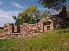 Joseph Brown House Ruinslisted 1986
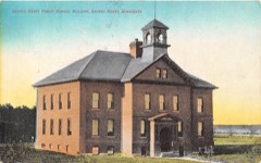 Sacred Heart Public Schoollisted 2014
- Hotel Sacred Heartlisted 2016
- Lars Rudi Houselisted 1986
Population over time
2 figuresSacred Heart fell from 548 to 510 between 2010 and 2020. These are the recorded population figures Wikidata holds for this place, reached through the Geographic Names Information System number this page is keyed on rather than by name, so they belong to this place and not to another of the same name. Most are census counts, but not all are: an early figure may be a founding or settlement estimate, and an estimate published within five years of a census is left out. The change column is computed, and is left blank where more than 20 years separate a figure from the one before it, because a gap that long is not a change between two counts.
| Year | People | Change |
|---|---|---|
| 2010 | 548 | |
| 2020 | 510 | -38 (-7%) |
Topographic sheets covering this place
6 surveys from 9 printed sheetsMatched by testing this settlement's coordinate against the published boundary of every sheet in the United States Geological Survey's historical collection. Each opens the scanned sheet at the Survey.
- 1953 USGS New Ulm quadrangle1:250000, 3 printings
- 1957 USGS New Ulm quadrangle1:250000
- 1958 USGS New Ulm quadrangle1:250000
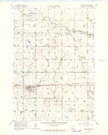
- 1965 USGS Sacred Heart quadrangle1:24000
- 1967 USGS New Ulm quadrangle1:250000
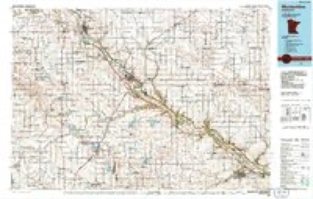
- 1986 USGS Montevideo quadrangle1:100000, 2 printings




In the county-history sources
9,233 words on this townshipThe History of Renville County, Minnesota, published 1916 names this settlement in its chapter on Sacred Heart City. These are the passages that mention it, exactly as the scans read.
This settlement of sturdy Scandinavians, while the beginning of the influx of the substantial people of that nationality to the western part of Renville county, was not the first settlement in Sacred Heart. People had been here before the Massacre. 1 he famous Major Joseph R. Brown stone house had been built about 1860. In 1865, before the Scandinavian colony arrived. G. P. Greene had settled in the township. Mr. Greene was a prominent man in the township. He was the first postmaster of Minnesota Crossing, so called from the ford below his house. The mail was brought by a carrier from Vicksburg until 1876.
Passage source: The History of Renville County, Minnesota, published 1916.
Two stories are told of the naming of Sacred Heart. One story concerns Charles Patterson, who settled in Flora township, on the Renville county side of the rapids in the Minnesota river, in 17S3, and there established a trading post. He wore a peculiar shaped hat, made of fur. and the Indians began to call him the man with the strange or mysterious or magic hat. Their word "wakan," really meaning "spirit," being applied to anything that they did not quite comprehend or that was unusual in any way. Each particular clan of Indians had some animal which they never killed and which they regarded as sacred. It has been said that the Indians then living in this locality esteemed the bear sacred and that Patterson's hat was made of the fur from a great bear which had frequented the neighborhood.
Passage source: The History of Renville County, Minnesota, published 1916.
Gradually they began to refer to the man himself as "The Spirit Hat" or "The Sacred Hat." the meaning being the same as the name from which "Medicine Hat" was translated. Later the white people corrupted the name of "Sacred Hat" to Sacred Heart.
Passage source: The History of Renville County, Minnesota, published 1916.
Machine-read from a century-old scan, so expect the errors a machine makes: misspelled names, dropped words, stray characters.
Read the whole chapter on Sacred Heart City - it names this place 12 more 12 times.
Fires near this place
1 since 2006Regional context, not property-specific evidence. The federal wildfire occurrence database lists 1 fire within 5 miles of Sacred Heart in 2006, burning about 17 acres in total. None started naturally. None was recorded as arson. Distance is straight-line from the map coordinates, so a fire counted here may appear on a neighbouring settlement's page as well.
| Reported cause | Fires |
|---|---|
| Equipment and vehicle use | 1 |
The most recent of them, most recent first, with the day each was reported and the service that recorded it.
| Date | Cause | Size | Reported by | Name on the report |
|---|---|---|---|---|
| 30 October 2006 | Equipment and vehicle use | 17 acres | Litchfield Wetland Management District | SACRED HEART FIRE |
Settlements close enough to share some of these fires:
Mines and quarries near this place
1 within 5 milesRegional context, not property-specific evidence. The federal mineral resources record lists 1 working within 5 miles of Sacred Heart: 1 producer. All of them still produce. What was taken out: Sand and Gravel, Construction. Distance is straight-line from the map coordinates, so a quarry counted here may appear on a neighbouring settlement's page as well.
| Where | Site | Commodity | Status | Recorded |
|---|---|---|---|---|
| Hagen Pit | Sand and Gravel, Construction | Producer |
Storms near this place
37 since 1996Regional context, not property-specific evidence. The National Weather Service names Sacred Heart in 37 storm reports between 1996 and 2024: 19 hail, 14 thunderstorm wind, 1 flash flood, 1 heavy rain. No death or injury is recorded in these reports. Each account below is quoted exactly as the forecast office filed it, from the NOAA Storm Events Database, and each date opens the federal record of that event.
| When | Event | Place named | Harm | What the report says |
|---|---|---|---|---|
| July 2016 | Lightning | Sacred Heart | $500,000 | A lightning bolt struck a church in Sacred Heart, Minnesota. The lightning started a fire and destroyed the church which was built 140 years before. No one was injured, but the church was a total loss. |
| August 2021 | Thunderstorm Wind | Sacred Heart | $50,000 | Damage occurred north of Sacred Heart, and south of County Road 11. There was a metal roof that was blown several feet from its foundation and had its roof peeled off. Plus, several large trees were blown down. In addition, the farm had some of their corn flattened. |
| May 2022 | Thunderstorm Wind | Sacred Heart | $25,000 | Severe straight-line winds blew down a large grain bin near Sacred Heart and blocked part of Highway 212. |
| August 2020 | Thunderstorm Wind | Sacred Heart | $5,000 | A few large trees were blown down between Sacred Heart, and Renville, including a large tree that fell on a house in Renville. |
| June 2024 | Tornado (EF0) | Sacred Heart | - | A storm chaser filmed a brief tornado. It broke a few large branches before moving into an open field and dissipating. |
| June 2024 | Hail | Sacred Heart | - | Photos were sent to the NWS. |
| September 2021 | Hail | Sacred Heart | - | A picture of 1 hail that fell north of Sacred Heart. |
| June 2017 | Thunderstorm Wind | Sacred Heart | - | Several power lines were blown down northwest of Sacred Heart. |
| July 2016 | Thunderstorm Wind | Sacred Heart | - | A few reports of downed trees and power lines from near Sacred Heart, south to the Minnesota River. |
| August 2016 | Heavy Rain | Sacred Heart | - | An individual measured 5.40 inches of rain in Sacred Heart. |
| August 2013 | Thunderstorm Wind | Sacred Heart | - | A large tree was blown down on Highway 212 in Sacred Heart. |
| September 2013 | Thunderstorm Wind | Sacred Heart | - | A power line was blown down, along with several large tree branches scattered across the town of Sacred Heart. |
| August 2013 | Thunderstorm Wind | Sacred Heart | - | Several large tree branches, up to six inches in diameter, were blown down northeast of Sacred Heart. |
| June 2012 | Thunderstorm Wind | Sacred Heart | - | A tractor trailer was blown over on Highway 212 west of Sacred Heart. |
| August 2010 | Flash Flood | Sacred Heart | - | Several inches of rainfall occurred between 10 PM CST to 12 Midnight CST across a large area of Renville County. A section of Highway 212 near Sacred Heart was closed due to the flood waters. Some areas along Highway 212 had knee deep water during the height of the storm. |
| June 2005 | Hail | Sacred Heart | - | Penny sized hail fell for 5 minutes. |
| July 2004 | Thunderstorm Wind | Sacred Heart | - | Six inch diameter branches were downed in Ericson Township. |
| July 2003 | Thunderstorm Wind | Sacred Heart | - | Trees and power lines down. |
| June 2001 | Thunderstorm Wind | Sacred Heart | - | Trees blown down. |
| June 1998 | Thunderstorm Wind | Sacred Heart | - | Ballpark damaged. Trees uprooted and power lines down. Estimated windspeed. |
| July 1998 | Thunderstorm Wind | Sacred Heart | - | Street lamps blown over. Estimated windspeed. |
| September 2024 | Hail | Sacred Heart | - | no account filed |
| September 2020 | Hail | Sacred Heart | - | no account filed |
| September 2020 | Hail | Sacred Heart | - | no account filed |
| September 2020 | Hail | Sacred Heart | - | no account filed |
| April 2019 | Hail | Sacred Heart | - | no account filed |
| July 2017 | Hail | Sacred Heart | - | no account filed |
| April 2012 | Hail | Sacred Heart | - | no account filed |
| July 2011 | Hail | Sacred Heart | - | no account filed |
| April 2010 | Hail | Sacred Heart | - | no account filed |
| August 2010 | Hail | Sacred Heart | - | no account filed |
| June 2007 | Hail | Sacred Heart | - | no account filed |
| August 2004 | Hail | Sacred Heart | - | no account filed |
| July 2000 | Hail | Sacred Heart | - | no account filed |
| June 1999 | Hail | Sacred Heart | - | no account filed |
| June 1999 | Hail | Sacred Heart | - | no account filed |
| June 1996 | Hail | Sacred Heart | - | no account filed |
Nearest settlements
The eight closest, with where each one stands in the county. Distances are straight-line, computed from the Geographic Names Information System coordinates.
| Map | Place | Distance | Sheets |
|---|---|---|---|
| Renville | 7.4 miles | 9 | |
| Danube | 13.5 miles | 9 | |
| Bechyn | 17.4 miles | 11 | |
| Olivia | 19.2 miles | 10 | |
| Beaver Falls | 21.4 miles | 13 | |
| Bird Island | 24.2 miles | 10 | |
| Morton | 25.4 miles | 12 | |
| Franklin | 30.7 miles | 12 |
Elsewhere
Matched on this settlement's Geographic Names Information System number rather than its name, so it cannot be a different place of the same name in another state.
| Wikipedia article on Sacred Heart | An encyclopaedic summary. Its text is share-alike, so it is linked here rather than copied. |
| Wikidata item Q2228164 | The structured record the population and elevation above come from. Public domain (CC0). |
Provenance
This settlement is recorded in the Geographic Names Information System as feature 650451. The sheet list is computed by point-in-boundary test against the United States Geological Survey's historical topographic inventory. Both are works of the United States government and carry no copyright under 17 U.S.C. 105.
Wildfire. Short, Karen C. 2022. Spatial wildfire occurrence data for the United States, 1992-2020 [FPA_FOD_20221014]. 6th Edition. Fort Collins, CO: Forest Service Research Data Archive. https://doi.org/10.2737/RDS-2013-0009.6 Collected with United States Government funding and usable without additional permissions or fees.
Mines and quarries. USGS Mineral Resources Data System (MRDS) https://mrdata.usgs.gov/mrds/ A work of the United States government, no copyright under 17 U.S.C. 105.
Storms. NOAA National Centers for Environmental Information, Storm Events Database https://www.ncei.noaa.gov/stormevents/ A work of the United States government, no copyright under 17 U.S.C. 105. Narratives are quoted verbatim from the National Weather Service report and are not edited or summarised.