 Block
Cokato, Minnesota
10 topographic sheets cover this place, the earliest surveyed in 1953 and the latest in 1986. It stands in Cokato City. It lies in ZIP code area 55321. The Survey maps it on the Cokato quadrangle. 2,799 people lived here at the 2020 count. It stands 1,056 feet above sea level.
On record in Cokato
Buildings and businesses the archive holds for this place. Each opens its own page, with the source record it came from.
On the National Register 2 records
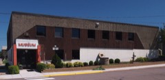 August Akerlund Photographic Studiolisted 1977
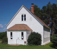 Cokaton P.R.S. Onnen Tovio Raittiusseuralisted 1976
Population over time
2 figuresCokato grew from 2,694 to 2,799 between 2010 and 2020. These are the recorded population figures Wikidata holds for this place, reached through the Geographic Names Information System number this page is keyed on rather than by name, so they belong to this place and not to another of the same name. Most are census counts, but not all are: an early figure may be a founding or settlement estimate, and an estimate published within five years of a census is left out. The change column is computed, and is left blank where more than 20 years separate a figure from the one before it, because a gap that long is not a change between two counts.
| Year | People | Change |
|---|---|---|
| 2010 | 2,694 | |
| 2020 | 2,799 | +105 (+4%) |
Topographic sheets covering this place
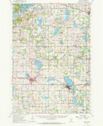
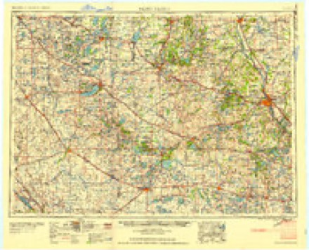
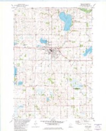
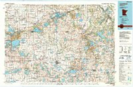
6 surveys from 10 printed sheetsMatched by testing this settlement's coordinate against the published boundary of every sheet in the United States Geological Survey's historical collection. Each opens the scanned sheet at the Survey.
- 1953 USGS Saint Cloud quadrangle1:250000, 3 printings
- 1957 USGS Saint Cloud quadrangle1:250000
- 1958 USGS Cokato quadrangle1:62500, 2 printings
- 1958 USGS Saint Cloud quadrangle1:250000
- 1982 USGS Cokato quadrangle1:24000
- 1986 USGS Litchfield quadrangle1:100000, 2 printings
In the county-history sources
3,888 words on this townshipHistory of Wright County, Minnesota Volume II, published 1915 names this settlement in its chapter on Cokato Township. These are the passages that mention it, exactly as the scans read.
Cokato embraces Congressional township 119, range 28. It is bounded on the north by the township of French Lake, on the east by Middleville, on the south by Stockholm, and on the west by Meeker county. The north fork of the Crow river passes through sections 2, 11 and 12, in the northeast part of the town. Sucker ereek flows from the south part of the town nearly through Cokato lake, in sections 14, 15 and 23. This is the largest lake in
Passage source: History of Wright County, Minnesota Volume II, published 1915.
The first actual settlers were Josiah P. Mooers and his sons, Augustus P. and Henry. They came to Minnesota from Maine in 1852, and in August, 1856, settled on section 34 in what is now Cokato township. All three became prominent men. Among other early settlers were Joseph Lane, Samuel Pavitt, Amos Chambers, Daniel Rose, William Lee, Luman Putnam, Timothy Lowell, David Griffith and Hugh MeNulty. Lane came in 1856; Griffith, Lee and Putnam in 1857; Pavitt, Chambers and Rose came in 1858.
Passage source: History of Wright County, Minnesota Volume II, published 1915.
In August, 1855, the town and range lines were surveyed, and in the winter the towns were subdivided into section lines. While engaged in this work, the United States surveyors camped for several months on the shore of Cokato lake. The name signified a stopping place, and was given by - Duffy, one of the crew. The surveyors cut a road from near the forks of the Crow river to Cokato lake, in the fall of 1855, and the settlers later improved this erude trail, By 1856 it was well cut and laid out, and a few bridges had been built over the creek, In April, 1856, a number of Minneapolis people laid out a city on section 14, at the north side, at the outlet of Cokato lake. A dam was put in, a hotel erected, and other improvements made. Among those interested were Dr. J. H. Murphy, of St. Paul, and the Messrs. Duffy, Sidel and Crane, of Minneapolis. MeNulty was the agent. He engaged Timothy Lowell and his family to keep the hotel,
Passage source: History of Wright County, Minnesota Volume II, published 1915.
Machine-read from a century-old scan, so expect the errors a machine makes: misspelled names, dropped words, stray characters.
Read the whole chapter on Cokato Township - it names this place 10 more 10 times.
Mines and quarries near this place
1 within 5 milesRegional context, not property-specific evidence. The federal mineral resources record lists 1 working within 5 miles of Cokato: 1 past producer. None of them still produces. What was taken out: Sand and Gravel, Construction. Distance is straight-line from the map coordinates, so a quarry counted here may appear on a neighbouring settlement's page as well.
| Where | Site | Commodity | Status | Recorded |
|---|---|---|---|---|
| Karinen Pit | Sand and Gravel, Construction | Past Producer |
Storms near this place
52 since 1997Regional context, not property-specific evidence. The National Weather Service names Cokato in 52 storm reports between 1997 and 2025: 29 hail, 21 thunderstorm wind, 2 funnel cloud. No death or injury is recorded in these reports. Each account below is quoted exactly as the forecast office filed it, from the NOAA Storm Events Database, and each date opens the federal record of that event.
| When | Event | Place named | Harm | What the report says |
|---|---|---|---|---|
| May 2002 | Thunderstorm Wind | Cokato | $200,000 | One barn was demolished with some materials blown 800 feet. Two other barns and several sheds were blown down. |
| May 2016 | Hail | Cokato | $10,000 | In addition to the quarter size hail, a wind gust of 55 mph southwest of of Cokato. There was a social media video of power poles blown down and large hail covering the ground. |
| July 2023 | Thunderstorm Wind | Cokato | - | Trees were reported down near Cokato. |
| May 2022 | Thunderstorm Wind | Cokato | - | Several trees were blown down around Cokato. |
| June 2022 | Thunderstorm Wind | Cokato | - | Several trees were blown down in the Cokato area. |
| August 2011 | Thunderstorm Wind | Cokato | - | Several large tree branches were blown down in Cokato, Minnesota. |
| June 2010 | Funnel Cloud | Cokato | - | Several funnel clouds were reported around Cokato, Minnesota. |
| July 2008 | Thunderstorm Wind | Cokato | - | Sixty mph wind gust measured at Dassel Cokato Middle School. |
| July 2008 | Thunderstorm Wind | Cokato | - | Numerous tree limbs severed and utility lines felled across roadway. |
| July 2008 | Thunderstorm Wind | Cokato | - | Residence affected was at 25495 750th SW. Just to the Southwest of the residence several trees in a small wooded area were toppled. In the Southwest portion of the farm site there was a tin shed approximately 20 feet by 40 feet. The majority of the tin shed roof was blown off or caved into the structure. Shingles blown off portion of roof of home on this property. Antenna on roof also damaged. Power lost for several hours. Portion of barn also damaged, with small sections of board from barn burrowed into the ground. Some wind damage to corn crop on Eastern portion of residence. |
| July 2008 | Thunderstorm Wind | Cokato | - | Damage occurred at 72780 240th St. Damage included: a small canvas shed blown down. Two trees severed at the base of the trunk, several tree branches also severed. A pole holding up a small television antenna was blown over. |
| July 2008 | Hail | Cokato | - | Strong winds were also reported with the hail. No wind damage was recorded. |
| June 2007 | Thunderstorm Wind | Cokato | - | Two trees felled. Power out for several hours. |
| August 2007 | Thunderstorm Wind | Cokato | - | Amateur radio spotters report power lines downed by strong winds in the Howard Lake and Cokato areas. |
| June 2005 | Thunderstorm Wind | Cokato | - | The roof of a hoop barn was removed at a farm on 98th Street in Stockholm Township, Section 21. The tops of trees were also snapped. |
| September 2005 | Hail | Cokato | - | Houses and vehicles were damaged by tennis ball to baseball sized hail. |
| May 2004 | Hail | Cokato | - | Penny sized hail fell for 15 minutes. |
| September 2002 | Funnel Cloud | Cokato | - | Distance approximate. |
| June 2001 | Thunderstorm Wind | Cokato | - | Ten inch diameter branches downed. Minor damage to siding on house. |
| July 1997 | Thunderstorm Wind | Cokato | - | Farm building blown down. Estimated windspeed. |
| July 1997 | Thunderstorm Wind | Cokato | - | Roof damage. Semitrailer blown over. Church steeple blown over. Township hall sustained heavy damage including roof blown off and wall collapse. Estimated windspeed. |
| July 1997 | Thunderstorm Wind | Cokato | - | Turkey barn destroyed. About 4,000 turkeys lost. |
| July 1997 | Thunderstorm Wind | Cokato | - | Barn collapse. Estimated windspeed. |
| July 1997 | Thunderstorm Wind | Cokato | - | Eight grain bins destroyed. Estimated windspeed. |
| June 1997 | Thunderstorm Wind | Cokato | - | Power lines and large branches down. Trees also reported down in Waverly. Estimated windspeed. |
| June 2025 | Hail | Cokato | - | no account filed |
| August 2025 | Thunderstorm Wind | Cokato | - | no account filed |
| August 2025 | Hail | Cokato | - | no account filed |
| July 2023 | Hail | Cokato | - | no account filed |
| July 2023 | Hail | Cokato | - | no account filed |
| September 2014 | Hail | Cokato | - | no account filed |
| August 2013 | Hail | Cokato | - | no account filed |
| May 2011 | Hail | Cokato | - | no account filed |
| July 2008 | Hail | Cokato | - | no account filed |
| June 2007 | Hail | Cokato | - | no account filed |
| September 2007 | Hail | Cokato | - | no account filed |
| September 2007 | Hail | Cokato | - | no account filed |
| September 2007 | Hail | Cokato | - | no account filed |
| April 2007 | Hail | Cokato | - | no account filed |
| September 2005 | Hail | Cokato | - | no account filed |
| April 2004 | Hail | Cokato | - | no account filed |
| April 2002 | Hail | Cokato | - | no account filed |
| June 2002 | Hail | Cokato | - | no account filed |
| May 2002 | Hail | Cokato | - | no account filed |
| May 2002 | Hail | Cokato | - | no account filed |
| August 2002 | Hail | Cokato | - | no account filed |
| June 2001 | Hail | Cokato | - | no account filed |
| June 1999 | Hail | Cokato | - | no account filed |
| May 1998 | Thunderstorm Wind | Cokato | - | no account filed |
| July 1997 | Hail | Cokato | - | no account filed |
| August 1997 | Hail | Cokato | - | no account filed |
| August 1997 | Hail | Cokato | - | no account filed |
Nearest settlements
The eight closest, with where each one stands in the county. Distances are straight-line, computed from the Geographic Names Information System coordinates.
| Map | Place | Distance | Sheets |
|---|---|---|---|
| Stockholm | 3.2 miles | 10 | |
| Smith Lake | 4.0 miles | 10 | |
| Rice Lake | 4.9 miles | 10 | |
| Albright | 5.5 miles | 10 | |
| Knapp | 5.6 miles | 10 | |
| Howard Lake | 6.3 miles | 10 | |
| French Lake | 8.6 miles | 10 | |
| West Albion | 8.8 miles | 10 |
Elsewhere
Matched on this settlement's Geographic Names Information System number rather than its name, so it cannot be a different place of the same name in another state.
| Wikipedia article on Cokato | An encyclopaedic summary. Its text is share-alike, so it is linked here rather than copied. |
| Wikidata item Q1005655 | The structured record the population and elevation above come from. Public domain (CC0). |
Provenance
This settlement is recorded in the Geographic Names Information System as feature 641381. The sheet list is computed by point-in-boundary test against the United States Geological Survey's historical topographic inventory. Both are works of the United States government and carry no copyright under 17 U.S.C. 105.
Mines and quarries. USGS Mineral Resources Data System (MRDS) https://mrdata.usgs.gov/mrds/ A work of the United States government, no copyright under 17 U.S.C. 105.
Storms. NOAA National Centers for Environmental Information, Storm Events Database https://www.ncei.noaa.gov/stormevents/ A work of the United States government, no copyright under 17 U.S.C. 105. Narratives are quoted verbatim from the National Weather Service report and are not edited or summarised.