 Block
Comfrey, Minnesota
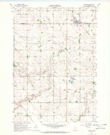
9 topographic sheets cover this place, the earliest surveyed in 1953 and the latest in 1991. It stands in Comfrey City. It lies in ZIP code area 56019. The Survey maps it on the Comfrey quadrangle. 392 people lived here at the 2020 count. It stands 1,122 feet above sea level.
Topographic sheets covering this place
7 surveys from 9 printed sheetsMatched by testing this settlement's coordinate against the published boundary of every sheet in the United States Geological Survey's historical collection. Each opens the scanned sheet at the Survey.
- 1953 USGS New Ulm quadrangle1:250000, 3 printings
- 1957 USGS New Ulm quadrangle1:250000
- 1958 USGS New Ulm quadrangle1:250000
- 1967 USGS Comfrey quadrangle1:24000
- 1967 USGS New Ulm quadrangle1:250000
- 1986 USGS New Ulm quadrangle1:100000
- 1991 USGS New Ulm quadrangle1:100000




What happened here
An account from the chapter on Comfrey city. The inset identifies its exact source book and publication year.
The First Comers
The band of settlers which first dared to brave the hardships in this wild, undeveloped section of Brown county, in 1857, included the family of Jonathan F. Brown, who made a claim in section 22. The family was killed by the Indians in 1862, while trying to escape from the township. In the spring of 1858, J.
In the county-history sources
841 words on this townshipHistory of Brown County, Minnesota: Its People, Industries and Institutions (Volume 1), published 1916 names this settlement in its chapter on Comfrey City. These are the passages that mention it, exactly as the scans read.
In 1910 Comf rey had a population of two hundred and thirty-eight. It was incorporated in March, 1900, and its first officers were: Eugene Fernholtz, mayor; Charles A. Nelson, recorder; C. H. Bradbury, treasurer. The following have served as mayors to present date: Eugene Fernholtz, O. W. Cooley, Oscar Erickson, F. W. Renner, Martin Windschill. The 1916 officials are : Martin Windschill, mayor; G. W. Schaffer, recorder; C. E. Armstrong, C. H. Bradbury and A. M. Johnson, councilmen.
Passage source: History of Brown County, Minnesota: Its People, Industries and Institutions (Volume 1), published 1916.
Auto garage, E. Valentine ; barber shop, Michael Hamilton; banks, State Bank and Farmers State Bank; attorney, August G. Erickson; blacksmith, Wenzel Schoedl; creamery, Comf rey Farmers Creamery Association, finishing an eight-thousand-dollar building at this time; drugs, A. J. Yackel; dentist, F. M. Robinson, D. D. S.; elevator, Comfrey Farmers Elevator Company; feed store, Comf rey Elevator Company; grocer, E. P. Lilla; general dealers,
Passage source: History of Brown County, Minnesota: Its People, Industries and Institutions (Volume 1), published 1916.
Machine-read from a century-old scan, so expect the errors a machine makes: misspelled names, dropped words, stray characters.
Read the whole chapter on Comfrey City - it names this place 2 more 2 times.
Fires near this place
3 since 2013Regional context, not property-specific evidence. The federal wildfire occurrence database lists 3 fires within 5 miles of Comfrey between 2013 and 2020, burning about 68 acres in total. None started naturally. 1 was recorded as arson. Distance is straight-line from the map coordinates, so a fire counted here may appear on a neighbouring settlement's page as well.
| Reported cause | Fires |
|---|---|
| Missing data/not specified/undetermined | 2 |
| Arson/incendiarism | 1 |
The most recent of them, most recent first, with the day each was reported and the service that recorded it.
| Date | Cause | Size | Reported by | Name on the report |
|---|---|---|---|---|
| 14 May 2020 | Arson/incendiarism | under an acre | Minnesota Department of Natural Resources | not named |
| 27 April 2013 | Missing data/not specified/undetermined | 23 acres | Minnesota Department of Natural Resources | not named |
| 13 November 2016 | Missing data/not specified/undetermined | 45 acres | Minnesota Department of Natural Resources | not named |
Settlements close enough to share some of these fires:
Storms near this place
18 since 1998Regional context, not property-specific evidence. The National Weather Service names Comfrey in 18 storm reports between 1998 and 2023: 8 thunderstorm wind, 8 hail, 1 tornado, 1 flood. The reports record 1 death and 16 injuries. Each account below is quoted exactly as the forecast office filed it, from the NOAA Storm Events Database, and each date opens the federal record of that event.
| When | Event | Place named | Harm | What the report says |
|---|---|---|---|---|
| March 1998 | Tornado (F4) | Comfrey | 1 killed, 16 hurt, $45,000,000 | Tornado began 7 miles east of Avoca in Murray county, continued through Cottonwood, Brown, extreme Northwest Watonwan, Northwest Blue Earth, and finally lifted off 4 miles east of Courtland in Nicollet county. Total storm track was 67 miles. The tornado ripped through the village of Comfrey destroying a grain elevator and damaging 75% of the town. Much of downtown Comfrey destroyed including the town hall. School heavily damaged. 100 people made homeless. 50 homes destroyed. 130 farmsteads damaged or destroyed in Brown county. 500 dairy cows killed. One man critically injured in collapse of farmstead northwest of the town of Hanska. He died the next day. 35 buildings destroyed or damaged in far Northwest Blue Earth county. Damage estimate estimated. Property damage to extreme northwest Blue Earth county across Cambria township estimated at 2 million. Property damage to extreme northwest Watonwan county estimated at 245 thousand. |
| May 2023 | Flood | Comfrey | - | The Brown County Emergency Manager reported that feet of water was observed in the City of Comfrey, MN (Brown County) due to repeated and prolonged periods of heavy rainfall. Sandbagging efforts were undertaken in order to protect area residential basements from flooding. Approximately ten residents from a senior citizen townhome community were evacuated. Law enforcement reported that CR-17 through Comfrey had to be closed due to flooding. Additionally, the intersection of CR-5 and 110th St three miles west of Comfrey was also flooded. |
| August 2021 | Thunderstorm Wind | Comfrey | - | A large tree was uprooted in Comfrey. |
| August 2021 | Thunderstorm Wind | Comfrey | - | A large tree was snapped off the top, with several other smaller trees blown down north of Comfrey. |
| July 2017 | Thunderstorm Wind | Comfrey | - | Several trees were blown down near Comfrey. |
| July 2017 | Thunderstorm Wind | Comfrey | - | A semi-trailer was tipped over near County Roads 8 and 18, east of Comfrey. |
| June 2015 | Thunderstorm Wind | Comfrey | - | The town of Comfrey had 6-7 blocks of tree debris from severe straight line winds. Power was out for an hour around the community. |
| June 2001 | Thunderstorm Wind | Comfrey | - | A door was blown off a pole barn. A few sheds damaged. Trees down. |
| July 1998 | Thunderstorm Wind | Comfrey | - | New building construction blown down. Power poles snapped. Estimated windspeed. |
| July 1998 | Thunderstorm Wind | Comfrey | - | House under construction blown down. Large trees blown down. Estimated windspeed. |
| June 2007 | Hail | Comfrey | - | no account filed |
| July 2006 | Hail | Comfrey | - | no account filed |
| July 2002 | Hail | Comfrey | - | no account filed |
| July 2002 | Hail | Comfrey | - | no account filed |
| May 2000 | Hail | Comfrey | - | no account filed |
| August 2000 | Hail | Comfrey | - | no account filed |
| August 1999 | Hail | Comfrey | - | no account filed |
| October 1998 | Hail | Comfrey | - | no account filed |
Nearest settlements
The eight closest, with where each one stands in the county. Distances are straight-line, computed from the Geographic Names Information System coordinates.
| Map | Place | Distance | Sheets |
|---|---|---|---|
| Dotson | 6.4 miles | 9 | |
| Leavenworth | 9.5 miles | 9 | |
| Springfield | 9.6 miles | 9 | |
| Cobden | 12.5 miles | 10 | |
| Godahl | 14.0 miles | 9 | |
| Iberia | 14.2 miles | 9 | |
| Sleepy Eye | 16.1 miles | 9 | |
| Stark | 16.2 miles | 9 |
Elsewhere
Matched on this settlement's Geographic Names Information System number rather than its name, so it cannot be a different place of the same name in another state.
| Wikipedia article on Comfrey | An encyclopaedic summary. Its text is share-alike, so it is linked here rather than copied. |
| Wikidata item Q2232266 | The structured record the population and elevation above come from. Public domain (CC0). |
Provenance
This settlement is recorded in the Geographic Names Information System as feature 641419. The sheet list is computed by point-in-boundary test against the United States Geological Survey's historical topographic inventory. Both are works of the United States government and carry no copyright under 17 U.S.C. 105.
Wildfire. Short, Karen C. 2022. Spatial wildfire occurrence data for the United States, 1992-2020 [FPA_FOD_20221014]. 6th Edition. Fort Collins, CO: Forest Service Research Data Archive. https://doi.org/10.2737/RDS-2013-0009.6 Collected with United States Government funding and usable without additional permissions or fees.
Storms. NOAA National Centers for Environmental Information, Storm Events Database https://www.ncei.noaa.gov/stormevents/ A work of the United States government, no copyright under 17 U.S.C. 105. Narratives are quoted verbatim from the National Weather Service report and are not edited or summarised.