 Block
Springfield, Minnesota
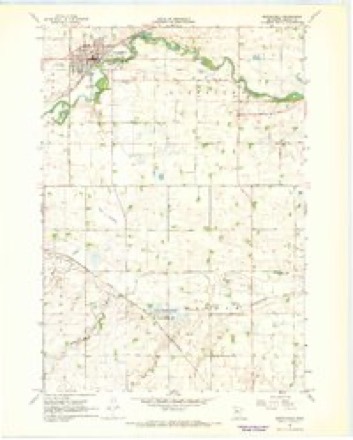
9 topographic sheets cover this place, the earliest surveyed in 1953 and the latest in 1991. It stands in Springfield City. It lies in ZIP code area 56087. The Survey maps it on the Springfield quadrangle. 2,027 people lived here at the 2020 count. It stands 1,020 feet above sea level.
On record in Springfield
Buildings and businesses the archive holds for this place. Each opens its own page, with the source record it came from.
On the National Register 4 records
- Bendixon-Schmid Houselisted 1979
- Kreitinger Garagelisted 1979
- Adolph C. Ochs Houselisted 1979
- Shady Lane Stock Farmlisted 1979
Population over time
2 figuresSpringfield fell from 2,152 to 2,027 between 2010 and 2020. These are the recorded population figures Wikidata holds for this place, reached through the Geographic Names Information System number this page is keyed on rather than by name, so they belong to this place and not to another of the same name. Most are census counts, but not all are: an early figure may be a founding or settlement estimate, and an estimate published within five years of a census is left out. The change column is computed, and is left blank where more than 20 years separate a figure from the one before it, because a gap that long is not a change between two counts.
| Year | People | Change |
|---|---|---|
| 2010 | 2,152 | |
| 2020 | 2,027 | -125 (-6%) |
Topographic sheets covering this place
7 surveys from 9 printed sheetsMatched by testing this settlement's coordinate against the published boundary of every sheet in the United States Geological Survey's historical collection. Each opens the scanned sheet at the Survey.
- 1953 USGS New Ulm quadrangle1:250000, 3 printings
- 1957 USGS New Ulm quadrangle1:250000
- 1958 USGS New Ulm quadrangle1:250000
- 1967 USGS New Ulm quadrangle1:250000
- 1967 USGS Springfield quadrangle1:24000
- 1986 USGS New Ulm quadrangle1:100000
- 1991 USGS New Ulm quadrangle1:100000




In the county-history sources
427 words on this townshipHistory of Brown County, Minnesota: Its People, Industries and Institutions (Volume 1), published 1916 names this settlement in its chapter on Springfield City. These are the passages that mention it, exactly as the scans read.
Springfield was originally known as the village of Burns. It was surveyed into lots in 1877 at a station point along the new railway then called the Winona & St. Peter, but now the Northwestern line. It is in sections 18 and 19, township 109, range 34 west. The first business house was erected in 1872 by H. M. Gamble. In 1881 the village had a population of three hundred ; in 1890 it had reached seven hundred and sixteen ; in 1900 it was placed at fifteen hundred and eleven, and in 1910 it stood fourteen hundred and eighty-two.
Passage source: History of Brown County, Minnesota: Its People, Industries and Institutions (Volume 1), published 1916.
Springfield was incorporated as a village in 1881. The first village records were all destroyed by fire. It is known, however, that J. S. Colomy was the first president of the village. The officers for 1916 are: Fred Bott, president ; A. G. Anderson, J. F. Bauch, Herman Birkemeyer, trustees; Edward J. Fernholz, recorder; C. H. Asch, treasurer; John Schultz, assessor; J. J. Ray and J. Farrell, justices of the peace; Jack Foster and August Bigot, constables.
Passage source: History of Brown County, Minnesota: Its People, Industries and Institutions (Volume 1), published 1916.
Of the lighting of Springfield it may be stated that electricity lights the place. It has a two-unit system - one directed to a fourteen by twenty-one Lentz engine generator 100-kw., and the other unit belted to an Ideal engine generator 50-kw., giving a continuous service.
Passage source: History of Brown County, Minnesota: Its People, Industries and Institutions (Volume 1), published 1916.
Machine-read from a century-old scan, so expect the errors a machine makes: misspelled names, dropped words, stray characters.
Read the whole chapter on Springfield City - it names this place 3 more 3 times.
Fires near this place
1 since 2014Regional context, not property-specific evidence. The federal wildfire occurrence database lists 1 fire within 5 miles of Springfield in 2014, burning about 50 acres in total. None started naturally. 1 was recorded as arson. Distance is straight-line from the map coordinates, so a fire counted here may appear on a neighbouring settlement's page as well.
| Reported cause | Fires |
|---|---|
| Arson/incendiarism | 1 |
The most recent of them, most recent first, with the day each was reported and the service that recorded it.
| Date | Cause | Size | Reported by | Name on the report |
|---|---|---|---|---|
| 26 October 2014 | Arson/incendiarism | 50 acres | Minnesota Department of Natural Resources | not named |
Settlements close enough to share some of these fires:
Mines and quarries near this place
6 within 5 milesRegional context, not property-specific evidence. The federal mineral resources record lists 6 workings within 5 miles of Springfield: 4 producers, 2 past producers. 4 still produce. What was taken out: Clay, Sand and Gravel, Construction, Kaolin. Distance is straight-line from the map coordinates, so a quarry counted here may appear on a neighbouring settlement's page as well.
| Where | Site | Commodity | Status | Recorded |
|---|---|---|---|---|
| Ochs Clay-Brown County Pit | Kaolin | Past Producer | Gibbsite, Illite, Kaolin, Montmorillonite | |
| Solonek Concrete Pit | Sand and Gravel, Construction | Producer | ||
| Vogel Bros Pit | Sand and Gravel, Construction | Producer | ||
| Acolite Plant | Clay | Producer | ||
| Brown County Clay Deposit No 6 | Clay | Past Producer | ||
| Springfield Pit | Clay | Producer |
Storms near this place
45 since 1994Regional context, not property-specific evidence. The National Weather Service names Springfield in 45 storm reports between 1994 and 2023: 23 hail, 14 thunderstorm wind, 3 flood, 2 tornado. No death or injury is recorded in these reports. Each account below is quoted exactly as the forecast office filed it, from the NOAA Storm Events Database, and each date opens the federal record of that event.
| When | Event | Place named | Harm | What the report says |
|---|---|---|---|---|
| July 2018 | Flood | Springfield | $385,000 | The excessive rainfall across Redwood County continued to flow into Brown County, especially along the Cottonwood River. There were numerous county roads along this river that were impassable during the height of the flooding. Residents of an apartment complex in Springfield, Minnesota were evacuated because of flooding along the Cottonwood River. The same scenario occur in New Ulm, Minnesota where another apartment complex was evacuated. |
| June 2016 | Thunderstorm Wind | Springfield | $50,000 | Numerous trees were blown down north of Springfield, along with a turkey barn that was damaged. |
| July 1997 | Lightning | Springfield | $40,000 | Lightning strike destroyed a storage shed. |
| July 2002 | Thunderstorm Wind | Springfield | $20,000 | Numerous trees down, including some on vehicles and garages. Corn flattened. |
| August 2016 | Thunderstorm Wind | Springfield | $10,000 | Two train box cars were blown off a track near Springfield. |
| June 2016 | Thunderstorm Wind | Springfield | $5,000 | Several trees were blown down in Springfield, one landed on a garage and damaged it. |
| August 2021 | Thunderstorm Wind | Springfield | - | A narrow path of crop damage, possibly related to a misovortex within a broader wind field, was identified using Sentinel satellite imagery. It was not possible to correlate the crop damage with any radar circulation. |
| August 2021 | Thunderstorm Wind | Springfield | - | A narrow path of crop damage, possibly related to a misovortex within a broader wind field, was identified using Sentinel satellite imagery. It was not possible to correlate the crop damage with any radar circulation. |
| August 2021 | Thunderstorm Wind | Springfield | - | A narrow path of crop damage, possibly related to a misovortex within a broader wind field, was identified using Sentinel satellite imagery. It was not possible to correlate the crop damage with any radar circulation. |
| July 2018 | Hail | Springfield | - | A swath of large hail, up to quarter size was observed from southeast of Sanborn, to west of Comfrey. |
| July 2018 | Funnel Cloud | Springfield | - | A funnel cloud picture was sent to the NWS through Twitter. The funnel cloud was located between Sanborn and Springfield on Highway 14. |
| July 2017 | Tornado (EF0) | Springfield | - | A fast moving tornado touched down near a farm, where it removed roofs off of two sheds and knocked over some trees. It then moved across a number of fields, occasionally hitting trees along the way. |
| June 2016 | Thunderstorm Wind | Springfield | - | A wind sensor measured a 52 knot wind gust. |
| June 2013 | Hail | Springfield | - | There was a nearly continuous swath of hail, up to tennis ball size at times, from near Highway 71 in far northwest Brown county, southeast to around Springfield. Crop damage was significant around Springfield, Minnesota. |
| September 2010 | Flash Flood | Springfield | - | Strong thunderstorms developed during the late afternoon, and early evening across the county, and dropped one to two inches of rainfall, along with some hail stones. By 730 pm, another band of thunderstorms developed across the county and began to train over the same areas. By 9 pm, portions of southern Brown County already received two to four inches of rainfall. Over the next several hours periods of heavy rainfall added up, and officials advised no travel on township roads. The City of Comfrey received 10,000 sandbags from the county during the height of the storm to keep water and sewage out of homes. |
| September 2010 | Flood | Springfield | - | Numerous roads were closed due to excessive rainfall that fell on September 22nd and 23th. The major areal flooding didn't recede until late Saturday when most of the small streams and creeks had crested and only mainstem rivers remained flooded. |
| August 2009 | Tornado (EF0) | Springfield | - | Several trained spotters observed funnel clouds, and occasional brief touchdowns between Springfield, and Leavenworth, Minnesota for approximately 15 minutes. No structural damage occurred. A damage survey noted crop damage. |
| March 2007 | Flood | Springfield | - | Spring snow melt and rapid warming brought ice jams and flooding to portions of Southern Minnesota. Lowland areas near the Cottonwood River in New Ulm caused flooding in this area from the 13th to the 21st, including Cottonwood Street. Just southwest of Springfield, the Cottonwood River rose nearly ten feet during the afternoon and evening on the 12th, but no damage was reported. |
| June 2007 | Thunderstorm Wind | Springfield | - | Large trees down, along with numerous branches from 3 inches to 15 inches in diameter. |
| June 2006 | Thunderstorm Wind | Springfield | - | Several trees felled. |
| September 2004 | Thunderstorm Wind | Springfield | - | A few trees were downed. |
| April 2002 | Thunderstorm Wind | Springfield | - | Shingles off roof. |
| July 1999 | Thunderstorm Wind | Springfield | - | Roof partially off house. Winds estimated. |
| July 1998 | Thunderstorm Wind | Springfield | - | Roof torn off several homes and businesses. Plate glass windows blown out of auto dealership. Torrential rainfall also resulted in street flooding. Estimated windspeed. |
| May 1994 | Hail | Springfield | - | Thunderstorm winds blew down several large trees in the city of New Ulm. Hail and strong winds damaged several hundred acres of crops in the Springfield area. |
| October 2023 | Hail | Springfield | - | no account filed |
| June 2017 | Hail | Springfield | - | no account filed |
| June 2013 | Hail | Springfield | - | no account filed |
| August 2012 | Hail | Springfield | - | no account filed |
| August 2009 | Hail | Springfield | - | no account filed |
| May 2008 | Hail | Springfield | - | no account filed |
| May 2008 | Hail | Springfield | - | no account filed |
| June 2007 | Hail | Springfield | - | no account filed |
| July 2006 | Hail | Springfield | - | no account filed |
| May 2005 | Hail | Springfield | - | no account filed |
| June 2005 | Hail | Springfield | - | no account filed |
| July 2002 | Hail | Springfield | - | no account filed |
| August 2001 | Hail | Springfield | - | no account filed |
| May 2000 | Hail | Springfield | - | no account filed |
| May 2000 | Hail | Springfield | - | no account filed |
| May 2000 | Hail | Springfield | - | no account filed |
| March 1998 | Hail | Springfield | - | no account filed |
| June 1998 | Hail | Springfield | - | no account filed |
| July 1997 | Hail | Springfield | - | no account filed |
| July 1995 | Hail | Springfield | - | no account filed |
Nearest settlements
The eight closest, with where each one stands in the county. Distances are straight-line, computed from the Geographic Names Information System coordinates.
| Map | Place | Distance | Sheets |
|---|---|---|---|
| Dotson | 4.7 miles | 9 | |
| Cobden | 7.5 miles | 10 | |
| Leavenworth | 9.3 miles | 9 | |
| Comfrey | 9.6 miles | 9 | |
| Evan | 10.7 miles | 10 | |
| Sleepy Eye | 13.9 miles | 9 | |
| Iberia | 14.9 miles | 9 | |
| Stark | 17.3 miles | 9 |
Elsewhere
Matched on this settlement's Geographic Names Information System number rather than its name, so it cannot be a different place of the same name in another state.
| Wikipedia article on Springfield | An encyclopaedic summary. Its text is share-alike, so it is linked here rather than copied. |
| Wikidata item Q726963 | The structured record the population and elevation above come from. Public domain (CC0). |
Provenance
This settlement is recorded in the Geographic Names Information System as feature 652489. The sheet list is computed by point-in-boundary test against the United States Geological Survey's historical topographic inventory. Both are works of the United States government and carry no copyright under 17 U.S.C. 105.
Wildfire. Short, Karen C. 2022. Spatial wildfire occurrence data for the United States, 1992-2020 [FPA_FOD_20221014]. 6th Edition. Fort Collins, CO: Forest Service Research Data Archive. https://doi.org/10.2737/RDS-2013-0009.6 Collected with United States Government funding and usable without additional permissions or fees.
Mines and quarries. USGS Mineral Resources Data System (MRDS) https://mrdata.usgs.gov/mrds/ A work of the United States government, no copyright under 17 U.S.C. 105.
Storms. NOAA National Centers for Environmental Information, Storm Events Database https://www.ncei.noaa.gov/stormevents/ A work of the United States government, no copyright under 17 U.S.C. 105. Narratives are quoted verbatim from the National Weather Service report and are not edited or summarised.