 Block
Dayton, Minnesota
15 topographic sheets cover this place, the earliest surveyed in 1909 and the latest in 1991. It stands in Dayton City. It lies in ZIP code area 55327. It lies near Goodin Island. The Survey maps it on the Rogers quadrangle. 7,262 people lived here at the 2020 count. It stands 879 feet above sea level.
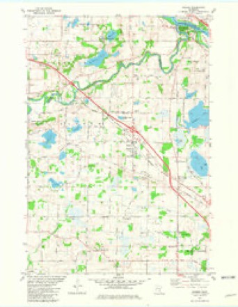
Topographic sheets covering this place
10 surveys from 15 printed sheetsMatched by testing this settlement's coordinate against the published boundary of every sheet in the United States Geological Survey's historical collection. Each opens the scanned sheet at the Survey.
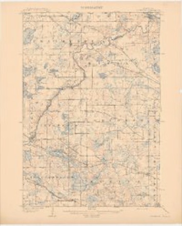
- 1909 USGS Rockford quadrangle1:62500, 2 printings
- 1953 USGS Stillwater quadrangle1:250000
- 1955 USGS Stillwater quadrangle1:250000
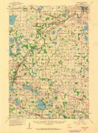
- 1958 USGS Rockford quadrangle1:62500, 2 printings
- 1958 USGS Stillwater quadrangle1:250000, 2 printings
- 1965 USGS Stillwater quadrangle1:250000
- 1975 USGS Stillwater quadrangle1:250000, 2 printings
- 1981 USGS Rogers quadrangle1:24000, 2 printings
- 1985 USGS Anoka quadrangle1:100000
- 1991 USGS Anoka quadrangle1:100000
In the county-history sources
3,375 words on this townshipHistory of Hennepin County and the City of Minneapolis, Including the Explorers and Pioneers of Minnesota, published 1881 names this settlement in its chapter on Dayton City. These are the passages that mention it, exactly as the scans read.
Neil McNeil was one of tlie early settlers, who came to Dayton and took at once, a front rank in I shaping the business <if the infant settlement. For three years, he had the entire control of Lyman Daytons liusiness. bis intelligent brain, directed by a master hand, was felt in every thing he touched. Not only was his genius felt in civil lil'e. l>nl lii' madr it fi'lt in military tactics ;ilsn: shdwim: liiniscll iKit an unworthy descend- ent of that race whose prowess, like Brace's, has adorned and embellished the pages of Scottish history. When the Indian outbreak, in 1862, burst upon the frightened settlers, carrying rapine and butchery in its gory track, he left the peaceful pursuits of life, and aidefl by that determined look which the earnest man carries, raised a squad of men and hastened to join Captain Stroufs command. They marched to the seat of war through Forest City to Acton, where they met the " Bloody Devils,'' and gave them fight. lie there received a woinid through liis right arm, but with his spartan band of sixtyfour, fighting for their firesides, and the little prattlers around them, thought not of the eiglit hundred fiends they were fighting, all the way from Acton to Hutchinson. Before reaching Hutchinson, they were reinforced, adding more strength, but no more courage; when they made a Waterloo, scattering the Indians in every direction. Returning from the Indian war, and with a country still imperiled, he joined Gen. Thomas' command in 1863, and remained until honorably discharged, when he returned again to Dayton and engaged in the more congenial and peaceful pursuits of life, enjoying the confidence of his fellow-citizens, filling the ofiice of supervisor for ten years, and constable seven years. He was the first constable elected in the town.
Passage source: History of Hennepin County and the City of Minneapolis, Including the Explorers and Pioneers of Minnesota, published 1881.
The French Catholic Church was organized in 1857, and a church built the same year, on the farm of Paul Godine, section 5. Father Jennis ofliciated at the organization. In 1862, Father Nicholas supplied the church for a time. In 1865, the society commenced the erection of a larger cluirch, in the village of Dayton, and completed it in 186G. It is -50x75 feet. The society contains one hundred and twenty families. Father Morrell has officiated since 1866, and closed his labors in the fall of 1880. The society has a cemetery of about two acres, located on the northwest corner of section 8.
Passage source: History of Hennepin County and the City of Minneapolis, Including the Explorers and Pioneers of Minnesota, published 1881.
The lirst male teadier was Thomas .McLeod. who taught after tlie organization of the town, in the winter of l>S.59-(iO. The lirst school was taught in a vacant store-room built by E.B.Ames, of jSIinneapolis. who failed in trade, and the room was used till 1S68, when the present village school building was erected, in the village of Dayton. Besides this, there are four school buildings, all in good condition, located as follows: School No. 37, on section 14 ; 2so. 41. on section 29; No. 40, on section 7 : and Xo. :->ii. on section 28. Two joint districts are included in the above.
Passage source: History of Hennepin County and the City of Minneapolis, Including the Explorers and Pioneers of Minnesota, published 1881.
Machine-read from a century-old scan, so expect the errors a machine makes: misspelled names, dropped words, stray characters.
Read the whole chapter on Dayton City - it names this place 13 more 13 times.
Fires near this place
39 since 1992Regional context, not property-specific evidence. The federal wildfire occurrence database lists 39 fires within 5 miles of Dayton between 1992 and 2018, burning about 519 acres in total. None started naturally. 11 were recorded as arson. Distance is straight-line from the map coordinates, so a fire counted here may appear on a neighbouring settlement's page as well.
| Reported cause | Fires |
|---|---|
| Arson/incendiarism | 11 |
| Debris and open burning | 10 |
| Missing data/not specified/undetermined | 9 |
| Equipment and vehicle use | 5 |
| Railroad operations and maintenance | 2 |
| Recreation and ceremony | 1 |
| Other causes | 1 |
The most recent of them, most recent first, with the day each was reported and the service that recorded it.
| Date | Cause | Size | Reported by | Name on the report |
|---|---|---|---|---|
| 8 August 2006 | Arson/incendiarism | under an acre | Minnesota Department of Natural Resources | not named |
| 15 August 2006 | Equipment and vehicle use | under an acre | Minnesota Department of Natural Resources | not named |
| 15 August 2006 | Equipment and vehicle use | under an acre | Minnesota Department of Natural Resources | not named |
| 3 June 2009 | Missing data/not specified/undetermined | under an acre | Minnesota Department of Natural Resources | not named |
| 7 May 2018 | Recreation and ceremony | 10 acres | Minnesota Department of Natural Resources | not named |
| 6 May 2013 | Debris and open burning | under an acre | Minnesota Department of Natural Resources | not named |
| 6 May 1992 | Missing data/not specified/undetermined | 2.0 acres | Minnesota Department of Natural Resources | not named |
| 4 May 2018 | Missing data/not specified/undetermined | under an acre | Minnesota Department of Natural Resources | not named |
Settlements close enough to share some of these fires:
Mines and quarries near this place
1 within 5 milesRegional context, not property-specific evidence. The federal mineral resources record lists 1 working within 5 miles of Dayton: 1 producer. All of them still produce. What was taken out: Sand and Gravel, Construction. Distance is straight-line from the map coordinates, so a quarry counted here may appear on a neighbouring settlement's page as well.
| Where | Site | Commodity | Status | Recorded |
|---|---|---|---|---|
| Kreger Pit and Mill | Sand and Gravel, Construction | Producer |
Storms near this place
8 since 1997Regional context, not property-specific evidence. The National Weather Service names Dayton in 8 storm reports between 1997 and 2023: 6 hail, 2 thunderstorm wind. No death or injury is recorded in these reports. Each account below is quoted exactly as the forecast office filed it, from the NOAA Storm Events Database, and each date opens the federal record of that event.
| When | Event | Place named | Harm | What the report says |
|---|---|---|---|---|
| August 2006 | Hail | Dayton | $20,000,000 | Vehicles, homes and businesses damaged. Damage total includes all storm reports from August 24 in Hennepin County. |
| August 2023 | Hail | Dayton | - | Most of the hail was pea size. |
| June 2015 | Hail | Dayton | - | Numerous reports of large hail occurred north, east and southeast of Rogers. The largest hail stone was quarter size. |
| July 2009 | Hail | Dayton | - | A trained spotter measured one inch diameter hail at the intersection of Brockton and Pine in Dayton. There were also several reports of penny size hail north of Dayton. |
| September 2005 | Hail | Dayton | - | Hail damaged numerous homes. |
| August 1997 | Thunderstorm Wind | Dayton | - | Wind rocked vehicles. |
| July 1997 | Thunderstorm Wind | Dayton | - | Numerous large trees blown down. Approximately 300 trees down. |
| July 2019 | Hail | Dayton | - | no account filed |
Nearest settlements
The eight closest, with where each one stands in the county. Distances are straight-line, computed from the Geographic Names Information System coordinates.
| Map | Place | Distance | Sheets |
|---|---|---|---|
| Rogers | 4.3 miles | 15 | |
| Fletcher | 5.1 miles | 15 | |
| Berning Mill | 6.3 miles | 15 | |
| Champlin | 7.3 miles | 19 | |
| Corcoran | 10.4 miles | 15 | |
| Burschville | 10.4 miles | 15 | |
| Osseo | 10.5 miles | 21 | |
| West Coon Rapids | 10.5 miles | 20 |
Elsewhere
Matched on this settlement's Geographic Names Information System number rather than its name, so it cannot be a different place of the same name in another state.
| Wikipedia article on Dayton | An encyclopaedic summary. Its text is share-alike, so it is linked here rather than copied. |
| Wikidata item Q1931777 | The structured record the population and elevation above come from. Public domain (CC0). |
Provenance
This settlement is recorded in the Geographic Names Information System as feature 642665. The sheet list is computed by point-in-boundary test against the United States Geological Survey's historical topographic inventory. Both are works of the United States government and carry no copyright under 17 U.S.C. 105.
Wildfire. Short, Karen C. 2022. Spatial wildfire occurrence data for the United States, 1992-2020 [FPA_FOD_20221014]. 6th Edition. Fort Collins, CO: Forest Service Research Data Archive. https://doi.org/10.2737/RDS-2013-0009.6 Collected with United States Government funding and usable without additional permissions or fees.
Mines and quarries. USGS Mineral Resources Data System (MRDS) https://mrdata.usgs.gov/mrds/ A work of the United States government, no copyright under 17 U.S.C. 105.
Storms. NOAA National Centers for Environmental Information, Storm Events Database https://www.ncei.noaa.gov/stormevents/ A work of the United States government, no copyright under 17 U.S.C. 105. Narratives are quoted verbatim from the National Weather Service report and are not edited or summarised.