 Block
Utica, Minnesota
10 topographic sheets cover this place, the earliest surveyed in 1954 and the latest in 1990. It stands in Utica City. It lies in ZIP code area 55979. The Survey maps it on the Utica quadrangle. 266 people lived here at the 2020 count. It stands 1,175 feet above sea level.
On record in Utica
Buildings and businesses the archive holds for this place. Each opens its own page, with the source record it came from.
On the National Register 1 record
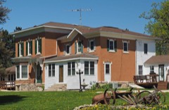 Benjamin Ellsworth Houselisted 1984
Population over time
2 figuresUtica fell from 291 to 266 between 2010 and 2020. These are the recorded population figures Wikidata holds for this place, reached through the Geographic Names Information System number this page is keyed on rather than by name, so they belong to this place and not to another of the same name. Most are census counts, but not all are: an early figure may be a founding or settlement estimate, and an estimate published within five years of a census is left out. The change column is computed, and is left blank where more than 20 years separate a figure from the one before it, because a gap that long is not a change between two counts.
| Year | People | Change |
|---|---|---|
| 2010 | 291 | |
| 2020 | 266 | -25 (-9%) |
Topographic sheets covering this place
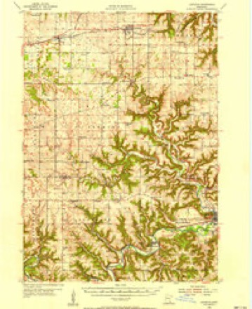
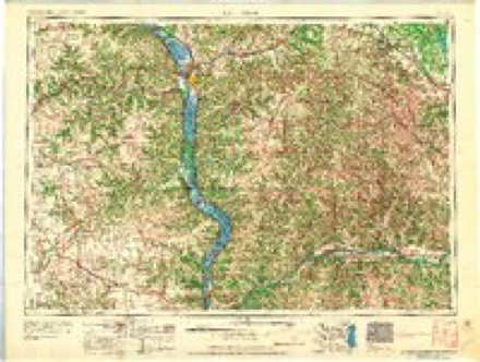
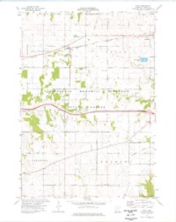
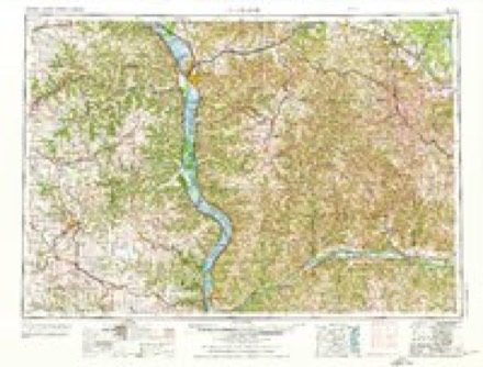
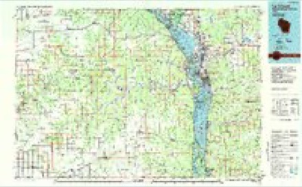
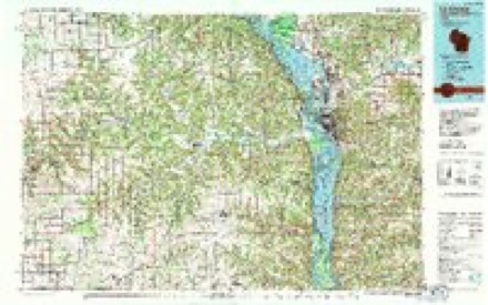
8 surveys from 10 printed sheetsMatched by testing this settlement's coordinate against the published boundary of every sheet in the United States Geological Survey's historical collection. Each opens the scanned sheet at the Survey.
- 1954 USGS Lewiston quadrangle1:62500, 2 printings
- 1958 USGS La Crosse quadrangle1:250000, 2 printings
- 1961 USGS La Crosse quadrangle1:250000
- 1965 USGS La Crosse quadrangle1:250000
- 1974 USGS Utica quadrangle1:24000
- 1976 USGS La Crosse quadrangle1:250000
- 1984 USGS La Crosse quadrangle1:100000
- 1990 USGS La Crosse quadrangle1:100000
In the county-history sources
2,913 words on this townshipHistory of Winona County, published 1883 names this settlement in its chapter on Utica City. These are the passages that mention it, exactly as the scans read.
In 1855 nearly all the land was taken up by settlers. In the spring of this year came Austin Raymond, father of the brothers above named, Luzon, his son, James Myers, William H. D wight, Clayburn Cheatham, J. S. Lewis, David Wlietstine, Philip Ramer, and numerous others. The first death was that of an infant child of Peter Ramer, wliich occurred in April, 1855. In the fall of the same year Mrs. Clayburn Cheatham died of consumption. In October, 1856, Daniel Ramer, a brother of Philip, died of the same disease, and about the same time Mrs. Perry Miller passed away. In February, 1857, Steward Cook, one of the pioneers, was killed by a landslide from the bluff while going through a valley on the way to Winona. Steps were early taken to secure postal facilities, and a postoffice was established on the northeast quarter of Sec. 23, the fall of 1855, at the house of William H. Dwight. The business of the office was transacted by Collins Rice. Soon after this a postofiice was also established at Dr. Bentley's house, on Sec. 17, ^ with the doctor as postmaster. It is still related, as one of the examples of the style of business in those days, that the mail was kept in an old trunk, and anyone expecting mail was free to sort over the contents of said trunk, taking or leaving as he pleased. This was quite as "convenient" as Elder Ely's hat, in the early days of Winona. The two postofiices still maintained in the town are near the above original sites, namely, at the villages of Lewiston and Utica.
Passage source: History of Winona County, published 1883.
Among the settlers of 1855 were a number of Dunkard families, who sought to settle a community of their faith. They succeeded in so doing, and now have a neat and commodious church edifice, standing on the eastern side of the line dividing Utica from Warren township. Philip Ramer, one of these pioneers, was a preacher of this faith, and very soon after their arrival regular meetings of the sect were inaugurated. As early as May 20, 1855, Mr. Ramer preached at the house of J. S. Lewis. In July of the same year Rev. William Sweet preached in a grove in the central part of the town. In 1856 Mr. Ramer conducted religions services in the western part of the town, in a shanty built by Luzon Raymond on his first claim. The first school of which we can find any memory was taught in the summer of 1856 by Miss Elizabeth Sands, in Mr. Raymond's pre-emption shanty on Sec. 19. The next year a frame schoolhouse was built in the same locality, and a good-sized school occupied it.
Passage source: History of Winona County, published 1883.
On the organization of the township, following the admission of the state. May 11, 1858, the town election was held at Dr. Bentley's house. The next year it was held at the house of Levi Matthews, on the S.E. ^ of Sec. 16, and continued to be held there for many years. Mr. Dwight very much desired to have the town named New Boston, but a majority of the voters coincided with Dr. Bentley's wish, and it was accordingly christened Utica. The first board of supervisors was composed of Clayburn Cheatham, E. P. Williams and William Elliott. Owing to the destruction of the town records by fire, in 1880, it is impossible to learn who were the other officers elected at that time ; and no record can be given of subsequent elections, except the last four. T. J. Hammer has been town clerk for the last seven years. In 1880 the supervisors elected were James H. Perry, John Posz and J. B. Stebbins ; the next year R. K. Holding took the place of Stebbins. The same board was elected in 1882 ; but Mr. Holding soon died, and John H. Firth was appointed in his place. At the election this year Henry Nusslock was chosen instead of Firth, the others being re-elected. James H. Perry has been chairman of the town board fourteen years, and a member of that body sixteen years. John Posz has been supervisor or assessor every year since 1874 except one.
Passage source: History of Winona County, published 1883.
Machine-read from a century-old scan, so expect the errors a machine makes: misspelled names, dropped words, stray characters.
Read the whole chapter on Utica City - it names this place 5 more 5 times.
Fires near this place
19 since 1992Regional context, not property-specific evidence. The federal wildfire occurrence database lists 19 fires within 5 miles of Utica between 1992 and 2009, burning about 72 acres in total. None started naturally. None was recorded as arson. Distance is straight-line from the map coordinates, so a fire counted here may appear on a neighbouring settlement's page as well.
| Reported cause | Fires |
|---|---|
| Equipment and vehicle use | 6 |
| Debris and open burning | 5 |
| Railroad operations and maintenance | 5 |
| Smoking | 3 |
The most recent of them, most recent first, with the day each was reported and the service that recorded it.
| Date | Cause | Size | Reported by | Name on the report |
|---|---|---|---|---|
| 26 August 2003 | Equipment and vehicle use | under an acre | Minnesota Department of Natural Resources | not named |
| 2 August 2007 | Smoking | under an acre | Minnesota Department of Natural Resources | not named |
| 5 July 2002 | Equipment and vehicle use | under an acre | Minnesota Department of Natural Resources | not named |
| 30 June 1992 | Equipment and vehicle use | under an acre | Minnesota Department of Natural Resources | not named |
| 27 June 2005 | Smoking | 1.0 acres | Minnesota Department of Natural Resources | not named |
| 6 May 1992 | Debris and open burning | under an acre | Minnesota Department of Natural Resources | not named |
| 30 May 1996 | Railroad operations and maintenance | under an acre | Minnesota Department of Natural Resources | not named |
| 25 May 1992 | Smoking | under an acre | Minnesota Department of Natural Resources | not named |
Settlements close enough to share some of these fires:
Mines and quarries near this place
2 within 5 milesRegional context, not property-specific evidence. The federal mineral resources record lists 2 workings within 5 miles of Utica: 2 producers. All of them still produce. What was taken out: Stone, Crushed/Broken. Distance is straight-line from the map coordinates, so a quarry counted here may appear on a neighbouring settlement's page as well.
| Where | Site | Commodity | Status | Recorded |
|---|---|---|---|---|
| Buckbee Quarry | Stone, Crushed/Broken | Producer | ||
| Woodward Quarry | Stone, Crushed/Broken | Producer |
Storms near this place
21 since 1997Regional context, not property-specific evidence. The National Weather Service names Utica in 21 storm reports between 1997 and 2024: 9 hail, 6 thunderstorm wind, 4 funnel cloud, 2 tornado. No death or injury is recorded in these reports. Each account below is quoted exactly as the forecast office filed it, from the NOAA Storm Events Database, and each date opens the federal record of that event.
| When | Event | Place named | Harm | What the report says |
|---|---|---|---|---|
| May 2024 | Tornado (EF1) | Utica | $120,000 | A fast moving and long track tornado began in St. Charles and produced EF-0 to EF-1 damage to farmsteads and trees in central Winona County. It then moved into Rollingstone, Minnesota were it damaged a few structures and caused widespread tree damage. The tornado continued northeast and crossed the Mississippi River into Buffalo County, Wisconsin where it dissipated. |
| July 2008 | Thunderstorm Wind | Utica | $50,000 | Thunderstorm wind gusts produced damage to a farm near Utica. Thunderstorm wind gusts also knocked down several elm trees, a 50 foot steel windmill, and blew a metal roof off of a tractor shed. |
| June 1999 | Thunderstorm Wind | Utica | $15,000 | no account filed |
| June 1998 | Thunderstorm Wind | Utica | $15,000 | no account filed |
| September 2000 | Hail | Utica | $10,000 | no account filed |
| July 2022 | Thunderstorm Wind | Utica | $2,000 | Trees were blown down west of Lewiston. |
| June 2001 | Hail | Utica | $1,200 | no account filed |
| November 2005 | Hail | Utica | $750 | no account filed |
| August 2019 | Funnel Cloud | Utica | - | A funnel cloud was sighted east of Saint Charles. |
| August 2019 | Hail | Utica | - | Quarter sized hail was reported in Utica. |
| September 2019 | Thunderstorm Wind | Utica | - | An estimated 60 mph wind gust occurred in Utica. |
| July 2018 | Funnel Cloud | Utica | - | A funnel cloud was sighted over Utica. |
| June 2018 | Funnel Cloud | Utica | - | A funnel cloud was sighted south of Utica. |
| August 2009 | Hail | Utica | - | no account filed |
| June 2007 | Hail | Utica | - | no account filed |
| June 2007 | Hail | Utica | - | no account filed |
| July 1997 | Hail | Utica | - | no account filed |
| July 1997 | Thunderstorm Wind | Utica | - | no account filed |
| June 1997 | Funnel Cloud | Utica | - | no account filed |
| June 1997 | Hail | Utica | - | no account filed |
| June 1997 | Tornado (F0) | Utica | - | no account filed |
Nearest settlements
The eight closest, with where each one stands in the county. Distances are straight-line, computed from the Geographic Names Information System coordinates.
| Map | Place | Distance | Sheets |
|---|---|---|---|
| Bethany | 4.1 miles | 14 | |
| Lewiston | 4.6 miles | 10 | |
| Fremont | 5.2 miles | 10 | |
| Clyde | 5.7 miles | 10 | |
| Saint Charles | 5.8 miles | 9 | |
| Altura | 6.7 miles | 14 | |
| Crystal Spring | 7.0 miles | 14 | |
| Saratoga | 8.4 miles | 9 |
Elsewhere
Matched on this settlement's Geographic Names Information System number rather than its name, so it cannot be a different place of the same name in another state.
| Wikipedia article on Utica | An encyclopaedic summary. Its text is share-alike, so it is linked here rather than copied. |
| Wikidata item Q1012271 | The structured record the population and elevation above come from. Public domain (CC0). |
Provenance
This settlement is recorded in the Geographic Names Information System as feature 653580. The sheet list is computed by point-in-boundary test against the United States Geological Survey's historical topographic inventory. Both are works of the United States government and carry no copyright under 17 U.S.C. 105.
Wildfire. Short, Karen C. 2022. Spatial wildfire occurrence data for the United States, 1992-2020 [FPA_FOD_20221014]. 6th Edition. Fort Collins, CO: Forest Service Research Data Archive. https://doi.org/10.2737/RDS-2013-0009.6 Collected with United States Government funding and usable without additional permissions or fees.
Mines and quarries. USGS Mineral Resources Data System (MRDS) https://mrdata.usgs.gov/mrds/ A work of the United States government, no copyright under 17 U.S.C. 105.
Storms. NOAA National Centers for Environmental Information, Storm Events Database https://www.ncei.noaa.gov/stormevents/ A work of the United States government, no copyright under 17 U.S.C. 105. Narratives are quoted verbatim from the National Weather Service report and are not edited or summarised.