 Block
Elmore, Minnesota
6 topographic sheets cover this place, the earliest surveyed in 1954 and the latest in 1985. It stands in Elmore City. It lies in ZIP code area 56027. The Survey maps it on the Elmore quadrangle. 549 people lived here at the 2020 count. It stands 1,132 feet above sea level.
Population over time
2 figuresElmore fell from 663 to 549 between 2010 and 2020. These are the recorded population figures Wikidata holds for this place, reached through the Geographic Names Information System number this page is keyed on rather than by name, so they belong to this place and not to another of the same name. Most are census counts, but not all are: an early figure may be a founding or settlement estimate, and an estimate published within five years of a census is left out. The change column is computed, and is left blank where more than 20 years separate a figure from the one before it, because a gap that long is not a change between two counts.
| Year | People | Change |
|---|---|---|
| 2010 | 663 | |
| 2020 | 549 | -114 (-17%) |
Topographic sheets covering this place
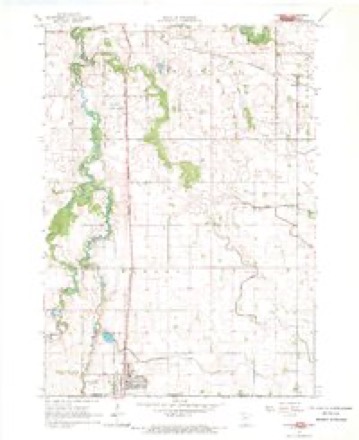
4 surveys from 6 printed sheetsMatched by testing this settlement's coordinate against the published boundary of every sheet in the United States Geological Survey's historical collection. Each opens the scanned sheet at the Survey.
- 1954 USGS Fairmont quadrangle1:250000, 3 printings
- 1958 USGS Fairmont quadrangle1:250000
- 1967 USGS Elmore quadrangle1:24000
- 1985 USGS Fairmont quadrangle1:100000
In the county-history sources
3,182 words on this townshipThe History of Faribault County, Minnesota : from Its First Settlement to the Close of the Year 1879 : the Story of the Pioneers, published 1896 names this settlement in its chapter on Elmore City. These are the passages that mention it, exactly as the scans read.
The name of the town was changed to -Elmore" by act of the legislature of 1B62. The town was so named in honor of Andrew E. Elmore, a distinguished citizen of the state of Wisconsin, and a life long friend of several early settlers and prominent citizens of the town.
Passage source: The History of Faribault County, Minnesota : from Its First Settlement to the Close of the Year 1879 : the Story of the Pioneers, published 1896.
At Mukwonago, Mr. Elmore engaged, for many years, in the mercantile business, and was. for some years, postmaster of that, place. Mr. Wm. S. Drake, now a resident of this county, was for some time a partner with Mr. Elmore, in business of merchandising. In 1842 hi' was elected to the Wisconsin territorial lesislalure, for Milwaukee and Washington counties, and served two years as such meralier. He was also a member of the llrst constitutional convention, in in 184e, and was a member of the assembly in the sessions of 1869 and I8C0 He was, for twelve years, chairman of the board of county supervisors of Waukesha county.
Passage source: The History of Faribault County, Minnesota : from Its First Settlement to the Close of the Year 1879 : the Story of the Pioneers, published 1896.
In 1864 he removed to Green Bay. Brown county, Wisconsin. From this place he removed to Fort Howard, Wisconsin, in 1868, where he has since resided Mr. Elmore has been a member of the State board of charities and reform, from its organization, in Aiiril, 1871, and is now, and has been for the past ten years, its president, a highly honorable ollice. Mr. Elmore received a good common school and busini.'ss education, but is essentially a self-made man. He is a diligent reader, and a close observer of public affairs, and has always taken a large interest in public enterprises. He is a man of positive convictions and opinions, energetic and prompt, and is one whose intluence is felt in the community. He has long been known, among his friends, as "The Sage of Mukwonago,"' at which place he resided twenty-tlve years.
Passage source: The History of Faribault County, Minnesota : from Its First Settlement to the Close of the Year 1879 : the Story of the Pioneers, published 1896.
Machine-read from a century-old scan, so expect the errors a machine makes: misspelled names, dropped words, stray characters.
Read the whole chapter on Elmore City - it names this place 6 more 6 times.
Fires near this place
1 since 2010Regional context, not property-specific evidence. The federal wildfire occurrence database lists 1 fire within 5 miles of Elmore in 2010, burning about 1 acre in total. None started naturally. None was recorded as arson. Distance is straight-line from the map coordinates, so a fire counted here may appear on a neighbouring settlement's page as well.
| Reported cause | Fires |
|---|---|
| Missing data/not specified/undetermined | 1 |
The most recent of them, most recent first, with the day each was reported and the service that recorded it.
| Date | Cause | Size | Reported by | Name on the report |
|---|---|---|---|---|
| 8 November 2010 | Missing data/not specified/undetermined | 1.0 acres | Iowa Department of Natural Resources | 547740 190TH AVE, IOWA |
Mines and quarries near this place
6 within 5 milesRegional context, not property-specific evidence. The federal mineral resources record lists 6 workings within 5 miles of Elmore: 6 past producers. None of them still produces. What was taken out: Sand and Gravel, Construction. Distance is straight-line from the map coordinates, so a quarry counted here may appear on a neighbouring settlement's page as well.
| Where | Site | Commodity | Status | Recorded |
|---|---|---|---|---|
| Unknown | Sand and Gravel, Construction | Past Producer | ||
| Unknown | Sand and Gravel, Construction | Past Producer | ||
| Unknown | Sand and Gravel, Construction | Past Producer | ||
| Unknown | Sand and Gravel, Construction | Past Producer | ||
| Unknown | Sand and Gravel, Construction | Past Producer | ||
| Unknown | Sand and Gravel, Construction | Past Producer |
Storms near this place
17 since 1998Regional context, not property-specific evidence. The National Weather Service names Elmore in 17 storm reports between 1998 and 2013: 8 hail, 4 thunderstorm wind, 2 funnel cloud, 2 tornado. No death or injury is recorded in these reports. Each account below is quoted exactly as the forecast office filed it, from the NOAA Storm Events Database, and each date opens the federal record of that event.
| When | Event | Place named | Harm | What the report says |
|---|---|---|---|---|
| May 1998 | Thunderstorm Wind | Elmore | $10,000,000 | 20 to 40 homes damaged. Estimated windspeed. Damage estimate for entire county. |
| June 2013 | Thunderstorm Wind | Elmore | - | Numerous trees and large branches were blown down around the town of Elmore and surrounding farms. |
| June 2013 | Flash Flood | Elmore | - | Heavy rainfall caused Highway 169 near Elmore to close due to flood waters. |
| June 2010 | Tornado (EF0) | Elmore | - | A metal shed building was blown in, with debris from the building up to a quarter mile away. Multiple trees were uprooted. The tornado was recorded on video by storm chasers. |
| June 2010 | Tornado (EF0) | Elmore | - | The tornado broke several dozen trees. It was recorded on video by storm chasers. |
| April 2004 | Thunderstorm Wind | Elmore | - | A tree and other large branches were downed. |
| June 1999 | Hail | Elmore | - | Crop damage reported. |
| March 2007 | Hail | Elmore | - | no account filed |
| March 2007 | Hail | Elmore | - | no account filed |
| August 2002 | Funnel Cloud | Elmore | - | no account filed |
| August 2002 | Funnel Cloud | Elmore | - | no account filed |
| April 2001 | Hail | Elmore | - | no account filed |
| June 2001 | Hail | Elmore | - | no account filed |
| June 2001 | Hail | Elmore | - | no account filed |
| June 1999 | Hail | Elmore | - | no account filed |
| June 1999 | Thunderstorm Wind | Elmore | - | no account filed |
| June 1999 | Hail | Elmore | - | no account filed |
Nearest settlements
The eight closest, with where each one stands in the county. Distances are straight-line, computed from the Geographic Names Information System coordinates.
| Map | Place | Distance | Sheets |
|---|---|---|---|
| Pilot Grove | 7.6 miles | 6 | |
| Marna | 8.2 miles | 6 | |
| Blue Earth | 9.2 miles | 7 | |
| Frost | 10.2 miles | 8 | |
| Riverside Heights | 11.1 miles | 7 | |
| Dell | 12.3 miles | 8 | |
| Guckeen | 12.4 miles | 7 | |
| Bricelyn | 15.2 miles | 8 |
Elsewhere
Matched on this settlement's Geographic Names Information System number rather than its name, so it cannot be a different place of the same name in another state.
| Wikipedia article on Elmore | An encyclopaedic summary. Its text is share-alike, so it is linked here rather than copied. |
| Wikidata item Q960340 | The structured record the population and elevation above come from. Public domain (CC0). |
Provenance
This settlement is recorded in the Geographic Names Information System as feature 643313. The sheet list is computed by point-in-boundary test against the United States Geological Survey's historical topographic inventory. Both are works of the United States government and carry no copyright under 17 U.S.C. 105.
Wildfire. Short, Karen C. 2022. Spatial wildfire occurrence data for the United States, 1992-2020 [FPA_FOD_20221014]. 6th Edition. Fort Collins, CO: Forest Service Research Data Archive. https://doi.org/10.2737/RDS-2013-0009.6 Collected with United States Government funding and usable without additional permissions or fees.
Mines and quarries. USGS Mineral Resources Data System (MRDS) https://mrdata.usgs.gov/mrds/ A work of the United States government, no copyright under 17 U.S.C. 105.
Storms. NOAA National Centers for Environmental Information, Storm Events Database https://www.ncei.noaa.gov/stormevents/ A work of the United States government, no copyright under 17 U.S.C. 105. Narratives are quoted verbatim from the National Weather Service report and are not edited or summarised.