 Block
Good Thunder, Minnesota
12 topographic sheets cover this place, the earliest surveyed in 1951 and the latest in 1991. It stands in Lyra Township. It lies in ZIP code area 56037. The Survey maps it on the Good Thunder quadrangle. 560 people lived here at the 2020 count. It stands 991 feet above sea level.
On record in Good Thunder
Buildings and businesses the archive holds for this place. Each opens its own page, with the source record it came from.
On the National Register 1 record
- Zieglers Ford Bridgelisted 1989
Population over time
2 figuresGood Thunder fell from 583 to 560 between 2010 and 2020. These are the recorded population figures Wikidata holds for this place, reached through the Geographic Names Information System number this page is keyed on rather than by name, so they belong to this place and not to another of the same name. Most are census counts, but not all are: an early figure may be a founding or settlement estimate, and an estimate published within five years of a census is left out. The change column is computed, and is left blank where more than 20 years separate a figure from the one before it, because a gap that long is not a change between two counts.
| Year | People | Change |
|---|---|---|
| 2010 | 583 | |
| 2020 | 560 | -23 (-4%) |
Topographic sheets covering this place
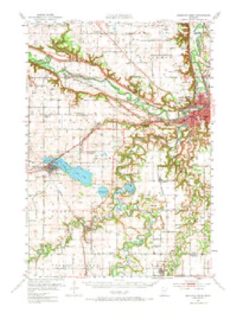
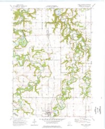
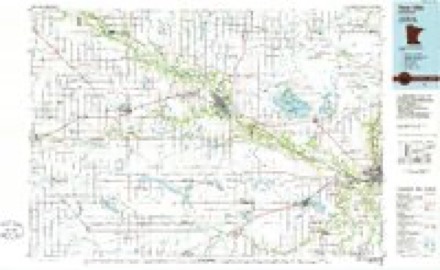
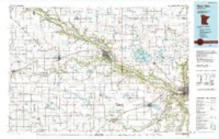
8 surveys from 12 printed sheetsMatched by testing this settlement's coordinate against the published boundary of every sheet in the United States Geological Survey's historical collection. Each opens the scanned sheet at the Survey.
- 1951 USGS Mankato West quadrangle1:62500, 3 printings
- 1953 USGS New Ulm quadrangle1:250000, 3 printings
- 1957 USGS New Ulm quadrangle1:250000
- 1958 USGS New Ulm quadrangle1:250000
- 1967 USGS New Ulm quadrangle1:250000
- 1974 USGS Good Thunder quadrangle1:24000
- 1986 USGS New Ulm quadrangle1:100000
- 1991 USGS New Ulm quadrangle1:100000




In the county-history sources
2,360 words on this townshipHistory of Blue Earth County and Biographies of Its Leading Citizens, published 1901 names this settlement in its chapter on Lyra Township. These are the passages that mention it, exactly as the scans read.
Meilicke, celebrated at the house of M. L. Plumb, in Section 28, by Eev. J. M. Thurston in December, 1865. The first religious services were conducted at the same house by the same minister in the fall of 1864. The first school was taught by Miss Elvira Eew in the summer of 1867, in a log school house located on the present site of Good Thunder.
Passage source: History of Blue Earth County and Biographies of Its Leading Citizens, published 1901.
About 1870, Geo. Doty built a mill on the- Maple river in Section 2, which he operated for a few years, called the "Elkhorn Mills." In the fall and winter of 1905, E. L. Houk and Walter Eedfern built a large steam grist mill at Good Thunder which burned in the summer of 1908.
Passage source: History of Blue Earth County and Biographies of Its Leading Citizens, published 1901.
During the days of the Winnebago Eeservation, an Indian chief called. Good Thunder, occupied the log buildings and field which had constituted the homestead of Noble G. Eoot in Section 10. Here was a good ford of the Maple river, which after the chief was called "Good Thunder's Ford." When the Wells Eailroad was located in 1869-70, the proprietors arranged to have a depot and town site near this ford.
Passage source: History of Blue Earth County and Biographies of Its Leading Citizens, published 1901.
Machine-read from a century-old scan, so expect the errors a machine makes: misspelled names, dropped words, stray characters.
Read the whole chapter on Lyra Township - it names this place 10 more 10 times.
Mines and quarries near this place
2 within 5 milesRegional context, not property-specific evidence. The federal mineral resources record lists 2 workings within 5 miles of Good Thunder: 1 past producer, 1 producer. 1 still produces. What was taken out: Stone, Crushed/Broken, Sand and Gravel, Construction. Distance is straight-line from the map coordinates, so a quarry counted here may appear on a neighbouring settlement's page as well.
| Where | Site | Commodity | Status | Recorded |
|---|---|---|---|---|
| Fairbanks Quarry | Stone, Crushed/Broken | Past Producer | ||
| Prange Pit | Sand and Gravel, Construction | Producer |
Storms near this place
12 since 1994Regional context, not property-specific evidence. The National Weather Service names Good Thunder in 12 storm reports between 1994 and 2016: 7 hail, 2 tornado, 2 thunderstorm wind, 1 funnel cloud. No death or injury is recorded in these reports. Each account below is quoted exactly as the forecast office filed it, from the NOAA Storm Events Database, and each date opens the federal record of that event.
| When | Event | Place named | Harm | What the report says |
|---|---|---|---|---|
| June 2016 | Thunderstorm Wind | Good Thunder | - | Numerous trees and power lines were blown down in the city of Good Thunder. |
| June 2010 | Tornado (EF2) | Good Thunder | - | This tornado damaged several farmsteads. A barn was caved in on a side, roofs of hog barns were blown off, trees were snapped or uprooted, and a wood pole was snapped. |
| June 2007 | Hail | Good Thunder | - | Occurred on County Road 13. |
| September 2006 | Funnel Cloud | Good Thunder | - | Multiple reports. |
| April 2004 | Thunderstorm Wind | Good Thunder | - | The roof was partially lifted off a home. |
| August 1994 | Tornado (F1) | Good Thunder- | - | Golfball size hail was reported in Garden City. |
| June 2014 | Hail | Good Thunder | - | no account filed |
| June 2014 | Hail | Good Thunder | - | no account filed |
| April 2010 | Hail | Good Thunder | - | no account filed |
| July 2006 | Hail | Good Thunder | - | no account filed |
| July 2006 | Hail | Good Thunder | - | no account filed |
| June 2005 | Hail | Good Thunder | - | no account filed |
Nearest settlements
The eight closest, with where each one stands in the county. Distances are straight-line, computed from the Geographic Names Information System coordinates.
| Map | Place | Distance | Sheets |
|---|---|---|---|
| Beauford | 5.7 miles | 13 | |
| Garden City | 6.0 miles | 12 | |
| Rapidan | 6.2 miles | 12 | |
| Vernon Center | 6.2 miles | 6 | |
| Sterling Center | 6.8 miles | 6 | |
| Mapleton | 7.8 miles | 7 | |
| Amboy | 9.4 miles | 6 | |
| Skyline | 9.7 miles | 13 |
Elsewhere
Matched on this settlement's Geographic Names Information System number rather than its name, so it cannot be a different place of the same name in another state.
| Wikipedia article on Good Thunder | An encyclopaedic summary. Its text is share-alike, so it is linked here rather than copied. |
| Wikidata item Q2230638 | The structured record the population and elevation above come from. Public domain (CC0). |
Provenance
This settlement is recorded in the Geographic Names Information System as feature 644218. The sheet list is computed by point-in-boundary test against the United States Geological Survey's historical topographic inventory. Both are works of the United States government and carry no copyright under 17 U.S.C. 105.
Mines and quarries. USGS Mineral Resources Data System (MRDS) https://mrdata.usgs.gov/mrds/ A work of the United States government, no copyright under 17 U.S.C. 105.
Storms. NOAA National Centers for Environmental Information, Storm Events Database https://www.ncei.noaa.gov/stormevents/ A work of the United States government, no copyright under 17 U.S.C. 105. Narratives are quoted verbatim from the National Weather Service report and are not edited or summarised.