 Block
Rapidan, Minnesota
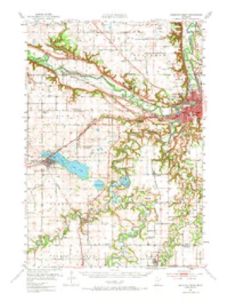
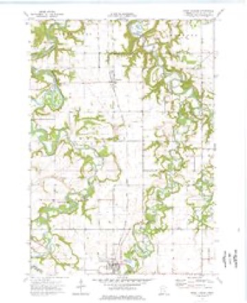
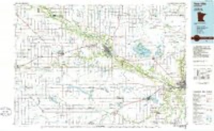
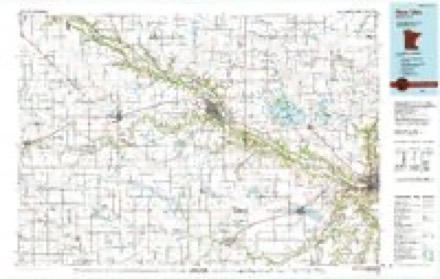
12 topographic sheets cover this place, the earliest surveyed in 1951 and the latest in 1991. It stands in Rapidan Township. It lies in ZIP code area 56001. The Survey maps it on the Good Thunder quadrangle. It stands 988 feet above sea level.
Topographic sheets covering this place
8 surveys from 12 printed sheetsMatched by testing this settlement's coordinate against the published boundary of every sheet in the United States Geological Survey's historical collection. Each opens the scanned sheet at the Survey.
- 1951 USGS Mankato West quadrangle1:62500, 3 printings
- 1953 USGS New Ulm quadrangle1:250000, 3 printings
- 1957 USGS New Ulm quadrangle1:250000
- 1958 USGS New Ulm quadrangle1:250000
- 1967 USGS New Ulm quadrangle1:250000
- 1974 USGS Good Thunder quadrangle1:24000
- 1986 USGS New Ulm quadrangle1:100000
- 1991 USGS New Ulm quadrangle1:100000




In the county-history sources
33,249 words on this townshipHistory of Blue Earth County and Biographies of Its Leading Citizens, published 1901 names this settlement in its chapter on Rapidan Township. These are the passages that mention it, exactly as the scans read.
The first claim in this town was located by Basil Moreland on Section 7 in March, 1854. A month later Oliver J. Roe made a claim in the same neighborhood. In August, Williston K. Greenwood, also, took a claim in Section 7. The same month Isaac Andrus and his son, Truman F. Andrus, located with their families on Sections 11 and 13 on the Maple. In October, Cornelius YanNice claimed in Section 21 and moved thereto with his family. Wm. P. Coffin and Joel Cloud, early in the spring of 1855, located on Section 5. But all of these settlers had to abandon their homes in a year or so as the town "n'as included in the Winnebago Reser^-ation. White settlers, were thereafter barred until the removal of the Indians in 1863. The fall of 1863 and the spring of 18G4 saw the beginning of white settlements again in the town. Among the first settlers were: Gottfried and Jacob Sanger, who located there in 1863, J. D. Hooser,
Passage source: History of Blue Earth County and Biographies of Its Leading Citizens, published 1901.
Eiley Stratton took possession of the log cabin, wliich Isaac Andrus had built and which during the Winnebago occupation had been used by the chief, Big Bear. The town was first named "DeSoto" by the County Board in yVpril, 1858. In July, 1864, C. P. Cook started a town site in Section 6, on the Blue Earth, which he called "Rapidan"" after the place he had come from in the east. March 2, 1865, a bill was passed by the State Ijegislature changing the name of the town to "Eapidan" at the suggestion of Mr. Cook.
Passage source: History of Blue Earth County and Biographies of Its Leading Citizens, published 1901.
In the summer of 1865, John Morrow purchased 120 acres of land near the mouth of Maple River, whereon he erected kilns and engaged in the manufacture of lime for two or three years. He also opened stone quarries on the same land. During the winter of 1866-7 S. Kenworthy and Co., erected a large flour mill, 30x40 and four stories high, at the foot of the Blue Earth River rapids. The mill had two runs of buhrs four feet across. It was afterwards much enlarged, and for many years was famous as one of the principal custom mills of the county. The site is still occupied by the Rogers Roller Mill. During the winter of 1866- 7 Geo. Heaton and Richard Rew built a saw mill on the Blue Earth in Section 31, to which in a year or two they added a flour mill and named it the "Union Mill." The same winter Lucius Dyer put up a saw mill on the Maple in Section 35, to which he added later a grist mill. This mill later passed into the hands of Geo. Gerlich, then to Jesse 0. Mericle. In 1884, Henry Dyer built a new saw mill on the Maple. In vVugust 1867, Silas Kenworthy, J. W. Mendenhall, James B. Swan and James A. Wiswell, laid out a town called "Rapids" on land adjoining the Rapidan Mill. In December, 1865, PafE and Reynolds opened a store at this place. Nothing further came of this townsite. About 1867, a postofEice was established in Sec. 35 with J jucius Dyer as postmaster called "Maple River." It was on a newly established mail route between Wilton and Garden City. In October, 1869 "The (.astle Garden" postoffice was created in charge of Dr. N. Bixby, who lived on Section 15, As. there was no mail route, Dr. Bixby had to carry the mail from Mankato for the office. J. W. Derby succeeded Dr. Bixby as postmaster but tlie office was discontinued in March, 1875. In January, 187 G, a new postoffice was established at the house of Olof Olson called "Rapidan" on the Milwaukee Railway near where the present station is situated. In October, 1880, Mr. Olson opened a store at the present site of Rapidan station, which he conducted until August, 1887, when he was succeeded by W. 0. Dustin & Co. April 1, 1888, Olaf Olson was succeeded as postmaster by Noah Webster, who also, had become the owner of the store at Eapidan Station. He died in November, 1891, and \\as succeeded by h's son, Wm. Webster. March 1, 1895, Wm. T. Just became storekeeper and postmaster, and in 1907, Daniel E. and Wm. A. Bosin became his successors in business and Daniel E. Bosin was made postmaster. A lumber yard and blacksmith shop are also, main- tained at the same place. An ek-vator was erected, and in 1897 a co-operative creamer}' was built. In 1900, a Woodman Hall was built, and a passenger depot put up in the fall of 1906. Theee buildings, with a church and number cf residences, make now of Eapidan Station, a sjnall village.
Passage source: History of Blue Earth County and Biographies of Its Leading Citizens, published 1901.
Machine-read from a century-old scan, so expect the errors a machine makes: misspelled names, dropped words, stray characters.
Read the whole chapter on Rapidan Township - it names this place 1 more 1 time.
Fires near this place
2 since 2009Regional context, not property-specific evidence. The federal wildfire occurrence database lists 2 fires within 5 miles of Rapidan between 2009 and 2013, burning about 6 acres in total. None started naturally. None was recorded as arson. Distance is straight-line from the map coordinates, so a fire counted here may appear on a neighbouring settlement's page as well.
| Reported cause | Fires |
|---|---|
| Railroad operations and maintenance | 1 |
| Fireworks | 1 |
The most recent of them, most recent first, with the day each was reported and the service that recorded it.
| Date | Cause | Size | Reported by | Name on the report |
|---|---|---|---|---|
| 5 July 2013 | Fireworks | 5.0 acres | Minnesota Department of Natural Resources | not named |
| 16 March 2009 | Railroad operations and maintenance | 1.0 acres | Minnesota Department of Natural Resources | not named |
Settlements close enough to share some of these fires:
Mines and quarries near this place
6 within 5 milesRegional context, not property-specific evidence. The federal mineral resources record lists 6 workings within 5 miles of Rapidan: 3 producers, 2 occurrences, 1 past producer. 3 still produce. What was taken out: Sand and Gravel, Construction, Stone, Crushed/Broken, Silica, Clay. Distance is straight-line from the map coordinates, so a quarry counted here may appear on a neighbouring settlement's page as well.
| Where | Site | Commodity | Status | Recorded |
|---|---|---|---|---|
| Blue Earth County Clay Deposit No 2 | Clay | Occurrence | ||
| Blue Earth County Sand Bed | Silica | Occurrence | ||
| Fairbanks Quarry | Stone, Crushed/Broken | Past Producer | ||
| Guaranteed Gravel & Sand Pit | Sand and Gravel, Construction | Producer | ||
| Hanel Sand & Gravel Pit | Sand and Gravel, Construction | Producer | ||
| Prange Pit | Sand and Gravel, Construction | Producer |
Storms near this place
15 since 1994Regional context, not property-specific evidence. The National Weather Service names Rapidan in 15 storm reports between 1994 and 2026: 6 tornado, 3 hail, 3 thunderstorm wind, 2 funnel cloud. No death or injury is recorded in these reports. Each account below is quoted exactly as the forecast office filed it, from the NOAA Storm Events Database, and each date opens the federal record of that event.
| When | Event | Place named | Harm | What the report says |
|---|---|---|---|---|
| July 2003 | Tornado (F1) | Rapidan | $500,000 | The fourth tornado in a series formed atop a bluff on the west side of the Le Sueur River valley, struck two homes down in the river valley, then moved back up the bluffs on the east side of the valley, where it snapped many trees and produced minor damage to some more houses, sheds and outbuildings. Videotaped by storm chasers. |
| August 2016 | Thunderstorm Wind | Rapidan | $150,000 | A newly constructed grain bin blew down, and landed on a machine shed and another bin. |
| September 2018 | Tornado (EF0) | Rapidan | $50,000 | A NWS storm survey, plus video from a drone, concluded that an EF0 tornado touched down north of Rapidan, and moved east for approximately a mile. Damage was confined to a field, and two homes. The main damage was to a home that had a tree fall on its roof. |
| July 2025 | Flash Flood | Rapidan | - | A few local county roads closed and minor debris was deposited on rural roads due to flooding. Main areas impacted were south of MSU-Mankato and along County Road 1. |
| July 2017 | Thunderstorm Wind | Rapidan | - | Numerous trees were blown down in Mankato. There were other reports of small limbs blown down throughout northern and central portions of Blue Earth County. |
| June 2016 | Thunderstorm Wind | Rapidan | - | A few trees and power lines were blown down near the city of Rapidan. |
| June 2010 | Tornado (EF0) | Rapidan | - | A tornado tore through a wooded area, knocking down or shearing off a couple hundred trees. |
| June 2010 | Tornado (EF2) | Rapidan | - | Barn walls collapsed and a garage was pushed off its foundation. Power poles were snapped and multiple trees uprooted. |
| August 2010 | Tornado (EF0) | Rapidan | - | Tornado touched down just southeast of the intersection of Highways 60 and 169. It hit a field and lofted numerous corn stalks. After dissipating, the parent circulation moved to the vicinity of the intersection of County Road 90 and State Highway 22, but no additional touchdowns were noted. Tornado was photographed by spotter. |
| July 2003 | Tornado (F1) | Rapidan | - | The third tornado in a series touched down in a corn field and trekked straight east. It caused minor house damage and knocked down several sheds and outbuildings, then moved across corn and bean fields before causing minor damage to a farmstead. It dissipated shortly after moving through the farmstead. Videotaped by storm chasers. |
| August 1994 | Hail | Rapidan | - | Golfball size hail pelted Rapidan. |
| April 2026 | Hail | Rapidan | - | no account filed |
| May 2014 | Hail | Rapidan | - | no account filed |
| August 2010 | Funnel Cloud | Rapidan | - | no account filed |
| September 1996 | Funnel Cloud | Rapidan | - | no account filed |
Nearest settlements
The eight closest, with where each one stands in the county. Distances are straight-line, computed from the Geographic Names Information System coordinates.
| Map | Place | Distance | Sheets |
|---|---|---|---|
| Skyline | 3.9 miles | 13 | |
| LeHillier | 4.3 miles | 13 | |
| University Park of Mankato | 5.4 miles | 14 | |
| Mankato | 6.0 miles | 14 | |
| Garden City | 6.1 miles | 12 | |
| Good Thunder | 6.2 miles | 12 | |
| Belle Haven | 7.5 miles | 14 | |
| Lake Crystal | 8.0 miles | 12 |
Elsewhere
Matched on this settlement's Geographic Names Information System number rather than its name, so it cannot be a different place of the same name in another state.
| Wikipedia article on Rapidan | An encyclopaedic summary. Its text is share-alike, so it is linked here rather than copied. |
| Wikidata item Q48848770 | The structured record the population and elevation above come from. Public domain (CC0). |
Provenance
This settlement is recorded in the Geographic Names Information System as feature 649825. The sheet list is computed by point-in-boundary test against the United States Geological Survey's historical topographic inventory. Both are works of the United States government and carry no copyright under 17 U.S.C. 105.
Wildfire. Short, Karen C. 2022. Spatial wildfire occurrence data for the United States, 1992-2020 [FPA_FOD_20221014]. 6th Edition. Fort Collins, CO: Forest Service Research Data Archive. https://doi.org/10.2737/RDS-2013-0009.6 Collected with United States Government funding and usable without additional permissions or fees.
Mines and quarries. USGS Mineral Resources Data System (MRDS) https://mrdata.usgs.gov/mrds/ A work of the United States government, no copyright under 17 U.S.C. 105.
Storms. NOAA National Centers for Environmental Information, Storm Events Database https://www.ncei.noaa.gov/stormevents/ A work of the United States government, no copyright under 17 U.S.C. 105. Narratives are quoted verbatim from the National Weather Service report and are not edited or summarised.