 Block
Hart, Minnesota
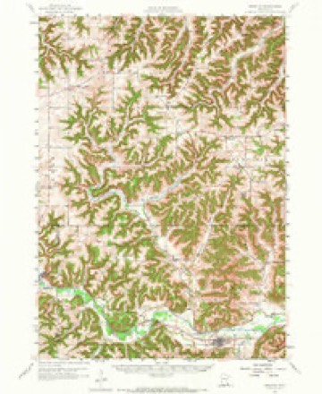
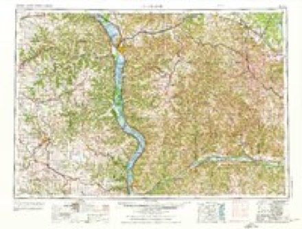
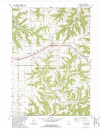
11 topographic sheets cover this place, the earliest surveyed in 1958 and the latest in 1990. It stands in Hart Township. It lies in ZIP code area 55971. The Survey maps it on the Wilson quadrangle. It stands 1,204 feet above sea level.
Topographic sheets covering this place
8 surveys from 11 printed sheetsMatched by testing this settlement's coordinate against the published boundary of every sheet in the United States Geological Survey's historical collection. Each opens the scanned sheet at the Survey.
- 1958 USGS Houston quadrangle1:62500, 2 printings
- 1958 USGS La Crosse quadrangle1:250000, 2 printings
- 1961 USGS La Crosse quadrangle1:250000
- 1965 USGS La Crosse quadrangle1:250000
- 1976 USGS La Crosse quadrangle1:250000
- 1980 USGS Wilson quadrangle1:24000, 2 printings
- 1984 USGS La Crosse quadrangle1:100000
- 1990 USGS La Crosse quadrangle1:100000
In the county-history sources
868 words on this townshipHistory of Winona County, published 1883 names this settlement in its chapter on Hart Township. These are the passages that mention it, exactly as the scans read.
This township lies in T. 105 N., of R. 8 West. It comprises thirty-six complete sections. Its boundaries are, on the north Warren township, on the east Wiscoy, on the south Fillmore county, and on the west Fremont township. The surface is rough and broken - what is known as ''grub land." The soil, nevertheless, is very productive. The high bluffs divide the country into four valleys. Rush Creek, Diy, Pine Creek and Knapp valleys. All excepting Pine Creek valley run north and south ; the latter runs east and west. Dry valley is so called from a small stream which disappears in a subterranean channel only to reappear again in unexpected places. Rush Creek valley is the largest of the four, and is named after Rush creek ; Knapp's valley, so called from J. R. Knapp, an old resident in that vicinity ; Pine Creek valley named after Pine creek. This stream in an early day was heavily timbered with black walnut, maple, oak, basswood and scattering pine. The pine has now disappeared. Rush creek enters the township on S.W. J Sec. 6, flows southeast through Sees. T, 13, 19, 29 and 33, leaving the township on Sec. 33 ; Pine creek enters township on S.W. ^ Sec. 30, flows southeast through Sees. 31 and 32, and joins Rush creek on Sec. 33. Hart was organized May 11, 1858, under the name of Benton township ; a year after it was given its present name. The first town clerk was John Pierce, appointed at the first meeting in 1858. The first board were : J. W. Young, John Knapp, justices of the peace ; Liborius Kauphusman, Patrick Orourke, constables ; George Bisset, assessor ; Jesse Conner, collector ; M. T. Doherty, Thomas Baily, F. M. Andrews, supervisors. The town clerks in succession : John Pierce, M. T. Doherty, J. M. Hitchcock, John King, Berend Bollmann, John King, Berend BoUmann (clerk for 1882-3). Board for 1882-3: Daniel McKay, M. Degnan. George Schaupp, supervisors ; B. Bollmann, D. H. Otis, justices of the peace ; John Millman, assessor ; Herman Trester, constable.
Passage source: History of Winona County, published 1883.
Oliver Parmelee came to this section in 1854 and took up part of Sec. 2. Laborius Kauphusman came in 1855, surveyed land, and made a claim on S.E. J Sec. 16. He then left, and returned soon afterward with his family ; he is now dead, but the farm is in the hands of his children. Thomas Heberer and M. T. Doherty came the same year (1855) ; Thomas Heberer settled on Sec. 2, while M. T. Doherty entered the N.E. J Sec. 12. The following made their appearance in 1856 : Henry Ronnenberg, Rev. A. Brand, John C. Brand, John Parmelee, Smith Thorington, Job Thorington and John Brammer. Henry Ronnenberg settled on Sec. 12 ; Rev. A. Brand came with a large herd of cattle and took up land on Sec. 24 ; John C. Brand entered part of Sec. 23 ; John Parmelee, Smith Thorington and Job Thorington settled on Sec. 10, while John Brammer made a claim of N.E. J Sec. 1. A large hotel (or tavern as it was called), named the "Benton House," was kept by O. E. Fockens in 1857 on Sec. 2. At this time there was an immense amount of travel through this section of the countr}', and the hotel did a thriving business. This soon fell off, however, at the entrance of railways, and the place was deserted in 18fi5. There is but one mill in Hart ; it is a flouring-mill built on Rush creek in 1860 (Sec. 29) by G. M. Hitchcock. It is a frame structure of medium size, and has a "custom business" only. There is but one postofftce in the township, namely. Hart postottice. It was established in 1872, with John Kiekbusch as })ostmaster. The present postmaster is Charles Wolfram, who also keeps a small country store. (This is on Sec. 26.)
Passage source: History of Winona County, published 1883.
Machine-read from a century-old scan, so expect the errors a machine makes: misspelled names, dropped words, stray characters.
Fires near this place
14 since 1995Regional context, not property-specific evidence. The federal wildfire occurrence database lists 14 fires within 5 miles of Hart between 1995 and 2018, burning about 158 acres in total. None started naturally. 1 was recorded as arson. Distance is straight-line from the map coordinates, so a fire counted here may appear on a neighbouring settlement's page as well.
| Reported cause | Fires |
|---|---|
| Debris and open burning | 6 |
| Missing data/not specified/undetermined | 5 |
| Smoking | 2 |
| Arson/incendiarism | 1 |
The most recent of them, most recent first, with the day each was reported and the service that recorded it.
| Date | Cause | Size | Reported by | Name on the report |
|---|---|---|---|---|
| 9 April 1997 | Debris and open burning | 15 acres | Minnesota Department of Natural Resources | not named |
| 8 April 1996 | Missing data/not specified/undetermined | 1.0 acres | Minnesota Department of Natural Resources | not named |
| 5 April 2004 | Missing data/not specified/undetermined | 3.0 acres | Minnesota Department of Natural Resources | not named |
| 29 April 2018 | Missing data/not specified/undetermined | 27 acres | Minnesota Department of Natural Resources | not named |
| 27 April 1996 | Debris and open burning | 2.0 acres | Minnesota Department of Natural Resources | not named |
| 24 April 2003 | Missing data/not specified/undetermined | 54 acres | Minnesota Department of Natural Resources | not named |
| 18 April 1996 | Debris and open burning | 30 acres | Minnesota Department of Natural Resources | not named |
| 14 April 1995 | Smoking | under an acre | Minnesota Department of Natural Resources | not named |
Settlements close enough to share some of these fires:
Storms near this place
13 since 1998Regional context, not property-specific evidence. The National Weather Service names Hart in 13 storm reports between 1998 and 2022: 6 hail, 4 thunderstorm wind, 1 lightning, 1 tornado. No death or injury is recorded in these reports. Each account below is quoted exactly as the forecast office filed it, from the NOAA Storm Events Database, and each date opens the federal record of that event.
| When | Event | Place named | Harm | What the report says |
|---|---|---|---|---|
| December 2021 | Thunderstorm Wind | Hart | $50,000 | A path of wind damage occurred west of Hart where the roof was removed from a farm outbuilding, a metal pole shed was destroyed and siding removed from a house. |
| May 1998 | Thunderstorm Wind | Hart | $40,000 | no account filed |
| May 1998 | Lightning | Hart | $25,000 | no account filed |
| June 2022 | Flood | Hart | $5,000 | Runoff from heavy rain caused a couple of small creeks across rural southern Winona County to go out of their banks. Water from these creeks went over State Highway 76 near the intersection with County Road 17 southwest of Ridgeway and over the intersection of County Roads 5 and 125 near New Hartford. |
| September 2018 | Tornado (EF1) | Hart | $5,000 | A NWS Storm Survey found that an EF-1 tornado that started in Fillmore County, entered Winona County southwest of Hart near County Highway 25. The tornado then traveled northeast across rural areas before ending along State Highway 43 between Hart and Interstate 90. The tornado had an intermittent damage path with only some minor damage to one home and some trees. |
| May 2008 | Hail | Hart | $5,000 | no account filed |
| September 2010 | Thunderstorm Wind | Hart | $2,500 | Several trees were blown down in the township of Hart. |
| July 2018 | Thunderstorm Wind | Hart | $2,000 | The outflow from a line of thunderstorms contained severe wind gusts as it moved across southern Winona County and blew down trees southeast of Lewiston. |
| August 2006 | Hail | Hart | $750 | no account filed |
| April 2017 | Hail | Hart | - | Quarter sized hail fell north of Rushford. |
| September 2012 | Hail | Hart | - | no account filed |
| June 1999 | Hail | Hart | - | no account filed |
| May 1998 | Hail | Hart | - | no account filed |
Nearest settlements
The eight closest, with where each one stands in the county. Distances are straight-line, computed from the Geographic Names Information System coordinates.
| Map | Place | Distance | Sheets |
|---|---|---|---|
| Wyattville | 5.2 miles | 10 | |
| Wilson | 6.5 miles | 11 | |
| Centerville | 7.2 miles | 11 | |
| Witoka | 7.5 miles | 11 | |
| Fremont | 8.8 miles | 10 | |
| Ridgeway | 9.9 miles | 11 | |
| Lewiston | 10.2 miles | 10 | |
| Stockton | 10.6 miles | 14 |
Elsewhere
Matched on this settlement's Geographic Names Information System number rather than its name, so it cannot be a different place of the same name in another state.
| Wikipedia article on Hart | An encyclopaedic summary. Its text is share-alike, so it is linked here rather than copied. |
| Wikidata item Q28912558 | The structured record the population and elevation above come from. Public domain (CC0). |
Provenance
This settlement is recorded in the Geographic Names Information System as feature 1817653. The sheet list is computed by point-in-boundary test against the United States Geological Survey's historical topographic inventory. Both are works of the United States government and carry no copyright under 17 U.S.C. 105.
Wildfire. Short, Karen C. 2022. Spatial wildfire occurrence data for the United States, 1992-2020 [FPA_FOD_20221014]. 6th Edition. Fort Collins, CO: Forest Service Research Data Archive. https://doi.org/10.2737/RDS-2013-0009.6 Collected with United States Government funding and usable without additional permissions or fees.
Storms. NOAA National Centers for Environmental Information, Storm Events Database https://www.ncei.noaa.gov/stormevents/ A work of the United States government, no copyright under 17 U.S.C. 105. Narratives are quoted verbatim from the National Weather Service report and are not edited or summarised.