 Block
Fremont, Minnesota
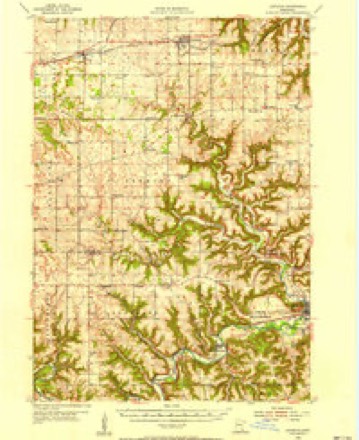
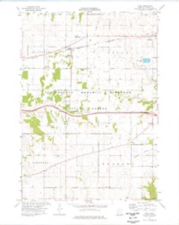
10 topographic sheets cover this place, the earliest surveyed in 1954 and the latest in 1990. It stands in Fremont Township. It lies in ZIP code area 55979. The Survey maps it on the Utica quadrangle.
Topographic sheets covering this place
8 surveys from 10 printed sheetsMatched by testing this settlement's coordinate against the published boundary of every sheet in the United States Geological Survey's historical collection. Each opens the scanned sheet at the Survey.
- 1954 USGS Lewiston quadrangle1:62500, 2 printings
- 1958 USGS La Crosse quadrangle1:250000, 2 printings
- 1961 USGS La Crosse quadrangle1:250000
- 1965 USGS La Crosse quadrangle1:250000
- 1974 USGS Utica quadrangle1:24000
- 1976 USGS La Crosse quadrangle1:250000
- 1984 USGS La Crosse quadrangle1:100000
- 1990 USGS La Crosse quadrangle1:100000
In the county-history sources
949 words on this townshipHistory of Winona County, published 1883 names this settlement in its chapter on Fremont Township. These are the passages that mention it, exactly as the scans read.
Fremont township lies in T. 105 N., R. 9 W. Its boundaries are, on the north LTtica, on J:he east Hart, on the west Saratoga, and on the south Fillmore county. The surface of Fremont township is diversified. In the eastern and southern portions the land is mucli broken, while in the central and western parts it is almost level. Rush creek flows through the northeastern corner, cutting Sees. 1, 2 and 12, while Pine creek flows through the southeastern portion, cutting Sees. 25 and 35.
Passage source: History of Winona County, published 1883.
The town was organized May 11, 1858, and E. B. Wells appointed town clerk. The first house built in FrenKjnt township was erected by Isaac Arnold, in the fall of 1854, on what is now Sec. 2. It was a small log-house, perhaps 14x16 feet in dimensions. In 1856 L. C. Rice built a small store on what is now Sec. 2. This was the first store known to have been kept in Fremont. In the same year (1856) "Captain" Hinkley started a blacksmith shop on Sec. 22. The first postoffice was established in 1857, on Sec. 2, at a village known as Neoca (long since abandoned), with L. C. Rice as postmaster.
Passage source: History of Winona County, published 1883.
In 1857 the first schoolhouse was built. It stood on Sec. 8, and was 24x16 feet. Malinda Joy was the first teacher. There were on an average forty pupils in attendance. Fremont has been honored by the presence of one doctor. Dr. W. S. Morrison came in 1867, and has been practicing in the vicinity ever since. The first hotel was kept by Isaac Arnold on Sec. 2 as early as 1855. The first road was built under the supervision of Phineas Gates in 1856. It was known as the Gates road, and led from the Du Bois mill on Sec. 26 to the territorial road in the center of the township. There are two churches in Fremont, - Scotch Presbyterian on Sec. 20 and the Methodist Episcopal church on Sec. 10. The Presbyterian church was built in 1865. It is 38 X 26 feet, with a spire seventy-one feet from the ground. The first minister was Rev. Craven, fi-om St. Charles. The congregation, which is composed entirely of
Passage source: History of Winona County, published 1883.
Machine-read from a century-old scan, so expect the errors a machine makes: misspelled names, dropped words, stray characters.
Read the whole chapter on Fremont Township - it names this place 1 more 1 time.
Fires near this place
23 since 1992Regional context, not property-specific evidence. The federal wildfire occurrence database lists 23 fires within 5 miles of Fremont between 1992 and 2009, burning about 39 acres in total. 1 started naturally. 1 was recorded as arson. Distance is straight-line from the map coordinates, so a fire counted here may appear on a neighbouring settlement's page as well.
| Reported cause | Fires |
|---|---|
| Equipment and vehicle use | 9 |
| Debris and open burning | 7 |
| Smoking | 2 |
| Railroad operations and maintenance | 2 |
| Arson/incendiarism | 1 |
| Natural | 1 |
| Missing data/not specified/undetermined | 1 |
The most recent of them, most recent first, with the day each was reported and the service that recorded it.
| Date | Cause | Size | Reported by | Name on the report |
|---|---|---|---|---|
| 8 September 2003 | Equipment and vehicle use | under an acre | Minnesota Department of Natural Resources | not named |
| 6 September 2006 | Missing data/not specified/undetermined | under an acre | Minnesota Department of Natural Resources | not named |
| 26 August 2003 | Equipment and vehicle use | under an acre | Minnesota Department of Natural Resources | not named |
| 24 August 1995 | Debris and open burning | under an acre | Minnesota Department of Natural Resources | not named |
| 2 August 2007 | Smoking | under an acre | Minnesota Department of Natural Resources | not named |
| 5 July 2002 | Equipment and vehicle use | under an acre | Minnesota Department of Natural Resources | not named |
| 3 July 1998 | Natural | under an acre | Minnesota Department of Natural Resources | not named |
| 30 June 1992 | Equipment and vehicle use | under an acre | Minnesota Department of Natural Resources | not named |
Settlements close enough to share some of these fires:
Mines and quarries near this place
4 within 5 milesRegional context, not property-specific evidence. The federal mineral resources record lists 4 workings within 5 miles of Fremont: 4 producers. All of them still produce. What was taken out: Stone, Crushed/Broken. Distance is straight-line from the map coordinates, so a quarry counted here may appear on a neighbouring settlement's page as well.
| Where | Site | Commodity | Status | Recorded |
|---|---|---|---|---|
| Buckbee Quarry | Stone, Crushed/Broken | Producer | ||
| Enterprise Quarry & Mill | Stone, Crushed/Broken | Producer | ||
| Woodward Quarry | Stone, Crushed/Broken | Producer | ||
| Wyattville Quarry | Stone, Crushed/Broken | Producer |
Storms near this place
10 since 2008Regional context, not property-specific evidence. The National Weather Service names Fremont in 10 storm reports between 2008 and 2022: 5 thunderstorm wind, 3 tornado, 2 hail. No death or injury is recorded in these reports. Each account below is quoted exactly as the forecast office filed it, from the NOAA Storm Events Database, and each date opens the federal record of that event.
| When | Event | Place named | Harm | What the report says |
|---|---|---|---|---|
| April 2022 | Thunderstorm Wind | Fremont | $20,000 | Outbuildings were damaged along with trees and power lines blown down southwest of Lewiston. Parts of the downed trees landed on a house. |
| April 2022 | Tornado (EF0) | Fremont | $10,000 | This EF0 tornado moved across rural parts of southwest Winona County in the Shelton Hill area. The tornado only caused some tree damage as it moved across farm fields. |
| April 2022 | Tornado (EF0) | Fremont | $10,000 | This EF0 tornado developed just southeast of the Fremont area in southwest Winona County and moved north across Interstate 90 before dissipating. Damage was limited to trees. |
| April 2022 | Thunderstorm Wind | Fremont | $10,000 | A farm outbuilding was damaged north of Fremont. |
| July 2022 | Tornado (EF0) | Fremont | $5,000 | A brief EF0 tornado tracked across the southwest sections of Winona County south of Fremont. The damage was limited to trees. |
| July 2008 | Thunderstorm Wind | Fremont | $5,000 | Law enforcement reported multiple trees down blocking the road at the intersection of Highway 33 and Henry Drive. |
| December 2021 | Thunderstorm Wind | Fremont | $1,000 | Large tree limbs were broke off south of Fremont. |
| May 2014 | Hail | Fremont | - | Golf ball sized hail fell southeast of St. Charles. |
| May 2013 | Thunderstorm Wind | Fremont | - | Wind gusts from a line of thunderstorms caused a semi truck to jack knife on Interstate 90 southwest of Lewiston. |
| May 2008 | Hail | Fremont | - | no account filed |
Nearest settlements
The eight closest, with where each one stands in the county. Distances are straight-line, computed from the Geographic Names Information System coordinates.
Provenance
This settlement is recorded in the Geographic Names Information System as feature 643929. The sheet list is computed by point-in-boundary test against the United States Geological Survey's historical topographic inventory. Both are works of the United States government and carry no copyright under 17 U.S.C. 105.
Wildfire. Short, Karen C. 2022. Spatial wildfire occurrence data for the United States, 1992-2020 [FPA_FOD_20221014]. 6th Edition. Fort Collins, CO: Forest Service Research Data Archive. https://doi.org/10.2737/RDS-2013-0009.6 Collected with United States Government funding and usable without additional permissions or fees.
Mines and quarries. USGS Mineral Resources Data System (MRDS) https://mrdata.usgs.gov/mrds/ A work of the United States government, no copyright under 17 U.S.C. 105.
Storms. NOAA National Centers for Environmental Information, Storm Events Database https://www.ncei.noaa.gov/stormevents/ A work of the United States government, no copyright under 17 U.S.C. 105. Narratives are quoted verbatim from the National Weather Service report and are not edited or summarised.