 Block
Judson, Minnesota
12 topographic sheets cover this place, the earliest surveyed in 1951 and the latest in 1991. It stands in Judson Township. It lies in ZIP code area 56055. The Survey maps it on the Judson quadrangle.
Topographic sheets covering this place
8 surveys from 12 printed sheetsMatched by testing this settlement's coordinate against the published boundary of every sheet in the United States Geological Survey's historical collection. Each opens the scanned sheet at the Survey.
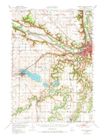
- 1951 USGS Mankato West quadrangle1:62500, 3 printings
- 1953 USGS New Ulm quadrangle1:250000, 3 printings
- 1957 USGS New Ulm quadrangle1:250000
- 1958 USGS New Ulm quadrangle1:250000
- 1967 USGS New Ulm quadrangle1:250000
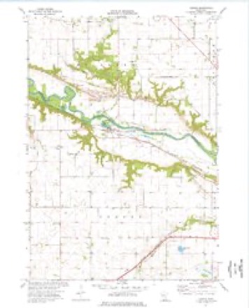
- 1974 USGS Judson quadrangle1:24000
- 1986 USGS New Ulm quadrangle1:100000
- 1991 USGS New Ulm quadrangle1:100000




In the county-history sources
5,837 words on this townshipHistory of Blue Earth County and Biographies of Its Leading Citizens, published 1901 names this settlement in its chapter on Judson Township. These are the passages that mention it, exactly as the scans read.
December 10, 1856, the "townsite of "Judson" was laid out by Eobert Patterson and John Goodwin on portions of sections 3, 4, 33, and 34 in Judson Bottom. A saw Mill was built that fall by Henry Fowler, E. Patterson and John Goodwin, which the next year was sold to Cephas S. Terry, who added a small grist mill. In the spring of 1857, Andrew Friend was employed by Mr. Terry to help run the mill, in which employment he continued until 1864, when he removed to Garden City.. The mill had now been bought by Keene & Whitcomb, and in June, 1866, it burned. Stores were built there by Mr. Terry and T. E. Coulson. Mr. Coulson, also, kept a small hotel. A postoffice was started in 1856, kept by John Goodwin. The first school in the town was taught in the winter of 1857, by Miss Jannette Jenkins (the late Mrs. Jannette Jones of Mankato). It was kept in a vacant log buildTng near Coulson's store. In 1858, a joint stock company purchased of Mr. Coulson a large frame building for $800 to start therein "Judson Academy." The school was put in charge of Eev. J. E. Ash, a young Baptist preacher from Illinois, whose wife had charge of the music department. After one year, Mr. and Mrs. Ash removed to Mankato and the Academy failed. In 1859, Judson village contained about thirty houses. About 1860, Anthony J. Crisp built him a neat frame house and barn on the farm now owned by Joseph Eoberts, and opened a bmall country store. A postoffice was located there called "Crisp's Store," in charge of Mr. Crisp. It continued until the Crisp family moved away after the close of the Civil war. The first school in District 99 was taught in 1860, by Mr. Crisp in his own house.
Passage source: History of Blue Earth County and Biographies of Its Leading Citizens, published 1901.
In August, 1867, Fredrick K. Jones purchased two acres in the southwest quarter of Section 6, about a quarter of a mile west of Crisp's store, and built thereon a store, which he conducted for two years and then sold the lot and building to Eev. P. Peregrine. About 1858, Robert Goodyear started a nursery on Section 12 of Judson, which he conducted for several years.
Passage source: History of Blue Earth County and Biographies of Its Leading Citizens, published 1901.
In 1858, Eev. J. E. Ash' organized a Baptist church in Judson village. Among the members were Eobert Patterson, John Goodwin, Eev. Wm. Williams, Morris Lewis, John Eees, Geo. Smith and others. After Eev. Ash left, the church was ministered to by Eev. Williams and Mr. Miller for a time, but for some years during the Indian trouble it suspended. About 1867, and 1868 it met again in school house No. 6, and on March 15, 1871, incorporated at the house of John Goodwin, when John Eees, Abel Keene and B. P. Muzzy were elected trustees. The church disbanded in Nov., 1882, and a number of the members joined the Baptistchurch of Lake Crystal.
Passage source: History of Blue Earth County and Biographies of Its Leading Citizens, published 1901.
Machine-read from a century-old scan, so expect the errors a machine makes: misspelled names, dropped words, stray characters.
Read the whole chapter on Judson Township - it names this place 8 more 8 times.
Fires near this place
1 since 2003Regional context, not property-specific evidence. The federal wildfire occurrence database lists 1 fire within 5 miles of Judson in 2003, burning about 150 acres in total. None started naturally. None was recorded as arson. Distance is straight-line from the map coordinates, so a fire counted here may appear on a neighbouring settlement's page as well.
| Reported cause | Fires |
|---|---|
| Missing data/not specified/undetermined | 1 |
The most recent of them, most recent first, with the day each was reported and the service that recorded it.
| Date | Cause | Size | Reported by | Name on the report |
|---|---|---|---|---|
| 13 April 2003 | Missing data/not specified/undetermined | 150 acres | Minnesota Department of Natural Resources | not named |
Mines and quarries near this place
2 within 5 milesRegional context, not property-specific evidence. The federal mineral resources record lists 2 workings within 5 miles of Judson: 2 producers. All of them still produce. What was taken out: Sand and Gravel, Construction. Distance is straight-line from the map coordinates, so a quarry counted here may appear on a neighbouring settlement's page as well.
| Where | Site | Commodity | Status | Recorded |
|---|---|---|---|---|
| Judson Sand Pit | Sand and Gravel, Construction | Producer | ||
| Zimmerman East Pit and Mill | Sand and Gravel, Construction | Producer |
Storms near this place
5 since 1998Regional context, not property-specific evidence. The National Weather Service names Judson in 5 storm reports between 1998 and 2026: 2 hail, 1 flood, 1 tornado, 1 heavy rain. No death or injury is recorded in these reports. Each account below is quoted exactly as the forecast office filed it, from the NOAA Storm Events Database, and each date opens the federal record of that event.
| When | Event | Place named | Harm | What the report says |
|---|---|---|---|---|
| June 2014 | Flood | Judson | $2,300,000 | There were multiple reports of road closures due to high water and debris along the Minnesota River. Flood waters caused around 70 people to move out of their apartment complex in Mankato. |
| June 2020 | Heavy Rain | Judson | - | There was a 12 hour rainfall report near Judson of 5.50 inches. |
| July 2017 | Tornado (EF1) | Judson | - | The tornado knocked a chimney off, crushed two old barns and snapped an old spruce tree. It also caused damage to hundreds of acres of crops along County Road 20 and County Road 11, where the wind flattened much corn. Some stalks were snapped at the base. |
| April 2026 | Hail | Judson | - | no account filed |
| May 1998 | Hail | Judson | - | no account filed |
Nearest settlements
The eight closest, with where each one stands in the county. Distances are straight-line, computed from the Geographic Names Information System coordinates.
| Map | Place | Distance | Sheets |
|---|---|---|---|
| Lake Crystal | 6.4 miles | 12 | |
| Rambush Estates II | 6.7 miles | 12 | |
| Cambria | 7.0 miles | 9 | |
| Butternut | 8.2 miles | 9 | |
| LeHillier | 9.0 miles | 13 | |
| Skyline | 9.5 miles | 13 | |
| Rapidan | 9.7 miles | 12 | |
| Garden City | 10.4 miles | 12 |
Provenance
This settlement is recorded in the Geographic Names Information System as feature 654772. The sheet list is computed by point-in-boundary test against the United States Geological Survey's historical topographic inventory. Both are works of the United States government and carry no copyright under 17 U.S.C. 105.
Wildfire. Short, Karen C. 2022. Spatial wildfire occurrence data for the United States, 1992-2020 [FPA_FOD_20221014]. 6th Edition. Fort Collins, CO: Forest Service Research Data Archive. https://doi.org/10.2737/RDS-2013-0009.6 Collected with United States Government funding and usable without additional permissions or fees.
Mines and quarries. USGS Mineral Resources Data System (MRDS) https://mrdata.usgs.gov/mrds/ A work of the United States government, no copyright under 17 U.S.C. 105.
Storms. NOAA National Centers for Environmental Information, Storm Events Database https://www.ncei.noaa.gov/stormevents/ A work of the United States government, no copyright under 17 U.S.C. 105. Narratives are quoted verbatim from the National Weather Service report and are not edited or summarised.