 Block
LeHillier, Minnesota
13 topographic sheets cover this place, the earliest surveyed in 1951 and the latest in 1991. It stands in South Bend Township. It lies in ZIP code area 56001. It stands on Blue Earth River. The Survey maps it on the Mankato West quadrangle. It stands 787 feet above sea level.
On record in LeHillier
Buildings and businesses the archive holds for this place. Each opens its own page, with the source record it came from.
On the National Register within a mile 2 records
The National Register names another town for these. They stand within one mile of this settlement's coordinate.
 Charles Chapman Houselisted 1980 · 0.3 miles away
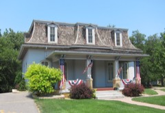 William Irving Houselisted 1980 · 0.9 miles away
Topographic sheets covering this place
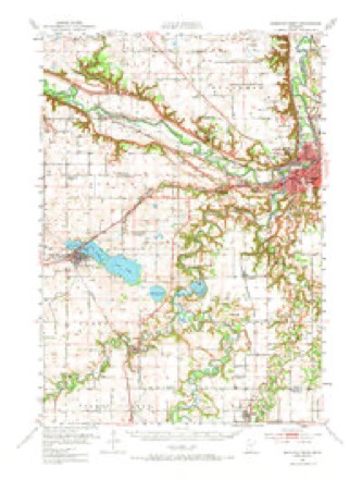
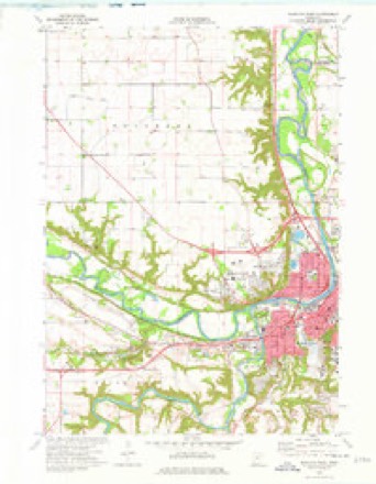
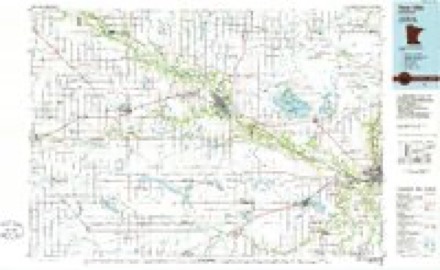
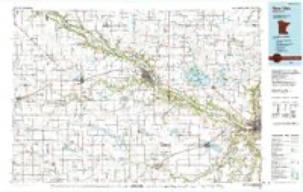
8 surveys from 13 printed sheetsMatched by testing this settlement's coordinate against the published boundary of every sheet in the United States Geological Survey's historical collection. Each opens the scanned sheet at the Survey.
- 1951 USGS Mankato West quadrangle1:62500, 3 printings
- 1953 USGS New Ulm quadrangle1:250000, 3 printings
- 1957 USGS New Ulm quadrangle1:250000
- 1958 USGS New Ulm quadrangle1:250000
- 1967 USGS New Ulm quadrangle1:250000
- 1974 USGS Mankato West quadrangle1:24000, 2 printings
- 1986 USGS New Ulm quadrangle1:100000
- 1991 USGS New Ulm quadrangle1:100000




In the county-history sources
2,306 words on this townshipHistory of Blue Earth County and Biographies of Its Leading Citizens, published 1901 names this settlement in its chapter on South Bend Township. These are the passages that mention it, exactly as the scans read.
In 1888-9 the big artesian well on the farm cf Wm. R. Williams was sunk by a company, who were prospecting for natural gas. In April, 1905, the Legislature passed a bill establishing a state park at the picturesque falls, and in 1906-7 seventy acres of land on which they are situated were bought by the State, and several thousand dollars spent in improvements. J. B. Hodge was appointed its first keeper, and in 1907 he was succeeded by Wm. R. Williams. In 1S59 Miner Porter built a summer hotel on his farm adjoining the village of South Bend, which he called "Llinneineopa." In 1868 Mr. Porter greatly improved and beautified both hotel and grounds. Planting trees, shrubbery and flowers, building arbors, swings and artistic walks, and surrounding all with a tasty fence, v.ith high arching gateways. In the nineties the farm was purchased by W. W. P. McConnell and Mrs. D. A. Swan, who conducted thereon for several years a fine dairy of high bred Jersey cattle. The old house burned February 1, 1906. in 1857 LeHillier was platted as a townsite and a stone hotel and about two dozen houses built thereon. In 1889 Samuel C. and Geo. Pond laid out Riverside Park Addition adjoining LeHillier on the west. A brick yard was started here by 0. R. Mather, I. K. Flanagan, E. A. Gibson and S. C. Pond. This yard for many years has been owned and operated with good success by F. G. Pannenberg & Co. Excellent cement stone in inexhaustible quantity is iound underlying the tableland, which lies just i-ast of the old village of South Bend. This for some years has furnished all the material use3 by Mr. Carney in the manufacture of the well kno^^Ti Mankato Standard Cements. In South Bend is, also, found the famous blue and green clay, used as a pigment by the Indians, and mistaken for copper by the French, and from which is derived the names "Mankato" and "Blue Earth." In 1869 Buck, Sowers and Co. started the manufacture of stoneware at South Bend village from the clays there found, and it is very probable that the future will see the clays
Passage source: History of Blue Earth County and Biographies of Its Leading Citizens, published 1901.
Machine-read from a century-old scan, so expect the errors a machine makes: misspelled names, dropped words, stray characters.
Fires near this place
2 since 2009Regional context, not property-specific evidence. The federal wildfire occurrence database lists 2 fires within 5 miles of LeHillier between 2009 and 2013, burning about 6 acres in total. None started naturally. None was recorded as arson. Distance is straight-line from the map coordinates, so a fire counted here may appear on a neighbouring settlement's page as well.
| Reported cause | Fires |
|---|---|
| Railroad operations and maintenance | 1 |
| Fireworks | 1 |
The most recent of them, most recent first, with the day each was reported and the service that recorded it.
| Date | Cause | Size | Reported by | Name on the report |
|---|---|---|---|---|
| 5 July 2013 | Fireworks | 5.0 acres | Minnesota Department of Natural Resources | not named |
| 16 March 2009 | Railroad operations and maintenance | 1.0 acres | Minnesota Department of Natural Resources | not named |
Settlements close enough to share some of these fires:
Mines and quarries near this place
10 of 11 shownRegional context, not property-specific evidence. The federal mineral resources record lists 11 workings within 5 miles of LeHillier: 8 producers, 3 occurrences. 8 still produce. What was taken out: Stone, Crushed/Broken, Sand and Gravel, Construction, Clay, Limestone, Dimension. Distance is straight-line from the map coordinates, so a quarry counted here may appear on a neighbouring settlement's page as well.
| Where | Site | Commodity | Status | Recorded |
|---|---|---|---|---|
| Blue Earth County Sand Bed | Silica | Occurrence | ||
| Blue Earth County Clay Deposit No 1 | Clay | Occurrence | ||
| Blue Earth County Clay Deposit No 2 | Clay | Occurrence | ||
| Guaranteed Gravel & Sand Pit | Sand and Gravel, Construction | Producer | ||
| Hanel Sand & Gravel Pit | Sand and Gravel, Construction | Producer | ||
| Mankato Stone Center | Limestone, Dimension, Stone, Crushed/Broken | Producer | ||
| Vetter Main Quarry & Mill | Limestone, Dimension | Producer | ||
| Lundin 8th Ave Quarry | Stone, Crushed/Broken | Producer | ||
| Lundin Quarry | Stone, Crushed/Broken | Producer | ||
| Mankago Aglime Quarry | Stone, Crushed/Broken | Producer |
Storms near this place
2 since 1996Regional context, not property-specific evidence. The National Weather Service names LeHillier in 2 storm reports in 1996: 1 debris flow, 1 lightning. No death or injury is recorded in these reports. Each account below is quoted exactly as the forecast office filed it, from the NOAA Storm Events Database, and each date opens the federal record of that event.
| When | Event | Place named | Harm | What the report says |
|---|---|---|---|---|
| September 1996 | Lightning | Lehillier | $100,000 | no account filed |
| June 1996 | Debris Flow | Lehillier | - | no account filed |
Nearest settlements
The eight closest, with where each one stands in the county. Distances are straight-line, computed from the Geographic Names Information System coordinates.
| Map | Place | Distance | Sheets |
|---|---|---|---|
| Skyline | 0.7 miles | 13 | |
| Mankato | 2.1 miles | 14 | |
| University Park of Mankato | 2.7 miles | 14 | |
| Belle Haven | 4.0 miles | 14 | |
| Benning | 4.1 miles | 14 | |
| Rapidan | 4.3 miles | 12 | |
| Knollwood Park | 5.0 miles | 14 | |
| Eagle Lake | 8.2 miles | 14 |
Elsewhere
Matched on this settlement's Geographic Names Information System number rather than its name, so it cannot be a different place of the same name in another state.
| Wikipedia article on LeHillier | An encyclopaedic summary. Its text is share-alike, so it is linked here rather than copied. |
| Wikidata item Q48848766 | The structured record the population and elevation above come from. Public domain (CC0). |
Provenance
This settlement is recorded in the Geographic Names Information System as feature 646553. The sheet list is computed by point-in-boundary test against the United States Geological Survey's historical topographic inventory. Both are works of the United States government and carry no copyright under 17 U.S.C. 105.
Wildfire. Short, Karen C. 2022. Spatial wildfire occurrence data for the United States, 1992-2020 [FPA_FOD_20221014]. 6th Edition. Fort Collins, CO: Forest Service Research Data Archive. https://doi.org/10.2737/RDS-2013-0009.6 Collected with United States Government funding and usable without additional permissions or fees.
Mines and quarries. USGS Mineral Resources Data System (MRDS) https://mrdata.usgs.gov/mrds/ A work of the United States government, no copyright under 17 U.S.C. 105.
Storms. NOAA National Centers for Environmental Information, Storm Events Database https://www.ncei.noaa.gov/stormevents/ A work of the United States government, no copyright under 17 U.S.C. 105. Narratives are quoted verbatim from the National Weather Service report and are not edited or summarised.