 Block
Kimball, Minnesota
9 topographic sheets cover this place, the earliest surveyed in 1953 and the latest in 1986. It stands in Maine Prairie Township. It lies in ZIP code area 55353. The Survey maps it on the Kimball quadrangle. 799 people lived here at the 2020 count. It stands 1,161 feet above sea level.
On record in Kimball
Buildings and businesses the archive holds for this place. Each opens its own page, with the source record it came from.
On the National Register 1 record
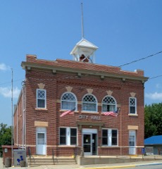 Kimball Prairie Village Halllisted 1982
Population over time
2 figuresKimball grew from 762 to 799 between 2010 and 2020. These are the recorded population figures Wikidata holds for this place, reached through the Geographic Names Information System number this page is keyed on rather than by name, so they belong to this place and not to another of the same name. Most are census counts, but not all are: an early figure may be a founding or settlement estimate, and an estimate published within five years of a census is left out. The change column is computed, and is left blank where more than 20 years separate a figure from the one before it, because a gap that long is not a change between two counts.
| Year | People | Change |
|---|---|---|
| 2010 | 762 | |
| 2020 | 799 | +37 (+5%) |
Topographic sheets covering this place
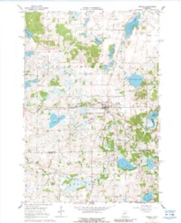
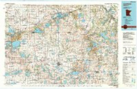
5 surveys from 9 printed sheetsMatched by testing this settlement's coordinate against the published boundary of every sheet in the United States Geological Survey's historical collection. Each opens the scanned sheet at the Survey.
- 1953 USGS Saint Cloud quadrangle1:250000, 3 printings
- 1957 USGS Saint Cloud quadrangle1:250000
- 1958 USGS Saint Cloud quadrangle1:250000
- 1967 USGS Kimball quadrangle1:24000, 2 printings
- 1986 USGS Litchfield quadrangle1:100000, 2 printings
In the county-history sources
3,817 words on this townshipHistory of Stearns County, Minnesota, published 1915 names this settlement in its chapter on Maine Prairie Township. These are the passages that mention it, exactly as the scans read.
D. W. Fowler, Joseph Dam, Joseph E. and Samuel Young, William and William L. Heywood, Albert Staples, A. T. Crommett, William Milligan, Horace Greely, Martin Greely, Hiram Millett, Moses Ireland, John and Orlen Farwell, Frey M. Kimball, R. F. Adley, James Taylor, George Clark, Daniel Spauling. Ruel Furlong, Marilla and Almira French. John P. Guptill, James Simmons, D. Sutherland, D. A. Hoyt, S. Leavett, Aaron Scribner, Andrew F. and Daniel Perkins, William Stewart, Henry Hutchinson, "Doc" Mayo, James M. Kimball, John C. Dolan, Edwin Kidder, Thomas Straw and A Wade.
Passage source: History of Stearns County, Minnesota, published 1915.
Farwell were to choose the site, and Daniel Spaulding, R. F. Adley and John Parwell were to supervise the erection of the building. Nothing, however, came of these plans. The second annual meeting was held April 5, 1859, at the store house of G. W. Cutter on the west side of Pearl lake. There was considerable bitter feeling engendered at this meeting. April 5, ot this year, Fair Haven was set off and organized. Rockville was set off and organized June 25, 1860. On that day the people of Maine Prairie elected the following officers: Supervisors, T. B. Stanley (chairman), J. Eaton, D. Spaulding; town clerk, S. P. Brown; treasurer, R. P. Adley; justice of the peace, Orlen Farwell; superintendent of schools, S. P. Brown; constables, William Milligan and F. M. Kimball; overseer of the poor, A. B. Greely.
Passage source: History of Stearns County, Minnesota, published 1915.
Maine Prairie has three villages. Kimball is a hamlet on the railroad in the southern part of the township. Its first house was built in 1886. Maine Prairie Corners is a small settlement on the site of the fort built for protection against the Indians in 1862. Marty has grown up around the Catholic church near Pearl lake.
Passage source: History of Stearns County, Minnesota, published 1915.
Machine-read from a century-old scan, so expect the errors a machine makes: misspelled names, dropped words, stray characters.
Read the whole chapter on Maine Prairie Township - it names this place 5 more 5 times.
Fires near this place
2 since 1999Regional context, not property-specific evidence. The federal wildfire occurrence database lists 2 fires within 5 miles of Kimball between 1999 and 2000, burning about 31 acres in total. None started naturally. None was recorded as arson. Distance is straight-line from the map coordinates, so a fire counted here may appear on a neighbouring settlement's page as well.
| Reported cause | Fires |
|---|---|
| Railroad operations and maintenance | 1 |
| Recreation and ceremony | 1 |
The most recent of them, most recent first, with the day each was reported and the service that recorded it.
| Date | Cause | Size | Reported by | Name on the report |
|---|---|---|---|---|
| 26 September 2000 | Railroad operations and maintenance | 9.0 acres | Minnesota Department of Natural Resources | not named |
| 15 November 1999 | Recreation and ceremony | 22 acres | Minnesota Department of Natural Resources | not named |
Settlements close enough to share some of these fires:
Mines and quarries near this place
1 within 5 milesRegional context, not property-specific evidence. The federal mineral resources record lists 1 working within 5 miles of Kimball: 1 producer. All of them still produce. What was taken out: Sand and Gravel, Construction. Distance is straight-line from the map coordinates, so a quarry counted here may appear on a neighbouring settlement's page as well.
| Where | Site | Commodity | Status | Recorded |
|---|---|---|---|---|
| Rockite Schram Pit | Sand and Gravel, Construction | Producer |
Storms near this place
24 since 1998Regional context, not property-specific evidence. The National Weather Service names Kimball in 24 storm reports between 1998 and 2023: 17 hail, 5 thunderstorm wind, 1 heavy rain, 1 tornado. No death or injury is recorded in these reports. Each account below is quoted exactly as the forecast office filed it, from the NOAA Storm Events Database, and each date opens the federal record of that event.
| When | Event | Place named | Harm | What the report says |
|---|---|---|---|---|
| May 2015 | Tornado (EF0) | Kimball | $100,000 | This tornado knocked down a couple dozen trees, pushed over a barn, and damaged sheds, including a storage shed at the football field at the Kimball Area Schools, where equipment was strewn downfield. The tornado dissipated shortly thereafter. |
| July 2010 | Hail | Kimball | $50,000 | Several trained spotters reported numerous nickel, up to baseball size hail stones near Kimball, Minnesota. |
| July 2016 | Thunderstorm Wind | Kimball | - | A storm chaser with a handheld anemometer measured the wind gust near Kimball. |
| July 2015 | Thunderstorm Wind | Kimball | - | A large tree limb was blown down in Kimball. |
| May 2014 | Hail | Kimball | - | Most of the hail was less than nickel size. |
| August 2009 | Heavy Rain | Kimball | - | A trained spotter measured 4.16 inches of rainfall overnight. |
| September 2005 | Thunderstorm Wind | Kimball | - | Street signs knocked down. |
| June 2004 | Hail | Kimball | - | Penny sized hail fell 1/2 mile south of Highway 15 near Delwood Road. |
| June 1999 | Thunderstorm Wind | Kimball | - | Barn blown down. Estimated Windspeed. |
| March 2023 | Hail | Kimball | - | no account filed |
| May 2022 | Hail | Kimball | - | no account filed |
| June 2019 | Thunderstorm Wind | Kimball | - | no account filed |
| August 2013 | Hail | Kimball | - | no account filed |
| May 2008 | Hail | Kimball | - | no account filed |
| May 2006 | Hail | Kimball | - | no account filed |
| June 2005 | Hail | Kimball | - | no account filed |
| April 2004 | Hail | Kimball | - | no account filed |
| June 2004 | Hail | Kimball | - | no account filed |
| April 2002 | Hail | Kimball | - | no account filed |
| June 2002 | Hail | Kimball | - | no account filed |
| May 2002 | Hail | Kimball | - | no account filed |
| June 2001 | Hail | Kimball | - | no account filed |
| June 1998 | Hail | Kimball | - | no account filed |
| May 1998 | Hail | Kimball | - | no account filed |
Nearest settlements
The eight closest, with where each one stands in the county. Distances are straight-line, computed from the Geographic Names Information System coordinates.
| Map | Place | Distance | Sheets |
|---|---|---|---|
| Fairhaven | 4.8 miles | 10 | |
| Marty | 6.3 miles | 8 | |
| Saint Nicholas | 8.6 miles | 9 | |
| Luxemburg | 10.1 miles | 10 | |
| Rockville | 11.2 miles | 8 | |
| Saint Augusta | 11.4 miles | 10 | |
| Cold Spring | 12.0 miles | 9 | |
| Pleasant Lake | 12.8 miles | 8 |
Elsewhere
Matched on this settlement's Geographic Names Information System number rather than its name, so it cannot be a different place of the same name in another state.
| Wikipedia article on Kimball | An encyclopaedic summary. Its text is share-alike, so it is linked here rather than copied. |
| Wikidata item Q2107925 | The structured record the population and elevation above come from. Public domain (CC0). |
Provenance
This settlement is recorded in the Geographic Names Information System as feature 646144. The sheet list is computed by point-in-boundary test against the United States Geological Survey's historical topographic inventory. Both are works of the United States government and carry no copyright under 17 U.S.C. 105.
Wildfire. Short, Karen C. 2022. Spatial wildfire occurrence data for the United States, 1992-2020 [FPA_FOD_20221014]. 6th Edition. Fort Collins, CO: Forest Service Research Data Archive. https://doi.org/10.2737/RDS-2013-0009.6 Collected with United States Government funding and usable without additional permissions or fees.
Mines and quarries. USGS Mineral Resources Data System (MRDS) https://mrdata.usgs.gov/mrds/ A work of the United States government, no copyright under 17 U.S.C. 105.
Storms. NOAA National Centers for Environmental Information, Storm Events Database https://www.ncei.noaa.gov/stormevents/ A work of the United States government, no copyright under 17 U.S.C. 105. Narratives are quoted verbatim from the National Weather Service report and are not edited or summarised.