 Block
Lamoille, Minnesota
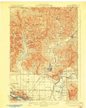
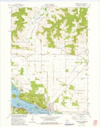
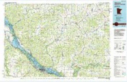
11 topographic sheets cover this place, the earliest surveyed in 1929 and the latest in 1985. It stands in Richmond Township. It lies in ZIP code area 55987. It stands on Big Trout Creek. The Survey maps it on the Trempealeau quadrangle. It stands 679 feet above sea level.
Topographic sheets covering this place
6 surveys from 11 printed sheetsMatched by testing this settlement's coordinate against the published boundary of every sheet in the United States Geological Survey's historical collection. Each opens the scanned sheet at the Survey.
- 1929 USGS Galesville quadrangle1:62500, 2 printings
- 1953 USGS Eau Claire quadrangle1:250000, 4 printings
- 1958 USGS Eau Claire quadrangle1:250000
- 1964 USGS Eau Claire quadrangle1:250000
- 1973 USGS Trempealeau quadrangle1:24000
- 1985 USGS Winona quadrangle1:100000, 2 printings
In the county-history sources
867 words on this townshipHistory of Winona County, published 1883 names this settlement in its chapter on Richmond Township. These are the passages that mention it, exactly as the scans read.
Besides these, u Mrs. Jennings owned a small millinery establishment. Fredrick Cushman built the first sawmill in 1855. At the same time a blacksmith shop was run by Iluttenhow. J. M. Winn was the village physician. The first school-building,- the present district school, was erected in 1857. School has never been discontinued. ''East Richmond," a rival to Richmond proper, was laid out in 1857 by A. Davenport and a Mr. Rodgers, just south of the first village on the same section. A few houses were built, but it was soon after abandoned. Richmond proper at that time was quite a town, but since then it has gradually decayed, houses have been torn down and removed entirely, until, at present writing, what once was a thriving little town, nothing remains but four shabby old dwellings and a small store kept by J. P. Nevill. Lamoille, a railway station on the Chicago, Milwaukee & St. Paul railway, is on the Mississippi river ; it is two miles from Pickwick, a small town in Homer township.
Passage source: History of Winona County, published 1883.
Machine-read from a century-old scan, so expect the errors a machine makes: misspelled names, dropped words, stray characters.
Fires near this place
25 since 1992Regional context, not property-specific evidence. The federal wildfire occurrence database lists 25 fires within 5 miles of Lamoille between 1992 and 2020, burning about 46 acres in total. 2 started naturally. None was recorded as arson. Distance is straight-line from the map coordinates, so a fire counted here may appear on a neighbouring settlement's page as well.
| Reported cause | Fires |
|---|---|
| Debris and open burning | 8 |
| Railroad operations and maintenance | 6 |
| Missing data/not specified/undetermined | 5 |
| Equipment and vehicle use | 2 |
| Natural | 2 |
| Recreation and ceremony | 1 |
| Smoking | 1 |
The most recent of them, most recent first, with the day each was reported and the service that recorded it.
| Date | Cause | Size | Reported by | Name on the report |
|---|---|---|---|---|
| 25 August 2014 | Natural | under an acre | Trempeleau National Wildlife Refuge | BFC |
| 10 July 2006 | Railroad operations and maintenance | under an acre | Minnesota Department of Natural Resources | not named |
| 15 June 1994 | Railroad operations and maintenance | under an acre | Minnesota Department of Natural Resources | not named |
| 7 May 2020 | Smoking | 1.0 acres | Wisconsin Department of Natural Resources | 2023 |
| 7 May 2005 | Debris and open burning | under an acre | Minnesota Department of Natural Resources | not named |
| 7 May 2004 | Natural | under an acre | Minnesota Department of Natural Resources | not named |
| 5 May 2018 | Missing data/not specified/undetermined | under an acre | Wisconsin Department of Natural Resources | 1826 |
| 3 May 1992 | Railroad operations and maintenance | under an acre | Minnesota Department of Natural Resources | not named |
Settlements close enough to share some of these fires:
Mines and quarries near this place
10 of 14 shownRegional context, not property-specific evidence. The federal mineral resources record lists 14 workings within 5 miles of Lamoille: 10 past producers, 2 producers, 2 occurrences. 2 still produce. What was taken out: Sand and Gravel, Construction, Stone, Crushed/Broken. Distance is straight-line from the map coordinates, so a quarry counted here may appear on a neighbouring settlement's page as well.
| Where | Site | Commodity | Status | Recorded |
|---|---|---|---|---|
| Trempealeau Dolomite Quarry #1 | Stone, Crushed/Broken | Past Producer | ||
| Trempealeau Dolomite Quarry #2 | Stone, Crushed/Broken | Past Producer | ||
| Eichman Gravel Pit | Sand and Gravel, Construction | Past Producer | ||
| Frank Eichman Pit | Sand and Gravel, Construction | Producer | ||
| G Stetzer Gravel Pit | Sand and Gravel, Construction | Past Producer | ||
| Gibbs Sand & Gravel Pit | Sand and Gravel, Construction | Producer | ||
| H Kohnle Sand Pit | Sand and Gravel, Construction | Past Producer | ||
| H Ryder Gravel Pit | Sand and Gravel, Construction | Past Producer | ||
| H Ryder Sand & Gravel Deposit | Sand and Gravel, Construction | Occurrence | ||
| Harold Ryder Gravel Deposit | Sand and Gravel, Construction | Occurrence |
Storms near this place
7 since 2008Regional context, not property-specific evidence. The National Weather Service names Lamoille in 7 storm reports between 2008 and 2024: 3 flash flood, 3 thunderstorm wind, 1 hail. No death or injury is recorded in these reports. Each account below is quoted exactly as the forecast office filed it, from the NOAA Storm Events Database, and each date opens the federal record of that event.
| When | Event | Place named | Harm | What the report says |
|---|---|---|---|---|
| June 2008 | Flash Flood | Lamoille | $250,000 | Flash flooding led to mudslides and damage to sections of County Road 9 along Cedar Creek. Pleasant Valley Creek also had a flash flood. Water flowed into nearby fields as well. |
| July 2024 | Hail | Lamoille | $25,000 | Local officials reported golf ball sized hail near Lamoille. |
| December 2021 | Thunderstorm Wind | Lamoille | $5,000 | Power outages were reported east of Pickwick from downed power lines. |
| September 2016 | Flash Flood | Lamoille | $4,000 | A mudslide sent trees onto one of the southbound lanes of U.S. Highway 61 near Pickwick. The heavy rain also caused water to go over some private driveways along County Highway 19. |
| September 2010 | Thunderstorm Wind | Lamoille | $2,000 | Small trees were knocked down along County Road 7. |
| April 2017 | Flash Flood | Lamoille | - | Debris from a mudslide caused the southbound lanes of U.S. Highway 61 to be closed southeast of Homer. |
| September 2011 | Thunderstorm Wind | Lamoille | - | An estimated a 60 mile per hour wind gust occurred near Pickwick. |
Nearest settlements
The eight closest, with where each one stands in the county. Distances are straight-line, computed from the Geographic Names Information System coordinates.
| Map | Place | Distance | Sheets |
|---|---|---|---|
| Pickwick | 1.8 miles | 14 | |
| Donehower | 4.5 miles | 14 | |
| Homer | 4.7 miles | 18 | |
| Nodine | 7.0 miles | 14 | |
| Ridgeway | 7.8 miles | 11 | |
| Sugarloaf | 8.2 miles | 18 | |
| Morningside Terrace | 8.2 miles | 18 | |
| New Hartford | 8.5 miles | 14 |
Elsewhere
Matched on this settlement's Geographic Names Information System number rather than its name, so it cannot be a different place of the same name in another state.
| Wikipedia article on Lamoille | An encyclopaedic summary. Its text is share-alike, so it is linked here rather than copied. |
| Wikidata item Q6482132 | The structured record the population and elevation above come from. Public domain (CC0). |
Provenance
This settlement is recorded in the Geographic Names Information System as feature 646461. The sheet list is computed by point-in-boundary test against the United States Geological Survey's historical topographic inventory. Both are works of the United States government and carry no copyright under 17 U.S.C. 105.
Wildfire. Short, Karen C. 2022. Spatial wildfire occurrence data for the United States, 1992-2020 [FPA_FOD_20221014]. 6th Edition. Fort Collins, CO: Forest Service Research Data Archive. https://doi.org/10.2737/RDS-2013-0009.6 Collected with United States Government funding and usable without additional permissions or fees.
Mines and quarries. USGS Mineral Resources Data System (MRDS) https://mrdata.usgs.gov/mrds/ A work of the United States government, no copyright under 17 U.S.C. 105.
Storms. NOAA National Centers for Environmental Information, Storm Events Database https://www.ncei.noaa.gov/stormevents/ A work of the United States government, no copyright under 17 U.S.C. 105. Narratives are quoted verbatim from the National Weather Service report and are not edited or summarised.