 Block
Mankato, Minnesota
14 topographic sheets cover this place, the earliest surveyed in 1950 and the latest in 1985. It stands in Mankato City. It lies in ZIP code area 56001. It lies near Thompson Ravine. The Survey maps it on the Mankato East quadrangle. 44,488 people lived here at the 2020 count. It stands 781 feet above sea level.
Research this city
On record in Mankato
Buildings and businesses the archive holds for this place. Each opens its own page, with the source record it came from.
On the National Register 12 of 16 shown
 Blue Earth County Courthouselisted 1980
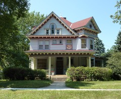 J. R. Brandrup Houselisted 1980
 Charles Chapman Houselisted 1980
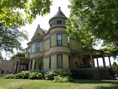 Lorin Cray Houselisted 1980
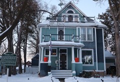 Adolph O. Eberhart Houselisted 1980
 Federal Courthouse and Post Officelisted 1980
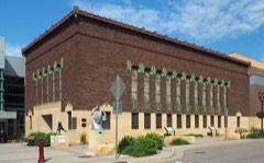 First National Bank of Mankatolisted 1974
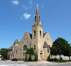 First Presbyterian Churchlisted 1980
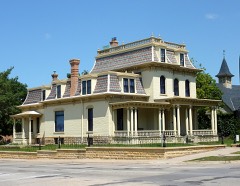 Renesselaer D. Hubbard Houselisted 1976
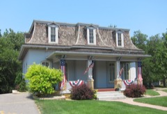 William Irving Houselisted 1980
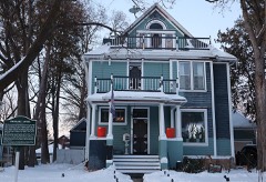 Lincoln Park Residential Historic Districtlisted 1995
 Mankato Public Library and Reading Roomlisted 1980
Population over time
2 figuresMankato grew from 39,305 to 44,488 between 2010 and 2020. These are the recorded population figures Wikidata holds for this place, reached through the Geographic Names Information System number this page is keyed on rather than by name, so they belong to this place and not to another of the same name. Most are census counts, but not all are: an early figure may be a founding or settlement estimate, and an estimate published within five years of a census is left out. The change column is computed, and is left blank where more than 20 years separate a figure from the one before it, because a gap that long is not a change between two counts.
| Year | People | Change |
|---|---|---|
| 2010 | 39,305 | |
| 2020 | 44,488 | +5,183 (+13%) |
Topographic sheets covering this place
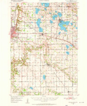
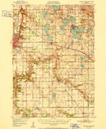
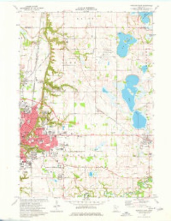
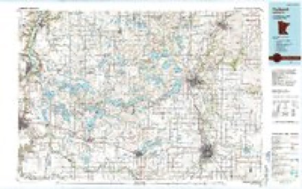
8 surveys from 14 printed sheetsMatched by testing this settlement's coordinate against the published boundary of every sheet in the United States Geological Survey's historical collection. Each opens the scanned sheet at the Survey.
- 1950 USGS Mankato East quadrangle1:62500, 3 printings
- 1951 USGS Mankato East quadrangle1:62500
- 1953 USGS Saint Paul quadrangle1:250000, 3 printings
- 1953 USGS St. Paul quadrangle1:250000
- 1959 USGS Saint Paul quadrangle1:250000
- 1959 USGS St. Paul quadrangle1:250000
- 1974 USGS Mankato East quadrangle1:24000, 2 printings
- 1985 USGS Faribault quadrangle1:100000, 2 printings




In the county-history sources
13,615 words on this townshipHistory of Blue Earth County and Biographies of Its Leading Citizens, published 1901 names this settlement in its chapter on Mankato City. These are the passages that mention it, exactly as the scans read.
This year (1869), the county bridge, 353 feet long, was erected over the Blue Earth at West Mankato. During this summer, also, the St. Paul and Sioux City Railroad was extended from Mankato to Crystal Lake. Here a new town was laid out in May, 1869 by Lucius 0. Hunt and Wniiam R. Robinson and named "Lake Crystal." By the time the railway reached this point in September, quite a village had sprung up, where two months before there was only a field to be seen. The Loon Lake Postofiice was discontinued and a new office established at Lake Crystal with Henry Humphrey as first postmaster on September 1, 1869. By December 1, 1869 we note that Lake Crystal possessed a grain elevator, a hotel, built by S. P. Oakley, a two story frame school house, 34x40, a two story frame store, built by Henry Humphrey and occupied with a stock of groceries and drugs by Pomeroy & Wickersham, a store building erected by W. C. Davis and occupied by him with a stock of hardware, a building occupied by Davis & Dunn as general store, another building occupied by P. A. Larfcon with another general store, a harness shop conducted by Wm. Seeger, a cooper shop in charge of Dorwood & McKay, and a doctor's office. H. C. Howard, also, had just sold his flour mill at Shelby Center to Henry Day for $1,600 and his sawmill at the same place to Asa White and S. C. Hilton, who moved it to section three of Mc- Pherson, and had built him a home at Lake
Passage source: History of Blue Earth County and Biographies of Its Leading Citizens, published 1901.
On July 3, 1869 the Republicans of Blue Earth County tried what was known as the Crawford plan of nominating their county officers. This was really a priniar}- election method such as is now in vogue. It happened this year that the Republicans had nine candidates for sheriff and there were three to five candidates each for some of the other offices, and the persons who were nominated, only received onefifth to one-third of the total vote. This caused great dissatisfaction with the Primary Election plan and it was abolished at an election held May 31, 1870, by a vote of 439 to 103. The Republican nominee for sheriff and some of the other nominees of that party for county offices were beaten at the polls. P. H. Waite of Mankato ran as an Independent candidate for Judge of the District Court at this election. Being a Democrat, he was endorsed by his own party, and elected by a good majority over Andrew C. Dunn the Republican nominee.
Passage source: History of Blue Earth County and Biographies of Its Leading Citizens, published 1901.
The snow fall of 1868-9 was seven and one half feet and that of 1869-70 seven and onesixth feet, which resulted in a good stage of water in the Minnesota each spring. The steamboat trade therefore continued quite good in spite of tha arrival of the railroads. Many of the boats, however, withdrew. Among those who continued in 1869, were the Ellen Hardy, St. Anthony Palls, Jennette Eoberts, Otter, Mankato, and Pioneer. The Otter for two or tnree years made regular trips between New Ulm and South Bend, transferring at the latter place passengers and freight to the St. Paul and Sioux City Eailroad. The Otter at this time was owned by New Ulm business men. John Segar was her captain in 1870, and afterwards Boncoeur Subilier, both of New Ulm. In 1870, there were about eighty steamboat arrivals at Mankato. Among the boats engaged this year were the Otter, Mankato, St. Anthony, Tiger, Dexter, John C. Gault and G. B. Knapp. The total wheat receipts at Mankato up to February 1, 1870 from the 1869 crop amounted to 213,970 bushels, which indicates that there was considerable transportation to do.
Passage source: History of Blue Earth County and Biographies of Its Leading Citizens, published 1901.
Machine-read from a century-old scan, so expect the errors a machine makes: misspelled names, dropped words, stray characters.
Read the whole chapter on Mankato City - it names this place 42 more 42 times.
Fires near this place
2 since 2009Regional context, not property-specific evidence. The federal wildfire occurrence database lists 2 fires within 5 miles of Mankato between 2009 and 2013, burning about 6 acres in total. None started naturally. None was recorded as arson. Distance is straight-line from the map coordinates, so a fire counted here may appear on a neighbouring settlement's page as well.
| Reported cause | Fires |
|---|---|
| Railroad operations and maintenance | 1 |
| Fireworks | 1 |
The most recent of them, most recent first, with the day each was reported and the service that recorded it.
| Date | Cause | Size | Reported by | Name on the report |
|---|---|---|---|---|
| 5 July 2013 | Fireworks | 5.0 acres | Minnesota Department of Natural Resources | not named |
| 16 March 2009 | Railroad operations and maintenance | 1.0 acres | Minnesota Department of Natural Resources | not named |
Settlements close enough to share some of these fires:
Mines and quarries near this place
10 of 11 shownRegional context, not property-specific evidence. The federal mineral resources record lists 11 workings within 5 miles of Mankato: 8 producers, 3 occurrences. 8 still produce. What was taken out: Stone, Crushed/Broken, Sand and Gravel, Construction, Clay, Limestone, Dimension. Distance is straight-line from the map coordinates, so a quarry counted here may appear on a neighbouring settlement's page as well.
| Where | Site | Commodity | Status | Recorded |
|---|---|---|---|---|
| Blue Earth County Sand Bed | Silica | Occurrence | ||
| Blue Earth County Clay Deposit No 1 | Clay | Occurrence | ||
| Blue Earth County Clay Deposit No 2 | Clay | Occurrence | ||
| Guaranteed Gravel & Sand Pit | Sand and Gravel, Construction | Producer | ||
| Hanel Sand & Gravel Pit | Sand and Gravel, Construction | Producer | ||
| Mankato Stone Center | Limestone, Dimension, Stone, Crushed/Broken | Producer | ||
| Vetter Main Quarry & Mill | Limestone, Dimension | Producer | ||
| Lundin 8th Ave Quarry | Stone, Crushed/Broken | Producer | ||
| Lundin Quarry | Stone, Crushed/Broken | Producer | ||
| Mankago Aglime Quarry | Stone, Crushed/Broken | Producer |
Storms near this place
60 of 103 shownRegional context, not property-specific evidence. The National Weather Service names Mankato in 103 storm reports between 1993 and 2025: 49 hail, 42 thunderstorm wind, 6 flash flood, 3 heavy rain. The reports record 1 death and 2 injuries. Each account below is quoted exactly as the forecast office filed it, from the NOAA Storm Events Database, and each date opens the federal record of that event.
| When | Event | Place named | Harm | What the report says |
|---|---|---|---|---|
| September 2021 | Thunderstorm Wind | Mankato | 1 killed, 1 hurt | A tree branch fell onto a tent at the Land of Memories Park. A family was in the tent and a 4 year old girl was killed from injuries of the fallen tree branch. |
| May 1998 | Thunderstorm Wind | Mankato | 1 hurt | Measured at law enforcement center. Extensive tree damage. Windows blown out. Semitrailer blown over on highway 14 injuring one person. |
| May 1998 | Thunderstorm Wind | Mankato | $20,000,000 | Trees down. Roof damage. Estimated windspeed. Damage estimate for entire county. |
| July 2015 | Thunderstorm Wind | Mankato | $100,000 | An amphitheater outer shell was ripped off. It occurred near downtown Mankato, and near the Minnesota River. Several large trees were toppled across town. |
| July 2003 | Tornado (F1) | Mankato | $100,000 | The fifth tornado in a series touched down in a corn field, clipped a couple of storage buildings and a lawn care center, then moved across more fields and a meadow before dissipating. |
| June 2016 | Thunderstorm Wind | Mankato | $25,000 | A few trees and power lines were blown down in the city of Mankato. A few trees landed on houses and damaged them. |
| July 2019 | Thunderstorm Wind | Mankato | $15,000 | A large tree blew down and landed on a van. |
| June 2016 | Thunderstorm Wind | Mankato | $5,000 | A large tree fell onto a house southwest of Mankato. |
| June 1994 | Thunderstorm Wind | Mankato | $500 | Winds estimated at 65 miles an hour and dime-size hail were reported in the city of Mankato. |
| June 1994 | Hail | Mankato | $500 | Winds estimated at 65 miles an hour and dime-size hail were reported in the city of Mankato. |
| July 1994 | Thunderstorm Wind | Mankato | $500 | The observation site in Mankato recorded a wind gust of 83 mph. |
| August 2025 | Heavy Rain | Mankato | - | Cocorahs station MN-BU-23 Mankato 1ESE. 72 hour storm total of 5.15 inches. |
| June 2024 | Flash Flood | Mankato | - | One to two feet of water was reported near the intersection of Warren St. and Balcerzak Dr. |
| July 2023 | Thunderstorm Wind | Mankato | - | Strong thunderstorm winds brough down several trees and large branches down in the Skyline neighborhood in Mankato, MN. |
| July 2023 | Thunderstorm Wind | Mankato | - | Large branches downed from strong thunderstorm wind gusts in Lion Park. Mankato Regional Airport recorded a 50-mph gust at 11:56 PM. |
| August 2021 | Hail | Mankato | - | There was a social media picture of half dollar size hail in Mankato. |
| August 2021 | Hail | Mankato | - | There was a social media picture of golf ball size hail in the western portion of Mankato. |
| July 2020 | Thunderstorm Wind | Mankato | - | Several large tree branches were blown down in Mankato. |
| August 2019 | Thunderstorm Wind | Mankato | - | A few trees were blown down in Mankato. |
| September 2018 | Thunderstorm Wind | Mankato | - | A private weather wind sensor measured a 58 knot wind gust. |
| August 2016 | Thunderstorm Wind | Mankato | - | A large tree was blown down south of Mankato. |
| August 2015 | Hail | Mankato | - | The hail was photographed. |
| June 2014 | Heavy Rain | Mankato | - | There was a 24 hour measured rainfall amount of 4.75 inches west of Mankato. All of the rain fell late on the 17th and during the early morning hours of the 18th. |
| September 2014 | Thunderstorm Wind | Mankato | - | Numerous trees were blown down around the city of Mankato. There was also a measured wind gust of 51 mph at the Mankato Airport. |
| June 2014 | Heavy Rain | Mankato | - | There was a 24 hour measured rainfall amount of 5.10 inches southwest of downtown Mankato. All of the rain fell late on the 17th and during the early morning hours of the 18th. |
| June 2014 | Thunderstorm Wind | Mankato | - | A ten inch diameter tree was blown down south of Mankato. |
| June 2013 | Thunderstorm Wind | Mankato | - | A few large trees and large branches were blown down around Mankato. |
| August 2012 | Thunderstorm Wind | Mankato | - | A large tree was blown down across Baker Road. |
| June 2010 | Thunderstorm Wind | Mankato | - | Power lines were blown down across Highway 169, near Mankato, Minnesota. |
| June 2010 | Flash Flood | Mankato | - | Significant street flooding occurred on the northwest side of Mankato, Minnesota, where some streets south of Highway 14, and west of U.S. Highway 169 were impassable. |
| June 2010 | Thunderstorm Wind | Mankato | - | Several large trees were uprooted and blocking the intersections of Warren and Highland near Mankato, Minnesota. |
| July 2010 | Thunderstorm Wind | Mankato | - | Several trees were uprooted between Mankato, to Eagle Lake, Minnesota. |
| July 2008 | Thunderstorm Wind | Mankato | - | Medium size branch toppled onto automobile. Windshield cracked. |
| July 2008 | Hail | Mankato | - | Hail occurred at Country Rd. 90 and Hwy. 22 intersection. |
| July 2008 | Thunderstorm Wind | Mankato | - | Several trees reported downed around Mankato. |
| July 2008 | Thunderstorm Wind | Mankato | - | Six to ten inch diameter trees toppled, four inch diameter tree branches severed. |
| July 2008 | Thunderstorm Wind | Mankato | - | Minnesota Vikings training camp tents and crowd control fences blown over. Eight inch diameter tree limbs severed off tree at Mankato State University campus. In addition, several other 2 to 4 inch diameter tree branches severed at MSU. Power reported out in some areas near MSU. Three very large trees also reported toppled in Mankato. |
| August 2007 | Flash Flood | Mankato | - | Street flooding in Mankato, with a few cars stranded. Between 0130 and 0300 CST, rain totaled 4.56 inches two miles south of St. Clair. One mile north of Minnesota Lake, 5.32 inches fell as of 0700 CST August 19. |
| June 2006 | Flash Flood | Mankato | - | Mud slide reported on the southern edge of town after several inches of rain had fallen. |
| June 2006 | Thunderstorm Wind | Mankato | - | A tree collapsed onto a home on Record Street, with another tree falling near the intersection of Mound Avenue and Owatonna Street. Reported by Mankato Free Press. |
| May 2005 | Thunderstorm Wind | Mankato | - | A trained spotter recorded a wind gust of 62 MPH at the intersection of River Front and Main. |
| June 2005 | Thunderstorm Wind | Mankato | - | A trained spotter recorded a wind gust of 66 MPH. Numerous trees were downed. |
| June 2005 | Thunderstorm Wind | Mankato | - | A wind gust of 72 MPH was recorded by a spotter and was relayed via HAM Radio. |
| April 2004 | Thunderstorm Wind | Mankato | - | A shed and a few trees were downed. |
| July 2003 | Thunderstorm Wind | Mankato | - | Scattered trees felled. |
| May 2003 | Hail | Mankato | - | Hailed on the northeast side of Mankato. |
| August 2002 | Thunderstorm Wind | Mankato | - | Scattered trees felled. |
| August 2002 | Thunderstorm Wind | Mankato | - | Several trees downed. |
| August 2000 | Thunderstorm Wind | Mankato | - | Trees felled. As reported by Lake Crystal Tribune. Light to moderate damage of approximately 15,000 acres of field corn. Severe damaged sustained to approximately 2000 acres of sweet corn. |
| June 1999 | Thunderstorm Wind | Mankato | - | Trees and power lines toppled. Estimated windspeed. |
| August 1999 | Flood | Mankato | - | Urban flooding reported within the city limits.. Estimated rainfall of 3.5 inches. Time of event estimated. |
| June 1998 | Thunderstorm Wind | Mankato | - | Large branches down. Estimated windspeed. |
| July 1997 | Hail | Mankato | - | Hail fell for 10 minutes. |
| July 1997 | Thunderstorm Wind | Mankato | - | 10 inch diameter branches down. Estimated windspeed. |
| July 1995 | Thunderstorm Wind | Mankato | - | Radio station reported trees down. |
| June 1994 | Thunderstorm Wind | Mankato | - | A local radio station recorded a wind gust to 75 mph. |
| June 2025 | Hail | Mankato | - | no account filed |
| June 2025 | Hail | Mankato | - | no account filed |
| April 2022 | Hail | Mankato | - | no account filed |
| April 2022 | Hail | Mankato | - | no account filed |
Nearest settlements
The eight closest, with where each one stands in the county. Distances are straight-line, computed from the Geographic Names Information System coordinates.
| Map | Place | Distance | Sheets |
|---|---|---|---|
| University Park of Mankato | 1.7 miles | 14 | |
| Belle Haven | 2.0 miles | 14 | |
| LeHillier | 2.1 miles | 13 | |
| Skyline | 2.2 miles | 13 | |
| Benning | 2.8 miles | 14 | |
| Knollwood Park | 3.1 miles | 14 | |
| Rapidan | 6.0 miles | 12 | |
| Eagle Lake | 6.3 miles | 14 |
Elsewhere
Matched on this settlement's Geographic Names Information System number rather than its name, so it cannot be a different place of the same name in another state.
| Wikipedia article on Mankato | An encyclopaedic summary. Its text is share-alike, so it is linked here rather than copied. |
| Wikidata item Q913243 | The structured record the population and elevation above come from. Public domain (CC0). |
Provenance
This settlement is recorded in the Geographic Names Information System as feature 647438. The sheet list is computed by point-in-boundary test against the United States Geological Survey's historical topographic inventory. Both are works of the United States government and carry no copyright under 17 U.S.C. 105.
Wildfire. Short, Karen C. 2022. Spatial wildfire occurrence data for the United States, 1992-2020 [FPA_FOD_20221014]. 6th Edition. Fort Collins, CO: Forest Service Research Data Archive. https://doi.org/10.2737/RDS-2013-0009.6 Collected with United States Government funding and usable without additional permissions or fees.
Mines and quarries. USGS Mineral Resources Data System (MRDS) https://mrdata.usgs.gov/mrds/ A work of the United States government, no copyright under 17 U.S.C. 105.
Storms. NOAA National Centers for Environmental Information, Storm Events Database https://www.ncei.noaa.gov/stormevents/ A work of the United States government, no copyright under 17 U.S.C. 105. Narratives are quoted verbatim from the National Weather Service report and are not edited or summarised.