 Block
Lemond, Minnesota
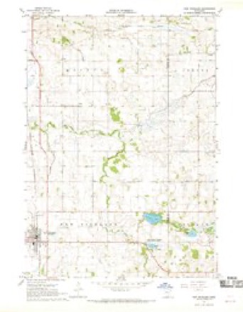
7 topographic sheets cover this place, the earliest surveyed in 1954 and the latest in 1985. It stands in Lemond Township. It lies in ZIP code area 56026. The Survey maps it on the New Richland quadrangle.
Topographic sheets covering this place
5 surveys from 7 printed sheetsMatched by testing this settlement's coordinate against the published boundary of every sheet in the United States Geological Survey's historical collection. Each opens the scanned sheet at the Survey.
- 1954 USGS Mason City quadrangle1:250000, 2 printings
- 1957 USGS Mason City quadrangle1:250000
- 1958 USGS Mason City quadrangle1:250000
- 1967 USGS New Richland quadrangle1:24000
- 1985 USGS Albert Lea quadrangle1:100000, 2 printings




In the county-history sources
332 words on this townshipGeographical and Statistical History of Steele County from Its Earliest Settlement to the Present Time. Embracing Leading Incidents of Pioneer Life, Names of Early Settlers ... &c, published 1868 names this settlement in its chapter on Lemond Township. These are the passages that mention it, exactly as the scans read.
The first settlement in the town of Lemond was in the spring of 1856, by Samuel Thomj^on, Sandford Kinney and Erasmus Teed, who were followed in the succeeding summer by Samuel Hastings. Kinney made his claim on section three, in the north-east part of the town ; Mr. Thompson located on section two. The settlement was not of rapid growth, but those who came were mostly permanent settlers, who had sought out this country to make a permanent home for themselves, and not to build up a home for others to occupy and enjoy.
Passage source: Geographical and Statistical History of Steele County from Its Earliest Settlement to the Present Time. Embracing Leading Incidents of Pioneer Life, Names of Early Settlers ... &c, published 1868.
The first birth in the town of Lemond was in the family of a Mr. Hughes. The first matrimonial alliance made and executed was contracted between Daniel Tuscan and Miss Cornelia Davis, the acknowledgement of which was taken by Sandford Kinney, Esq., in May, 1859. No deaths occurred in this town till 1860, when Mr. Wm. Hanson died in November of that year. The first school was taught by Mr. Stillman Kinney, in the winter of 1858-9. The irst religious service was held in January, 1858, Rev. Mr.
Passage source: Geographical and Statistical History of Steele County from Its Earliest Settlement to the Present Time. Embracing Leading Incidents of Pioneer Life, Names of Early Settlers ... &c, published 1868.
Machine-read from a century-old scan, so expect the errors a machine makes: misspelled names, dropped words, stray characters.
Fires near this place
1 since 2020Regional context, not property-specific evidence. The federal wildfire occurrence database lists 1 fire within 5 miles of Lemond in 2020, burning about 1 acre in total. None started naturally. 1 was recorded as arson. Distance is straight-line from the map coordinates, so a fire counted here may appear on a neighbouring settlement's page as well.
| Reported cause | Fires |
|---|---|
| Arson/incendiarism | 1 |
The most recent of them, most recent first, with the day each was reported and the service that recorded it.
| Date | Cause | Size | Reported by | Name on the report |
|---|---|---|---|---|
| 1 August 2020 | Arson/incendiarism | 1.0 acres | Minnesota Valley National Wildlife Refuge | FELBER |
Settlements close enough to share some of these fires:
Mines and quarries near this place
2 within 5 milesRegional context, not property-specific evidence. The federal mineral resources record lists 2 workings within 5 miles of Lemond: 2 producers. All of them still produce. What was taken out: Sand and Gravel, Construction. Distance is straight-line from the map coordinates, so a quarry counted here may appear on a neighbouring settlement's page as well.
| Where | Site | Commodity | Status | Recorded |
|---|---|---|---|---|
| Schmidt Pit | Sand and Gravel, Construction | Producer | ||
| Schultz Pit & Mill | Sand and Gravel, Construction | Producer |
Storms near this place
10 since 2002Regional context, not property-specific evidence. The National Weather Service names Lemond in 10 storm reports between 2002 and 2020: 4 thunderstorm wind, 3 hail, 1 heavy rain, 1 funnel cloud. No death or injury is recorded in these reports. Each account below is quoted exactly as the forecast office filed it, from the NOAA Storm Events Database, and each date opens the federal record of that event.
| When | Event | Place named | Harm | What the report says |
|---|---|---|---|---|
| August 2019 | Tornado (EF0) | Lemond | $1,000 | Multiple storms chasers, spotters and citizens filmed and photographed this tornado. It mostly moved across fields, and there was minor damage to one soybean field. It blew a portable hoop barn across a field. There was a two mile gap in the middle of its path where it did not appear to be in contact with the ground, but video and pictures show the parent funnel cloud remained consistently evident. |
| August 2019 | Funnel Cloud | Lemond | - | A funnel cloud was observed near Lemond. |
| June 2017 | Thunderstorm Wind | Lemond | - | A barn roof was lofted due to severe winds. It was misplaced several feet from the original location of the barn. |
| September 2016 | Heavy Rain | Lemond | - | A local trained weather observer measured 5.22 inches of rainfall south of Lemond between Wednesday afternoon, September 21st, to the early morning of Thursday, September 22nd. |
| July 2015 | Thunderstorm Wind | Lemond | - | A one foot diameter tree was blown down east of New Richland. |
| June 2014 | Thunderstorm Wind | Lemond | - | Several 4 to 6 inch diameter tree limbs were blown off. |
| September 2012 | Thunderstorm Wind | Lemond | - | A private weather station measured a wind gust of 58 mph. |
| August 2020 | Hail | Lemond | - | no account filed |
| August 2019 | Hail | Lemond | - | no account filed |
| July 2002 | Hail | Lemond | - | no account filed |
Nearest settlements
The eight closest, with where each one stands in the county. Distances are straight-line, computed from the Geographic Names Information System coordinates.
| Map | Place | Distance | Sheets |
|---|---|---|---|
| Hope | 5.7 miles | 7 | |
| Saco | 6.2 miles | 10 | |
| Meriden | 6.3 miles | 10 | |
| River Point | 7.8 miles | 7 | |
| Steele Center | 8.2 miles | 7 | |
| Ellendale | 8.6 miles | 7 | |
| Litomysl | 10.6 miles | 7 | |
| Owatonna | 10.8 miles | 9 |
Provenance
This settlement is recorded in the Geographic Names Information System as feature 654791. The sheet list is computed by point-in-boundary test against the United States Geological Survey's historical topographic inventory. Both are works of the United States government and carry no copyright under 17 U.S.C. 105.
Wildfire. Short, Karen C. 2022. Spatial wildfire occurrence data for the United States, 1992-2020 [FPA_FOD_20221014]. 6th Edition. Fort Collins, CO: Forest Service Research Data Archive. https://doi.org/10.2737/RDS-2013-0009.6 Collected with United States Government funding and usable without additional permissions or fees.
Mines and quarries. USGS Mineral Resources Data System (MRDS) https://mrdata.usgs.gov/mrds/ A work of the United States government, no copyright under 17 U.S.C. 105.
Storms. NOAA National Centers for Environmental Information, Storm Events Database https://www.ncei.noaa.gov/stormevents/ A work of the United States government, no copyright under 17 U.S.C. 105. Narratives are quoted verbatim from the National Weather Service report and are not edited or summarised.