 Block
Owatonna, Minnesota
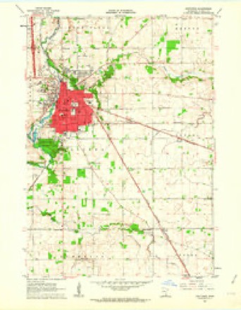
9 topographic sheets cover this place, the earliest surveyed in 1953 and the latest in 1985. It stands in Owatonna City. It lies in ZIP code area 55060. It stands on Maple Creek. The Survey maps it on the Owatonna quadrangle. 26,420 people lived here at the 2020 count. It stands 1,152 feet above sea level.
Research this city
On record in Owatonna
Buildings and businesses the archive holds for this place. Each opens its own page, with the source record it came from.
On the National Register 11 records
 National Farmers' BankNational Historic Landmark · listed 1971
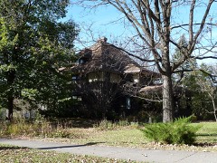 Dr. John H. Adair Houselisted 1986
 Administration Building-Minnesota State Public School For Dependent and Neglected Childrenlisted 1975
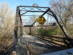 Bridge No. L-5573listed 1997
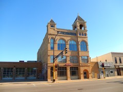 Owatonna City and Firemen's Halllisted 1997
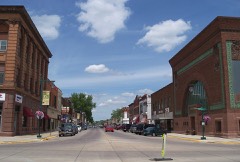 Owatonna Commercial Historic Districtlisted 2015
 Pillsbury Academy Campus Historic Districtlisted 2021
- Ezra Abbott Houselisted 1975
- Minnesota State Public School for Dependent and Neglected Childrenlisted 2010
- Owatonna Free Public Librarylisted 1976
- Steele County Courthouselisted 1978
Population over time
2 figuresOwatonna grew from 25,599 to 26,420 between 2010 and 2020. These are the recorded population figures Wikidata holds for this place, reached through the Geographic Names Information System number this page is keyed on rather than by name, so they belong to this place and not to another of the same name. Most are census counts, but not all are: an early figure may be a founding or settlement estimate, and an estimate published within five years of a census is left out. The change column is computed, and is left blank where more than 20 years separate a figure from the one before it, because a gap that long is not a change between two counts.
| Year | People | Change |
|---|---|---|
| 2010 | 25,599 | |
| 2020 | 26,420 | +821 (+3%) |
Topographic sheets covering this place
6 surveys from 9 printed sheetsMatched by testing this settlement's coordinate against the published boundary of every sheet in the United States Geological Survey's historical collection. Each opens the scanned sheet at the Survey.
- 1953 USGS Saint Paul quadrangle1:250000, 3 printings
- 1953 USGS St. Paul quadrangle1:250000
- 1959 USGS Saint Paul quadrangle1:250000
- 1959 USGS St. Paul quadrangle1:250000
- 1962 USGS Owatonna quadrangle1:24000
- 1985 USGS Faribault quadrangle1:100000, 2 printings




In the county-history sources
2,867 words on this townshipGeographical and Statistical History of Steele County from Its Earliest Settlement to the Present Time. Embracing Leading Incidents of Pioneer Life, Names of Early Settlers ... &c, published 1868 names this settlement in its chapter on Owatonna City. These are the passages that mention it, exactly as the scans read.
In the summer of 1855 Mr. Pettit sold his claim to John H. Abbott, and bought soon after an undivided half of Mr. Cornell's claim lying immediately south of the one just sold. It required but little argument to get all parties interested in building up a first-class town, and as usual among western men, when they had once decided to do it, they went directly to work to accomplish the object. Roads and bridges for the purpose of communication with other sections of the country, were the first things to be attended to, and with willing hearts and stout hands they Went to work and opened up the roads, bridged the sluices and water courses, and soon had the satisfaction of knowing that at least an important thoroughfare was opened through their town. Mr» Cornell, with true western energy and perseverance, built a bridge across the Straight river, and travel was seemingly nearly constant. Not unfrequently were there from twenty to thirty or forty emigrant teams in the streets at one and the same time. Business flourished, and the high road to prosperity was opened and all seemed determined to travel therein. Every settler whose house was large enough to accommodate more than his ewn family had all the spare room ox^cupied with strangers and those seeking homes. A village was platted, streets and lots marked out and speculation in city property was very active. A newspaper was established, and it was a live, energetic paper, just suited to the occasion, and one that did its full share in developing the resources of the country. In the spring of 1^56 Mr. Ezra Abbott built a steam saw mill, which was put into operation, and the building interests were greatly accelerated by this addition to the power and material. The common lumber for most of the new buildings was manufactured at this mill. In 1857 Messrs Wm. F. Pettit, John H, Abbott and A. B. Cornell built a mill just above the town, intended for a grist mill; but the demand for lumber was so great that machinery for sawing was soon put in operation, and the building interests were materially enhanced thereby. Immigration to Minnesota that year was literally immense, and every available space was occupied for hotel room. At one time the log house of Mr. Winship accommodated, or at least contained, some fifty persons. In the fall of 1855 a postoffice was established by the name of Owatonnia, from the Indian name of the river Ouitunya^ which in the Sioux dialect signifies straight, as the general course of the river is straight, though in its meanderings one of the most serpentine to be found on the maps. The same name was given the town and the spelling corrected as now used, '"Owatonna." In the winter the mail route was extended via Austin and West Union in Iowa to Dubuque, and the mail carried by J. J. Bracket, of Lakeville. Previous to the establishment of this route Mr. Pettit had put a line of daily stages in operation between Owatonna and Faribault for the purpose of bringing in all parties who were looking for locations. In September, Mr. Cornell and Mr. John H. Abbott laid out the town site, comprising 120 acres, about sixty acres on each of their claims. In November they went to Winona and pre-empted the land, and on the 26th of December filed the town plats in the office of Charles Ellison, Register of Deeds.
Passage source: Geographical and Statistical History of Steele County from Its Earliest Settlement to the Present Time. Embracing Leading Incidents of Pioneer Life, Names of Early Settlers ... &c, published 1868.
The first death in the town of Owatonna was that of a Mr. Presburg, who had lived about a mile north of the village in the timber. This death occurred in 1856, and a clergyman passing through the town officiated at the funeral. Mr. Morford made a claim about three miles east of town, and adjoining that of his partner, Mr. Odell. He lived on his claim yet attended to his business in town, generally going home each night when not detained too late by business. Whenever he was detained in town, Mrs. Morford would spend the night at Mr. Odell's. On one of these occasions, the 20th of November, 1856, Mrs. Morford having waited till somewhat late for her husband's return, started for her friend's house, which was distant about half a mile. After walking, as she thought, far enough to reach the house, she began to look about her, but could perceive no signs of the shanty. She wandered about for some time searching for the house, and finally concluded that she was lost on the prairie. But she did not despond, as she knew that she had not gone so far but daylight would set her all right again, and coming to a thicket she very philosophically wrapped her shawl around her and laid down to sleep. The weather being quite mild she enjoyed a good rest and awoke in the morning very much refreshed and started for home. Seeing a shanty she approached it, thinking she would make some inquiry as to her whereabouts. No one answering her repeated knocks she raised the latch and stepped in. Things looked strangely familiar to her, and upon a closer scrutiny she found she was in her own home that she had left the night previous ; but so completely bewildered had she become on the prairie, that she did not recognize the place till she had got inside and saw the familiar furniture.
Passage source: Geographical and Statistical History of Steele County from Its Earliest Settlement to the Present Time. Embracing Leading Incidents of Pioneer Life, Names of Early Settlers ... &c, published 1868.
Owatonna has frequently been represented in the Legislature of the State and in other public positions. The members of the Legislature from this town have been H. M. Sheetz, Wm. F. Pettit, J. B. Crooker, and W. R. Kinyon. Wm. F. Pettit and M. A. Daily, have been elected to the State Senate. Hon. N. M. Donaldson has occupied the bench in that judicial district since its organization. Hon. M. H. Dunnell, the present State Superintendent of public schools, is also a resident of Qwatonna.
Passage source: Geographical and Statistical History of Steele County from Its Earliest Settlement to the Present Time. Embracing Leading Incidents of Pioneer Life, Names of Early Settlers ... &c, published 1868.
Machine-read from a century-old scan, so expect the errors a machine makes: misspelled names, dropped words, stray characters.
Read the whole chapter on Owatonna City - it names this place 1 more 1 time.
Fires near this place
1 since 2012Regional context, not property-specific evidence. The federal wildfire occurrence database lists 1 fire within 5 miles of Owatonna in 2012, burning about 1 acre in total. None started naturally. None was recorded as arson. Distance is straight-line from the map coordinates, so a fire counted here may appear on a neighbouring settlement's page as well.
| Reported cause | Fires |
|---|---|
| Equipment and vehicle use | 1 |
The most recent of them, most recent first, with the day each was reported and the service that recorded it.
| Date | Cause | Size | Reported by | Name on the report |
|---|---|---|---|---|
| 1 November 2012 | Equipment and vehicle use | 1.0 acres | Minnesota Valley National Wildlife Refuge | LINCOLN |
Settlements close enough to share some of these fires:
Mines and quarries near this place
2 within 5 milesRegional context, not property-specific evidence. The federal mineral resources record lists 2 workings within 5 miles of Owatonna: 1 unknown, 1 producer. 1 still produces. What was taken out: Stone, Crushed/Broken. Distance is straight-line from the map coordinates, so a quarry counted here may appear on a neighbouring settlement's page as well.
| Where | Site | Commodity | Status | Recorded |
|---|---|---|---|---|
| Fretham Quarry | Stone, Crushed/Broken | Unknown | ||
| Lundin Cashman Quarry | Stone, Crushed/Broken | Producer |
Storms near this place
60 of 69 shownRegional context, not property-specific evidence. The National Weather Service names Owatonna in 69 storm reports between 1994 and 2026: 25 hail, 24 thunderstorm wind, 9 flash flood, 6 heavy rain. No death or injury is recorded in these reports. Each account below is quoted exactly as the forecast office filed it, from the NOAA Storm Events Database, and each date opens the federal record of that event.
| When | Event | Place named | Harm | What the report says |
|---|---|---|---|---|
| May 1996 | Thunderstorm Wind | Owatonna | $5,000,000 | no account filed |
| October 2007 | Flash Flood | Owatonna | $3,000,000 | Three to five inches of rain fell over Owatonna, resulting in flooding of roads, homes and businesses. A city storm sewer also backed up, causing basements to flood in about 40 homes. This event began September 30, 2007 at 2200 CST (see September 2007 Storm Data). |
| August 2007 | Flash Flood | Owatonna | $2,500,000 | A Presidential Disaster Declaration was signed for Steele County in the wake of major flooding and damage. Large areas of Owatonna were reported under two to three feet of water. Water completely covered a few roads, and was above car doors in some areas. Maple Creek at Dartt's Park was reported three times as wide as normal, and spread out into the parking lot. Some basement walls were reported to have collapsed. Two hotels in Owatonna were evacuated. The Steele County emergency manager reported 274 homes and 8 businesses were damaged. Seven homes were considered destroyed. The cooperative observer in Owatonna measured 6.47 inches as of 0700 CST August 19. Some information provided by the Owatonna People's Press newspaper. |
| June 2006 | Flash Flood | Owatonna | $500,000 | Rainfall was reported to vary from 4.4 to 6.3 inches over a narrow area of Steele County. Significant localized flooding occurred, most of which was contained in the industrial park on the western edge of Owatonna. Several of the local factories had flooding in their parking lots. Railroad tracks washed out on North Street. The Microtel hotel, located in this area, had approximately 35 cars submerged in 3 to 4 feet of water. One hundred and eighty people were evacuated from 63 rooms of the hotel by Emergency Services. Some guests of the hotel reported they had water up to their knees in the lower level rooms. Owatonna fire chief Mike Johnson mentioned that 15 homes, mostly in the southeast section of Owatonna had flooding in their basements. Some of these residents reported water up to five feet deep. The over one half million dollar damage estimate included the damage at the hotel plus the flooded vehicles. Information provided by county officials. A large area of mud washed over Highway 14. Interstate 35 was closed at Owatonna. The Red Cross opened an emergency shelter at the Owatonna High School. Some information provided by Faribault Daily News newspaper. |
| June 2001 | Thunderstorm Wind | Owatonna | $10,000 | Roof partially torn off of two businesses. Sheds torn down along with numberous trees. |
| September 2010 | Thunderstorm Wind | Owatonna | $5,000 | Several trees and power lines were blown down in Owatonna, Minnesota. |
| May 1994 | Hail | Owatonna | $500 | A severe thunderstorm produced dime-size hail outside of Owatonna. Damaging thunderstorms winds broke several large tree limbs, destroyed numberous hay bales, and toppled mailboxes and posts. |
| April 2025 | Hail | Owatonna | - | Hail measurement provided via phone. |
| August 2025 | Flash Flood | Owatonna | - | The Emergency Manager reported that Hoffman Drive in Owatonna had emergency barricading in place due to water over the road Saturday night. The water had since receded by Sunday morning. |
| September 2024 | Hail | Owatonna | - | A picture on X showed 1 inch hail in Owatonna. |
| June 2024 | Flash Flood | Owatonna | - | Maple Creek overflowed and flooded roads in and around Mineral Springs Park. |
| May 2022 | Heavy Rain | Owatonna | - | Rainfall was measured at 1.7 inches. Some minor street flooding occurred in Owatonna. |
| June 2022 | Flash Flood | Owatonna | - | Very heavy rainfall occurred in a short period of time in the city of Owatonna. There were a few streets that had water covering the roadway and were impassable at one point. These roads included the intersection of Elm and Main Street, and Rose and Elm Street on the east side of town. |
| May 2021 | Funnel Cloud | Owatonna | - | Numerous videos, including some from trained spotters, showed a funnel cloud west of Owatonna. Toward the end, it became rope-like and then dissipated. None of the videos were close-up, and no debris cloud was ever noted, so ground contact contact could not be confirmed by video. Two surveys by local officials and the NWS revealed no damage anywhere. Therefore this has been recorded as a funnel cloud. Videos showed another funnel cloud close to this one, and a separate entry has been made for that funnel. |
| May 2021 | Funnel Cloud | Owatonna | - | Numerous videos, including some from trained spotters and a MNDOT traffic camera, showed a funnel cloud west of Owatonna. None of the videos were close-up, and no debris cloud was ever noted, so ground contact contact could not be confirmed by video. Two surveys by local officials and the NWS revealed no damage anywhere. Therefore this has been recorded as a funnel cloud. Videos showed another funnel cloud (that was rope-like) close to this one, and a separate entry has been made for that funnel. |
| June 2019 | Tornado (EF0) | Owatonna | - | The Steele County Sheriff filmed a brief landspout tornado over an open field. |
| July 2019 | Thunderstorm Wind | Owatonna | - | A tree was uprooted at the Owatonna country club. |
| August 2017 | Thunderstorm Wind | Owatonna | - | The local emergency manager reported several trees blown down around Owatonna. |
| September 2017 | Thunderstorm Wind | Owatonna | - | Several power poles were blown down in the city of Owatonna. |
| September 2017 | Thunderstorm Wind | Owatonna | - | Several trees, up to 24 inches in diameter, were uprooted at the Brooktree Golf Course in Owatonna. |
| July 2017 | Thunderstorm Wind | Owatonna | - | A tree was blown down in Owatonna. |
| July 2017 | Thunderstorm Wind | Owatonna | - | Several trees were blown down northeast of Owatonna. |
| June 2014 | Heavy Rain | Owatonna | - | A measured 12 hour rainfall total of 2.88 inches near Owatonna. |
| July 2013 | Heavy Rain | Owatonna | - | A measured rainfall amount of 2.92 inches fell in less than 3 hours. |
| June 2012 | Heavy Rain | Owatonna | - | A measured rainfall report of 4.18 inches occurred in less than 18 hours. |
| June 2012 | Heavy Rain | Owatonna | - | A measured rainfall report of 4.10 inches occurred in less than 18 hours. |
| June 2010 | Flash Flood | Owatonna | - | Significant street flooding was reported in the south side of Owatonna, Minnesota. |
| June 2009 | Funnel Cloud | Owatonna | - | Trained spotters had reported a rotating wall cloud and several funnel clouds on the southeast side of Owatonna and through the township of Havana. |
| July 2008 | Thunderstorm Wind | Owatonna | - | Large trees downed in Central Park. Minor street flooding also reported.|Port-o-potty blown 20 feet. Small to medium tree limbs on ground, with debris scattered across town. |
| July 2008 | Thunderstorm Wind | Owatonna | - | One six inch diameter tree toppled. Another 14 inch diameter tree downed. |
| July 2008 | Thunderstorm Wind | Owatonna | - | Measured at the airport. |
| August 2007 | Thunderstorm Wind | Owatonna | - | Measured by MNDOT sensor along Interstate 35. Numerous trees in the area were toppled. |
| September 2007 | Flash Flood | Owatonna | - | Three to five inches of rain fell over Owatonna, resulting in flooding of roads, homes and businesses. A city storm sewer also backed up, causing basements to flood in about 40 homes. This event ended October 1, 2007 at 0300 CST (see October 2007 Storm Data). Damage totals are listed in October 2007 Storm Data. |
| August 2007 | Hail | Owatonna | - | Reported near the Steele/Waseca county line. |
| July 2006 | Hail | Owatonna | - | Hail reported on the west side of Owatonna. |
| June 2006 | Thunderstorm Wind | Owatonna | - | Reported by the Owatonna police department. Damage was incurred to outside merchandise at a local Cabela's store. A tent pole was also snapped at this location. The store manager also reported a portable toilet was flung about 100 yards due to the strong winds. |
| June 2005 | Thunderstorm Wind | Owatonna | - | A wind gust of 66 MPH was recorded at the Owatonna Airport. A wind gust of 61 MPH was reported in town by emergency management. Trees and limbs were downed onto homes and vehicles across town. Five trees were downed and garbage cans and portable toilets were blown over in city parks. A large industrial sized garbage container was blown into the street behind the Fire Department. |
| August 2005 | Heavy Rain | Owatonna | - | Two feet of standing water was reported at several intersections in town after 2.5 inches of rain fell. Flooded roads included SE 18th Street, Allen Avenue, Elm Avenue, Broadway Street, and Highway 218. Overflowing sewers also caused manhole covers to be forced off near Hoffman Street and State Avenue. |
| September 2005 | Flash Flood | Owatonna | - | Two feet of water flowed across roads in town. Manhole covers were forced off by an overflow of draining storm water. Three inches of rain was recorded in Owatonna. |
| October 2004 | Thunderstorm Wind | Owatonna | - | Several trees were snapped and a light pole was pulled out of the ground at a homestead along 48th Street. |
| July 2003 | Thunderstorm Wind | Owatonna | - | Few trees down. |
| July 2002 | Thunderstorm Wind | Owatonna | - | Several trees and power lines down along Interstate 35. |
| August 2002 | Thunderstorm Wind | Owatonna | - | Several trees down. |
| June 1998 | Thunderstorm Wind | Owatonna | - | Roof ripped off mobile home. Estimated windspeed. |
| July 1997 | Thunderstorm Wind | Owatonna | - | Large trees blown down. |
| April 2026 | Hail | Owatonna | - | no account filed |
| April 2026 | Hail | Owatonna | - | no account filed |
| April 2022 | Hail | Owatonna | - | no account filed |
| June 2022 | Hail | Owatonna | - | no account filed |
| June 2022 | Hail | Owatonna | - | no account filed |
| April 2022 | Hail | Owatonna | - | no account filed |
| August 2018 | Hail | Owatonna | - | no account filed |
| September 2010 | Hail | Owatonna | - | no account filed |
| June 2009 | Hail | Owatonna | - | no account filed |
| June 2009 | Hail | Owatonna | - | no account filed |
| June 2007 | Hail | Owatonna | - | no account filed |
| June 2007 | Hail | Owatonna | - | no account filed |
| July 2006 | Hail | Owatonna | - | no account filed |
| May 2002 | Hail | Owatonna | - | no account filed |
| June 2002 | Hail | Owatonna | - | no account filed |
Nearest settlements
The eight closest, with where each one stands in the county. Distances are straight-line, computed from the Geographic Names Information System coordinates.
| Map | Place | Distance | Sheets |
|---|---|---|---|
| Clinton Falls | 4.0 miles | 9 | |
| Havana | 4.4 miles | 9 | |
| Pratt | 5.5 miles | 9 | |
| Saco | 5.9 miles | 10 | |
| Merton | 6.0 miles | 9 | |
| Medford | 6.3 miles | 9 | |
| Steele Center | 6.5 miles | 7 | |
| Meriden | 8.6 miles | 10 |
Elsewhere
Matched on this settlement's Geographic Names Information System number rather than its name, so it cannot be a different place of the same name in another state.
| Wikipedia article on Owatonna | An encyclopaedic summary. Its text is share-alike, so it is linked here rather than copied. |
| Wikidata item Q853577 | The structured record the population and elevation above come from. Public domain (CC0). |
Provenance
This settlement is recorded in the Geographic Names Information System as feature 649095. The sheet list is computed by point-in-boundary test against the United States Geological Survey's historical topographic inventory. Both are works of the United States government and carry no copyright under 17 U.S.C. 105.
Wildfire. Short, Karen C. 2022. Spatial wildfire occurrence data for the United States, 1992-2020 [FPA_FOD_20221014]. 6th Edition. Fort Collins, CO: Forest Service Research Data Archive. https://doi.org/10.2737/RDS-2013-0009.6 Collected with United States Government funding and usable without additional permissions or fees.
Mines and quarries. USGS Mineral Resources Data System (MRDS) https://mrdata.usgs.gov/mrds/ A work of the United States government, no copyright under 17 U.S.C. 105.
Storms. NOAA National Centers for Environmental Information, Storm Events Database https://www.ncei.noaa.gov/stormevents/ A work of the United States government, no copyright under 17 U.S.C. 105. Narratives are quoted verbatim from the National Weather Service report and are not edited or summarised.