 Block
Mazeppa, Minnesota
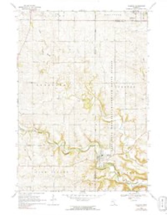
11 topographic sheets cover this place, the earliest surveyed in 1953 and the latest in 1989. It stands in Mazeppa City. It lies in ZIP code area 55956. The Survey maps it on the Mazeppa quadrangle. 874 people lived here at the 2020 count. It stands 955 feet above sea level.
On record in Mazeppa
Buildings and businesses the archive holds for this place. Each opens its own page, with the source record it came from.
On the National Register 2 records
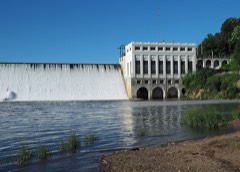 Lake Zumbro Hydroelectric Generating Plantlisted 1991
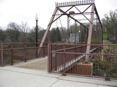 Walnut Street Bridgelisted 2003
Population over time
2 figuresMazeppa grew from 842 to 874 between 2010 and 2020. These are the recorded population figures Wikidata holds for this place, reached through the Geographic Names Information System number this page is keyed on rather than by name, so they belong to this place and not to another of the same name. Most are census counts, but not all are: an early figure may be a founding or settlement estimate, and an estimate published within five years of a census is left out. The change column is computed, and is left blank where more than 20 years separate a figure from the one before it, because a gap that long is not a change between two counts.
| Year | People | Change |
|---|---|---|
| 2010 | 842 | |
| 2020 | 874 | +32 (+4%) |
Topographic sheets covering this place
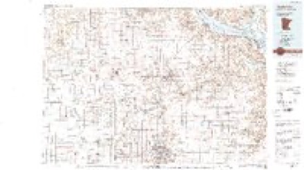
7 surveys from 11 printed sheetsMatched by testing this settlement's coordinate against the published boundary of every sheet in the United States Geological Survey's historical collection. Each opens the scanned sheet at the Survey.
- 1953 USGS Saint Paul quadrangle1:250000, 3 printings
- 1953 USGS St. Paul quadrangle1:250000
- 1959 USGS Saint Paul quadrangle1:250000
- 1959 USGS St. Paul quadrangle1:250000
- 1968 USGS Mazeppa quadrangle1:24000, 2 printings
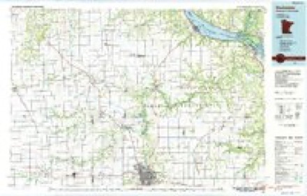
- 1985 USGS Rochester quadrangle1:100000
- 1989 USGS Rochester quadrangle1:100000, 2 printings




In the county-history sources
7,069 words on this townshipHistory of Wabasha County : Together with Biographical Matter, Statistics, Etc. : Gathered from Matter Furnished by Interviews with Old Settlers, County, Township, and Other Records, and Extracts from Files of Papers, Pamphlets, and Such Other Sources As Have Been Available : Also a History of Winona County, published 1884 names this settlement in its chapter on Mazeppa City. These are the passages that mention it, exactly as the scans read.
The credit of the first settlement within the limits of this township is unanimously ascribed to Ira O. Seeley, now a prominent citizen of Appleton, this state. It is said that Mr. Seeley visited tlie locality in the fall of 1854, and being pleased with the valley where Mazeppa village now stands, decided to squat upon a claim there, and to that end erected a bark shant}' on the west side of the river, not far from the present site of the milldam. Keturning to "Wabasha for his familj^, he became convinced, on reflection, that the valley of Trout Brook afforded greater advantages for general farming purposes ; so when he came on with his family' next spring he located on section .5, where Daniel Mack now resides. Immediately after Mr. Seeley came Enoch Young, Joseph Fuller and G. C. Sleeper, all making claims on sections 4 and 5. In April of the same year came Joseph Ford and his son, Orville D., and George Maxwell ; the last two named are still residents of the village, where O. D. Ford located at that time. During the same season the following located within the township : Anson L. Carrier, Nelson B. Smith, Turner Preble, Francis A. Stowell, John E. Hyde, Elijah Lont, J. B. Miller, James H. Sandford, Lewis Blunt, George Duncan, Charles Fox, Isaac NichoUs, George Bailey, and possibly others.
The advantages of the water-])ower and town site were at once perceived by the Fords, who made their claims thereon. All of the west half of section 6 lying east and north of the river was by them platted for a village. They offered the water-jjower to Mr. Nicholls if he would build a mill thereon. Tiie offer was at once accepted, and preparations were immediately made for the erection of a sawmill. This was set in operation during the winter, and timbers were at the same time prepared for a gristmill. William Amsbry became associated with Nichols in the construction of the gristmill, and subsequently bought out the latter. Amsbry & Barber completed it and began business in the fall of 1856. They were succeeded by Augustus Ambler, and the latter by the Forest Mills and Mazeppa Mill companies.
The first town meeting under the state organization was held at the residence and hotel of Elijah Lont, in the village of Mazeppa, May 11, 1858, in common with all other townships. John AMarten was made chairman, G. Maxwell was elected moderator and Charles F. -Fox and H. M. Stanton clerks. The next annual meetiug was there fixed, by a vote of twent\'-nine to thirteen, at the residence of C. F. Fox. One hundred and three votes were polled. For chairman, C. F. Fox had 57 votes ; F. A. Stowell, 46. For side supervisors, James H. Sandford received 102 votes ; H. "W". Drinkwater 50; C. F. Fox, 40; scattering, 4. For town clerk, Ansel F. Fox, 67 ; H. M. Stanton, 45. For assesssor, George ^Y. Fowler, 98. For collector, Ansel F. Carrier, 102. Overseer of the poor, William A. Preble, 57 ; Otis K. Gould, 43. Constables, A. F. Carrier, 102 ; W. A. Preble, 59 ; Orville Ford, 9. Justices of the peace, Corjdon Avery, 60 ; John Eeimund, 69 ; James Bent, James L. Bent, Ladd Eobi and G. Maxwell, received each a number of votes. In each case, the persons first named under the respective oflices are the ones elected. ,
Machine-read from a century-old scan, so expect the errors a machine makes: misspelled names, dropped words, stray characters.
Read the whole chapter on Mazeppa City - it names this place 16 more 16 times.
Fires near this place
5 since 1995Regional context, not property-specific evidence. The federal wildfire occurrence database lists 5 fires within 5 miles of Mazeppa between 1995 and 2020, burning about 57 acres in total. None started naturally. None was recorded as arson. Distance is straight-line from the map coordinates, so a fire counted here may appear on a neighbouring settlement's page as well.
| Reported cause | Fires |
|---|---|
| Smoking | 2 |
| Missing data/not specified/undetermined | 1 |
| Debris and open burning | 1 |
| Fireworks | 1 |
The most recent of them, most recent first, with the day each was reported and the service that recorded it.
| Date | Cause | Size | Reported by | Name on the report |
|---|---|---|---|---|
| 18 July 1995 | Smoking | under an acre | Minnesota Department of Natural Resources | not named |
| 6 May 2020 | Missing data/not specified/undetermined | 55 acres | Minnesota Department of Natural Resources | not named |
| 27 April 1995 | Smoking | 1.0 acres | Minnesota Department of Natural Resources | not named |
| 12 December 2020 | Fireworks | under an acre | Minnesota Department of Natural Resources | not named |
| 22 October 2015 | Debris and open burning | under an acre | Minnesota Department of Natural Resources | not named |
Settlements close enough to share some of these fires:
Mines and quarries near this place
3 within 5 milesRegional context, not property-specific evidence. The federal mineral resources record lists 3 workings within 5 miles of Mazeppa: 2 producers, 1 occurrence. 2 still produce. What was taken out: Stone, Crushed/Broken, Silica. Distance is straight-line from the map coordinates, so a quarry counted here may appear on a neighbouring settlement's page as well.
| Where | Site | Commodity | Status | Recorded |
|---|---|---|---|---|
| Goodhue County Sand Deposit No 1 | Silica | Occurrence | ||
| Betcher Quarry | Stone, Crushed/Broken | Producer | ||
| Kyllo Quarry | Stone, Crushed/Broken | Producer |
Storms near this place
15 since 1998Regional context, not property-specific evidence. The National Weather Service names Mazeppa in 15 storm reports between 1998 and 2025: 9 thunderstorm wind, 6 hail. No death or injury is recorded in these reports. Each account below is quoted exactly as the forecast office filed it, from the NOAA Storm Events Database, and each date opens the federal record of that event.
| When | Event | Place named | Harm | What the report says |
|---|---|---|---|---|
| July 2016 | Thunderstorm Wind | Mazeppa | $60,000 | A grain bin and farm outbuildings were damaged north of Mazeppa. |
| June 1998 | Thunderstorm Wind | Mazeppa | $24,000 | no account filed |
| July 2015 | Thunderstorm Wind | Mazeppa | $3,000 | A pine tree was snapped off and other trees were blown down in Mazeppa. |
| July 2011 | Thunderstorm Wind | Mazeppa | $3,000 | High winds from thunderstorms knocked down power lines and caused power outages around Mazeppa. |
| August 2000 | Hail | Mazeppa | $2,500 | no account filed |
| July 2016 | Thunderstorm Wind | Mazeppa | $2,000 | East of Mazeppa, trees were blown down and blocked the lanes of State Highway 60 near County Road 7. |
| August 2012 | Thunderstorm Wind | Mazeppa | $1,000 | Trees were blown down in Mazeppa. |
| July 2011 | Thunderstorm Wind | Mazeppa | $1,000 | Power lines were blown down around Mazeppa. |
| June 2005 | Thunderstorm Wind | Mazeppa | $800 | no account filed |
| April 2025 | Hail | Mazeppa | - | The public reported quarter sized hail in Mazeppa. |
| July 2024 | Thunderstorm Wind | Mazeppa | - | Trained spotters reported multiple trees down in Mazeppa. |
| May 2017 | Hail | Mazeppa | - | Up to walnut sized hail fell in Mazeppa. |
| September 2007 | Hail | Mazeppa | - | no account filed |
| August 2006 | Hail | Mazeppa | - | no account filed |
| July 1999 | Hail | Mazeppa | - | no account filed |
Nearest settlements
The eight closest, with where each one stands in the county. Distances are straight-line, computed from the Geographic Names Information System coordinates.
| Map | Place | Distance | Sheets |
|---|---|---|---|
| Bear Valley | 4.1 miles | 13 | |
| Zumbro Falls | 6.5 miles | 13 | |
| South Troy | 7.6 miles | 16 | |
| Oak Center | 9.5 miles | 13 | |
| Hammond | 9.7 miles | 15 | |
| Jarrett | 11.2 miles | 15 | |
| Bremen | 13.2 miles | 15 | |
| Millville | 13.4 miles | 15 |
Elsewhere
Matched on this settlement's Geographic Names Information System number rather than its name, so it cannot be a different place of the same name in another state.
| Wikipedia article on Mazeppa | An encyclopaedic summary. Its text is share-alike, so it is linked here rather than copied. |
| Wikidata item Q1926592 | The structured record the population and elevation above come from. Public domain (CC0). |
Provenance
This settlement is recorded in the Geographic Names Information System as feature 647648. The sheet list is computed by point-in-boundary test against the United States Geological Survey's historical topographic inventory. Both are works of the United States government and carry no copyright under 17 U.S.C. 105.
Wildfire. Short, Karen C. 2022. Spatial wildfire occurrence data for the United States, 1992-2020 [FPA_FOD_20221014]. 6th Edition. Fort Collins, CO: Forest Service Research Data Archive. https://doi.org/10.2737/RDS-2013-0009.6 Collected with United States Government funding and usable without additional permissions or fees.
Mines and quarries. USGS Mineral Resources Data System (MRDS) https://mrdata.usgs.gov/mrds/ A work of the United States government, no copyright under 17 U.S.C. 105.
Storms. NOAA National Centers for Environmental Information, Storm Events Database https://www.ncei.noaa.gov/stormevents/ A work of the United States government, no copyright under 17 U.S.C. 105. Narratives are quoted verbatim from the National Weather Service report and are not edited or summarised.