 Block
Minneota, Minnesota
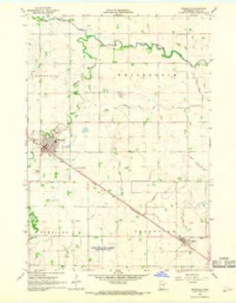
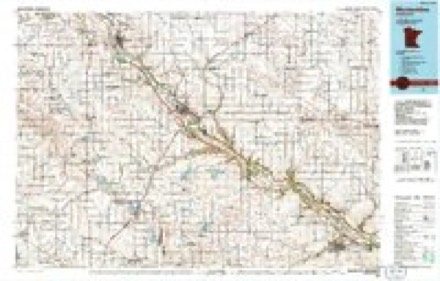
9 topographic sheets cover this place, the earliest surveyed in 1953 and the latest in 1986. It stands in Minneota City. It lies in ZIP code area 56264. The Survey maps it on the Minneota quadrangle. 1,366 people lived here at the 2020 count. It stands 1,168 feet above sea level.
On record in Minneota
Buildings and businesses the archive holds for this place. Each opens its own page, with the source record it came from.
On the National Register 3 records
 J. S. Anderson Houselisted 1982
 Anderson, O. G., & Co. Storelisted 1982
 St. Paul's Evangelical Lutheran Church & Parsonagelisted 1982
Population over time
2 figuresMinneota fell from 1,392 to 1,366 between 2010 and 2020. These are the recorded population figures Wikidata holds for this place, reached through the Geographic Names Information System number this page is keyed on rather than by name, so they belong to this place and not to another of the same name. Most are census counts, but not all are: an early figure may be a founding or settlement estimate, and an estimate published within five years of a census is left out. The change column is computed, and is left blank where more than 20 years separate a figure from the one before it, because a gap that long is not a change between two counts.
| Year | People | Change |
|---|---|---|
| 2010 | 1,392 | |
| 2020 | 1,366 | -26 (-2%) |
Topographic sheets covering this place
6 surveys from 9 printed sheetsMatched by testing this settlement's coordinate against the published boundary of every sheet in the United States Geological Survey's historical collection. Each opens the scanned sheet at the Survey.
- 1953 USGS New Ulm quadrangle1:250000, 3 printings
- 1957 USGS New Ulm quadrangle1:250000
- 1958 USGS New Ulm quadrangle1:250000
- 1967 USGS Minneota quadrangle1:24000
- 1967 USGS New Ulm quadrangle1:250000
- 1986 USGS Montevideo quadrangle1:100000, 2 printings




In the county-history sources
6,003 words on this townshipAn Illustrated History of Lyon County, Minnesota, published 1912 names this settlement in its chapter on Minneota City. These are the passages that mention it, exactly as the scans read.
Minneota is in the northwestern part of the county, on the Chicago & Northwestern railroad. The platted village is on the southeast quarter of section 25. Kidsvold township. Its elevation above sea level is 1179 feet. The population when the 1910 census was taken was 819.
Passage source: An Illustrated History of Lyon County, Minnesota, published 1912.
So early as 1871 located in the northwest corner township in close proximity to the site of the present village. Others came the following year, and in 1872 a postoffice named Nordland was established for their benefit. It was located on section 26, just west of the site of the village, and H. D. Frink, a homesteader, was the postmaster. That office was the predecessor of the Minneota office and Mr. Frink remained in charge until it was moved to the present location in 1875. Mr. Frink
Passage source: An Illustrated History of Lyon County, Minnesota, published 1912.
The change in the name of the postoffice from Nordland to Minneota (an Indian word signifying "big water") occurred in February, 1878. The change was not brought about without much bickering, jealousy and hard feelings. Owing to the manner of selecting the name great excitement prevailed and enmities were made that took years to overcome. The name Minneota was suggested by T. I). Seals."
Passage source: An Illustrated History of Lyon County, Minnesota, published 1912.
Machine-read from a century-old scan, so expect the errors a machine makes: misspelled names, dropped words, stray characters.
Read the whole chapter on Minneota City - it names this place 39 more 39 times.
Storms near this place
44 since 1994Regional context, not property-specific evidence. The National Weather Service names Minneota in 44 storm reports between 1994 and 2025: 23 hail, 14 thunderstorm wind, 4 tornado, 1 flash flood. The reports record 2 injuries. Each account below is quoted exactly as the forecast office filed it, from the NOAA Storm Events Database, and each date opens the federal record of that event.
| When | Event | Place named | Harm | What the report says |
|---|---|---|---|---|
| May 2022 | Thunderstorm Wind | Minneota | 2 hurt | High winds downed numerous trees and damaged several buildings in Minneota. The roof was torn off the Auto Center. One direct injury resulted to a driver when his semi-truck was blown into the ditch and rolled 3 miles east of Minneota. A second direct injury occurred when a person was blown down by the wind. |
| June 1997 | Hail | Minneota | $100,000 | Large hail devastated about 40 thousand acres of crops in western Lyon County. The area just south of Minneota was the most affected. |
| June 1997 | Thunderstorm Wind | Minneota | $50,000 | Thunderstorm winds caused tree and minor building damage damage and blew down signs. |
| March 2014 | Tornado (EF0) | Minneota | $15,000 | A tornado destroyed outbuildings, damaged a grain bin, and broke windows in a house in northern Lyon County, then crossed the county line into Yellow Medicine County. |
| August 2020 | Thunderstorm Wind | Minneota | $1,000 | A large tree was toppled on a farmstead. Property damage costs are rough estimates. Crop damage is an estimate from insured losses. Information provided by the United States Department of Agriculture. |
| June 2025 | Thunderstorm Wind | Minneota | - | Strong thunderstorm wind gusts broke off several 2 inch diameter tree limbs. |
| April 2023 | Flood | Minneota | - | Areal flooding from rapid snowmelt resulted in damage to several gravel roads and culverts across Lyon County, Minnesota during mid April. The most concentrated area of issues occurred in Westerheim Township in northern Lyon County. This flooding resulted in a Presidential Disaster Declaration for several townships across the county. |
| August 2022 | Thunderstorm Wind | Minneota | - | A thunderstorm wind gust of 65 mph was measured by a hand-held anemometer. |
| August 2022 | Thunderstorm Wind | Minneota | - | Medium to large diameter branches were downed by thunderstorm winds in Minneota. |
| August 2020 | Thunderstorm Wind | Minneota | - | Wind estimate through social media report. |
| August 2017 | Thunderstorm Wind | Minneota | - | Peal size hail and very heavy rain occurred at the same time. |
| July 2017 | Thunderstorm Wind | Minneota | - | Several large tree branches were downed. |
| June 2016 | Thunderstorm Wind | Minneota | - | Thunderstorm winds caused widespread tree damage, with numerous trees in Minneota blown down. |
| June 2013 | Hail | Minneota | - | Large hail caused an unknown amount of damage to vehicles. |
| April 2012 | Tornado (EF0) | Minneota | - | A brief tornado caused no reported damage. |
| August 2012 | Hail | Minneota | - | Large hail caused an unknown amount of crop, vehicle, window, and roof damage. |
| June 2004 | Tornado (F0) | Minneota | - | A brief tornado caused no reported damage. |
| June 2004 | Tornado (F0) | Minneota | - | A brief tornado caused no reported damage. |
| June 2002 | Flash Flood | Minneota | - | Heavy rain caused flooding of several township roads. |
| June 2001 | Thunderstorm Wind | Minneota | - | Thunderstorm winds blew down power lines and moved cars. |
| July 2000 | Hail | Minneota | - | Large hail caused widespread crop damage, with soybean crops especially hard hit. Crop damage estimates were available but incomplete. |
| July 2023 | Hail | Minneota | - | no account filed |
| May 2023 | Hail | Minneota | - | no account filed |
| May 2022 | Hail | Minneota | - | no account filed |
| September 2020 | Hail | Minneota | - | no account filed |
| June 2016 | Hail | Minneota | - | no account filed |
| July 2016 | Hail | Minneota | - | no account filed |
| June 2014 | Funnel Cloud | Minneota | - | no account filed |
| April 2012 | Hail | Minneota | - | no account filed |
| August 2009 | Hail | Minneota | - | no account filed |
| June 2006 | Hail | Minneota | - | no account filed |
| July 2006 | Hail | Minneota | - | no account filed |
| June 2005 | Thunderstorm Wind | Minneota | - | no account filed |
| May 2005 | Hail | Minneota | - | no account filed |
| May 2004 | Hail | Minneota | - | no account filed |
| June 2002 | Hail | Minneota | - | no account filed |
| June 2002 | Hail | Minneota | - | no account filed |
| June 2001 | Hail | Minneota | - | no account filed |
| June 2001 | Hail | Minneota | - | no account filed |
| July 2000 | Thunderstorm Wind | Minneota | - | no account filed |
| July 1999 | Thunderstorm Wind | Minneota | - | no account filed |
| June 1999 | Hail | Minneota | - | no account filed |
| September 1995 | Hail | Minneota | - | no account filed |
| July 1994 | Hail | Minneota | - | no account filed |
Nearest settlements
The eight closest, with where each one stands in the county. Distances are straight-line, computed from the Geographic Names Information System coordinates.
| Map | Place | Distance | Sheets |
|---|---|---|---|
| Taunton | 4.9 miles | 8 | |
| Ghent | 5.9 miles | 9 | |
| Green Valley | 12.3 miles | 9 | |
| Lynd | 12.9 miles | 9 | |
| Marshall | 13.0 miles | 11 | |
| Garvin Park | 13.0 miles | 11 | |
| Village Park | 14.0 miles | 11 | |
| Russell | 16.6 miles | 9 |
Elsewhere
Matched on this settlement's Geographic Names Information System number rather than its name, so it cannot be a different place of the same name in another state.
| Wikipedia article on Minneota | An encyclopaedic summary. Its text is share-alike, so it is linked here rather than copied. |
| Wikidata item Q1005708 | The structured record the population and elevation above come from. Public domain (CC0). |
Provenance
This settlement is recorded in the Geographic Names Information System as feature 647933. The sheet list is computed by point-in-boundary test against the United States Geological Survey's historical topographic inventory. Both are works of the United States government and carry no copyright under 17 U.S.C. 105.
Storms. NOAA National Centers for Environmental Information, Storm Events Database https://www.ncei.noaa.gov/stormevents/ A work of the United States government, no copyright under 17 U.S.C. 105. Narratives are quoted verbatim from the National Weather Service report and are not edited or summarised.