 Block
Taunton, Minnesota
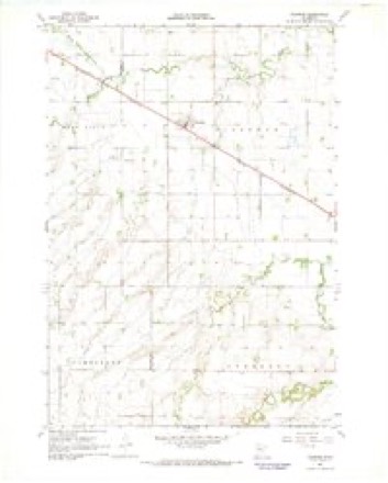
8 topographic sheets cover this place, the earliest surveyed in 1953 and the latest in 1985. It stands in Taunton City. It lies in ZIP code area 56291. The Survey maps it on the Taunton quadrangle. 136 people lived here at the 2020 count. It stands 1,175 feet above sea level.
Population over time
2 figuresTaunton fell from 139 to 136 between 2010 and 2020. These are the recorded population figures Wikidata holds for this place, reached through the Geographic Names Information System number this page is keyed on rather than by name, so they belong to this place and not to another of the same name. Most are census counts, but not all are: an early figure may be a founding or settlement estimate, and an estimate published within five years of a census is left out. The change column is computed, and is left blank where more than 20 years separate a figure from the one before it, because a gap that long is not a change between two counts.
| Year | People | Change |
|---|---|---|
| 2010 | 139 | |
| 2020 | 136 | -3 (-2%) |
Topographic sheets covering this place
4 surveys from 8 printed sheetsMatched by testing this settlement's coordinate against the published boundary of every sheet in the United States Geological Survey's historical collection. Each opens the scanned sheet at the Survey.
- 1953 USGS Watertown quadrangle1:250000, 3 printings
- 1958 USGS Watertown quadrangle1:250000, 2 printings
- 1967 USGS Taunton quadrangle1:24000
- 1985 USGS Clear Lake quadrangle1:100000, 2 printings
In the county-history sources
1,172 words on this townshipAn Illustrated History of Lyon County, Minnesota, published 1912 names this settlement in its chapter on Taunton City. These are the passages that mention it, exactly as the scans read.
Until 1885 the site of Taunton was bare of improvements. That year the railroad company built a side-track there and the site became known as Siding No. 4. In the fall of 1885 Marfield & Company put up a warehouse and J. P. Tumelty bought grain for the firm at the new station.
Passage source: An Illustrated History of Lyon County, Minnesota, published 1912.
The second building on the site was put up by Fred Smuhl, who conducted a small grocery store and became postmaster.14 In April, 1886, the village was platted and "Siding Xo. 4" became Taunton. The plat was surveyed by C. C. Pudor and the dedication was made April 30 by Albert Keep, as president of the Winona & St. Peter Railroad Company. Only two blocks were platted. The streets were named First, Second, Garfield, Main and Lincoln.1, business with Marfield & Company. In the summer of 1892 Nick Grengs erected a building and opened a general store. He sold the next year to E. II. Carstens, who still carries on the business. The Catholic church was built in 1895 and the same year residences were put up by Philip Ahern and Fred Smuhl. A few more improvements were made in 189616
Passage source: An Illustrated History of Lyon County, Minnesota, published 1912.
In your paper of November 25 you speak of Taunton as a railroad station with but half a dozen or less buildings. You have a mistaken idea of the size of our town. Taunton has about 100 inhabitants. We have thirty business and dwelling houses; we have three firms buying grain, two elevators and one warehouse; we have a lumber yard which does a good business; three general stores and one hardware store, all doing a good business; we also have one restaurant and one boarding house and two blacksmith shops. And at present there are three gangs of carpenters busy every day, and there will be several new buildings added to the list.
Passage source: An Illustrated History of Lyon County, Minnesota, published 1912.
Machine-read from a century-old scan, so expect the errors a machine makes: misspelled names, dropped words, stray characters.
Read the whole chapter on Taunton City - it names this place 12 more 12 times.
Fires near this place
1 since 2012Regional context, not property-specific evidence. The federal wildfire occurrence database lists 1 fire within 5 miles of Taunton in 2012, burning under an acre in total. None started naturally. None was recorded as arson. Distance is straight-line from the map coordinates, so a fire counted here may appear on a neighbouring settlement's page as well.
| Reported cause | Fires |
|---|---|
| Missing data/not specified/undetermined | 1 |
The most recent of them, most recent first, with the day each was reported and the service that recorded it.
| Date | Cause | Size | Reported by | Name on the report |
|---|---|---|---|---|
| 11 October 2012 | Missing data/not specified/undetermined | under an acre | Minnesota Department of Natural Resources | not named |
Storms near this place
13 since 1994Regional context, not property-specific evidence. The National Weather Service names Taunton in 13 storm reports between 1994 and 2025: 5 thunderstorm wind, 4 hail, 4 flood. No death or injury is recorded in these reports. Each account below is quoted exactly as the forecast office filed it, from the NOAA Storm Events Database, and each date opens the federal record of that event.
| When | Event | Place named | Harm | What the report says |
|---|---|---|---|---|
| June 2014 | Flood | Taunton | $200,000 | Persistent moderate to heavy rain caused flooding of fields and other lowlands, including numerous roads, and several homes and businesses. This flooding lasted through most of the daytime hours. Some roads were damaged or washed out. |
| April 2011 | Flood | Taunton | $200,000 | Flooding of lakes, streams, and lowlands, including some farmland, continued in the county through April. The Redwood river crested at a foot above flood stage at Russel on April 10th. While flooding of small streams abated, lake and lowland flooding continued with very slow improvement. Several roads remained flooded. High water and groundwater levels resulting from record precipitation in the previous year was the main reason that the flooding either grew worse or improved so slowly. |
| June 2005 | Thunderstorm Wind | Taunton | $20,000 | Thunderstorm winds caused tree and power line damage with several trees blown down. The winds blew open part of the roof of a mobile home in Cottonwood, and falling power lines caused a small fire in Cottonwood. The winds also caused other minor property damage. |
| June 2010 | Thunderstorm Wind | Taunton | $10,000 | Thunderstorm winds blew sown power lines, causing a power outage. The winds also caused tree damage, including large limbs blown down. |
| June 2025 | Thunderstorm Wind | Taunton | - | Thunderstorm wind gusts measured by the Minnesota RWIS station at Taunton. |
| May 2022 | Thunderstorm Wind | Taunton | - | A thunderstorm wind gust of 81 mph was measured by Minnesota Road Weather Information System site near Taunton. |
| June 2022 | Thunderstorm Wind | Taunton | - | A thunderstorm wind gust to 58 mph was measured at 2001CST at a Minnesota Road Weather Information System site near Taunton with a peak gust of 68 mph at 2006CST. |
| July 2018 | Flood | Taunton | - | U.S Highway 14 remained closed east of Tracy with water ponded over the roadway. Numerous basements in Marshall were flooded and city streets remained impassable due to standing water. |
| August 2012 | Hail | Taunton | - | Large hail caused an unknown amount of damage to corn and soybean crops, and to vehicles. |
| March 2011 | Flood | Taunton | - | Melting of a heavy winter snow cover caused flooding of the Redwood River, as well as flooding of lowlands, lakes, and small streams. The Redwood River crested at 3.85 feet above flood stage at Russel on March 23rd. There was considerable flooding of farmland. Numerous roads in the county were flooded. Some of the roads were closed, and some were washed out in spots. The flooding onset was rapid for a snow melt flood due to high water and groundwater levels from record precipitation in the year 2010. |
| June 2006 | Hail | Taunton | - | no account filed |
| July 2006 | Hail | Taunton | - | no account filed |
| July 1994 | Hail | Taunton | - | no account filed |
Nearest settlements
The eight closest, with where each one stands in the county. Distances are straight-line, computed from the Geographic Names Information System coordinates.
| Map | Place | Distance | Sheets |
|---|---|---|---|
| Minneota | 4.9 miles | 9 | |
| Ghent | 10.8 miles | 9 | |
| Green Valley | 17.0 miles | 9 | |
| Lynd | 17.1 miles | 9 | |
| Marshall | 17.9 miles | 11 | |
| Garvin Park | 17.9 miles | 11 | |
| Village Park | 18.8 miles | 11 | |
| Russell | 19.9 miles | 9 |
Elsewhere
Matched on this settlement's Geographic Names Information System number rather than its name, so it cannot be a different place of the same name in another state.
| Wikipedia article on Taunton | An encyclopaedic summary. Its text is share-alike, so it is linked here rather than copied. |
| Wikidata item Q2227099 | The structured record the population and elevation above come from. Public domain (CC0). |
Provenance
This settlement is recorded in the Geographic Names Information System as feature 653041. The sheet list is computed by point-in-boundary test against the United States Geological Survey's historical topographic inventory. Both are works of the United States government and carry no copyright under 17 U.S.C. 105.
Wildfire. Short, Karen C. 2022. Spatial wildfire occurrence data for the United States, 1992-2020 [FPA_FOD_20221014]. 6th Edition. Fort Collins, CO: Forest Service Research Data Archive. https://doi.org/10.2737/RDS-2013-0009.6 Collected with United States Government funding and usable without additional permissions or fees.
Storms. NOAA National Centers for Environmental Information, Storm Events Database https://www.ncei.noaa.gov/stormevents/ A work of the United States government, no copyright under 17 U.S.C. 105. Narratives are quoted verbatim from the National Weather Service report and are not edited or summarised.