 Block
Monticello, Minnesota
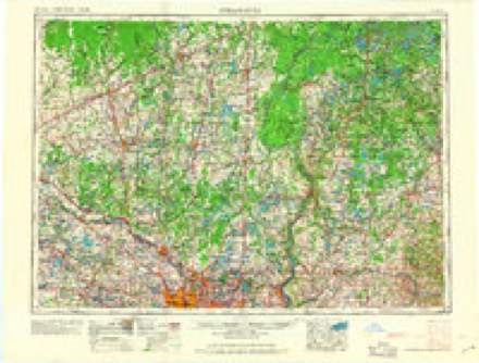
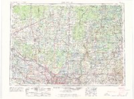
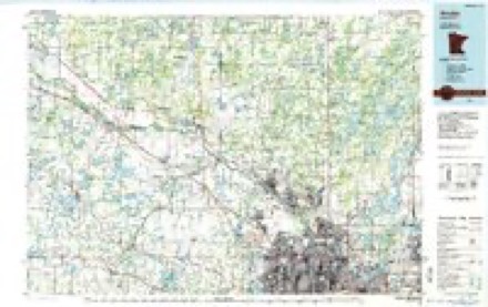
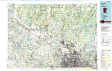
16 topographic sheets cover this place, the earliest surveyed in 1953 and the latest in 1991. It stands in Monticello City. It lies in ZIP code area 55362. It stands on Otter Creek. The Survey maps it on the Monticello quadrangle. 14,455 people lived here at the 2020 count. It stands 925 feet above sea level.
Research this city
On record in Monticello
Buildings and businesses the archive holds for this place. Each opens its own page, with the source record it came from.
On the National Register 4 records
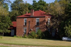 David Hanaford Farmsteadlisted 1979
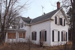 Tobias G. Mealey Houselisted 1976
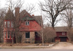 Nicherson-Tarbox House, Shed and Barnlisted 1979
 Rufus Rand Summer House and Carriage Barnlisted 1979
Population over time
2 figuresMonticello grew from 12,759 to 14,455 between 2010 and 2020. These are the recorded population figures Wikidata holds for this place, reached through the Geographic Names Information System number this page is keyed on rather than by name, so they belong to this place and not to another of the same name. Most are census counts, but not all are: an early figure may be a founding or settlement estimate, and an estimate published within five years of a census is left out. The change column is computed, and is left blank where more than 20 years separate a figure from the one before it, because a gap that long is not a change between two counts.
| Year | People | Change |
|---|---|---|
| 2010 | 12,759 | |
| 2020 | 14,455 | +1,696 (+13%) |
Topographic sheets covering this place
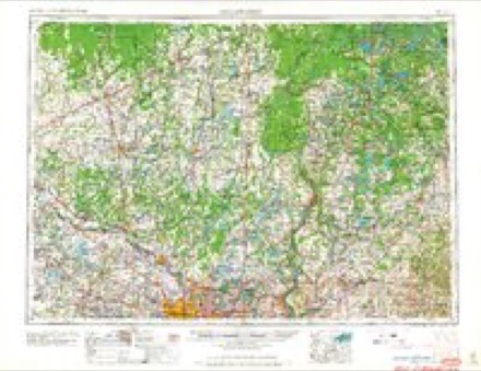
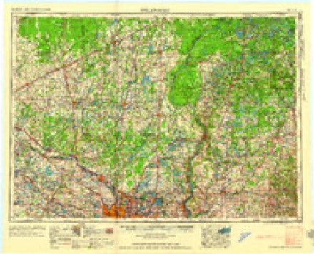
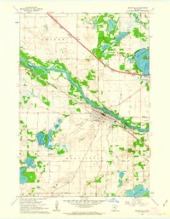
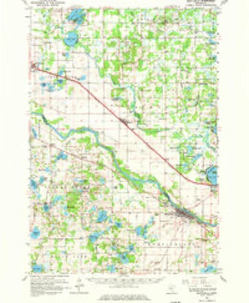
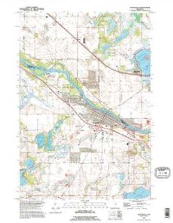
10 surveys from 16 printed sheetsMatched by testing this settlement's coordinate against the published boundary of every sheet in the United States Geological Survey's historical collection. Each opens the scanned sheet at the Survey.
- 1953 USGS Stillwater quadrangle1:250000
- 1955 USGS Stillwater quadrangle1:250000
- 1958 USGS Stillwater quadrangle1:250000, 2 printings
- 1961 USGS Monticello quadrangle1:24000, 3 printings
- 1961 USGS Monticello quadrangle1:62500, 3 printings
- 1965 USGS Stillwater quadrangle1:250000
- 1975 USGS Stillwater quadrangle1:250000, 2 printings
- 1985 USGS Anoka quadrangle1:100000
- 1991 USGS Anoka quadrangle1:100000
- 1991 USGS Monticello quadrangle1:24000
In the county-history sources
5,017 words on this townshipHistory of Wright County, Minnesota Volume II, published 1915 names this settlement in its chapter on Monticello City. These are the passages that mention it, exactly as the scans read.
Monticello is an irregular shaped township on the Mississippi river in the northeastern part of the county. It embraces township 121, range 25, fractional township 122, range 25, and the west fractional half of township 121, range 24. It is bounded on the north by the Mississippi river, on the east by Otsego township, on the south by Frankfort and Buffalo townships, and on the west by Maple Lake and Silver Creek townships.
Passage source: History of Wright County, Minnesota Volume II, published 1915.
The surface is nearly level and slightly rolling, not hilly or broken. About one-half of the town was originally prairie, the remainder brush land and timber. When the first settlers came there was more prairie land in this township than in any other in the county. The soil that was originally covered with brush and timber is a deep, dark loam with clay subsoil. The prairie land does not differ much except that it is more sandy, and in places sand and the hard gravelly subsoil is found on the surface.
Passage source: History of Wright County, Minnesota Volume II, published 1915.
The experiences of the pioneers were similar to those of the early settlers in other parts of the county, except that those who located on the prairie did not have to clear the land as did those who took up their home in the Big Woods. When the great grasshopper plague arrived August 20, 1856, they suffered somewhat more than the other people in the county by reason that they had a great acreage of crops planted. In the spring of 1857, about half the crop was destroyed. It was about the middle of July, 1857, when the insects left this region headed toward the southwest, In 1858 and 1859 the people of Monticello were somewhat better prepared to meet the financial depression than some of the people in other parts of the county, for while they had no money, they had larger farms under cultivation and had raised larger crops.
Passage source: History of Wright County, Minnesota Volume II, published 1915.
Machine-read from a century-old scan, so expect the errors a machine makes: misspelled names, dropped words, stray characters.
Read the whole chapter on Monticello City - it names this place 18 more 18 times.
Fires near this place
71 since 1992Regional context, not property-specific evidence. The federal wildfire occurrence database lists 71 fires within 5 miles of Monticello between 1992 and 2018, burning about 90 acres in total. None started naturally. 10 were recorded as arson. Distance is straight-line from the map coordinates, so a fire counted here may appear on a neighbouring settlement's page as well.
| Reported cause | Fires |
|---|---|
| Debris and open burning | 22 |
| Railroad operations and maintenance | 18 |
| Arson/incendiarism | 10 |
| Missing data/not specified/undetermined | 8 |
| Equipment and vehicle use | 7 |
| Smoking | 3 |
| Misuse of fire by a minor | 1 |
| Other causes | 1 |
| Recreation and ceremony | 1 |
The most recent of them, most recent first, with the day each was reported and the service that recorded it.
| Date | Cause | Size | Reported by | Name on the report |
|---|---|---|---|---|
| 1 August 2008 | Equipment and vehicle use | 13 acres | Minnesota Department of Natural Resources | not named |
| 4 June 1994 | Smoking | 2.0 acres | Minnesota Department of Natural Resources | not named |
| 25 June 1996 | Railroad operations and maintenance | under an acre | Minnesota Department of Natural Resources | not named |
| 12 June 2009 | Debris and open burning | under an acre | Minnesota Department of Natural Resources | not named |
| 6 May 2013 | Railroad operations and maintenance | under an acre | Minnesota Department of Natural Resources | not named |
| 6 May 2013 | Railroad operations and maintenance | under an acre | Minnesota Department of Natural Resources | not named |
| 6 May 2013 | Railroad operations and maintenance | under an acre | Minnesota Department of Natural Resources | not named |
| 3 May 1997 | Arson/incendiarism | under an acre | Minnesota Department of Natural Resources | not named |
Settlements close enough to share some of these fires:
Mines and quarries near this place
2 within 5 milesRegional context, not property-specific evidence. The federal mineral resources record lists 2 workings within 5 miles of Monticello: 2 producers. All of them still produce. What was taken out: Sand and Gravel, Construction. Distance is straight-line from the map coordinates, so a quarry counted here may appear on a neighbouring settlement's page as well.
| Where | Site | Commodity | Status | Recorded |
|---|---|---|---|---|
| Big Lake Pit and Mill | Sand and Gravel, Construction | Producer | ||
| Gullings Pit | Sand and Gravel, Construction | Producer |
Storms near this place
60 of 74 shownRegional context, not property-specific evidence. The National Weather Service names Monticello in 74 storm reports between 1995 and 2024: 39 hail, 24 thunderstorm wind, 3 lightning, 2 tornado. The reports record 2 injuries. Each account below is quoted exactly as the forecast office filed it, from the NOAA Storm Events Database, and each date opens the federal record of that event.
| When | Event | Place named | Harm | What the report says |
|---|---|---|---|---|
| July 2008 | Lightning | Monticello | 1 hurt | Man struck and injured by lightning while accomplishing construction work on the roof of a home. |
| August 1995 | Thunderstorm Wind | Monticello | 1 hurt | Tree fell on house injuring one person. |
| July 1997 | Thunderstorm Wind | Monticello | $20,000,000 | While several tornadoes converged on the southern edge of town, hurricane force winds battered the northern portions. The intersection of Interstate 94 and highway 25 was hardest hit by downburst winds resulting in extensive roof damage. Every tree in Ellison Park damaged. Roof ripped off automobile dealership flung into new car area destroying 75 new cars and trucks. Numerous recreational vehicles at RV dealership totaled. Over 200 structures significantly damaged. 61 homes and apartment buildings declared uninhabitable. 30 factories closed. Northern States Power transmission towers blown down. 2500 trees lost. Air conditioning unit blown off high school roof. Parked truck blown two thirds of a block. $100 million dollars damage estimate in Wright county. Called worst storm in 60 year history of Wright-Hennepin Cooperative Electric Association. |
| July 2016 | Lightning | Monticello | $500,000 | The Wright County Sheriffs Office said that several people had to be evacuated from their homes, and three townhouses were damaged in the fire-related lightning strike. The lightning struck a home and spread to three different townhouses near the area. No one was injured. |
| July 2016 | Thunderstorm Wind | Monticello | $250,000 | A pole barn was destroyed west of Monticello, on County Road 39. |
| July 2011 | Thunderstorm Wind | Monticello | $15,000 | Several trees and power lines were blown down in Monticello, Minnesota. |
| July 2024 | Hail | Monticello | - | Additionally sent in a photo with hail size measurement. |
| June 2017 | Thunderstorm Wind | Monticello | - | Power lines and large branches were blown down via social media. |
| June 2017 | Thunderstorm Wind | Monticello | - | A cinder block dugout was destroyed at a high school ballpark. |
| July 2016 | Heavy Rain | Monticello | - | A trained spotter measured 3.75 inches of rain near Monticello. |
| July 2016 | Flash Flood | Monticello | - | The ramp from southbound Highway 25, to eastbound Interstate 94 was completed flooded. One car was stranded and had to be towed due to the flooded roadway. |
| July 2016 | Heavy Rain | Monticello | - | A trained spotter measured 4.22 inches of rain east of Monticello. |
| July 2016 | Thunderstorm Wind | Monticello | - | A large 14 inch diameter tree was blown down between Buffalo and Monticello near Highway 25. |
| June 2013 | Thunderstorm Wind | Monticello | - | A large 30 inch diameter tree was blown down in Monticello, with other smaller trees blown down in Monticello as well. |
| September 2013 | Hail | Monticello | - | Quarter size hail was reported near interstate 94, and Highway 118. |
| July 2012 | Thunderstorm Wind | Monticello | - | A 22-inch diameter tree blew down near Monticello, Minnesota. |
| July 2011 | Thunderstorm Wind | Monticello | - | Several power poles were blown down near Monticello, Minnesota. |
| July 2011 | Hail | Monticello | - | Several reports of baseball size hail occurred in the city of Monticello, Minnesota. |
| August 2010 | Thunderstorm Wind | Monticello | - | A 14 inch diameter tree was uprooted near Monticello, Minnesota. |
| July 2010 | Thunderstorm Wind | Monticello | - | A trained spotter measured a wind gust of 70 mph. |
| July 2008 | Thunderstorm Wind | Monticello | - | Seventeen inch and fifteen inch diameter trees felled. A total of 5 trees downed. |
| July 2008 | Thunderstorm Wind | Monticello | - | Debris observed on road, large branches also felled. |
| July 2008 | Hail | Monticello | - | Hail occurred at intersection of 25th and 137th. |
| May 2008 | Hail | Monticello | - | Widespread damage to houses and vehicles. |
| June 2008 | Thunderstorm Wind | Monticello | - | Eleven inch diameter branches down. |
| July 2008 | Thunderstorm Wind | Monticello | - | Sixteen inch box elder tree toppled. Eighty pound dog house tossed 50 feet across yard. |
| May 2006 | Hail | Monticello | - | Ground covered with hail. Scattered leaves torn off trees. |
| June 2005 | Lightning | Monticello | - | Lightning struck a TV antenna on top of a house on Meadow Lane. The bolt traveled into the garage where it started a fire. After the roof of the garage caught fire, the flames moved onto the roof of the home and produced significant damage. |
| September 2005 | Flash Flood | Monticello | - | Torrential rain produced over four inches of rain in less than two hours. Two county roads northwest of Monticello were covered with water, and intersections in Monticello were flooded with water two feet deep. Streets and intersections flooded in Albertville and St. Michael. |
| September 2005 | Thunderstorm Wind | Monticello | - | Siding ripped off some homes. Scattered trees and large branches down. |
| July 2003 | Thunderstorm Wind | Monticello | - | Numerous trees and power lines down. |
| June 2003 | Thunderstorm Wind | Monticello | - | Few trees down. |
| June 1999 | Hail | Monticello | - | Strong winds also blew scaffolding down at high school. |
| June 1999 | Thunderstorm Wind | Monticello | - | Large Tree toppled near home. Estimated wind speed. |
| June 1998 | Thunderstorm Wind | Monticello | - | Trees blown down. Estimated windspeed. |
| July 1997 | Tornado (F2) | Monticello | - | Two tornadoes converged on the Prairie Acres housing development 1 south of Monticello at about the same time. Extensive damage in area. |
| August 1997 | Thunderstorm Wind | Monticello | - | Power line poles broken in half. Estimated windspeed. |
| July 2024 | Hail | Monticello | - | no account filed |
| July 2023 | Hail | Monticello | - | no account filed |
| April 2021 | Hail | Monticello | - | no account filed |
| June 2019 | Hail | Monticello | - | no account filed |
| July 2019 | Hail | Monticello | - | no account filed |
| March 2017 | Hail | Monticello | - | no account filed |
| July 2016 | Funnel Cloud | Monticello | - | no account filed |
| July 2016 | Hail | Monticello | - | no account filed |
| July 2016 | Hail | Monticello | - | no account filed |
| July 2016 | Hail | Monticello | - | no account filed |
| July 2011 | Hail | Monticello | - | no account filed |
| June 2010 | Hail | Monticello | - | no account filed |
| July 2008 | Funnel Cloud | Monticello | - | no account filed |
| May 2008 | Hail | Monticello | - | no account filed |
| May 2008 | Hail | Monticello | - | no account filed |
| May 2008 | Hail | Monticello | - | no account filed |
| June 2008 | Thunderstorm Wind | Monticello | - | no account filed |
| July 2007 | Hail | Monticello | - | no account filed |
| July 2007 | Hail | Monticello | - | no account filed |
| July 2007 | Hail | Monticello | - | no account filed |
| September 2007 | Hail | Monticello | - | no account filed |
| April 2007 | Hail | Monticello | - | no account filed |
| August 2006 | Hail | Monticello | - | no account filed |
Nearest settlements
The eight closest, with where each one stands in the county. Distances are straight-line, computed from the Geographic Names Information System coordinates.
| Map | Place | Distance | Sheets |
|---|---|---|---|
| Enfield | 8.1 miles | 15 | |
| Albertville | 8.8 miles | 15 | |
| Saint Michael | 9.5 miles | 15 | |
| Buffalo Manor East | 9.6 miles | 12 | |
| Bufflao Manor | 9.6 miles | 12 | |
| Silver Creek | 9.9 miles | 15 | |
| Buffalo | 10.2 miles | 12 | |
| Hasty | 10.5 miles | 15 |
Elsewhere
Matched on this settlement's Geographic Names Information System number rather than its name, so it cannot be a different place of the same name in another state.
| Wikipedia article on Monticello | An encyclopaedic summary. Its text is share-alike, so it is linked here rather than copied. |
| Wikidata item Q1913775 | The structured record the population and elevation above come from. Public domain (CC0). |
Provenance
This settlement is recorded in the Geographic Names Information System as feature 648048. The sheet list is computed by point-in-boundary test against the United States Geological Survey's historical topographic inventory. Both are works of the United States government and carry no copyright under 17 U.S.C. 105.
Wildfire. Short, Karen C. 2022. Spatial wildfire occurrence data for the United States, 1992-2020 [FPA_FOD_20221014]. 6th Edition. Fort Collins, CO: Forest Service Research Data Archive. https://doi.org/10.2737/RDS-2013-0009.6 Collected with United States Government funding and usable without additional permissions or fees.
Mines and quarries. USGS Mineral Resources Data System (MRDS) https://mrdata.usgs.gov/mrds/ A work of the United States government, no copyright under 17 U.S.C. 105.
Storms. NOAA National Centers for Environmental Information, Storm Events Database https://www.ncei.noaa.gov/stormevents/ A work of the United States government, no copyright under 17 U.S.C. 105. Narratives are quoted verbatim from the National Weather Service report and are not edited or summarised.