 Block
New Richland, Minnesota
7 topographic sheets cover this place, the earliest surveyed in 1954 and the latest in 1985. It stands in New Richland City. It lies in ZIP code area 56072. The Survey maps it on the New Richland quadrangle. 1,229 people lived here at the 2020 count. It stands 1,181 feet above sea level.
On record in New Richland
Buildings and businesses the archive holds for this place. Each opens its own page, with the source record it came from.
On the National Register 2 records
- Strangers Refuge Lodge Number 74, IOOFlisted 2006
- Vista Lutheran Churchlisted 1982
Population over time
2 figuresNew Richland grew from 1,203 to 1,229 between 2010 and 2020. These are the recorded population figures Wikidata holds for this place, reached through the Geographic Names Information System number this page is keyed on rather than by name, so they belong to this place and not to another of the same name. Most are census counts, but not all are: an early figure may be a founding or settlement estimate, and an estimate published within five years of a census is left out. The change column is computed, and is left blank where more than 20 years separate a figure from the one before it, because a gap that long is not a change between two counts.
| Year | People | Change |
|---|---|---|
| 2010 | 1,203 | |
| 2020 | 1,229 | +26 (+2%) |
Topographic sheets covering this place
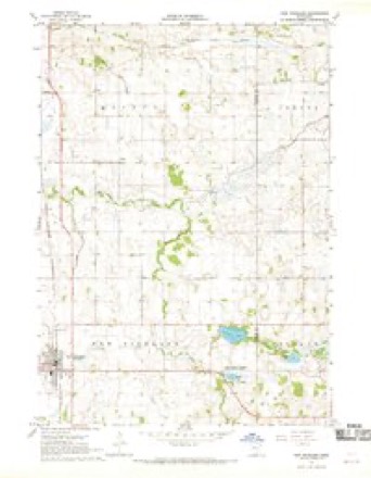
5 surveys from 7 printed sheetsMatched by testing this settlement's coordinate against the published boundary of every sheet in the United States Geological Survey's historical collection. Each opens the scanned sheet at the Survey.
- 1954 USGS Mason City quadrangle1:250000, 2 printings
- 1957 USGS Mason City quadrangle1:250000
- 1958 USGS Mason City quadrangle1:250000
- 1967 USGS New Richland quadrangle1:24000
- 1985 USGS Albert Lea quadrangle1:100000, 2 printings




In the county-history sources
122 words on this townshipChild's History of Waseca County, Minnesota : from Its First Settlement in 1854 to the Close of the Year 1904, a Record of Fifty Years : the Story of the Pioneers, published 1905 has no passage naming this settlement, which was common for smaller places. Its township is covered in full.
The chapter on New Richland City covers the township.
Read the chapter on New Richland City - 122 words.
Storms near this place
33 since 1994Regional context, not property-specific evidence. The National Weather Service names New Richland in 33 storm reports between 1994 and 2024: 13 hail, 12 thunderstorm wind, 2 funnel cloud, 2 flash flood. No death or injury is recorded in these reports. Each account below is quoted exactly as the forecast office filed it, from the NOAA Storm Events Database, and each date opens the federal record of that event.
| When | Event | Place named | Harm | What the report says |
|---|---|---|---|---|
| June 2020 | Thunderstorm Wind | New Richland | $100,000 | A large church steeple was blown over, landing in the parking lot. |
| June 1994 | Thunderstorm Wind | New Richland | $50,000 | High thunderstorm winds blew a roof off of a 376-foot hog confinement building just south of New Richland. |
| June 2024 | Thunderstorm Wind | New Richland | - | Several trees were downed, including one across a railroad track. |
| June 2024 | Thunderstorm Wind | New Richland | - | There were photos of large tree branches down across town and several trees snapped near their base. Some branches were down on homes and power lines were down. Time was estimated via radar. |
| May 2023 | Flash Flood | New Richland | - | Emergency Management in Waseca County reported that street and small stream flooding was occurring in and about three miles north of New Richland, MN. There were also reports of numerous structures and homes with flooded basements. Approximately two miles north of New Richland, a trained spotter reported that heavy rains were allowing Boot Creek to flow about six feet out of its banks and it started to run over 120th Street (Paved elevated road). Approximately three miles north of New Richland, MN, heavy rainfall caused flooding of a roadway which cut off access to a household's driveway. New Richland City Administration confirmed that flash flood waters receded within 24 hours and no longer posed a threat to public safety. |
| August 2021 | Tornado (EF0) | New Richland | - | A damage survey noted several trees were damaged at a farmstead, with large branches down. Satellite imagery showed more details to the tornado path. A time-stamped photo from a storm chaser showed a visible funnel in the area where the tornado damage occurred, and the photo was consistent with the tornado being in the flanking line. |
| August 2021 | Tornado (EF0) | New Richland | - | Radar shows this tornado occurred with a flanking line, just south of precipitation echoes. A damage survey revealed mostly corn damage, but some large branches were knocked down at a farmstead and some plywood was blown into a field. The damage survey revealed it was tornadic. Satellite imagery revealed more detail about the exact path through fields. Storm chaser video definitely shows the tornado and correct time, which was consistent with this being a tornado from a flanking line. |
| June 2020 | Thunderstorm Wind | New Richland | - | A large tree was blown down at the intersection of 105th and 120th streets. |
| April 2016 | Thunderstorm Wind | New Richland | - | Power lines were blown down in New Richland. |
| September 2016 | Flood | New Richland | - | Runoff from torrential rainfall that occurred across most of Waseca County Wednesday night, September 21st, caused numerous roads to remain impassable and closed. |
| June 2014 | Thunderstorm Wind | New Richland | - | Several areas in town were without power due to power lines blown down. |
| March 2010 | Flood | New Richland | - | Flood waters caused 160th Street, near New Richland to close. |
| June 2010 | Thunderstorm Wind | New Richland | - | Several large trees were blown down near New Richland, Minnesota. |
| June 2006 | Hail | New Richland | - | Hail covered the ground up to half an inch. Some small branches and leaves were removed from trees. |
| June 2005 | Thunderstorm Wind | New Richland | - | Power lines were downed. |
| June 2004 | Funnel Cloud | New Richland | - | HAM Radio operators relayed a spotter report of a funnel cloud halfway down to the ground. |
| August 2004 | Flash Flood | New Richland | - | Widespread field and lowland flooding was reported around New Richland. A small creek overflowed into a ballpark in town. |
| July 2003 | Thunderstorm Wind | New Richland | - | Numerous ten inch diameter branches down. |
| June 1998 | Thunderstorm Wind | New Richland | - | Trees and power lines down on southwest side of city. Grain bin lost its top. |
| May 2022 | Thunderstorm Wind | New Richland | - | no account filed |
| August 2020 | Hail | New Richland | - | no account filed |
| August 2018 | Hail | New Richland | - | no account filed |
| June 2015 | Hail | New Richland | - | no account filed |
| June 2010 | Hail | New Richland | - | no account filed |
| March 2007 | Hail | New Richland | - | no account filed |
| May 2006 | Hail | New Richland | - | no account filed |
| October 2006 | Hail | New Richland | - | no account filed |
| June 2004 | Hail | New Richland | - | no account filed |
| May 2001 | Hail | New Richland | - | no account filed |
| June 2001 | Hail | New Richland | - | no account filed |
| June 1998 | Hail | New Richland | - | no account filed |
| July 1997 | Funnel Cloud | New Richland | - | no account filed |
| July 1997 | Hail | New Richland | - | no account filed |
Nearest settlements
The eight closest, with where each one stands in the county. Distances are straight-line, computed from the Geographic Names Information System coordinates.
| Map | Place | Distance | Sheets |
|---|---|---|---|
| Vista | 4.6 miles | 7 | |
| Otisco | 5.9 miles | 7 | |
| Matawan | 7.9 miles | 7 | |
| Wilton | 8.6 miles | 11 | |
| Saint Mary | 10.9 miles | 11 | |
| Waldorf | 11.2 miles | 7 | |
| Waseca | 12.7 miles | 11 | |
| Colony Court | 14.1 miles | 11 |
Elsewhere
Matched on this settlement's Geographic Names Information System number rather than its name, so it cannot be a different place of the same name in another state.
| Wikipedia article on New Richland | An encyclopaedic summary. Its text is share-alike, so it is linked here rather than copied. |
| Wikidata item Q2228040 | The structured record the population and elevation above come from. Public domain (CC0). |
Provenance
This settlement is recorded in the Geographic Names Information System as feature 648518. The sheet list is computed by point-in-boundary test against the United States Geological Survey's historical topographic inventory. Both are works of the United States government and carry no copyright under 17 U.S.C. 105.
Storms. NOAA National Centers for Environmental Information, Storm Events Database https://www.ncei.noaa.gov/stormevents/ A work of the United States government, no copyright under 17 U.S.C. 105. Narratives are quoted verbatim from the National Weather Service report and are not edited or summarised.