 Block
Wilton, Minnesota
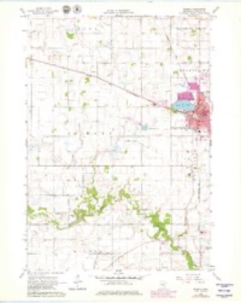
11 topographic sheets cover this place, the earliest surveyed in 1953 and the latest in 1991. It stands in Wilton Township. It lies in ZIP code area 56093. It stands on Little Le Sueur River. The Survey maps it on the Waseca quadrangle. It stands 1,109 feet above sea level.
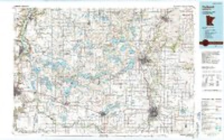
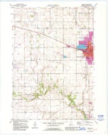
Topographic sheets covering this place
7 surveys from 11 printed sheetsMatched by testing this settlement's coordinate against the published boundary of every sheet in the United States Geological Survey's historical collection. Each opens the scanned sheet at the Survey.
- 1953 USGS Saint Paul quadrangle1:250000, 3 printings
- 1953 USGS St. Paul quadrangle1:250000
- 1959 USGS Saint Paul quadrangle1:250000
- 1959 USGS St. Paul quadrangle1:250000
- 1966 USGS Waseca quadrangle1:24000, 2 printings
- 1985 USGS Faribault quadrangle1:100000, 2 printings
- 1991 USGS Waseca quadrangle1:24000




In the county-history sources
1,269 words on this townshipHistory of Steele and Waseca Counties, Minnesota : an Album of History and Biography, Embracing Sketches of the Villages, Cities, and Townships : Educational, Civil, Military, and Political History : Portraits of Prominent Citizens, and Biographies of Old Settlers and Representative Men, published 1887 names this settlement in its chapter on Wilton Township. These are the passages that mention it, exactly as the scans read.
Buel Welsh, came to the State in 1855, and located at Faribault, pursuing his trade of carpenter. He came there from Wisconsin. In the fall of 1856, he removed to Wilton, where he remained for many years. He was a kind-hearted man of but little education, but had picked up considerable knowledge of law and other subjects, and had practiced for about twenty-five years in the various justices' courts. On Saturday, April 24, 1886, he fell dead in a neighbor's wagon, while going from Alma City to his home in Freedom Township.
Passage source: History of Steele and Waseca Counties, Minnesota : an Album of History and Biography, Embracing Sketches of the Villages, Cities, and Townships : Educational, Civil, Military, and Political History : Portraits of Prominent Citizens, and Biographies of Old Settlers and Representative Men, published 1887.
Dr. M. S. Gove, one of the pioneer physicians, came to Wilton in 1858, from his native State, "Vermont, and remained in practice in Waseca County until December 1, 1874, when he passed to " that land from whose bourne no traveler ever returns," in the very prime of life.
Passage source: History of Steele and Waseca Counties, Minnesota : an Album of History and Biography, Embracing Sketches of the Villages, Cities, and Townships : Educational, Civil, Military, and Political History : Portraits of Prominent Citizens, and Biographies of Old Settlers and Representative Men, published 1887.
A. J. Woodbury came to Wilton in 1856 and put up a hotel which he called the Washington. This place he ran for man^' years, up to 1882, except some six or eight months when it was rented and operated by Joseph Doty. He is a native of Beverley, Mass., born in 1808. In 1855, he came west, after having been to Texas, New Orleans, etc., and in the spring of 1856 came to Wilton as alreadj' detailed. About 1830 he married Elizabeth Stratton, by whom he had two children : Henry C. and George H. both of whom came with their father. All three have been identified with the history of the county since. George H., however, is now a resident of Jamestown, D. T. Henry C. is the municipal judge of the city of Waseca, and his father, A. J. lives in the same city.
Passage source: History of Steele and Waseca Counties, Minnesota : an Album of History and Biography, Embracing Sketches of the Villages, Cities, and Townships : Educational, Civil, Military, and Political History : Portraits of Prominent Citizens, and Biographies of Old Settlers and Representative Men, published 1887.
Machine-read from a century-old scan, so expect the errors a machine makes: misspelled names, dropped words, stray characters.
Read the whole chapter on Wilton Township - it names this place 5 more 5 times.
Fires near this place
1 since 2020Regional context, not property-specific evidence. The federal wildfire occurrence database lists 1 fire within 5 miles of Wilton in 2020, burning about 1 acre in total. None started naturally. 1 was recorded as arson. Distance is straight-line from the map coordinates, so a fire counted here may appear on a neighbouring settlement's page as well.
| Reported cause | Fires |
|---|---|
| Arson/incendiarism | 1 |
The most recent of them, most recent first, with the day each was reported and the service that recorded it.
| Date | Cause | Size | Reported by | Name on the report |
|---|---|---|---|---|
| 1 August 2020 | Arson/incendiarism | 1.0 acres | Minnesota Valley National Wildlife Refuge | FELBER |
Settlements close enough to share some of these fires:
Mines and quarries near this place
2 within 5 milesRegional context, not property-specific evidence. The federal mineral resources record lists 2 workings within 5 miles of Wilton: 2 producers. All of them still produce. What was taken out: Sand and Gravel, Construction. Distance is straight-line from the map coordinates, so a quarry counted here may appear on a neighbouring settlement's page as well.
| Where | Site | Commodity | Status | Recorded |
|---|---|---|---|---|
| Bauman Pit & Mill | Sand and Gravel, Construction | Producer | ||
| Harguth Pit | Sand and Gravel, Construction | Producer |
Storms near this place
1 since 2010Regional context, not property-specific evidence. The National Weather Service names Wilton in 1 storm report in 2010: 1 flood. No death or injury is recorded in these reports. Each account below is quoted exactly as the forecast office filed it, from the NOAA Storm Events Database, and each date opens the federal record of that event.
| When | Event | Place named | Harm | What the report says |
|---|---|---|---|---|
| March 2010 | Flood | Wilton | - | Flood waters caused 128th Street, near Wilton to close. |
Nearest settlements
The eight closest, with where each one stands in the county. Distances are straight-line, computed from the Geographic Names Information System coordinates.
| Map | Place | Distance | Sheets |
|---|---|---|---|
| Otisco | 3.0 miles | 7 | |
| Saint Mary | 3.7 miles | 11 | |
| Waseca | 4.6 miles | 11 | |
| Vista | 5.3 miles | 7 | |
| Colony Court | 6.0 miles | 11 | |
| New Richland | 8.6 miles | 7 | |
| Palmer | 9.6 miles | 10 | |
| Waldorf | 10.2 miles | 7 |
Elsewhere
Matched on this settlement's Geographic Names Information System number rather than its name, so it cannot be a different place of the same name in another state.
| Wikipedia article on Wilton | An encyclopaedic summary. Its text is share-alike, so it is linked here rather than copied. |
| Wikidata item Q20710969 | The structured record the population and elevation above come from. Public domain (CC0). |
Provenance
This settlement is recorded in the Geographic Names Information System as feature 655016. The sheet list is computed by point-in-boundary test against the United States Geological Survey's historical topographic inventory. Both are works of the United States government and carry no copyright under 17 U.S.C. 105.
Wildfire. Short, Karen C. 2022. Spatial wildfire occurrence data for the United States, 1992-2020 [FPA_FOD_20221014]. 6th Edition. Fort Collins, CO: Forest Service Research Data Archive. https://doi.org/10.2737/RDS-2013-0009.6 Collected with United States Government funding and usable without additional permissions or fees.
Mines and quarries. USGS Mineral Resources Data System (MRDS) https://mrdata.usgs.gov/mrds/ A work of the United States government, no copyright under 17 U.S.C. 105.
Storms. NOAA National Centers for Environmental Information, Storm Events Database https://www.ncei.noaa.gov/stormevents/ A work of the United States government, no copyright under 17 U.S.C. 105. Narratives are quoted verbatim from the National Weather Service report and are not edited or summarised.