 Block
Waseca, Minnesota
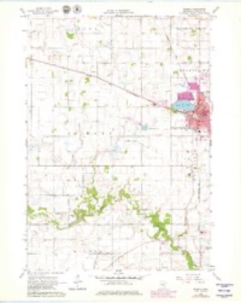
11 topographic sheets cover this place, the earliest surveyed in 1953 and the latest in 1991. It stands in Waseca City. It lies in ZIP code area 56093. The Survey maps it on the Waseca quadrangle. 9,229 people lived here at the 2020 count. It stands 1,152 feet above sea level.
Research this city
On record in Waseca
Buildings and businesses the archive holds for this place. Each opens its own page, with the source record it came from.
On the National Register 7 records
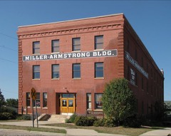 W. J. Armstrong Company Wholesale Grocerslisted 1982
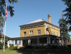 John W. Aughenbaugh Houselisted 1982
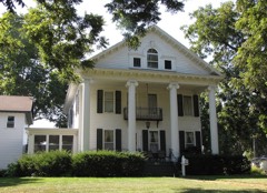 Roscoe P. Ward Houselisted 1982
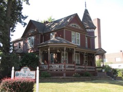 William R. Wolf Houselisted 1982
- Philo C. Bailey Houselisted 1994
- Waseca Commercial Historic Districtlisted 2020
- Waseca County Courthouselisted 1982
Population over time
2 figuresWaseca fell from 9,410 to 9,229 between 2010 and 2020. These are the recorded population figures Wikidata holds for this place, reached through the Geographic Names Information System number this page is keyed on rather than by name, so they belong to this place and not to another of the same name. Most are census counts, but not all are: an early figure may be a founding or settlement estimate, and an estimate published within five years of a census is left out. The change column is computed, and is left blank where more than 20 years separate a figure from the one before it, because a gap that long is not a change between two counts.
| Year | People | Change |
|---|---|---|
| 2010 | 9,410 | |
| 2020 | 9,229 | -181 (-2%) |
Topographic sheets covering this place
7 surveys from 11 printed sheetsMatched by testing this settlement's coordinate against the published boundary of every sheet in the United States Geological Survey's historical collection. Each opens the scanned sheet at the Survey.
- 1953 USGS Saint Paul quadrangle1:250000, 3 printings
- 1953 USGS St. Paul quadrangle1:250000
- 1959 USGS Saint Paul quadrangle1:250000
- 1959 USGS St. Paul quadrangle1:250000
- 1966 USGS Waseca quadrangle1:24000, 2 printings
- 1985 USGS Faribault quadrangle1:100000, 2 printings
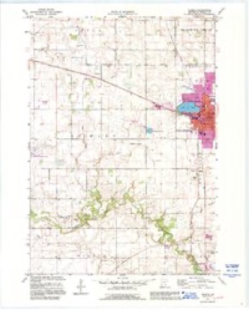
- 1991 USGS Waseca quadrangle1:24000




What happened here
An account from the chapter on Waseca city. The inset identifies its exact source book and publication year.
The Colorado Beetle
Potato bugs were then new to the people of this country. Very few people had ever seen one prior to 1865. This year, (1868) the Mankato Record (now Review) remarked that "those striped bugs which, for the past three years have so seriously damaged the crop west of us, have already made their appear- ance in large numbers." Other papers noticed their appearance, and our paper remarlied that "we have not heard of any of these pests in this immediate vicinity, but doubt not tliey will soon visit this section." We remarked that they should be "attacked at first sight and exterminated if possible." As M'e soon after learned, this was more easily said tlian done.
In the county-history sources
35,970 words on this townshipHistory of Steele and Waseca Counties, Minnesota : an Album of History and Biography, Embracing Sketches of the Villages, Cities, and Townships : Educational, Civil, Military, and Political History : Portraits of Prominent Citizens, and Biographies of Old Settlers and Representative Men, published 1887 names this settlement in its chapter on Waseca City. These are the passages that mention it, exactly as the scans read.
Mrs. Eastlick received a ball in one heel ; Ireland's youngest child was shot through one leg ; Emma Duly received a wound in the arm, and "Willie Duly received a shot in the shoulder. They soon reached the slough, and although concealed from view, it afi'orded little protection. There were about two hundred Indians and only six white men left. For two hours the cowardly savages, keeping out of sight as much as possible, poured volley after volley into the slough. They would skulk behind the hills, crawl to the top, rise and fire, then drop out white men to fire his gun, for immediately there would be a volley fired into the grass where he was. One after another of the whites were wounded or killed. Eastlick, after doing brave work, was killed. Mrs. Eastlick received a scalp wound and another in the side. Mrs. Everett received a shot in her neck. Everett received a bullet in the thigh which struck the bone, followed around and lodged under the knee. Charles Hatch was wounded in the hand and arm, and Bentley in the arm. There was little chance for further resistance by the settlers. The firing ceased. Three of the skulking Indians, one of them old Pawn, then came forward and called upon the women to come out of the slough. Everett answered them. Pawn who knew the voice, commanded him to come, out of the slough. Everett told him he could not for he was wounded. Pawn said : " You lie ; you can walk if you want to."
Passage source: History of Steele and Waseca Counties, Minnesota : an Album of History and Biography, Embracing Sketches of the Villages, Cities, and Townships : Educational, Civil, Military, and Political History : Portraits of Prominent Citizens, and Biographies of Old Settlers and Representative Men, published 1887.
Two of the Indians then fired into the grass where Everett was, one of the bullets striking his arm near the elbow and shattering the bone and a buckshot entering his foot. Mrs. Everett, forgetting all fear, bravely arose and in the most piteous manner told them her husband was dead, and they had killed him.
Passage source: History of Steele and Waseca Counties, Minnesota : an Album of History and Biography, Embracing Sketches of the Villages, Cities, and Townships : Educational, Civil, Military, and Political History : Portraits of Prominent Citizens, and Biographies of Old Settlers and Representative Men, published 1887.
Shortly after the surrender, the fiendish brutality and devilish cruelty of the Sioux were fully demonstrated. A little boy, five years old, son of Mrs. Eastlick, while following his mother, who was being led away by an Indian, was attacked by a squaw, beaten over the head with a club, and finally ri])ped open with a knife. Another of her children, Frank, was shot and murdered before her eyes. Mrs. Duly's boy, "Willie, was shot in her presence, and left in a suffering, dying condition on the prairie. Mrs. Ireland and Mrs. Smith were murdered in cold blood, and left near each other ; and near by was the corpse of Mrs. Eastlick's third child, Giles.
Passage source: History of Steele and Waseca Counties, Minnesota : an Album of History and Biography, Embracing Sketches of the Villages, Cities, and Townships : Educational, Civil, Military, and Political History : Portraits of Prominent Citizens, and Biographies of Old Settlers and Representative Men, published 1887.
Machine-read from a century-old scan, so expect the errors a machine makes: misspelled names, dropped words, stray characters.
Read the whole chapter on Waseca City - it names this place 107 more 107 times.
Fires near this place
1 since 2020Regional context, not property-specific evidence. The federal wildfire occurrence database lists 1 fire within 5 miles of Waseca in 2020, burning about 1 acre in total. None started naturally. 1 was recorded as arson. Distance is straight-line from the map coordinates, so a fire counted here may appear on a neighbouring settlement's page as well.
| Reported cause | Fires |
|---|---|
| Arson/incendiarism | 1 |
The most recent of them, most recent first, with the day each was reported and the service that recorded it.
| Date | Cause | Size | Reported by | Name on the report |
|---|---|---|---|---|
| 1 August 2020 | Arson/incendiarism | 1.0 acres | Minnesota Valley National Wildlife Refuge | FELBER |
Settlements close enough to share some of these fires:
Mines and quarries near this place
2 within 5 milesRegional context, not property-specific evidence. The federal mineral resources record lists 2 workings within 5 miles of Waseca: 2 producers. All of them still produce. What was taken out: Sand and Gravel, Construction. Distance is straight-line from the map coordinates, so a quarry counted here may appear on a neighbouring settlement's page as well.
| Where | Site | Commodity | Status | Recorded |
|---|---|---|---|---|
| Bauman Pit & Mill | Sand and Gravel, Construction | Producer | ||
| Harguth Pit | Sand and Gravel, Construction | Producer |
Storms near this place
60 of 84 shownRegional context, not property-specific evidence. The National Weather Service names Waseca in 84 storm reports between 1993 and 2025: 30 thunderstorm wind, 30 hail, 12 flash flood, 7 heavy rain. No death or injury is recorded in these reports. Each account below is quoted exactly as the forecast office filed it, from the NOAA Storm Events Database, and each date opens the federal record of that event.
| When | Event | Place named | Harm | What the report says |
|---|---|---|---|---|
| May 1996 | Thunderstorm Wind | Waseca | $4,000,000 | no account filed |
| May 2014 | Thunderstorm Wind | Waseca | $100,000 | Many large trees and power poles were snapped off from south to north across the city of Waseca. Also, a large grain bin was destroyed north of Waseca. |
| August 2025 | Heavy Rain | Waseca | - | A trained spotter reported 72 hour storm total of 9.83 inches of rain. |
| August 2025 | Flash Flood | Waseca | - | The city of Waseca received close to 9 inches of rain spanning from Saturday evening into Sunday morning. Several roads near and around the city of Waseca were closed due to water over the road, including a portion of 110th street stretching from 325th to 360th. Emergency manager reported that the city had to bypass the sanitary sewer and dump into the lake to save numerous homes. |
| August 2025 | Heavy Rain | Waseca | - | Cocorahs station MN-WC-12 Waseca 1.6 SSE. 72 hour total of 6.87 inches. |
| August 2025 | Heavy Rain | Waseca | - | Cocorahs station MN-WC-8 Waseca 2.0 N. 72 hour storm total of 5.28 inches. |
| July 2024 | Thunderstorm Wind | Waseca | - | Six to eight trees down in the southeast bay of Watkins Lake. They were downed toward the west-northwest, which along with another report from the west side of Watkins Lake, is consistent with this having been due to a microburst. |
| July 2024 | Thunderstorm Wind | Waseca | - | About two dozen trees were downed on the west side of Watkins Lake. They were all knocked down toward the west-northwest. Trained spotters never reported a tornado with this highly visible storm. Discussion with local residents also took place and led to the conclusion that this was microburst damage. |
| June 2024 | Flash Flood | Waseca | - | Road closures were reported south of Waseca due to flooded roadways. |
| May 2022 | Heavy Rain | Waseca | - | Rainfall was measured at 3.20 inches. |
| June 2022 | Heavy Rain | Waseca | - | This was a measured rainfall report of 2.80 inches of rain in less than three hours. |
| August 2019 | Hail | Waseca | - | In addition to the large hail stone, there was a power pole blown down in Waseca. |
| July 2019 | Flash Flood | Waseca | - | Local law enforcement officials barricaded 415th and 105th Street due to water over the road. |
| July 2019 | Flash Flood | Waseca | - | Local law enforcement officials barricaded parts of 410th and 120th street due to water over the road. |
| July 2019 | Thunderstorm Wind | Waseca | - | There were reports of multiple trees blown down around Waseca. |
| September 2018 | Tornado (EF0) | Waseca | - | A NWS storm survey, plus areal footage of drone and satellite data, concluded that an EF0 tornado started east of Waseca, and tracked northeast for 3.9 miles until moving into Steele County. This tornado tracked mainly through corn and soy bean fields, and occasionally damaging a few power lines and power poles. The damage was consistent with EF0 damage with maximum wind speeds of 85 mph and a width of 250 yards. |
| September 2018 | Thunderstorm Wind | Waseca | - | A NWS storm survey concluded that severe straight-line winds up to 70 mph, damaged corn and soy bean fields in far northeast Waseca county. |
| August 2018 | Thunderstorm Wind | Waseca | - | Several trees were blown down north of Waseca. |
| June 2017 | Thunderstorm Wind | Waseca | - | Multiple large tree limbs were blown down in the city of Waseca. |
| June 2017 | Thunderstorm Wind | Waseca | - | The Minnesota Department of Transportation mesonet site at the southern edge of Waseca, along Highway 14, measured a wind gust of 63 mph. The first severe wind gust was 1220 LST at 59 mph, and continued to gust up to 63 mph through 1225 LST. |
| June 2016 | Thunderstorm Wind | Waseca | - | A measured wind gust at the Waseca airport. |
| September 2016 | Flash Flood | Waseca | - | Several roads in Waseca had one to two feet of flowing water. In addition, an unverified report of 10 inches of rain fell in the northeast part of Waseca late Wednesday night. Several homes and businesses in Waseca had flooded basements and other structural problems due to the flood waters. |
| September 2016 | Flash Flood | Waseca | - | Highway 13 near Highway 14 was closed due to flood waters. |
| September 2016 | Flash Flood | Waseca | - | The city of Waseca continued to receive torrential rainfall that caused several roads to close. The flood waters started to affect homes that had to be evacuated. |
| September 2016 | Flash Flood | Waseca | - | Flood waters continued to affect the city of Waseca with the community arena reported of 6-8 inches of standing water on their ice rink. |
| September 2016 | Heavy Rain | Waseca | - | A local trained weather observer measured 6.55 inches of rainfall near Waseca between Wednesday afternoon, September 21st, to the early morning of Thursday, September 22nd. |
| September 2016 | Heavy Rain | Waseca | - | A National Weather Service coop observer measured 7.64 inches of rainfall southwest of Waseca between Wednesday afternoon, September 21st, to the early morning of Thursday, September 22nd. |
| August 2016 | Flash Flood | Waseca | - | A portion of County Road 2 was closed near Waseca due to high water. Several businesses and residential homes had water in their basements. |
| June 2015 | Thunderstorm Wind | Waseca | - | Large trees and a wooden swing were blown down north of Waseca near County Road 13. |
| September 2014 | Hail | Waseca | - | Hail was piled up in town, with some areas up to 6 inches deep in the town of Waseca. |
| September 2014 | Thunderstorm Wind | Waseca | - | Nearly 100 trees were blown down in the city of Waseca. It was also accompanied by large hail. In addition, an outdoor tent was blown down trapping approximately 30-40 people underneath the tent. |
| June 2014 | Thunderstorm Wind | Waseca | - | Several large trees were blown down around the town of Waseca, with power outages. |
| June 2014 | Flash Flood | Waseca | - | Significant street flooding occurred in Waseca, with several roads impassable. |
| June 2014 | Thunderstorm Wind | Waseca | - | A large tree was blown down in Waseca. |
| July 2011 | Thunderstorm Wind | Waseca | - | Numerous trees and power lines were blown down around Waseca, Minnesota. A few trees fell on homes in Waseca. |
| July 2011 | Thunderstorm Wind | Waseca | - | Power lines were blown down near Waseca, Minnesota. |
| June 2010 | Flash Flood | Waseca | - | Several inches of rainfall occurred around the area and produced significant flooding in fields, and local roadways. Some of the water was two to three feet high and flowing over sidewalks in Waseca, Minnesota. |
| June 2010 | Thunderstorm Wind | Waseca | - | A trained spotter measured a wind gust of 52 knots near Waseca, Minnesota. |
| June 2009 | Funnel Cloud | Waseca | - | A trained spotter followed a persistent wall cloud from the City of Waseca along Highway 14. It produced one and sometimes two adjacent funnel clouds, a comment echoed by a Steele County spotter who also photographed the funnel. |
| June 2009 | Tornado (EF0) | Waseca | - | Several storm chasers, local law enforcement officers and trained spotters followed funnel clouds across central Waseca County, before the tornado was observed forming just north of the City of Waseca on Clear Lake. The tornado moved onshore and then eastsouthward to Goose Lake. No property damage occurred but several large 14 diameter trees were uprooted when the tornado came onshore. Other broken trees were noted near Goose Lake. |
| August 2007 | Flash Flood | Waseca | - | Street flooding with a few cars stranded. One basement flooded, with water coming in through windows and a downstairs door. |
| August 2007 | Thunderstorm Wind | Waseca | - | Numerous reports of 12 to 18 inch diameter trees downed. |
| July 2006 | Thunderstorm Wind | Waseca | - | Power pole down. |
| July 2006 | Hail | Waseca | - | Hail occurred at the County Fairgrounds in the northeastern portion of the city. Ponding of water was also reported near Clear Lake Park. |
| June 2005 | Thunderstorm Wind | Waseca | - | Trees were downed. |
| June 2005 | Lightning | Waseca | - | An outbuilding at a farm was destroyed by a lightning-related fire on 110th Street in Section 36 of Iosco Township. The time was estimated. |
| June 2005 | Lightning | Waseca | - | A bolt of lightning struck the fascia of a home on 368th Avenue and came out through the siding. Three people inside the structure felt tingling immediately after the bolt hit, but were uninjured. The time was estimated. |
| June 2005 | Hail | Waseca | - | Penny sized hail fell near the Waseca and Steele County border east of Waseca. |
| June 2005 | Thunderstorm Wind | Waseca | - | Two trees up to 10 inches in diameter were downed. A power line was downed onto Elm Avenue. |
| June 2005 | Hail | Waseca | - | Quarter sized hail fell just south of the Waseca Federal Correction Institution. Dime to nickel size hail fell in town. |
| June 2005 | Thunderstorm Wind | Waseca | - | A tree was downed onto a power line on County Road 4 near Wilton Bridge. |
| August 2005 | Thunderstorm Wind | Waseca | - | Several trees were downed across town. The hardest hit areas included the Highlands and Clear Lake. Debris from a damaged roof and sun porch broke windows on a home and damaged a garage and a car on Highland Drive. Boats and docks were damaged, roofs of homes were damaged, and several trees were downed along the northwest and east side of Clear Lake. In addition, many trees were downed in Goose Lake Park three miles east of town. One felled tree smashed a metal gate. |
| June 2004 | Thunderstorm Wind | Waseca | - | Trees up to one foot in diameter were downed. One felled tree damaged a home. A temporary greenhouse was also damaged. |
| June 2004 | Thunderstorm Wind | Waseca | - | Small buildings sustained roof damage and some trees were downed in Section 33 of Iosco Township. |
| July 2003 | Thunderstorm Wind | Waseca | - | Scattered trees down across the east side of Waseca. |
| May 2014 | Hail | Waseca | - | no account filed |
| June 2014 | Hail | Waseca | - | no account filed |
| May 2012 | Hail | Waseca | - | no account filed |
| May 2012 | Hail | Waseca | - | no account filed |
| May 2011 | Hail | Waseca | - | no account filed |
Nearest settlements
The eight closest, with where each one stands in the county. Distances are straight-line, computed from the Geographic Names Information System coordinates.
| Map | Place | Distance | Sheets |
|---|---|---|---|
| Colony Court | 1.4 miles | 11 | |
| Wilton | 4.6 miles | 11 | |
| Palmer | 5.5 miles | 10 | |
| Saint Mary | 6.1 miles | 11 | |
| Otisco | 6.8 miles | 7 | |
| Vista | 8.6 miles | 7 | |
| Janesville | 11.0 miles | 9 | |
| Lake Elysian | 12.0 miles | 10 |
Elsewhere
Matched on this settlement's Geographic Names Information System number rather than its name, so it cannot be a different place of the same name in another state.
| Wikipedia article on Waseca | An encyclopaedic summary. Its text is share-alike, so it is linked here rather than copied. |
| Wikidata item Q987118 | The structured record the population and elevation above come from. Public domain (CC0). |
Provenance
This settlement is recorded in the Geographic Names Information System as feature 653793. The sheet list is computed by point-in-boundary test against the United States Geological Survey's historical topographic inventory. Both are works of the United States government and carry no copyright under 17 U.S.C. 105.
Wildfire. Short, Karen C. 2022. Spatial wildfire occurrence data for the United States, 1992-2020 [FPA_FOD_20221014]. 6th Edition. Fort Collins, CO: Forest Service Research Data Archive. https://doi.org/10.2737/RDS-2013-0009.6 Collected with United States Government funding and usable without additional permissions or fees.
Mines and quarries. USGS Mineral Resources Data System (MRDS) https://mrdata.usgs.gov/mrds/ A work of the United States government, no copyright under 17 U.S.C. 105.
Storms. NOAA National Centers for Environmental Information, Storm Events Database https://www.ncei.noaa.gov/stormevents/ A work of the United States government, no copyright under 17 U.S.C. 105. Narratives are quoted verbatim from the National Weather Service report and are not edited or summarised.