 Block
Pine Island, Minnesota
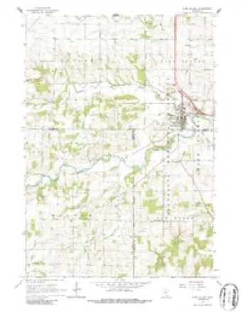
11 topographic sheets cover this place, the earliest surveyed in 1953 and the latest in 1989. It stands in Pine Island City. It lies in ZIP code area 55963. It stands on North Branch Middle Fork Zumbro River. The Survey maps it on the Pine Island quadrangle. 3,769 people lived here at the 2020 count. It stands 1,004 feet above sea level.
On record in Pine Island
Buildings and businesses the archive holds for this place. Each opens its own page, with the source record it came from.
On the National Register 6 records
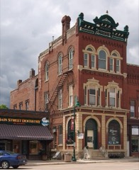 Opera Block Houselisted 1980
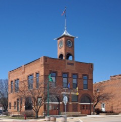 Pine Island City Hall and Fire Stationlisted 1980
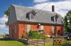 Roscoe Butter and Cheese Factorylisted 1980
- George Baslington Farmhouselisted 1980
- Jacob Bringghold Houselisted 1980
- Bringgold, Jacob A. and Mary Finn Houselisted 2014
Topographic sheets covering this place
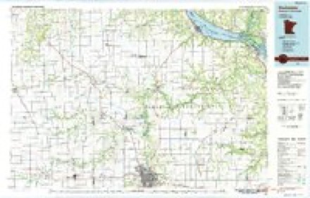
7 surveys from 11 printed sheetsMatched by testing this settlement's coordinate against the published boundary of every sheet in the United States Geological Survey's historical collection. Each opens the scanned sheet at the Survey.
- 1953 USGS Saint Paul quadrangle1:250000, 3 printings
- 1953 USGS St. Paul quadrangle1:250000
- 1959 USGS Saint Paul quadrangle1:250000
- 1959 USGS St. Paul quadrangle1:250000
- 1965 USGS Pine Island quadrangle1:24000, 2 printings
- 1985 USGS Rochester quadrangle1:100000
- 1989 USGS Rochester quadrangle1:100000, 2 printings




In the county-history sources
4,149 words on this townshipHistory of Goodhue County, Including a Sketch of the Territory and State of Minnesota; Together with an Account of the Early French Discoveries, Indian Massacres, the Part Borne by Minnesota's Patriots in the War of the Great Rebellion, and a Full and Complete History of the County from the Time of Its Occupancy by Swiss Missionaries in 1838. Pioneer Incidents, Biographical Sketches of Early and Prominent Settlers and Representative Men, and of Its Cities, Towns, Churches, Schools, Secret Societies, Etc, published 1878 names this settlement in its chapter on Pine Island City. These are the passages that mention it, exactly as the scans read.
Mr. Jewell took a claim on sec. 32, in April, 1855. The village was platted by William Rock, in the winter of 1856-7, on this land. This plat also included a portion of the land then owned by J. A. Tarbox, on which the village is built. The first house was built by Dr. Carver, a log structure. The first store building was erected by Jacob Wiltse and Mr. Worthing.
The first building erected for hotel purposes, was built in the spring of 1857, by E. Demmon, on lot 2, block 22. It was rented to William P. Hall, but in 1858, Demmon sold to Truman Parker, who has since been its proprietor, excepting a short time he rented it to Mr. Gilbert.
This church is the outgrowth of the labors of Rev. Rulliford, who held a camp-meeting in the grove on Mr. Jewell's land in the summer of 1855. Early in the spring of 1856, J. M. Rodgen, organized a church with fifteen members. In 1864, they built a brick church 36x50. Their present membership is one hundred, with J. Barnard, as pastor. L. D. Farrington, H. D. Cornwell, and A. Hamlin, trustees.
Machine-read from a century-old scan, so expect the errors a machine makes: misspelled names, dropped words, stray characters.
Read the whole chapter on Pine Island City - it names this place 4 more 4 times.
Fires near this place
1 since 2016Regional context, not property-specific evidence. The federal wildfire occurrence database lists 1 fire within 5 miles of Pine Island in 2016, burning under an acre in total. None started naturally. None was recorded as arson. Distance is straight-line from the map coordinates, so a fire counted here may appear on a neighbouring settlement's page as well.
| Reported cause | Fires |
|---|---|
| Missing data/not specified/undetermined | 1 |
The most recent of them, most recent first, with the day each was reported and the service that recorded it.
| Date | Cause | Size | Reported by | Name on the report |
|---|---|---|---|---|
| 15 November 2016 | Missing data/not specified/undetermined | under an acre | Minnesota Department of Natural Resources | not named |
Settlements close enough to share some of these fires:
Storms near this place
1 since 1996Regional context, not property-specific evidence. The National Weather Service names Pine Island in 1 storm report in 1996: 1 thunderstorm wind. No death or injury is recorded in these reports. Each account below is quoted exactly as the forecast office filed it, from the NOAA Storm Events Database, and each date opens the federal record of that event.
| When | Event | Place named | Harm | What the report says |
|---|---|---|---|---|
| May 1996 | Thunderstorm Wind | Pine Island | - | no account filed |
Nearest settlements
The eight closest, with where each one stands in the county. Distances are straight-line, computed from the Geographic Names Information System coordinates.
| Map | Place | Distance | Sheets |
|---|---|---|---|
| Roscoe Center | 5.9 miles | 11 | |
| Zumbrota | 6.5 miles | 11 | |
| Forest Mills | 6.7 miles | 11 | |
| Roscoe | 6.8 miles | 11 | |
| Wanamingo | 10.4 miles | 11 | |
| White Willow | 11.2 miles | 11 | |
| Bellechester | 13.6 miles | 11 | |
| Goodhue | 13.8 miles | 11 |
Elsewhere
Matched on this settlement's Geographic Names Information System number rather than its name, so it cannot be a different place of the same name in another state.
| Wikipedia article on Pine Island | An encyclopaedic summary. Its text is share-alike, so it is linked here rather than copied. |
| Wikidata item Q2229465 | The structured record the population and elevation above come from. Public domain (CC0). |
Provenance
This settlement is recorded in the Geographic Names Information System as feature 649465. The sheet list is computed by point-in-boundary test against the United States Geological Survey's historical topographic inventory. Both are works of the United States government and carry no copyright under 17 U.S.C. 105.
Wildfire. Short, Karen C. 2022. Spatial wildfire occurrence data for the United States, 1992-2020 [FPA_FOD_20221014]. 6th Edition. Fort Collins, CO: Forest Service Research Data Archive. https://doi.org/10.2737/RDS-2013-0009.6 Collected with United States Government funding and usable without additional permissions or fees.
Storms. NOAA National Centers for Environmental Information, Storm Events Database https://www.ncei.noaa.gov/stormevents/ A work of the United States government, no copyright under 17 U.S.C. 105. Narratives are quoted verbatim from the National Weather Service report and are not edited or summarised.