 Block
Saratoga, Minnesota
9 topographic sheets cover this place, the earliest surveyed in 1954 and the latest in 1985. It stands in Saratoga Township. It lies in ZIP code area 55972. The Survey maps it on the Saint Charles quadrangle.
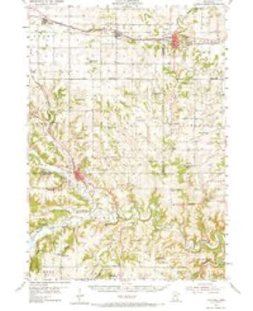
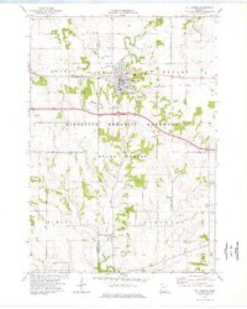
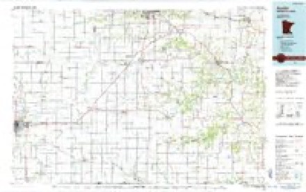
Topographic sheets covering this place
6 surveys from 9 printed sheetsMatched by testing this settlement's coordinate against the published boundary of every sheet in the United States Geological Survey's historical collection. Each opens the scanned sheet at the Survey.
- 1954 USGS Chatfield quadrangle1:62500, 2 printings
- 1954 USGS Mason City quadrangle1:250000, 2 printings
- 1957 USGS Mason City quadrangle1:250000
- 1958 USGS Mason City quadrangle1:250000
- 1974 USGS St Charles quadrangle1:24000
- 1985 USGS Austin quadrangle1:100000, 2 printings



In the county-history sources
2,247 words on this townshipHistory of Winona County, published 1883 names this settlement in its chapter on Saratoga Township. These are the passages that mention it, exactly as the scans read.
This township lies in the extreme southwestern corner of Winona county, having Qlrastead county on the west and FiUmore county on the south. Though the face of the country is somewhat broken along its western front, it contains some of as fine farming land as is to be found in any state of the Union. Settlements were made almost simultaneously in the western portion of the township and. along the northern ridge, adjoining the township of St. Charles. These settlements date back a period of nearly thirty years, and some of the claims then taken are still being farmed by the original pre-emptors. Tlie soil upon the prairie is a deep vegetable loam, with a clay subsoil ; but in the oak openings it is of a lighter character, a sandy loam intermixed with gravel. This latter is a quicker, warmer soil, and specially adapted to the growth of corn, as this cereal ripens quicker on the gravelly soil, a very material consideration in this latitude. All the valuable farming lands of the township may be included under one or the other of these classes of soil. The western portion of the township is well watered and quite a valuable water privilege exists at Troy. The volume of water, thougli not large, having its sources in unfailing springs, afibrds with its head of twenty feet sufficient power to maintain a very considerable milling industry. The staple of the farms in past years has been wheat, to which within the past decade the growth of barley has been added in quantities sufficient to dispute the palm. These grains, with clover and timothy seed (which are grown in large quantities), oats and corn, have been and still are the main dependence of the farmer throughout this whole region, little if any stock more than sufficient for farm purposes being raised. But as the wheat yield has decreased from time to time, more and more attention has been paid to the breeding of horses, cattle and swine for market, and now there are some valuable herds of these animals on well conducted stock farms within the area of the township. Dairying has also begun to challenge the attention of the farmers of this and adjoining townships, and some farms keep quite a number of milch cows, the number and quality of them increasing from year to year. Creameries are being established to manufacture the cream product of these dairy herds, and the industry promises soon to assume an important rank among the farm products of the western portions of the county. Considerable settlements had been made in Saratoga township as early as the s])ring of 1855, a few pre-emptions and actual occupancy of the land dating as far back as the fall of 1858. The settlements during 1855 were numerous, and the following season, 1856, it was (juite difhcult if not impossible to fingl any valuable lands unclaimed. The formal organization of the township was effected under the new state government, May 11, 1858, at Troy, a small village and postoffice in the southwestern part of the township, at which time the usual officers were elected. Luke Blair and Thomas P. Dixon were appointed judges of election, and J. P. Moulton and E. W. Day, clerks. The whole number of ballots cast was MO. Luke Blair, elames Walker and Robert JSTesbit were elected supervisors ; J. C. Dixon, town clerk ; E. S. Harvey, assessor ; D. Durham, collector of taxes ; Thos. P. Dixon and Oscar Kately, justices of the ]>eace ; L. M. Phelps and Alvin Durham, constables ; Geo. W. Grain, overseer of the poor, and L. B, Smitli, overseer of roads. The townshi]) was named Saratoga, on account of the beautiful natural springs in its western section, the vote standing eighty-six in favor of Saratoga and sixty in favor of Afton. The office of town clerk has been successively filled as follows: A. D. Trowbridge, elected as the successor of J. G. Dixon, in 1859, held the office three years ; E. W. Day, elected in 1862, served one year ; P. F. Thurbur, one year ; Wm. LI. Fry, one year. In 1865 E. W. Day was again elected and served until 1878, a period of thirteen years, when the present incumbent, E. B. Gery, was elected, and has held the office continuously until date, March 1, 1883. The town officers elected or holding over for 1882, are: J. D. Ball (chairman), Alexander Gampbell and O. B. Suthei-land, supervisors ; N. M. Gross, treasurer; W. B. Hesselgrave, assessor; E. B. Gery, town clerk; G. French and Samuel Gary, justices of the peace; Ira Canfield and James Wise, constables. A comfortable and commodious town hall was erected in 1877. It is situated in the center of the township and
Passage source: History of Winona County, published 1883.
The first death and burial in the township was that of a non-resident, Rev. Angel Wright, who, following some horse thieves into this section from Iowa, was taken sick and died in Saratoga village, some time in the summer of 1855. The first death of an actual resident was that of Justen Braddock, early in August, 1 856, and immediately following was that of Mrs. Dr. Gates, wife of G. L. Gates, M.D., now of Winona city, who died August 25, 1856. Harriet Warren died April 29, 185Y; an infant son of George Blair's, July 1, that season; a child of Henry Olney's about the same time, and Kate Flannigan in the following September. These last four were buried in what is known as Wortli cemetery, the others in Saratoga cemetery, but all within the bounds of the township.
Passage source: History of Winona County, published 1883.
On the night before Christmas, 1856, a brother of Mrs. William Reeves, traveling from High Forest, Olmstead county, passed through Saratoga village, warmed himself at the hotel of Moulton & Dixon, and notwithstanding the warning of Mr. Dixon, concluded to try and reach his sister's house, five miles distant, despite the severe storm and cold. This man was found frozen to death on Sec. 9, by Mr. Charles Gerrish, on Christmas morning, eight o'clock, onehalf a mile from his house, one and one-fourth miles from Mr. Reeves'. Mr. Gerrish took charge of the body without waiting for a coroner, and finding from the deceased papers that he had come from Chatfield, took him to Saratoga for identification. And this act of Mr. Gerrish's in taking charge of the bod} without waiting for coroner, was made the occasion of an electioneering argument
Passage source: History of Winona County, published 1883.
Machine-read from a century-old scan, so expect the errors a machine makes: misspelled names, dropped words, stray characters.
Read the whole chapter on Saratoga Township - it names this place 6 more 6 times.
Fires near this place
6 since 1993Regional context, not property-specific evidence. The federal wildfire occurrence database lists 6 fires within 5 miles of Saratoga between 1993 and 2008, burning about 2 acres in total. None started naturally. None was recorded as arson. Distance is straight-line from the map coordinates, so a fire counted here may appear on a neighbouring settlement's page as well.
| Reported cause | Fires |
|---|---|
| Smoking | 3 |
| Debris and open burning | 1 |
| Equipment and vehicle use | 1 |
| Missing data/not specified/undetermined | 1 |
The most recent of them, most recent first, with the day each was reported and the service that recorded it.
| Date | Cause | Size | Reported by | Name on the report |
|---|---|---|---|---|
| 2 September 1996 | Smoking | 1.0 acres | Minnesota Department of Natural Resources | not named |
| 9 July 2008 | Missing data/not specified/undetermined | under an acre | Minnesota Department of Natural Resources | not named |
| 28 April 1998 | Equipment and vehicle use | under an acre | Minnesota Department of Natural Resources | not named |
| 26 April 2000 | Smoking | under an acre | Minnesota Department of Natural Resources | not named |
| 2 April 1993 | Debris and open burning | under an acre | Minnesota Department of Natural Resources | not named |
| 23 March 2000 | Smoking | under an acre | Minnesota Department of Natural Resources | not named |
Settlements close enough to share some of these fires:
Mines and quarries near this place
1 within 5 milesRegional context, not property-specific evidence. The federal mineral resources record lists 1 working within 5 miles of Saratoga: 1 producer. All of them still produce. What was taken out: Stone, Crushed/Broken. Distance is straight-line from the map coordinates, so a quarry counted here may appear on a neighbouring settlement's page as well.
| Where | Site | Commodity | Status | Recorded |
|---|---|---|---|---|
| Bailey Quarry | Stone, Crushed/Broken | Producer |
Storms near this place
3 since 2012Regional context, not property-specific evidence. The National Weather Service names Saratoga in 3 storm reports between 2012 and 2022: 2 thunderstorm wind, 1 hail. No death or injury is recorded in these reports. Each account below is quoted exactly as the forecast office filed it, from the NOAA Storm Events Database, and each date opens the federal record of that event.
| When | Event | Place named | Harm | What the report says |
|---|---|---|---|---|
| July 2022 | Thunderstorm Wind | Saratoga | $2,000 | Several large tree branches were blown down near Saratoga. |
| July 2018 | Thunderstorm Wind | Saratoga | - | Winds of 50 to 70 mph flattened corn from the Olmsted County border south of St. Charles to areas east of St. Charles. |
| September 2012 | Hail | Saratoga | - | Hail up to 2 inches in diameter was reported northwest of Clyde. |
Nearest settlements
The eight closest, with where each one stands in the county. Distances are straight-line, computed from the Geographic Names Information System coordinates.
| Map | Place | Distance | Sheets |
|---|---|---|---|
| Troy | 1.5 miles | 9 | |
| Clyde | 4.8 miles | 10 | |
| Saint Charles | 5.4 miles | 9 | |
| Utica | 8.4 miles | 10 | |
| Fremont | 9.2 miles | 10 | |
| Bethany | 12.4 miles | 14 | |
| Lewiston | 12.4 miles | 10 | |
| Crystal Spring | 13.4 miles | 14 |
Provenance
This settlement is recorded in the Geographic Names Information System as feature 651213. The sheet list is computed by point-in-boundary test against the United States Geological Survey's historical topographic inventory. Both are works of the United States government and carry no copyright under 17 U.S.C. 105.
Wildfire. Short, Karen C. 2022. Spatial wildfire occurrence data for the United States, 1992-2020 [FPA_FOD_20221014]. 6th Edition. Fort Collins, CO: Forest Service Research Data Archive. https://doi.org/10.2737/RDS-2013-0009.6 Collected with United States Government funding and usable without additional permissions or fees.
Mines and quarries. USGS Mineral Resources Data System (MRDS) https://mrdata.usgs.gov/mrds/ A work of the United States government, no copyright under 17 U.S.C. 105.
Storms. NOAA National Centers for Environmental Information, Storm Events Database https://www.ncei.noaa.gov/stormevents/ A work of the United States government, no copyright under 17 U.S.C. 105. Narratives are quoted verbatim from the National Weather Service report and are not edited or summarised.