 Block
Walcott, Minnesota
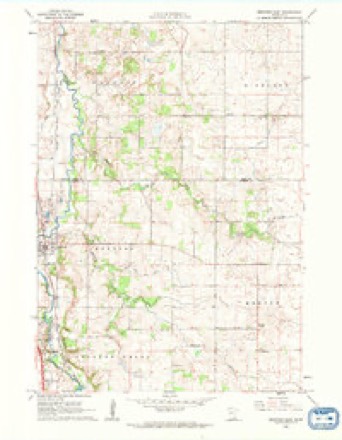
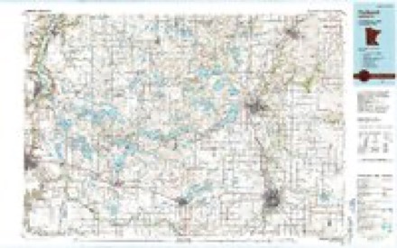
9 topographic sheets cover this place, the earliest surveyed in 1953 and the latest in 1985. It stands in Walcott Township. It lies in ZIP code area 55021. The Survey maps it on the Medford East quadrangle.
Topographic sheets covering this place
6 surveys from 9 printed sheetsMatched by testing this settlement's coordinate against the published boundary of every sheet in the United States Geological Survey's historical collection. Each opens the scanned sheet at the Survey.
- 1953 USGS Saint Paul quadrangle1:250000, 3 printings
- 1953 USGS St. Paul quadrangle1:250000
- 1959 USGS Saint Paul quadrangle1:250000
- 1959 USGS St. Paul quadrangle1:250000
- 1962 USGS Medford East quadrangle1:24000
- 1985 USGS Faribault quadrangle1:100000, 2 printings




In the county-history sources
2,525 words on this townshipHistory of Rice County, Including Explorers and Pioneers of Minnesota and Outline History of the State of Minnesota, published 1882 names this settlement in its chapter on Walcott Township. These are the passages that mention it, exactly as the scans read.
Laurits Andersen, a native of Denmark, was born on the 22d of October, 1845. He emigrated to Wisconsin in 1868, and one year later married Miss Anna C. Johnson, the ceremony taking place on the 9th of April. They have one child. In 1871, they removed to Steele county, Minnesota, and four years later to Rice county, where, in 1880, he purchased his present farm of one hundred acres in Walcott, in sections eight and nine.
Passage source: History of Rice County, Including Explorers and Pioneers of Minnesota and Outline History of the State of Minnesota, published 1882.
Chandler O. Castle was also born in Oneida county. New York, on the 3d of June, 1826. He was married in 1851, to Miss Elmira Knotgrass, the ceremony taking place on the 20th of November. In 1878, he removed to this county where he has two hundred acres of land in Walcott, sections twenty and twenty-one. Mr. and Mrs. Castle have had four children, three of whom are living. James Denison was born in New York, on the 3d of May, 1820, and while young removed with his parents to Ohio. In 1840, he was united in matrimony with Miss Mary McCochran, the ceremony taking place on tbe 13th of March. They removed to Indiana in 1842, and in 1855, came to Minnesota and located in Walcott, where he preempted one hundred and sixty acres of land to which he has since added one hundred and forty acres. He has had a family of nine children, but five of them are now dead. Mr. Denison was Treasurer of the town in 1856, and Assessor and Collector in 1859, and is the j^resent Chairman of the board of Supervisors.
Passage source: History of Rice County, Including Explorers and Pioneers of Minnesota and Outline History of the State of Minnesota, published 1882.
Frank Decker was born in Tompkins county. New York, on the 15th of July, 1848, and in 1864, came to Minnesota, where he purchased land in Walcott in section seventeen. His farm was rented until three years ago, previous to which time he was engaged in a feed store in Faribault. His mother and sister reside with him on the farm.
Passage source: History of Rice County, Including Explorers and Pioneers of Minnesota and Outline History of the State of Minnesota, published 1882.
Machine-read from a century-old scan, so expect the errors a machine makes: misspelled names, dropped words, stray characters.
Read the whole chapter on Walcott Township - it names this place 13 more 13 times.
Fires near this place
1 since 2007Regional context, not property-specific evidence. The federal wildfire occurrence database lists 1 fire within 5 miles of Walcott in 2007, burning about 20 acres in total. None started naturally. 1 was recorded as arson. Distance is straight-line from the map coordinates, so a fire counted here may appear on a neighbouring settlement's page as well.
| Reported cause | Fires |
|---|---|
| Arson/incendiarism | 1 |
The most recent of them, most recent first, with the day each was reported and the service that recorded it.
| Date | Cause | Size | Reported by | Name on the report |
|---|---|---|---|---|
| 28 April 2007 | Arson/incendiarism | 20 acres | Minnesota Department of Natural Resources | not named |
Settlements close enough to share some of these fires:
Mines and quarries near this place
4 within 5 milesRegional context, not property-specific evidence. The federal mineral resources record lists 4 workings within 5 miles of Walcott: 4 producers. All of them still produce. What was taken out: Sand and Gravel, Construction, Stone, Dimension. Distance is straight-line from the map coordinates, so a quarry counted here may appear on a neighbouring settlement's page as well.
| Where | Site | Commodity | Status | Recorded |
|---|---|---|---|---|
| B H Heselton Ls Quarry | Stone, Dimension | Producer | ||
| Concrete Materials Pit #1 | Sand and Gravel, Construction | Producer | ||
| Jones Pit | Sand and Gravel, Construction | Producer | ||
| Swedberg Quarry | Sand and Gravel, Construction | Producer |
Nearest settlements
The eight closest, with where each one stands in the county. Distances are straight-line, computed from the Geographic Names Information System coordinates.
| Map | Place | Distance | Sheets |
|---|---|---|---|
| Ruskin | 2.6 miles | 11 | |
| Prairieville | 3.5 miles | 11 | |
| Faribault | 6.2 miles | 10 | |
| Cannon City | 6.8 miles | 11 | |
| Epsom | 7.0 miles | 10 | |
| Nerstrand | 9.7 miles | 10 | |
| Comus | 11.2 miles | 10 | |
| Warsaw | 11.2 miles | 10 |
Provenance
This settlement is recorded in the Geographic Names Information System as feature 654527. The sheet list is computed by point-in-boundary test against the United States Geological Survey's historical topographic inventory. Both are works of the United States government and carry no copyright under 17 U.S.C. 105.
Wildfire. Short, Karen C. 2022. Spatial wildfire occurrence data for the United States, 1992-2020 [FPA_FOD_20221014]. 6th Edition. Fort Collins, CO: Forest Service Research Data Archive. https://doi.org/10.2737/RDS-2013-0009.6 Collected with United States Government funding and usable without additional permissions or fees.
Mines and quarries. USGS Mineral Resources Data System (MRDS) https://mrdata.usgs.gov/mrds/ A work of the United States government, no copyright under 17 U.S.C. 105.