 Block
Warsaw, Minnesota
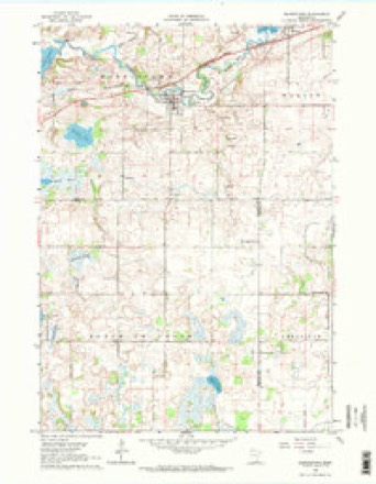
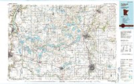
10 topographic sheets cover this place, the earliest surveyed in 1953 and the latest in 1985. It stands in Warsaw Township. It lies in ZIP code area 55087. The Survey maps it on the Morristown quadrangle.
Topographic sheets covering this place
6 surveys from 10 printed sheetsMatched by testing this settlement's coordinate against the published boundary of every sheet in the United States Geological Survey's historical collection. Each opens the scanned sheet at the Survey.
- 1953 USGS Saint Paul quadrangle1:250000, 3 printings
- 1953 USGS St. Paul quadrangle1:250000
- 1959 USGS Saint Paul quadrangle1:250000
- 1959 USGS St. Paul quadrangle1:250000
- 1962 USGS Morristown quadrangle1:24000, 2 printings
- 1985 USGS Faribault quadrangle1:100000, 2 printings




In the county-history sources
5,684 words on this townshipHistory of Rice County, Including Explorers and Pioneers of Minnesota and Outline History of the State of Minnesota, published 1882 names this settlement in its chapter on Warsaw Township. These are the passages that mention it, exactly as the scans read.
As to the earliest settlement of the village, not much can be said that would not apply, as to date, with the other village in this township. In 1851, J. Freeman Weatherhead, a native of New Hampshire, migrated to Minnesota, freezing both legs so severely that he was obliged to have them amputated, and made his way to Warsaw township, securing by pre-emption the northeast quarter of section eighteen. In 1855, he moved his family upon the farm, and commenced improvements. Following him in 1855, came Christian Hershey, a native of Canada, and took the quarter section adjoining Weatherhead's on the west, in section eighteen. The ^ame year A. Lamb, a native of Wisconsin, pre-empted a claim in the southeru part of section seven. This, it will be seen, made quite a settlement in this neighborhood, and in 1857, they conceived the plan of laying out lots and blocks for the village of Warsaw, which was accomplished in this year. C. Hershey and J. F. Weatherhead platted the main part of the village on their farms in section eighteen, and Mr. Lamb staked out Lamb's addition in the southern part of section seven. This was all recorded as Warsaw, and started as a village.
Passage source: History of Rice County, Including Explorers and Pioneers of Minnesota and Outline History of the State of Minnesota, published 1882.
In 1858, Nye & McDonald put up a building and went into partnership in the mercantile business. They continued for about two years and dissolved, to disappear. A boot and shoe manufacturing establishment was started in 1857, by E. B. Peterson, and during the war he resigned in favor of Moses Sear.s, who continued it until 1872, since which time Warsaw has been without an establishment of this kind.
Passage source: History of Rice County, Including Explorers and Pioneers of Minnesota and Outline History of the State of Minnesota, published 1882.
The first religious services ever held in Warsaw was in 1856, by Rev. A. S. Ketchum, of the Baptist faith, in the old log schoolhouse to a small audience. The year following the Baptist denomination was duly organized by the above minister in
Passage source: History of Rice County, Including Explorers and Pioneers of Minnesota and Outline History of the State of Minnesota, published 1882.
Machine-read from a century-old scan, so expect the errors a machine makes: misspelled names, dropped words, stray characters.
Read the whole chapter on Warsaw Township - it names this place 17 more 17 times.
Fires near this place
2 since 2002Regional context, not property-specific evidence. The federal wildfire occurrence database lists 2 fires within 5 miles of Warsaw between 2002 and 2003, burning about 4 acres in total. None started naturally. None was recorded as arson. Distance is straight-line from the map coordinates, so a fire counted here may appear on a neighbouring settlement's page as well.
| Reported cause | Fires |
|---|---|
| Smoking | 2 |
The most recent of them, most recent first, with the day each was reported and the service that recorded it.
| Date | Cause | Size | Reported by | Name on the report |
|---|---|---|---|---|
| 10 April 2003 | Smoking | 2.0 acres | Minnesota Department of Natural Resources | not named |
| 17 December 2002 | Smoking | 2.0 acres | Minnesota Department of Natural Resources | not named |
Settlements close enough to share some of these fires:
Mines and quarries near this place
3 within 5 milesRegional context, not property-specific evidence. The federal mineral resources record lists 3 workings within 5 miles of Warsaw: 3 producers. All of them still produce. What was taken out: Sand and Gravel, Construction. Distance is straight-line from the map coordinates, so a quarry counted here may appear on a neighbouring settlement's page as well.
| Where | Site | Commodity | Status | Recorded |
|---|---|---|---|---|
| Heil Pit | Sand and Gravel, Construction | Producer | ||
| Walbern Pit | Sand and Gravel, Construction | Producer | ||
| Witte Pit & Mill | Sand and Gravel, Construction | Producer |
Storms near this place
14 since 2008Regional context, not property-specific evidence. The National Weather Service names Warsaw in 14 storm reports between 2008 and 2025: 6 thunderstorm wind, 4 tornado, 3 hail, 1 flash flood. No death or injury is recorded in these reports. Each account below is quoted exactly as the forecast office filed it, from the NOAA Storm Events Database, and each date opens the federal record of that event.
| When | Event | Place named | Harm | What the report says |
|---|---|---|---|---|
| May 2012 | Flash Flood | Warsaw | $100,000 | Heavy rainfall occurred during the early evening of May 2nd. Flooding was observed in the town of Warsaw, with flood waters up to 5 feet in residential areas, stalled cars, and several roads impassable. |
| May 2012 | Hail | Warsaw | $25,000 | Golf ball size hail fell in Warsaw, Minnesota, it covered the ground in areas, and damaged numerous cars. |
| April 2025 | Tornado (EF0) | Warsaw | - | A group of trees sustained damage and an outbuilding lost its roof and wall panels. The maximum estimated wind was 75 mph. |
| May 2021 | Tornado (EF0) | Warsaw | - | A trained spotter took video of a brief tornado that touched down in a wooded area and knocked down large branches. Another spotter was also monitoring the storm. The tornado was also caught on video by a MNDOT camera along I-35 near Clinton Falls, so the timing could be confirmed. A broader view of the storm suggested this tornado had some characteristics similar to that of a satellite tornado just east of a larger tornado. |
| May 2021 | Tornado (EF0) | Warsaw | - | Trained spotters took video of a tornado that touched down in an open field and moved northward. It struck a farmstead at the end of its path, with only large branches knocked down per a NWS damage survey. |
| May 2021 | Tornado (EF0) | Warsaw | - | Two different trained spotters took video of a tornado that made ground contact in far northern Steele County, where about a dozen trees were broken per a NWS damage survey. It tracked north and moved into Rice County. One of the videos showed this tornado was the larger tornado, with another narrow tornado to its east that had characteristics similar to that of a satellite tornado. |
| September 2018 | Thunderstorm Wind | Warsaw | - | A NWS storm survey, plus areal footage of drone and satellite data, concluded that damaging downburst winds, up to 80 mph, occurred from west and north of Wells Lake. Damage was consistent with all the damage directed from southwest to northeast, and related to uprooted trees and power lines. |
| September 2018 | Thunderstorm Wind | Warsaw | - | A NWS storm survey concluded that sporadic downburst and inflow winds occurred on the east, and south side of the tornado track from Morristown, and west of Cannon Lake. The worst damage occurred to a metal building that was attached to a home that was blown down west of Warsaw. |
| June 2016 | Thunderstorm Wind | Warsaw | - | Several trees were blown down over County Road 12 and Independence Avenue, west of Faribault. |
| May 2014 | Hail | Warsaw | - | Quarter size hail fell for several minutes west, and through the town of Faribault. |
| July 2008 | Thunderstorm Wind | Warsaw | - | Measured with anemometer. |
| July 2008 | Thunderstorm Wind | Warsaw | - | Measured by anemometer on Cedar Lake. |
| July 2008 | Thunderstorm Wind | Warsaw | - | Numerous trees toppled around town. Some two feet in diameter or greater. Some trees felled over vehicles, some over home garage.|Excel Energy reported over 2400 power poles were toppled in Warsaw. Power cut to many homes for over 24 hours. |
| August 2023 | Hail | Warsaw | - | no account filed |
Nearest settlements
The eight closest, with where each one stands in the county. Distances are straight-line, computed from the Geographic Names Information System coordinates.
| Map | Place | Distance | Sheets |
|---|---|---|---|
| Morristown | 3.1 miles | 10 | |
| Faribault | 7.3 miles | 10 | |
| Shieldsville | 8.1 miles | 12 | |
| Prairieville | 10.9 miles | 11 | |
| Cannon City | 11.1 miles | 11 | |
| Walcott | 11.2 miles | 9 | |
| Comus | 11.8 miles | 10 | |
| Ruskin | 12.4 miles | 11 |
Provenance
This settlement is recorded in the Geographic Names Information System as feature 653792. The sheet list is computed by point-in-boundary test against the United States Geological Survey's historical topographic inventory. Both are works of the United States government and carry no copyright under 17 U.S.C. 105.
Wildfire. Short, Karen C. 2022. Spatial wildfire occurrence data for the United States, 1992-2020 [FPA_FOD_20221014]. 6th Edition. Fort Collins, CO: Forest Service Research Data Archive. https://doi.org/10.2737/RDS-2013-0009.6 Collected with United States Government funding and usable without additional permissions or fees.
Mines and quarries. USGS Mineral Resources Data System (MRDS) https://mrdata.usgs.gov/mrds/ A work of the United States government, no copyright under 17 U.S.C. 105.
Storms. NOAA National Centers for Environmental Information, Storm Events Database https://www.ncei.noaa.gov/stormevents/ A work of the United States government, no copyright under 17 U.S.C. 105. Narratives are quoted verbatim from the National Weather Service report and are not edited or summarised.