 Block
Janesville, Minnesota
9 topographic sheets cover this place, the earliest surveyed in 1953 and the latest in 1985. It stands in Janesville City. It lies in ZIP code area 56048. The Survey maps it on the Janesville quadrangle. 2,421 people lived here at the 2020 count. It stands 1,066 feet above sea level.
On record in Janesville
Buildings and businesses the archive holds for this place. Each opens its own page, with the source record it came from.
On the National Register 3 records
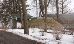 Hoffman Apiarieslisted 2016
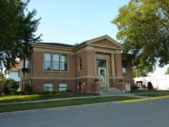 Janesville Free Public Librarylisted 1982
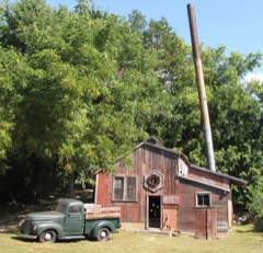 Seha Sorghum Milllisted 1979
Population over time
2 figuresJanesville grew from 2,256 to 2,421 between 2010 and 2020. These are the recorded population figures Wikidata holds for this place, reached through the Geographic Names Information System number this page is keyed on rather than by name, so they belong to this place and not to another of the same name. Most are census counts, but not all are: an early figure may be a founding or settlement estimate, and an estimate published within five years of a census is left out. The change column is computed, and is left blank where more than 20 years separate a figure from the one before it, because a gap that long is not a change between two counts.
| Year | People | Change |
|---|---|---|
| 2010 | 2,256 | |
| 2020 | 2,421 | +165 (+7%) |
Topographic sheets covering this place
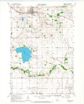
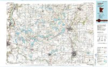
6 surveys from 9 printed sheetsMatched by testing this settlement's coordinate against the published boundary of every sheet in the United States Geological Survey's historical collection. Each opens the scanned sheet at the Survey.
- 1953 USGS Saint Paul quadrangle1:250000, 3 printings
- 1953 USGS St. Paul quadrangle1:250000
- 1959 USGS Saint Paul quadrangle1:250000
- 1959 USGS St. Paul quadrangle1:250000
- 1966 USGS Janesville quadrangle1:24000
- 1985 USGS Faribault quadrangle1:100000, 2 printings




In the county-history sources
970 words on this townshipChild's History of Waseca County, Minnesota : from Its First Settlement in 1854 to the Close of the Year 1904, a Record of Fifty Years : the Story of the Pioneers, published 1905 names this settlement in its chapter on Janesville Township. These are the passages that mention it, exactly as the scans read.
The records of this township for the first ten years of its existence are missing; and the best that can be done is to give Avhat can be picked up here and there from other sources. It is among the early traditions that the first white settlers in Janesville were a man named John Douglas and another named Hughes. They did not become permanent settlers, but removed, shortly afti.Twards, further west. The next settlers were two dissolute characters, Alfred Holstein and John Davis. Davis claimed a portion of section 28, and Holstein a portion of section 27. Their principal business was trading with the Indians, and, by common reputation, they dealt mostly in whisky and tobacco - Davis, especially, being a great drinker himself. Both of them were social, friendly, and kind hearted to all comers, but their ideas of morality and decency were not of high grade. Davis finally went to one of the Carolinas. Holstein was sent to state prison by a United' States court for stealing horses from the Winnebago Indians. A man named John Rowley settled on section 9, the same summer and became a long-time resident.
Passage source: Child's History of Waseca County, Minnesota : from Its First Settlement in 1854 to the Close of the Year 1904, a Record of Fifty Years : the Story of the Pioneers, published 1905.
John Cunningham was one of those first-class men who settled in Janesville in 1855. He made his claim on section 29, where he resided until his death, August 30, 1870. He was one of the first to respond to the call for men to fight the Indians in 1862, and enlisted October 4th, with ten other men from this county, in Company B, First Minnesota ^Mounted Rangers, and served until the close of the Indian war. He married Mrs. ]\Iary Crawford, widow of AV. H. Crawford, one of the early settlers of this county. At the breaking out of the war ^iv. Crawford was murdered by Texas rebels for the awful crime of being a northern republican.
Passage source: Child's History of Waseca County, Minnesota : from Its First Settlement in 1854 to the Close of the Year 1904, a Record of Fifty Years : the Story of the Pioneers, published 1905.
Janesville, or "East Janesville, " as it was platted, is one of the substantial and permanent towns of Southern Minnesota. It is in the midst of a beautiful and rich farming country, inhabited by an industrious and frugal people, who earn and command prosperity. It was platted in August, 1869, by Surveyor S. H. Mott for J. W. Sprague, general manager of the W. & St. P. railroad at that time. Nine additions have been added since. Buildings were constructed as if by magic. James Cummins hauled the first load of lumber for the first building, Baldwin's hotel. J. O. Chandler, A. W. Jennison, F. II. I\Iiner, D. J. Dodge & Co., J. D. Andrews, and others erected buildings that fall. Dr. Crai'i' wa.s the first physician, and John Bradish, Es([., the first attorney, as he was the first in Waseca county In the winter of 1869-70, several buildings from Old Janesville were moved to the now town, and in the spring of 1870 the new town was full of life and vigor. James Cummins, born March 5, 1840, in Kenosha county, AVis., came to Blue Earth county in 1857, lived in Old Janesville for a time, and soon took a hand in the business of the new town. Joseph Davison, horn in the state of Xew York, in 1834, came to Byron township in 1862, enlisted in Company D, First Minnesota heavy artillery Oct. 20, 1864, served until Sept. 27, 1865, returned to Minnesota the same year, and in 1869 went to Janesville and helped to build the town as a contractor and builder. The Banner flouring mill, now owned by Jennison & Co., was built in 1873, by the firm of Stokes, Kimball & Co. The Diadem flouring mill was erected in 1877, by Harn, Snyder & Co. They became financially involved and the mill passed to Ilillyer & Tillotson, then to J. S. Snteliffe, and finally, in 1886, it became the property of Jennison Bros. The W. & St. P. railroad company erected a grain elevator in 1S()I), which soon after passed into other hands. Among the business houses, that of Byron & Barden is very popular.
Passage source: Child's History of Waseca County, Minnesota : from Its First Settlement in 1854 to the Close of the Year 1904, a Record of Fifty Years : the Story of the Pioneers, published 1905.
Machine-read from a century-old scan, so expect the errors a machine makes: misspelled names, dropped words, stray characters.
Read the whole chapter on Janesville Township - it names this place 1 more 1 time.
Fires near this place
15 since 2006Regional context, not property-specific evidence. The federal wildfire occurrence database lists 15 fires within 5 miles of Janesville between 2006 and 2012, burning about 142 acres in total. None started naturally. 12 were recorded as arson. Distance is straight-line from the map coordinates, so a fire counted here may appear on a neighbouring settlement's page as well.
| Reported cause | Fires |
|---|---|
| Arson/incendiarism | 12 |
| Equipment and vehicle use | 2 |
| Missing data/not specified/undetermined | 1 |
The most recent of them, most recent first, with the day each was reported and the service that recorded it.
| Date | Cause | Size | Reported by | Name on the report |
|---|---|---|---|---|
| 2 November 2006 | Arson/incendiarism | under an acre | Minnesota Department of Natural Resources | not named |
| 10 November 2012 | Arson/incendiarism | 50 acres | Minnesota Department of Natural Resources | not named |
| 8 October 2012 | Missing data/not specified/undetermined | 9.0 acres | Minnesota Department of Natural Resources | not named |
| 7 October 2006 | Arson/incendiarism | under an acre | Minnesota Department of Natural Resources | not named |
| 7 October 2006 | Arson/incendiarism | under an acre | Minnesota Department of Natural Resources | not named |
| 6 October 2006 | Arson/incendiarism | under an acre | Minnesota Department of Natural Resources | not named |
| 31 October 2006 | Arson/incendiarism | 2.8 acres | Minnesota Department of Natural Resources | not named |
| 30 October 2006 | Arson/incendiarism | under an acre | Minnesota Department of Natural Resources | not named |
Settlements close enough to share some of these fires:
Storms near this place
40 since 1997Regional context, not property-specific evidence. The National Weather Service names Janesville in 40 storm reports between 1997 and 2025: 17 hail, 14 thunderstorm wind, 3 tornado, 2 funnel cloud. No death or injury is recorded in these reports. Each account below is quoted exactly as the forecast office filed it, from the NOAA Storm Events Database, and each date opens the federal record of that event.
| When | Event | Place named | Harm | What the report says |
|---|---|---|---|---|
| March 2012 | Tornado (EF0) | Janesville | $100,000 | An EF-0 tornado touched down just south of Elysian Lake Road, just south of 412th Avenue, in northern Waseca County. The tornado tracked north for approximately 2.8 miles while paralleling the eastern shore of Elysian Lake and Elysian Lake Road. It crossed Elysian Lake near 427th Ave, before moving into southern Le Sueur County. ||Damage was primarily associated with uprooted trees and roof damage. The worst damage occurred to a farmstead which had a metal storage shed collapse along Elysian Lake Road. ||Based on trees uprooted and structural damage to a metal storage shed, winds were estimated around 80 mph. |
| August 2003 | Thunderstorm Wind | Janesville | $50,000 | Roof partially blown off home. Barn blown down. Numerous trees and large branches down. |
| August 2019 | Thunderstorm Wind | Janesville | $15,000 | A large tree fell on a house in Janesville. |
| April 2022 | Thunderstorm Wind | Janesville | $10,000 | A farm outbuilding was damaged near Reeds Lake, or northeast of Janesville. In addition, a couple of trees were blown down. |
| December 2021 | Thunderstorm Wind | Janesville | $10,000 | Several trees and large branches were blown down between Janesville and Waseca, with a street light damaged, and a few metal sheds and trampolines thrown. |
| August 2025 | Heavy Rain | Janesville | - | Cocorahs station MN-WC-17 Janesville 3.0 S - 72 hour total of 7.62 inches. |
| June 2024 | Heavy Rain | Janesville | - | A total of 4 to 6 inches of rain fell from multiple rounds of thunderstorms. CoCoRaHS observers measured 6.45 inches near Elysian. |
| June 2024 | Flash Flood | Janesville | - | Road closures were reported around the town of Janesville due to flooded roadways. |
| June 2023 | Funnel Cloud | Janesville | - | A trained spotter reported that the funnel reached about halfway to the ground southwest of Janesville, MN. |
| July 2023 | Thunderstorm Wind | Janesville | - | Strong thunderstorm winds brought down a 10-inch diameter tree limb which blocked a roadway in Janesville, MN. |
| September 2020 | Thunderstorm Wind | Janesville | - | There was a picture of a large tree blown down in Janesville. |
| July 2020 | Thunderstorm Wind | Janesville | - | A large tree was snapped. A video was also included which illustrated the near zero visibility. |
| July 2019 | Thunderstorm Wind | Janesville | - | There were multiple reports of downed trees in the city of Janesville. |
| September 2018 | Tornado (EF0) | Janesville | - | A NWS storm survey, plus areal footage of drone and satellite data, concluded that an EF0 tornado tracked 1.4 miles from southwest of Reeds Lake, then northeast to the Waseca, Le Sueur county line. Tornado damage was consistent with EF0 damage with winds up to 75 mph, and a maximum path width of 125 yards. |
| September 2017 | Thunderstorm Wind | Janesville | - | A large tree was blown over in the city of Janesville. |
| July 2017 | Thunderstorm Wind | Janesville | - | A tree was blown down in Janesville. |
| March 2010 | Flood | Janesville | - | County Road 53, near Janesville was closed due to flood waters. |
| September 2006 | Hail | Janesville | - | Hail occurred at Highway 60 and County Road 3. |
| June 2005 | Funnel Cloud | Janesville | - | A "rope-shaped" funnel cloud was observed and photographed for 2 minutes by a trained spotter about 10 miles east of Janesville. |
| August 2005 | Thunderstorm Wind | Janesville | - | A tree was downed. |
| April 2004 | Thunderstorm Wind | Janesville | - | A 60 MPH wind gust was reported by emergency management near Lake Elysian. |
| July 2003 | Tornado (F0) | Janesville | - | Captured on video by law enforcement, this was the seventh and last in a series of tornadoes produced by a cyclic tornadic supercell. It touched down briefly in an open field and dissipated before reaching the city of Janesville. |
| May 2002 | Thunderstorm Wind | Janesville | - | Measured by storm chaser. No damage. |
| June 2002 | Thunderstorm Wind | Janesville | - | Trees down. |
| July 2023 | Hail | Janesville | - | no account filed |
| May 2017 | Hail | Janesville | - | no account filed |
| August 2016 | Hail | Janesville | - | no account filed |
| May 2015 | Hail | Janesville | - | no account filed |
| May 2014 | Hail | Janesville | - | no account filed |
| May 2012 | Hail | Janesville | - | no account filed |
| July 2008 | Hail | Janesville | - | no account filed |
| August 2007 | Hail | Janesville | - | no account filed |
| March 2007 | Hail | Janesville | - | no account filed |
| April 2007 | Hail | Janesville | - | no account filed |
| June 2007 | Hail | Janesville | - | no account filed |
| July 2006 | Hail | Janesville | - | no account filed |
| May 2002 | Hail | Janesville | - | no account filed |
| June 2002 | Hail | Janesville | - | no account filed |
| May 1998 | Hail | Janesville | - | no account filed |
| July 1997 | Hail | Janesville | - | no account filed |
Nearest settlements
The eight closest, with where each one stands in the county. Distances are straight-line, computed from the Geographic Names Information System coordinates.
| Map | Place | Distance | Sheets |
|---|---|---|---|
| Lake Elysian | 2.3 miles | 10 | |
| Smiths Mill | 3.5 miles | 13 | |
| Alma City | 6.5 miles | 9 | |
| Saint Mary | 8.3 miles | 11 | |
| Palmer | 9.2 miles | 10 | |
| Colony Court | 10.8 miles | 11 | |
| Waseca | 11.0 miles | 11 | |
| Wilton | 11.6 miles | 11 |
Elsewhere
Matched on this settlement's Geographic Names Information System number rather than its name, so it cannot be a different place of the same name in another state.
| Wikipedia article on Janesville | An encyclopaedic summary. Its text is share-alike, so it is linked here rather than copied. |
| Wikidata item Q2230618 | The structured record the population and elevation above come from. Public domain (CC0). |
Provenance
This settlement is recorded in the Geographic Names Information System as feature 645580. The sheet list is computed by point-in-boundary test against the United States Geological Survey's historical topographic inventory. Both are works of the United States government and carry no copyright under 17 U.S.C. 105.
Wildfire. Short, Karen C. 2022. Spatial wildfire occurrence data for the United States, 1992-2020 [FPA_FOD_20221014]. 6th Edition. Fort Collins, CO: Forest Service Research Data Archive. https://doi.org/10.2737/RDS-2013-0009.6 Collected with United States Government funding and usable without additional permissions or fees.
Storms. NOAA National Centers for Environmental Information, Storm Events Database https://www.ncei.noaa.gov/stormevents/ A work of the United States government, no copyright under 17 U.S.C. 105. Narratives are quoted verbatim from the National Weather Service report and are not edited or summarised.