 Block
Bancroft, Missouri
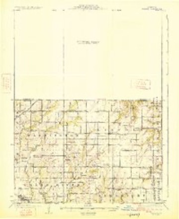
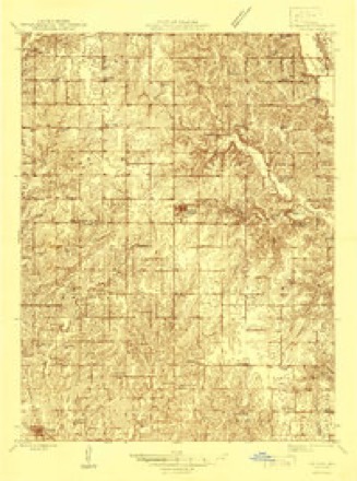
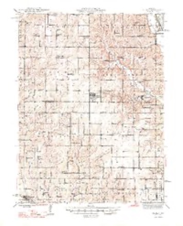
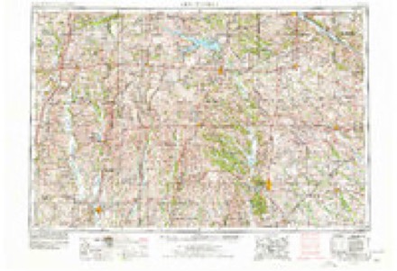
13 topographic sheets cover this place, the earliest surveyed in 1925 and the latest in 1984. It stands in Lincoln Township. It lies in ZIP code area 64642. The Survey maps it on the Bancroft quadrangle.
Topographic sheets covering this place
8 surveys from 13 printed sheetsMatched by testing this settlement's coordinate against the published boundary of every sheet in the United States Geological Survey's historical collection. Each opens the scanned sheet at the Survey.
- 1925 USGS Gilman quadrangle1:62500, 3 printings
- 1946 USGS Gilman quadrangle1:48000
- 1948 USGS Gilman quadrangle1:62500, 2 printings
- 1954 USGS Centerville quadrangle1:250000, 3 printings
- 1957 USGS Centerville quadrangle1:250000
- 1958 USGS Centerville quadrangle1:250000
- 1981 USGS Trenton quadrangle1:100000
- 1984 USGS Bancroft quadrangle1:24000
In the county-history sources
7,714 words on this townshipThe History Of Daviess County, Missouri (Birdsall & Dean, 1882), published 1882 names this settlement in its chapter on Lincoln Township. These are the passages that mention it, exactly as the scans read.
This church had quite an early organization in the township, but the first church was not erected until 1868. This was a handsome building, costing $1,000, and was dedicated hy the Revs. Hale and Hanley, the same year. The church has been of steady growth, in youd financial condition and hasa following of sixty-two earnest and faithful members of God's household, This church is located at Bancroft.
Passage source: The History Of Daviess County, Missouri (Birdsall & Dean, 1882), published 1882.
This church known as Wood's s Baptist Church was erected in 1580 and is under the pastorate of Rey. Joseph Wood. It is situated three miles southeast of Bancroft and has a membership of forty-tive. It has quite a large following and many earnest workers in its cause.
Passage source: The History Of Daviess County, Missouri (Birdsall & Dean, 1882), published 1882.
Bancroft has not grown rapidly nor has it caused any rivalry. It is the only village in the township, and is a busy, lively little place of some 150 inhabitants, and commands a good tr aide, being surrounded by a splendid agricultural country and well-to-do farmers. One of the institntions of the village i is the brass band, which was organized early in the decade between 1870 and 1880. This band attended the Gentry County Fair in September of 1873, a premium of $100 having been offered for the best musical performance at the fair, To the eredit of the Baneroft brass band let it be said they took in that $100. The first leader was William E. Peery, The band is now made up as follows, and still holds its well-earned reputation: E. S. Jolinson, leader, E-flat cornet; W.J. Weldon, B-flat cornet: Charles A. Chaplin, first alto; James Endicott, second alto; W. E. Peery, B-flat tenor; William Oram, barytone; H. E. Gibson, tuba; Jolin B. Markey, bass drum.
Passage source: The History Of Daviess County, Missouri (Birdsall & Dean, 1882), published 1882.
Machine-read from a century-old scan, so expect the errors a machine makes: misspelled names, dropped words, stray characters.
Read the whole chapter on Lincoln Township - it names this place 1 more 1 time.
Fires near this place
2 since 1997Regional context, not property-specific evidence. The federal wildfire occurrence database lists 2 fires within 5 miles of Bancroft in 1997, burning about 2 acres in total. None started naturally. None was recorded as arson. Distance is straight-line from the map coordinates, so a fire counted here may appear on a neighbouring settlement's page as well.
| Reported cause | Fires |
|---|---|
| Missing data/not specified/undetermined | 1 |
| Debris and open burning | 1 |
The most recent of them, most recent first, with the day each was reported and the service that recorded it.
| Date | Cause | Size | Reported by | Name on the report |
|---|---|---|---|---|
| 7 March 1997 | Debris and open burning | 1.0 acres | Missouri Department of Conservation | not named |
| 17 March 1997 | Missing data/not specified/undetermined | 1.0 acres | Missouri Department of Conservation | not named |
Settlements close enough to share some of these fires:
Mines and quarries near this place
10 of 12 shownRegional context, not property-specific evidence. The federal mineral resources record lists 12 workings within 5 miles of Bancroft: 12 past producers. None of them still produces. What was taken out: Stone, Crushed/Broken, Sand and Gravel, Construction. Distance is straight-line from the map coordinates, so a quarry counted here may appear on a neighbouring settlement's page as well.
| Where | Site | Commodity | Status | Recorded |
|---|---|---|---|---|
| Unk | Sand and Gravel, Construction | Past Producer | ||
| Unk | Sand and Gravel, Construction | Past Producer | ||
| Harvey | Stone, Crushed/Broken | Past Producer | ||
| Harvey Quarry | Stone, Crushed/Broken | Past Producer | ||
| Robinson Quarry | Stone, Crushed/Broken | Past Producer | ||
| Sugar Creek Quarry | Stone, Crushed/Broken | Past Producer | ||
| Unk | Stone, Crushed/Broken | Past Producer | ||
| Unk | Stone, Crushed/Broken | Past Producer | ||
| Unk | Stone, Crushed/Broken | Past Producer | ||
| Unk | Stone, Crushed/Broken | Past Producer |
Storms near this place
5 since 2015Regional context, not property-specific evidence. The National Weather Service names Bancroft in 5 storm reports between 2015 and 2023: 4 thunderstorm wind, 1 hail. No death or injury is recorded in these reports. Each account below is quoted exactly as the forecast office filed it, from the NOAA Storm Events Database, and each date opens the federal record of that event.
| When | Event | Place named | Harm | What the report says |
|---|---|---|---|---|
| March 2023 | Hail | Bancroft | - | A supercell produced 1 hail in northeastern Daviess County. |
| May 2023 | Thunderstorm Wind | Bancroft | - | Wind gust of 60-70 mph were reported. |
| May 2023 | Thunderstorm Wind | Bancroft | - | Straight line winds of 60 to 70 mph were estimated south of Gilman City in association with the rear flank downdraft of a supercell thunderstorm. |
| May 2020 | Thunderstorm Wind | Bancroft | - | Tree limbs and powerlines were down at Flint Road and HWY K. |
| May 2015 | Thunderstorm Wind | Bancroft | - | Tree limbs were blown down. |
Nearest settlements
The eight closest, with where each one stands in the county. Distances are straight-line, computed from the Geographic Names Information System coordinates.
| Map | Place | Distance | Sheets |
|---|---|---|---|
| Madelaine (historical) | 2.8 miles | 13 | |
| Coffey | 7.8 miles | 16 | |
| Salem Coffey P O and Station | 7.9 miles | 16 | |
| Jameson | 10.1 miles | 13 | |
| Jamesport | 10.4 miles | 10 | |
| Cypress | 11.5 miles | 16 | |
| Blake | 11.9 miles | 10 | |
| Pattonsburg | 13.3 miles | 16 |
Provenance
This settlement is recorded in the Geographic Names Information System as feature 740654. The sheet list is computed by point-in-boundary test against the United States Geological Survey's historical topographic inventory. Both are works of the United States government and carry no copyright under 17 U.S.C. 105.
Wildfire. Short, Karen C. 2022. Spatial wildfire occurrence data for the United States, 1992-2020 [FPA_FOD_20221014]. 6th Edition. Fort Collins, CO: Forest Service Research Data Archive. https://doi.org/10.2737/RDS-2013-0009.6 Collected with United States Government funding and usable without additional permissions or fees.
Mines and quarries. USGS Mineral Resources Data System (MRDS) https://mrdata.usgs.gov/mrds/ A work of the United States government, no copyright under 17 U.S.C. 105.
Storms. NOAA National Centers for Environmental Information, Storm Events Database https://www.ncei.noaa.gov/stormevents/ A work of the United States government, no copyright under 17 U.S.C. 105. Narratives are quoted verbatim from the National Weather Service report and are not edited or summarised.