 Block
Jamesport, Missouri
10 topographic sheets cover this place, the earliest surveyed in 1922 and the latest in 1984. It stands in Jamesport Township. It lies in ZIP code area 64648. The Survey maps it on the Jamesport quadrangle. 559 people lived here at the 2020 count. It stands 991 feet above sea level.
Population over time
2 figuresJamesport grew from 524 to 559 between 2010 and 2020. These are the recorded population figures Wikidata holds for this place, reached through the Geographic Names Information System number this page is keyed on rather than by name, so they belong to this place and not to another of the same name. Most are census counts, but not all are: an early figure may be a founding or settlement estimate, and an estimate published within five years of a census is left out. The change column is computed, and is left blank where more than 20 years separate a figure from the one before it, because a gap that long is not a change between two counts.
| Year | People | Change |
|---|---|---|
| 2010 | 524 | |
| 2020 | 559 | +35 (+7%) |
Topographic sheets covering this place
7 surveys from 10 printed sheetsMatched by testing this settlement's coordinate against the published boundary of every sheet in the United States Geological Survey's historical collection. Each opens the scanned sheet at the Survey.
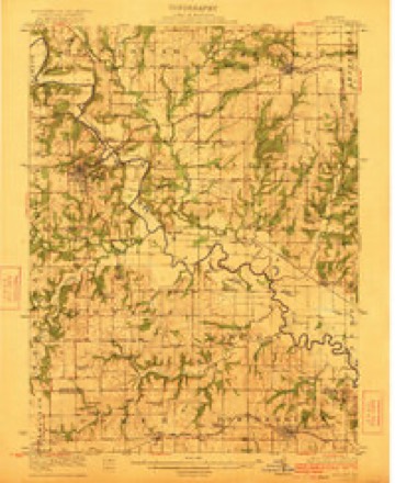
- 1922 USGS Gallatin quadrangle1:62500, 2 printings
- 1953 USGS Moberly quadrangle1:250000
- 1954 USGS Moberly quadrangle1:250000, 3 printings
- 1957 USGS Moberly quadrangle1:250000
- 1960 USGS Moberly quadrangle1:250000
- 1981 USGS Chillicothe quadrangle1:100000
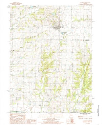
- 1984 USGS Jamesport quadrangle1:24000




In the county-history sources
18,202 words on this townshipThe History Of Daviess County, Missouri (Birdsall & Dean, 1882), published 1882 names this settlement in its chapter on Jamesport Township. These are the passages that mention it, exactly as the scans read.
Jamesport township was not organized until 1870, and was then ealled Grant. The territory was taken froma portion of Grand River township, and also of Jackson, making the municipal township six miles square or a congressional township in extent ot territory. Asa part of Grand River township it was settled as early as 1834. Thomas N. Auberry was the first settler, and he was followed by many others.
Passage source: The History Of Daviess County, Missouri (Birdsall & Dean, 1882), published 1882.
The township is six miles square, with the exception of a small jog in the range line in township sixy-one, and has twenty-two thousand forty-six and thirty-three one hundreths aeres of as beantifi) and fruitful land as the sun ever shone upon. It is bounded on the north by Lincoln township, on the east by the Grundy county line, south by Jackson, and west by Grand River township. It is watered by the Little Maddy and its branches on the west, and Hickory Creek and a branch which empties in the East Pork of Grand River in Grundy county on the north and west side. When the township was organized in 1870 its assessed valuation was $11,648. The township is fully two-thirds prairie and in depth and richness of soil and in produetive capacity has not a superior in the county. The prairies are just rolling enough to give ita splendid drainage, and this undulating surtace gives it a beantiful and picturesque appearance to the eye. When we take the beauty of its surroundings and the fertility of its soil, there is little more to wish for to the farmers or the stock-raisers of Jamesport township, and he would indeed be hard to please if, in choosing an agricn]tural life the land of James port township did not fill the full meed of his desire.
Passage source: The History Of Daviess County, Missouri (Birdsall & Dean, 1882), published 1882.
The first settler, as we have mentioned above, was Thomas N. Auberry, who came from Ray county in 1834 and settled about two miles trom where the town of Jamesport now stands. His place took the name of Auberry Grove. Mr. Auberry came from Kentucky and he located on section twenty-nine.
Passage source: The History Of Daviess County, Missouri (Birdsall & Dean, 1882), published 1882.
Machine-read from a century-old scan, so expect the errors a machine makes: misspelled names, dropped words, stray characters.
Read the whole chapter on Jamesport Township - it names this place 78 more 78 times.
Fires near this place
1 since 1999Regional context, not property-specific evidence. The federal wildfire occurrence database lists 1 fire within 5 miles of Jamesport in 1999, burning about 6 acres in total. None started naturally. None was recorded as arson. Distance is straight-line from the map coordinates, so a fire counted here may appear on a neighbouring settlement's page as well.
| Reported cause | Fires |
|---|---|
| Misuse of fire by a minor | 1 |
The most recent of them, most recent first, with the day each was reported and the service that recorded it.
| Date | Cause | Size | Reported by | Name on the report |
|---|---|---|---|---|
| 31 July 1999 | Misuse of fire by a minor | 6.0 acres | Missouri Department of Conservation | not named |
Mines and quarries near this place
5 within 5 milesRegional context, not property-specific evidence. The federal mineral resources record lists 5 workings within 5 miles of Jamesport: 5 past producers. None of them still produces. What was taken out: Stone, Crushed/Broken, Sand and Gravel, Construction, Zinc, Silver, Copper. Distance is straight-line from the map coordinates, so a quarry counted here may appear on a neighbouring settlement's page as well.
| Where | Site | Commodity | Status | Recorded |
|---|---|---|---|---|
| Jefferson Twp Quarry | Stone, Crushed/Broken, Zinc, Silver, Copper | Past Producer | ||
| Unk | Sand and Gravel, Construction | Past Producer | ||
| Jackson Twp Quarry | Stone, Crushed/Broken | Past Producer | ||
| Township Quarry | Stone, Crushed/Broken | Past Producer | ||
| Unk | Stone, Crushed/Broken | Past Producer |
Storms near this place
37 since 1994Regional context, not property-specific evidence. The National Weather Service names Jamesport in 37 storm reports between 1994 and 2025: 22 hail, 11 thunderstorm wind, 2 tornado, 1 funnel cloud. No death or injury is recorded in these reports. Each account below is quoted exactly as the forecast office filed it, from the NOAA Storm Events Database, and each date opens the federal record of that event.
| When | Event | Place named | Harm | What the report says |
|---|---|---|---|---|
| April 1994 | Thunderstorm Wind | Jamesport | $500,000 | A squall line, with wind gusts over 70 mph, caused widespread damage from the north side of Cameron to south of Jamesport. The wind destroyed a number of barns, downed trees and power lines, and heavily damaged several hotel/restaurant marquee signs. Hail up to one inch in diameter was also reported in the northern part of Kansas City. |
| June 1995 | Thunderstorm Wind | Jamesport | $9,000 | Severe thunderstorms moved through the area with hail and damaging winds. A telephone pole was downed east of Gallatin, and several trees and power lines were downed in and around the Jamesport area. A tree was blown down onto a porch. |
| May 2004 | Hail | Jamesport | $5,000 | Also 2 inch diameter tree branches down. |
| July 2002 | Tornado (F0) | Jamesport | $5,000 | Brief tornado touchdown. Minor damage to a barn and farmstead. |
| July 2001 | Thunderstorm Wind | Jamesport | $3,000 | Power line reported down. |
| April 2010 | Thunderstorm Wind | Jamesport | $1,000 | Thunderstorm winds were estimated up to 80 mph. Sheds were reported overturned. |
| March 2025 | Thunderstorm Wind | Jamesport | - | Roof blown off old agriculture building. |
| May 2024 | Hail | Jamesport | - | Report of golf ball sized hail in Jamesport. |
| May 2020 | Hail | Jamesport | - | The report came via social media. |
| August 2020 | Thunderstorm Wind | Jamesport | - | Several trees were uprooted. Metal farm outbuildings were heavily damaged, and an aluminum grain trailer was blown over. |
| August 2020 | Thunderstorm Wind | Jamesport | - | A power pole and numerous trees were snapped near the intersection of Highway P and Highway 190 near Jamesport. |
| July 2017 | Flood | Jamesport | - | Route K was flooded in both directions at Big Creek. |
| March 2017 | Thunderstorm Wind | Jamesport | - | An Emergency Manager for Daviess County reported 70 mph wind near Jamesport. |
| May 2015 | Thunderstorm Wind | Jamesport | - | The emergency manager relayed a report from the public of winds in excess of 60 mph with power flickering. |
| May 2014 | Thunderstorm Wind | Jamesport | - | Small outbuildings were blown down. Some minor siding damage was reported from debris blown into a residence. And an small deer fence was blown down near Jamesport. |
| June 2014 | Funnel Cloud | Jamesport | - | A funnel cloud was reported over Highway V and Highway 6. |
| June 2009 | Thunderstorm Wind | Jamesport | - | A car was blown off Highway 6, by winds estimated at 80 mph. |
| May 2004 | Tornado (F0) | Jamesport | - | Brief tornado touchdown along the Harrison and Daviess county line. Tornado entered Daviess county 10 miles north of Jamesport, and then dissipated. |
| June 1995 | Hail | Jamesport | - | Severe thunderstorms moved through the area with hail and damaging winds. A telephone pole was downed east of Gallatin, and several trees and power lines were downed in and around the Jamesport area. A tree was blown down onto a porch. |
| May 2020 | Hail | Jamesport | - | no account filed |
| May 2020 | Hail | Jamesport | - | no account filed |
| June 2019 | Hail | Jamesport | - | no account filed |
| May 2012 | Hail | Jamesport | - | no account filed |
| June 2011 | Hail | Jamesport | - | no account filed |
| June 2011 | Hail | Jamesport | - | no account filed |
| June 2011 | Hail | Jamesport | - | no account filed |
| June 2011 | Hail | Jamesport | - | no account filed |
| June 2010 | Hail | Jamesport | - | no account filed |
| March 2009 | Hail | Jamesport | - | no account filed |
| April 2009 | Hail | Jamesport | - | no account filed |
| June 2009 | Hail | Jamesport | - | no account filed |
| June 2009 | Hail | Jamesport | - | no account filed |
| May 2005 | Hail | Jamesport | - | no account filed |
| May 2005 | Hail | Jamesport | - | no account filed |
| August 2005 | Hail | Jamesport | - | no account filed |
| June 2001 | Hail | Jamesport | - | no account filed |
| September 2000 | Hail | Jamesport | - | no account filed |
Nearest settlements
The eight closest, with where each one stands in the county. Distances are straight-line, computed from the Geographic Names Information System coordinates.
| Map | Place | Distance | Sheets |
|---|---|---|---|
| Blake | 4.2 miles | 10 | |
| Carlow | 6.7 miles | 10 | |
| Wabash Crossing | 7.9 miles | 10 | |
| Magill | 8.2 miles | 10 | |
| Lock Springs | 8.8 miles | 10 | |
| Gallatin | 9.5 miles | 10 | |
| Jameson | 9.7 miles | 13 | |
| Bancroft | 10.4 miles | 13 |
Elsewhere
Matched on this settlement's Geographic Names Information System number rather than its name, so it cannot be a different place of the same name in another state.
| Wikipedia article on Jamesport | An encyclopaedic summary. Its text is share-alike, so it is linked here rather than copied. |
| Wikidata item Q963290 | The structured record the population and elevation above come from. Public domain (CC0). |
Provenance
This settlement is recorded in the Geographic Names Information System as feature 720254. The sheet list is computed by point-in-boundary test against the United States Geological Survey's historical topographic inventory. Both are works of the United States government and carry no copyright under 17 U.S.C. 105.
Wildfire. Short, Karen C. 2022. Spatial wildfire occurrence data for the United States, 1992-2020 [FPA_FOD_20221014]. 6th Edition. Fort Collins, CO: Forest Service Research Data Archive. https://doi.org/10.2737/RDS-2013-0009.6 Collected with United States Government funding and usable without additional permissions or fees.
Mines and quarries. USGS Mineral Resources Data System (MRDS) https://mrdata.usgs.gov/mrds/ A work of the United States government, no copyright under 17 U.S.C. 105.
Storms. NOAA National Centers for Environmental Information, Storm Events Database https://www.ncei.noaa.gov/stormevents/ A work of the United States government, no copyright under 17 U.S.C. 105. Narratives are quoted verbatim from the National Weather Service report and are not edited or summarised.