 Block
Browning, Missouri
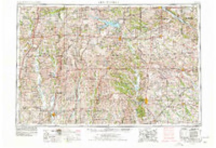
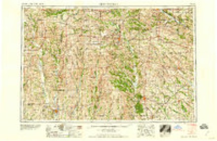
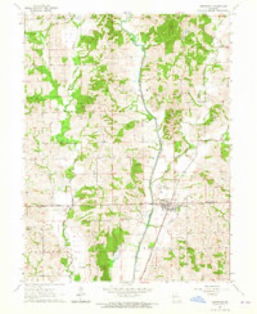
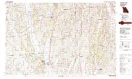
7 topographic sheets cover this place, the earliest surveyed in 1954 and the latest in 1981. It stands in Benton Township. It lies in ZIP code area 64630. It stands on Mairs Branch. The Survey maps it on the Browning quadrangle.
Topographic sheets covering this place
5 surveys from 7 printed sheetsMatched by testing this settlement's coordinate against the published boundary of every sheet in the United States Geological Survey's historical collection. Each opens the scanned sheet at the Survey.
- 1954 USGS Centerville quadrangle1:250000, 3 printings
- 1957 USGS Centerville quadrangle1:250000
- 1958 USGS Centerville quadrangle1:250000
- 1964 USGS Browning quadrangle1:24000
- 1981 USGS Trenton quadrangle1:100000
What happened here
An account from the chapter on Benton township. The inset identifies its exact source book and publication year.
William F. Gibson
was born in South Carolina, June 7, 1810. His parents were Thomas N. and Knth Gibson, who moved out to Tennessee at an early day. On the way ont, AVilliam F,, then a small boy, knocked a tomahawk out of a "kid" Indian's hand and brained him with it. It seems, however, that they arrived safe in Tennessee.
In the county-history sources
19,484 words on this townshipThe History of Linn County, Missouri. An Encyclopedia of Useful Information, published 1882 names this settlement in its chapter on Benton Township. These are the passages that mention it, exactly as the scans read.
In a conversation with Mrs. Nancy Minnis, wife of John W. Minnis, the first sheriff of Linn county, she says they came from Tennessee; that Jere Hooker came in 1837; also Morgan Pierce and William Bingham; that Barton school-house, afterward called Crab Orchard, was located on section twelve, township fifty-nine, range twenty-one, and was built in 1838, and that her daughter Adeline taught in it in the summer of 1839. The first store was the one spoken of above on Kentucky Rupell's place, and did a good business. The first physician was a Dr. Talilee, who remained in the township but a few months, when he was followed by Dr. Jacob Holland, who practiced some two years, and then removed to Sullivan county. Then Dr. Nathaniel Dryden took his practice, but he lived in Locust Creek township. He came from Kentucky, and dying several years ago, was buried in the Rupell graveyard. The Rev. Jesse Goins, before spoken of in this work, was supposed to have been the first preacher. Rev. William F. Gibson and Thomas Barbee were known to have preached several times, although the latter was a store-keeper, so-called at the time. Rev. Constantine Dryden and Rev. Forsythes, both Methodists, also preached at an early day, and are often spoken of as the first in the township. Mrs. Minnis is now living with her granddaughter, Mrs. J. T. Frather. Mr. Frather is an old settler, has a fine farm, fruit, and some blooded stock, and holds a leading position as a citizen in town and county. Judge Schrock, George W. Taylor, William O. Browning, and others in the township are giving their attention to blooded stock, and it is expected that Benton township will lead all others in that line. The farmers are pretty ambitious, and propose to beat their neighbors, if possible.
Passage source: The History of Linn County, Missouri. An Encyclopedia of Useful Information, published 1882.
Among the first births was George Taylor, son of Isaac and Elizabeth Taylor, on section twenty-one, township sixty, range twenty. Elvina, daughter of Robert Warren, was born in 1841, on a farm about two miles south of Browning ; and Ellen J. Hawley, daughter of James and Mary Hawley, was also one of the early natives of Benton township. She first saw light on section twenty-eight, township sixty, range twenty. And this child also was one of the first whose so al was wafted to the God who gave it. She died in 1845, and was buried in the Gibson family graveyard. William H. Moore, sou of Amos and Ruth Moore, was born on the southeast quarter of section twenty-eight, township sixty, range twenty, in 1840, and Elvira Jenkins in 1841. She was the daughter of David and Magdalena Jenkins. It is said that the daughter of William F. Gibson was the first death in the township, who was buried in the family lot above mentioned. Mr. Newton Albert died as early as 1838 or 1839, on the northeast quarter of section thirty-one, township sixty, range twenty, and was buried in the Wesley chapel graveyard. Another early death was the daughter of John Daily, who died at the age of two years, in 1840. Mr. Lot Lantz went to Linneus for the cofiin. Squire Goins's wife, Mr. Brooks's wife, and the old man Knifong, all died in 1841.
Passage source: The History of Linn County, Missouri. An Encyclopedia of Useful Information, published 1882.
It is said that Mrs. Minnis, wife of John W., was quite a doctor, and prescribed for a good many cases in that early day and with much success. There was also a Dr. Cooper in the township for a short time, besides the physicians spoken of previously. And there can also be added to the list of preachers the name of the Rev. Mr. Aldridge, who held regular service at Mount Nebo church, two and one-half miles west of Browning, and known also as Hooker's school-house. It was one of the oldest established organizations in the township. It has no church of its own, and the members meet at the Mundell school-house.
Passage source: The History of Linn County, Missouri. An Encyclopedia of Useful Information, published 1882.
Machine-read from a century-old scan, so expect the errors a machine makes: misspelled names, dropped words, stray characters.
Read the whole chapter on Benton Township - it names this place 43 more 43 times.
Fires near this place
1 since 2019Regional context, not property-specific evidence. The federal wildfire occurrence database lists 1 fire within 5 miles of Browning in 2019, burning about 18 acres in total. None started naturally. None was recorded as arson. Distance is straight-line from the map coordinates, so a fire counted here may appear on a neighbouring settlement's page as well.
| Reported cause | Fires |
|---|---|
| Missing data/not specified/undetermined | 1 |
The most recent of them, most recent first, with the day each was reported and the service that recorded it.
| Date | Cause | Size | Reported by | Name on the report |
|---|---|---|---|---|
| 22 March 2019 | Missing data/not specified/undetermined | 18 acres | Missouri Department of Conservation | 179607-10547-03222019-1535 |
Mines and quarries near this place
3 within 5 milesRegional context, not property-specific evidence. The federal mineral resources record lists 3 workings within 5 miles of Browning: 3 past producers. None of them still produces. What was taken out: Sand and Gravel, Construction, Stone, Crushed/Broken. Distance is straight-line from the map coordinates, so a quarry counted here may appear on a neighbouring settlement's page as well.
| Where | Site | Commodity | Status | Recorded |
|---|---|---|---|---|
| Bubany Farms Quarry | Stone, Crushed/Broken | Past Producer | ||
| Unk | Sand and Gravel, Construction | Past Producer | ||
| Unk | Sand and Gravel, Construction | Past Producer |
Nearest settlements
The eight closest, with where each one stands in the county. Distances are straight-line, computed from the Geographic Names Information System coordinates.
| Map | Place | Distance | Sheets |
|---|---|---|---|
| Enterprise | 4.2 miles | 7 | |
| Purdin | 5.8 miles | 11 | |
| Grantsville | 6.9 miles | 11 | |
| Shafter | 7.4 miles | 14 | |
| Leverton | 8.4 miles | 11 | |
| Haseville | 8.4 miles | 10 | |
| Shelby | 8.9 miles | 11 | |
| North Salem | 9.2 miles | 8 |
Provenance
This settlement is recorded in the Geographic Names Information System as feature 714793. The sheet list is computed by point-in-boundary test against the United States Geological Survey's historical topographic inventory. Both are works of the United States government and carry no copyright under 17 U.S.C. 105.
Wildfire. Short, Karen C. 2022. Spatial wildfire occurrence data for the United States, 1992-2020 [FPA_FOD_20221014]. 6th Edition. Fort Collins, CO: Forest Service Research Data Archive. https://doi.org/10.2737/RDS-2013-0009.6 Collected with United States Government funding and usable without additional permissions or fees.
Mines and quarries. USGS Mineral Resources Data System (MRDS) https://mrdata.usgs.gov/mrds/ A work of the United States government, no copyright under 17 U.S.C. 105.