 Block
Burlington Junction, Missouri
14 topographic sheets cover this place, the earliest surveyed in 1939 and the latest in 1986. It stands in Nodaway Township. It lies in ZIP code area 64428. It stands on Cuyhoga Creek. The Survey maps it on the Burlington Junction quadrangle. 521 people lived here at the 2020 count. It stands 971 feet above sea level.
On record in Burlington Junction
Buildings and businesses the archive holds for this place. Each opens its own page, with the source record it came from.
On the National Register 1 record
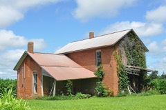 Possum Walk Hotellisted 1983
Population over time
2 figuresBurlington Junction fell from 537 to 521 between 2010 and 2020. These are the recorded population figures Wikidata holds for this place, reached through the Geographic Names Information System number this page is keyed on rather than by name, so they belong to this place and not to another of the same name. Most are census counts, but not all are: an early figure may be a founding or settlement estimate, and an estimate published within five years of a census is left out. The change column is computed, and is left blank where more than 20 years separate a figure from the one before it, because a gap that long is not a change between two counts.
| Year | People | Change |
|---|---|---|
| 2010 | 537 | |
| 2020 | 521 | -16 (-3%) |
Topographic sheets covering this place
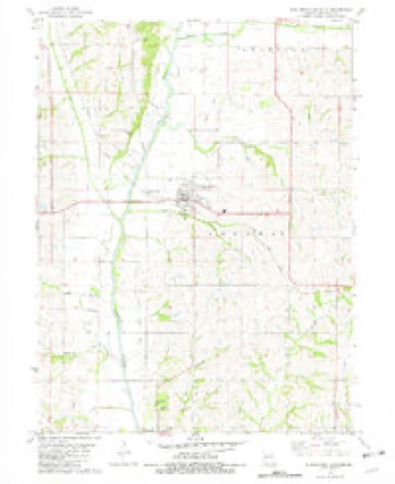
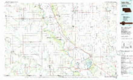
8 surveys from 14 printed sheetsMatched by testing this settlement's coordinate against the published boundary of every sheet in the United States Geological Survey's historical collection. Each opens the scanned sheet at the Survey.
- 1939 USGS Skidmore quadrangle1:62500, 3 printings
- 1941 USGS Skidmore quadrangle1:62500
- 1942 USGS Skidmore quadrangle1:62500, 2 printings
- 1955 USGS Nebraska City quadrangle1:250000, 3 printings
- 1957 USGS Nebraska City quadrangle1:250000
- 1958 USGS Nebraska City quadrangle1:250000
- 1981 USGS Burlington Junction quadrangle1:24000
- 1986 USGS Falls City quadrangle1:100000, 2 printings
In the county-history sources
3,786 words on this townshipThe History of Nodaway County, Missouri, Containing a History of the County, Its Cities, Towns, Etc., Biographical Sketches of Its Citizens, published 1882 names this settlement in its chapter on Nodaway Township. These are the passages that mention it, exactly as the scans read.
There is considerable timber in the north and northeastern portions of the township, and also along the Nodaway River. Some stone quarries are found along the Nodaway. The land in the western and southern portions of the township is gently rolling, and is counted among the best in the county, while the land in the northern and northeastern portion of the township is considerably rolling, and in places might be termed rough.
Passage source: The History of Nodaway County, Missouri, Containing a History of the County, Its Cities, Towns, Etc., Biographical Sketches of Its Citizens, published 1882.
Among the earliest pioneers in Nodaway Township was Levi Martin, who came in 1842, and entered the claim on which Burlington Junction now stands. In the same year, John Shepherd settled on an adjoining farm, a little south of him, just across the branch. Jesse Roberts, Mr. Thomas and his son, John Thomas, took claims about a mile west, and a little south of Mr, Martin's. Joseph Hough, at a very early day, entered the claim at Corkin's Spring, and John Clark, father of W. Clark, bought out his interests in March, 1849.
Passage source: The History of Nodaway County, Missouri, Containing a History of the County, Its Cities, Towns, Etc., Biographical Sketches of Its Citizens, published 1882.
In 1856, Mr. J. H. Ware, Sr., came from Chillicothe, Ohio, and took a claim near Burlington Junction. Mr. Ware was formerly prosecuting attorney of Ross County, Ohio. Col. John Davis came soon after and bought out the claim of Levi Martin. He afterward sold his farm and went to Kansas. Thomas Corkin took a claim in 1862 about two miles northwest of where Burlington Junction now stands. Shadrick Cole and his son-in-law, Wm. H. Franklin, took claims two miles south of Burlington Junction. About that time Shadrick Cole took a claim two miles south and a little west of them, near the Nodaway River. Austin Jones and Wm. B. Sunderland settled half a mile northwest of where Burlington Junction now stands, near each other. Thomas Fields, Mr. Sunderland's son-in-law, settled on Jones' land and lives there still. Wm. Jones, the father of Austin Jones, a man who is well remembered for his amiability, spent his time between Nodaway County and Atchison County. He died about sixteen years ago, and was buried in the cemetery near Burlington Junction. James Mitchel settled near Austin Jones, one mile north of Burlington Junction. Dr. Myers came nearly at the some time, and' took a claim in the Nodaway River Valley. He still lives in Burlington Junction. Soon afterward came George Wilson, and took a claim two miles north of Burlington Junction, on the lowest terrace of the river. Jesse Walker built a residence one-half mile south of Burlington Junction, his farm adjoining the town. There were some forty families in the Ohio settlement, who came from the middle southern portion of Ohio. The Ohio settlement was composed of men who possessed thrift and energy, and they opened and improved some of the finest farms in Nodaway County. Ohio farmers have always been characterized by intelligence and enterprise, and this settlement did not lose any of these characteristics in settling in the Nodaway Valley. Many of their farms are still under a high state of cultivation, and their houses, fences, orchards, farm implements, and live stock all indicate that they have kept abreast of the improvements of the age.
Passage source: The History of Nodaway County, Missouri, Containing a History of the County, Its Cities, Towns, Etc., Biographical Sketches of Its Citizens, published 1882.
Machine-read from a century-old scan, so expect the errors a machine makes: misspelled names, dropped words, stray characters.
Read the whole chapter on Nodaway Township - it names this place 11 more 11 times.
Fires near this place
3 since 2013Regional context, not property-specific evidence. The federal wildfire occurrence database lists 3 fires within 5 miles of Burlington Junction between 2013 and 2020, burning about 21 acres in total. None started naturally. None was recorded as arson. Distance is straight-line from the map coordinates, so a fire counted here may appear on a neighbouring settlement's page as well.
| Reported cause | Fires |
|---|---|
| Missing data/not specified/undetermined | 2 |
| Equipment and vehicle use | 1 |
The most recent of them, most recent first, with the day each was reported and the service that recorded it.
| Date | Cause | Size | Reported by | Name on the report |
|---|---|---|---|---|
| 3 May 2016 | Equipment and vehicle use | 1.0 acres | Missouri Department of Conservation | 140218-07409-05032016-1500 |
| 7 April 2013 | Missing data/not specified/undetermined | 20 acres | Missouri Department of Conservation | not named |
| 4 March 2020 | Missing data/not specified/undetermined | under an acre | Missouri Department of Conservation | 190156-07499-03042020-1748 |
Settlements close enough to share some of these fires:
Mines and quarries near this place
3 within 5 milesRegional context, not property-specific evidence. The federal mineral resources record lists 3 workings within 5 miles of Burlington Junction: 3 past producers. None of them still produces. What was taken out: Sand and Gravel, Construction. Distance is straight-line from the map coordinates, so a quarry counted here may appear on a neighbouring settlement's page as well.
Storms near this place
2 since 1994Regional context, not property-specific evidence. The National Weather Service names Burlington Junction in 2 storm reports between 1994 and 1996: 2 hail. No death or injury is recorded in these reports. Each account below is quoted exactly as the forecast office filed it, from the NOAA Storm Events Database, and each date opens the federal record of that event.
| When | Event | Place named | Harm | What the report says |
|---|---|---|---|---|
| June 1994 | Hail | Burlington Junction | $5,000 | Two seperate thunderstorms produced an estimated $10 million in damage to nearly 45,000 acres after large hail fell. The first swath of hail was about 5 miles wide from Burlington Junction to Grahm. The second swath was about a mile wide and 15 miles long. The storm also downed trees and power lines throughout parts of the county. A roof was torn off a nursing home in Maryville with other buildings damaged in Arkoe. |
| May 1996 | Hail | Burlington Junction | - | no account filed |
Nearest settlements
The eight closest, with where each one stands in the county. Distances are straight-line, computed from the Geographic Names Information System coordinates.
| Map | Place | Distance | Sheets |
|---|---|---|---|
| Roseberry | 1.4 miles | 14 | |
| Dawsonville | 2.2 miles | 14 | |
| Possum Walk | 3.5 miles | 14 | |
| Clearmont | 4.8 miles | 12 | |
| Quitman | 5.0 miles | 14 | |
| Elmo | 5.7 miles | 12 | |
| Wilcox | 6.2 miles | 11 | |
| Skidmore | 10.8 miles | 14 |
Elsewhere
Matched on this settlement's Geographic Names Information System number rather than its name, so it cannot be a different place of the same name in another state.
| Wikipedia article on Burlington Junction | An encyclopaedic summary. Its text is share-alike, so it is linked here rather than copied. |
| Wikidata item Q953013 | The structured record the population and elevation above come from. Public domain (CC0). |
Provenance
This settlement is recorded in the Geographic Names Information System as feature 730064. The sheet list is computed by point-in-boundary test against the United States Geological Survey's historical topographic inventory. Both are works of the United States government and carry no copyright under 17 U.S.C. 105.
Wildfire. Short, Karen C. 2022. Spatial wildfire occurrence data for the United States, 1992-2020 [FPA_FOD_20221014]. 6th Edition. Fort Collins, CO: Forest Service Research Data Archive. https://doi.org/10.2737/RDS-2013-0009.6 Collected with United States Government funding and usable without additional permissions or fees.
Mines and quarries. USGS Mineral Resources Data System (MRDS) https://mrdata.usgs.gov/mrds/ A work of the United States government, no copyright under 17 U.S.C. 105.
Storms. NOAA National Centers for Environmental Information, Storm Events Database https://www.ncei.noaa.gov/stormevents/ A work of the United States government, no copyright under 17 U.S.C. 105. Narratives are quoted verbatim from the National Weather Service report and are not edited or summarised.