 Block
Quitman, Missouri
14 topographic sheets cover this place, the earliest surveyed in 1939 and the latest in 1986. It stands in Green Township. It lies in ZIP code area 64487. It stands on Huff Creek. The Survey maps it on the Skidmore quadrangle. 42 people lived here at the 2020 count. It stands 961 feet above sea level.
Population over time
2 figuresQuitman fell from 45 to 42 between 2010 and 2020. These are the recorded population figures Wikidata holds for this place, reached through the Geographic Names Information System number this page is keyed on rather than by name, so they belong to this place and not to another of the same name. Most are census counts, but not all are: an early figure may be a founding or settlement estimate, and an estimate published within five years of a census is left out. The change column is computed, and is left blank where more than 20 years separate a figure from the one before it, because a gap that long is not a change between two counts.
| Year | People | Change |
|---|---|---|
| 2010 | 45 | |
| 2020 | 42 | -3 (-7%) |
Topographic sheets covering this place
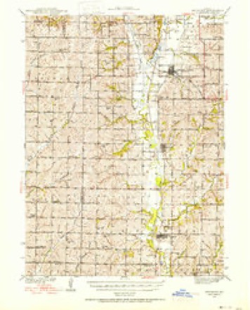
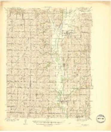
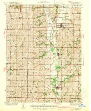
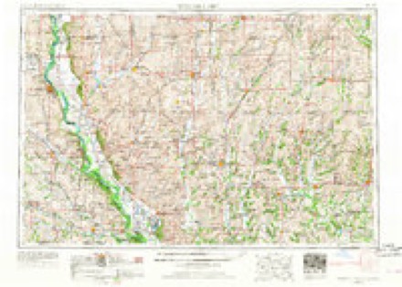
8 surveys from 14 printed sheetsMatched by testing this settlement's coordinate against the published boundary of every sheet in the United States Geological Survey's historical collection. Each opens the scanned sheet at the Survey.
- 1939 USGS Skidmore quadrangle1:62500, 3 printings
- 1941 USGS Skidmore quadrangle1:62500
- 1942 USGS Skidmore quadrangle1:62500, 2 printings
- 1955 USGS Nebraska City quadrangle1:250000, 3 printings
- 1957 USGS Nebraska City quadrangle1:250000
- 1958 USGS Nebraska City quadrangle1:250000
- 1981 USGS Skidmore quadrangle1:24000
- 1986 USGS Falls City quadrangle1:100000, 2 printings
In the county-history sources
17,677 words on this townshipThe History of Nodaway County, Missouri, Containing a History of the County, Its Cities, Towns, Etc., Biographical Sketches of Its Citizens, published 1882 names this settlement in its chapter on Green Township. These are the passages that mention it, exactly as the scans read.
The first bottom of the Nodaway Valley is about a mile in width on the east side af the river, and on the west side it is wider and sometimes extends back from the river two miles. A few lakes occur along the valley in close proximity to the river. The eastern watershed of the valley lies near the east line of Green township, and the western watershed lies beyond the western boundary of the township, in Atchison County. The whole township is made up of fine valley lands, rather rolling in character, but not subject to the " wash " so common to many portions of Missouri. The western half of the township lying west of the Nodaway River, and portions of the eastern half, possess the rich vegetable mold or alluvium resting upon the Loess or bluff formation, the very best soil in the Missouri Valley. The Nodaway Valley has considerable timber, Sand Creek and Huff Branch are well timbered, the timber on Sand Creek extending near its sources, and all of the creeks in the township have more or less timber. It is estimated that about one-tenth of the township is timbered land. Along the Nodaway River and Sand Creek there is an abundance of stone for building purposes, and there is some stone found along the branches' of the Florida. Coal is found a little south of Quitman, and along the Florida Branch, and is mined in considerable quantities for commercial purposes. The best veins will average from eighteen to twenty-two inches in thickness, and produce a fair article of bituminous coal. In Green Township there are several water privileges only, one of which has been improved in the erection of the mill near Quitman.
Passage source: The History of Nodaway County, Missouri, Containing a History of the County, Its Cities, Towns, Etc., Biographical Sketches of Its Citizens, published 1882.
Elijah Dodson came soon afterward in the year 1842, and settled a little north of where Quitman is now located, on the east side of the Nodaway River. He lived there about ten years and then, under the impulse of the fever to go to the Pacific Coast, sold out and went to Oregon. He had two sons, William and Jesse, and three sons-in-law, who settled near where he located in Green Township. The names of these sons-in-law were John Dawson and Dennis Dawson, who were brothers, and John Harris. They all came in the year 1842.
Passage source: The History of Nodaway County, Missouri, Containing a History of the County, Its Cities, Towns, Etc., Biographical Sketches of Its Citizens, published 1882.
Hiram Lee was among the earliest settlers of Green Township. He came and opened a claim and built the first grist mill near where Quitman now stands. He sold out to Rankin Russell, and moved down four miles south, and opened another claim. Mr. Russell tore down the old log mill, and put up a frame grist and saw mill in the place of it.
Passage source: The History of Nodaway County, Missouri, Containing a History of the County, Its Cities, Towns, Etc., Biographical Sketches of Its Citizens, published 1882.
Machine-read from a century-old scan, so expect the errors a machine makes: misspelled names, dropped words, stray characters.
Read the whole chapter on Green Township - it names this place 12 more 12 times.
Fires near this place
2 since 1995Regional context, not property-specific evidence. The federal wildfire occurrence database lists 2 fires within 5 miles of Quitman between 1995 and 2016, burning about 2 acres in total. None started naturally. None was recorded as arson. Distance is straight-line from the map coordinates, so a fire counted here may appear on a neighbouring settlement's page as well.
| Reported cause | Fires |
|---|---|
| Debris and open burning | 1 |
| Equipment and vehicle use | 1 |
The most recent of them, most recent first, with the day each was reported and the service that recorded it.
| Date | Cause | Size | Reported by | Name on the report |
|---|---|---|---|---|
| 3 May 2016 | Equipment and vehicle use | 1.0 acres | Missouri Department of Conservation | 140218-07409-05032016-1500 |
| 19 March 1995 | Debris and open burning | 1.0 acres | Missouri Department of Conservation | not named |
Settlements close enough to share some of these fires:
Mines and quarries near this place
1 within 5 milesRegional context, not property-specific evidence. The federal mineral resources record lists 1 working within 5 miles of Quitman: 1 past producer. None of them still produces. What was taken out: Sand and Gravel, Construction. Distance is straight-line from the map coordinates, so a quarry counted here may appear on a neighbouring settlement's page as well.
| Where | Site | Commodity | Status | Recorded |
|---|---|---|---|---|
| Unk | Sand and Gravel, Construction | Past Producer |
Storms near this place
12 since 2001Regional context, not property-specific evidence. The National Weather Service names Quitman in 12 storm reports between 2001 and 2024: 5 thunderstorm wind, 3 hail, 3 flash flood, 1 tornado. No death or injury is recorded in these reports. Each account below is quoted exactly as the forecast office filed it, from the NOAA Storm Events Database, and each date opens the federal record of that event.
| When | Event | Place named | Harm | What the report says |
|---|---|---|---|---|
| October 2024 | Thunderstorm Wind | Quitman | - | Several reports of wires down and power outages in western Nodaway County, primarily north of Skidmore and west of Maryville. |
| October 2024 | Thunderstorm Wind | Quitman | - | Multiple power poles down near Route 46 and Route 113. |
| June 2023 | Thunderstorm Wind | Quitman | - | Tree limbs on the order of 6 to 8 inches in diameter downed and corn flattened. |
| June 2017 | Thunderstorm Wind | Quitman | - | Several trees were down across western portions of Nodaway County. |
| May 2015 | Flash Flood | Quitman | - | Water was reported over highway 113. |
| September 2014 | Flash Flood | Quitman | - | Several areas across Nodaway County received several inches of rain, which led to many roads being impassible for a short time near Burlington Junction, Barnard, Skidmore, and Arkoe. |
| June 2014 | Flash Flood | Quitman | - | Eight inches of water flowing over Highway 46 and HH. |
| August 2004 | Tornado (F0) | Quitman | - | Brief tornado touchdown with no damage or injuries. |
| March 2016 | Hail | Quitman | - | no account filed |
| May 2007 | Hail | Quitman | - | no account filed |
| August 2006 | Thunderstorm Wind | Quitman | - | no account filed |
| April 2001 | Hail | Quitman | - | no account filed |
Nearest settlements
The eight closest, with where each one stands in the county. Distances are straight-line, computed from the Geographic Names Information System coordinates.
| Map | Place | Distance | Sheets |
|---|---|---|---|
| Roseberry | 4.8 miles | 14 | |
| Burlington Junction | 5.0 miles | 14 | |
| Skidmore | 5.8 miles | 14 | |
| Wilcox | 6.1 miles | 11 | |
| Dawsonville | 6.4 miles | 14 | |
| Possum Walk | 8.4 miles | 14 | |
| Clearmont | 9.7 miles | 12 | |
| Bell Grove | 9.9 miles | 11 |
Elsewhere
Matched on this settlement's Geographic Names Information System number rather than its name, so it cannot be a different place of the same name in another state.
| Wikipedia article on Quitman | An encyclopaedic summary. Its text is share-alike, so it is linked here rather than copied. |
| Wikidata item Q430441 | The structured record the population and elevation above come from. Public domain (CC0). |
Provenance
This settlement is recorded in the Geographic Names Information System as feature 730184. The sheet list is computed by point-in-boundary test against the United States Geological Survey's historical topographic inventory. Both are works of the United States government and carry no copyright under 17 U.S.C. 105.
Wildfire. Short, Karen C. 2022. Spatial wildfire occurrence data for the United States, 1992-2020 [FPA_FOD_20221014]. 6th Edition. Fort Collins, CO: Forest Service Research Data Archive. https://doi.org/10.2737/RDS-2013-0009.6 Collected with United States Government funding and usable without additional permissions or fees.
Mines and quarries. USGS Mineral Resources Data System (MRDS) https://mrdata.usgs.gov/mrds/ A work of the United States government, no copyright under 17 U.S.C. 105.
Storms. NOAA National Centers for Environmental Information, Storm Events Database https://www.ncei.noaa.gov/stormevents/ A work of the United States government, no copyright under 17 U.S.C. 105. Narratives are quoted verbatim from the National Weather Service report and are not edited or summarised.