 Block
Chilton, Missouri
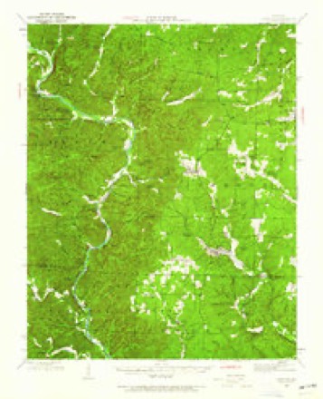
12 topographic sheets cover this place, the earliest surveyed in 1944 and the latest in 1983. It stands in Kelly Township. It lies in ZIP code area 63965. It lies near Aldrich Valley. The Survey maps it on the Big Spring quadrangle.
Topographic sheets covering this place
7 surveys from 12 printed sheetsMatched by testing this settlement's coordinate against the published boundary of every sheet in the United States Geological Survey's historical collection. Each opens the scanned sheet at the Survey.
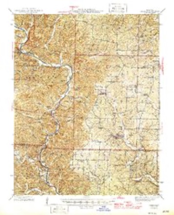
- 1944 USGS Grandin quadrangle1:62500
- 1946 USGS Grandin quadrangle1:62500, 2 printings
- 1957 USGS Poplar Bluff quadrangle1:250000, 3 printings
- 1959 USGS Poplar Bluff quadrangle1:250000
- 1960 USGS Poplar Bluff quadrangle1:250000
- 1968 USGS Big Spring quadrangle1:24000, 3 printings
- 1983 USGS Poplar Bluff quadrangle1:100000
Fires near this place
53 since 1992Regional context, not property-specific evidence. The federal wildfire occurrence database lists 53 fires within 5 miles of Chilton between 1992 and 2019, burning about 970 acres in total. None started naturally. 21 were recorded as arson. Distance is straight-line from the map coordinates, so a fire counted here may appear on a neighbouring settlement's page as well.
| Reported cause | Fires |
|---|---|
| Arson/incendiarism | 21 |
| Debris and open burning | 18 |
| Missing data/not specified/undetermined | 9 |
| Recreation and ceremony | 4 |
| Equipment and vehicle use | 1 |
The most recent of them, most recent first, with the day each was reported and the service that recorded it.
| Date | Cause | Size | Reported by | Name on the report |
|---|---|---|---|---|
| 3 August 1997 | Missing data/not specified/undetermined | 1.0 acres | Missouri Department of Conservation | not named |
| 28 July 2011 | Missing data/not specified/undetermined | under an acre | Ozark National Scenic River | FREE STORE |
| 19 July 1999 | Debris and open burning | 2.0 acres | Missouri Department of Conservation | not named |
| 4 May 1994 | Arson/incendiarism | 1.0 acres | Ozark National Scenic River | KELLY |
| 15 May 1993 | Arson/incendiarism | 3.0 acres | Missouri Department of Conservation | not named |
| 15 May 1993 | Arson/incendiarism | 2.0 acres | Missouri Department of Conservation | not named |
| 15 May 1993 | Arson/incendiarism | 1.0 acres | Missouri Department of Conservation | not named |
| 15 May 1993 | Arson/incendiarism | 2.0 acres | Missouri Department of Conservation | not named |
Settlements close enough to share some of these fires:
Mines and quarries near this place
10 of 16 shownRegional context, not property-specific evidence. The federal mineral resources record lists 16 workings within 5 miles of Chilton: 7 past producers, 5 prospects, 3 occurrences, 1 unknown. None of them still produces. What was taken out: Iron, Stone, Crushed/Broken, Manganese. Distance is straight-line from the map coordinates, so a quarry counted here may appear on a neighbouring settlement's page as well.
| Where | Site | Commodity | Status | Recorded |
|---|---|---|---|---|
| Unknown | Manganese | Past Producer | ||
| Unknown | Manganese | Past Producer | ||
| Mayes Quarry | Stone, Crushed/Broken | Past Producer | ||
| Unknown | Stone, Crushed/Broken | Past Producer | ||
| Unknown | Stone, Crushed/Broken | Past Producer | ||
| Unknown | Stone, Crushed/Broken | Past Producer | ||
| Brown Land # 1 | Iron | Prospect | ||
| Tract # 2 | Iron | Occurrence | ||
| Tract # 22 | Iron | Prospect | ||
| Tract # 23 | Iron | Prospect |
Storms near this place
3 since 2010Regional context, not property-specific evidence. The National Weather Service names Chilton in 3 storm reports between 2010 and 2015: 2 tornado, 1 thunderstorm wind. No death or injury is recorded in these reports. Each account below is quoted exactly as the forecast office filed it, from the NOAA Storm Events Database, and each date opens the federal record of that event.
| When | Event | Place named | Harm | What the report says |
|---|---|---|---|---|
| December 2010 | Tornado (EF2) | Chilton | $200,000 | The tornado touched down near County Road 223, where a tin roof was peeled up on a small outbuilding. A gate and fence were blown about 50 feet. The tornado reached its maximum width and its peak intensity as it crossed County Road 225. This is where a permanent home suffered partial wall and roof loss, a mobile home was blown 15 feet off its foundation, and over one hundred trees were uprooted. The residents of the mobile home took refuge in the laundry room, which was the only room not destroyed. Residents of both homes were provided food and shelter by the Red Cross. A large oak tree fell on a vehicle, causing major damage to the vehicle. Two other vehicles were damaged by debris. A shed and outbuildings were destroyed. A bicycle was blown up into a tree. A twin-pole high voltage transmission tower was partially blown over. The tornado crossed U.S. Highway 60, then struck a sawmill on Highway FF. The 40-by-100 foot sawmill was destroyed. None of the eight workers in the sawmill were injured, possibly because they jumped into a sawdust pit. A home near the sawmill lost part of its roof (less than 20 percent), and dozens of large trees were uprooted. As the tornado crossed County Road 327, a few more trees were blown down. Part of a metal roof from a small barn was blown into a tree. Due to damage to the high-voltage transmission lines, over 1,500 customers from Van Buren to Ellsinore were without power for up to four hours. A National Weather Service damage survey confirmed a convergent signature to the debris pattern. A person in the area reported witnessing the tornado. Peak winds in this tornado were estimated near 120 mph. |
| December 2015 | Tornado (EF1) | Chilton | $90,000 | The tornado began near the Current River along Highway Z and then moved northeast. Hundreds of trees were snapped or uprooted within a well-defined path in the Ozark National Scenic Riverways. The tornado passed through the tiny community of Chilton, where an old abandoned schoolhouse was nearly destroyed. A few homes received siding and shingle damage. Near the end of the damage path along Missouri Highway 21 and U.S. Highway 60, there was damage to the metal roofing of an old saw mill. A saw mill employee reported visually witnessing the tornado. Missouri Highway 21 was closed due to debris and power lines across it. The path was mostly through hilly and forested country. Peak winds were estimated near 95 mph. |
| January 2013 | Thunderstorm Wind | Chilton | $50,000 | A home and a shed was damaged along Highway 21. The roof of one home was blown into the road, and the shed was blown away. A carport was blown into some nearby trees. |
Nearest settlements
The eight closest, with where each one stands in the county. Distances are straight-line, computed from the Geographic Names Information System coordinates.
| Map | Place | Distance | Sheets |
|---|---|---|---|
| Hunter | 4.8 miles | 11 | |
| Crites Corner | 5.4 miles | 11 | |
| Chicopee | 5.7 miles | 13 | |
| South Van Buren | 6.2 miles | 13 | |
| Van Buren | 6.6 miles | 13 | |
| Eastwood | 6.6 miles | 13 | |
| Barren (historical) | 8.8 miles | 15 | |
| Grandin | 8.9 miles | 11 |
Provenance
This settlement is recorded in the Geographic Names Information System as feature 715784. The sheet list is computed by point-in-boundary test against the United States Geological Survey's historical topographic inventory. Both are works of the United States government and carry no copyright under 17 U.S.C. 105.
Wildfire. Short, Karen C. 2022. Spatial wildfire occurrence data for the United States, 1992-2020 [FPA_FOD_20221014]. 6th Edition. Fort Collins, CO: Forest Service Research Data Archive. https://doi.org/10.2737/RDS-2013-0009.6 Collected with United States Government funding and usable without additional permissions or fees.
Mines and quarries. USGS Mineral Resources Data System (MRDS) https://mrdata.usgs.gov/mrds/ A work of the United States government, no copyright under 17 U.S.C. 105.
Storms. NOAA National Centers for Environmental Information, Storm Events Database https://www.ncei.noaa.gov/stormevents/ A work of the United States government, no copyright under 17 U.S.C. 105. Narratives are quoted verbatim from the National Weather Service report and are not edited or summarised.