 Block
Grandin, Missouri
11 topographic sheets cover this place, the earliest surveyed in 1944 and the latest in 1997. It stands in Johnson Township. It lies in ZIP code area 63943. It stands on Middle Fork North Prong Little Black River. The Survey maps it on the Grandin quadrangle. 226 people lived here at the 2020 count. It stands 587 feet above sea level.
On record in Grandin
Buildings and businesses the archive holds for this place. Each opens its own page, with the source record it came from.
On the National Register 12 of 25 shown
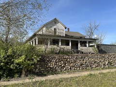 Mrs. Louis Bedell Houselisted 1980
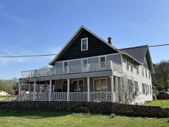 Hazel Owens Houselisted 1980
- Earl Boyer Houselisted 1980
- J. W. Gibson Houselisted 1980
- Delia Greensfelder Houselisted 1980
- Loretta Herrington Houselisted 1980
- James Hinton Houselisted 1980
- Nettie Jacobson Houselisted 1980
- Nola Kitterman Houselisted 1980
- Wallace Knapp Houselisted 1980
- Buford Lawhorn Houselisted 1980
- Iva Lewis Houselisted 1980
Population over time
2 figuresGrandin fell from 243 to 226 between 2010 and 2020. These are the recorded population figures Wikidata holds for this place, reached through the Geographic Names Information System number this page is keyed on rather than by name, so they belong to this place and not to another of the same name. Most are census counts, but not all are: an early figure may be a founding or settlement estimate, and an estimate published within five years of a census is left out. The change column is computed, and is left blank where more than 20 years separate a figure from the one before it, because a gap that long is not a change between two counts.
| Year | People | Change |
|---|---|---|
| 2010 | 243 | |
| 2020 | 226 | -17 (-7%) |
Topographic sheets covering this place
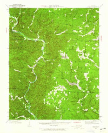
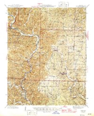
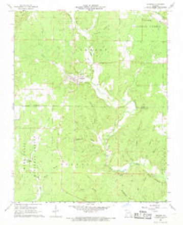
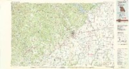
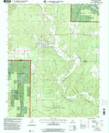
8 surveys from 11 printed sheetsMatched by testing this settlement's coordinate against the published boundary of every sheet in the United States Geological Survey's historical collection. Each opens the scanned sheet at the Survey.
- 1944 USGS Grandin quadrangle1:62500
- 1946 USGS Grandin quadrangle1:62500, 2 printings
- 1957 USGS Poplar Bluff quadrangle1:250000, 3 printings
- 1959 USGS Poplar Bluff quadrangle1:250000
- 1960 USGS Poplar Bluff quadrangle1:250000
- 1968 USGS Grandin quadrangle1:24000
- 1983 USGS Poplar Bluff quadrangle1:100000
- 1997 USGS Grandin quadrangle1:24000
Fires near this place
33 since 1992Regional context, not property-specific evidence. The federal wildfire occurrence database lists 33 fires within 5 miles of Grandin between 1992 and 2020, burning about 423 acres in total. None started naturally. 6 were recorded as arson. Distance is straight-line from the map coordinates, so a fire counted here may appear on a neighbouring settlement's page as well.
| Reported cause | Fires |
|---|---|
| Debris and open burning | 20 |
| Arson/incendiarism | 6 |
| Missing data/not specified/undetermined | 3 |
| Equipment and vehicle use | 2 |
| Smoking | 1 |
| Recreation and ceremony | 1 |
The most recent of them, most recent first, with the day each was reported and the service that recorded it.
| Date | Cause | Size | Reported by | Name on the report |
|---|---|---|---|---|
| 6 September 1999 | Debris and open burning | 30 acres | Missouri Department of Conservation | not named |
| 16 May 1997 | Debris and open burning | 25 acres | Missouri Department of Conservation | not named |
| 4 April 2000 | Debris and open burning | 45 acres | Missouri Department of Conservation | not named |
| 28 April 1997 | Debris and open burning | 14 acres | Missouri Department of Conservation | not named |
| 18 April 2001 | Debris and open burning | 50 acres | Missouri Department of Conservation | not named |
| 18 April 2001 | Debris and open burning | 5.0 acres | Missouri Department of Conservation | not named |
| 18 April 2001 | Missing data/not specified/undetermined | 1.0 acres | Missouri Department of Conservation | not named |
| 16 April 2000 | Debris and open burning | 2.0 acres | Missouri Department of Conservation | not named |
Settlements close enough to share some of these fires:
Mines and quarries near this place
8 within 5 milesRegional context, not property-specific evidence. The federal mineral resources record lists 8 workings within 5 miles of Grandin: 6 prospects, 2 past producers. None of them still produces. What was taken out: Iron, Stone, Crushed/Broken. Distance is straight-line from the map coordinates, so a quarry counted here may appear on a neighbouring settlement's page as well.
| Where | Site | Commodity | Status | Recorded |
|---|---|---|---|---|
| Mayes Quarry | Stone, Crushed/Broken | Past Producer | ||
| Mine # 21 | Iron | Prospect | ||
| Tract # 17 | Iron | Prospect | ||
| Tract # 18 | Iron | Prospect | ||
| Tract # 19 | Iron | Prospect | ||
| Tract # 20 | Iron | Past Producer | ||
| Tract # 5 | Iron | Prospect | ||
| Tract # 6 | Iron | Prospect |
Storms near this place
21 since 1996Regional context, not property-specific evidence. The National Weather Service names Grandin in 21 storm reports between 1996 and 2023: 9 thunderstorm wind, 5 hail, 3 tornado, 3 flood. No death or injury is recorded in these reports. Each account below is quoted exactly as the forecast office filed it, from the NOAA Storm Events Database, and each date opens the federal record of that event.
| When | Event | Place named | Harm | What the report says |
|---|---|---|---|---|
| May 2011 | Tornado (EF3) | Grandin | $300,000 | The tornado reached its peak intensity about a mile east of Ellsinore, where an unanchored modular home with a conventionally-built addition was almost entirely blown away and carried an unknown distance. Several large oak trees were nubbed out. Several homes east of Ellsinore received moderate to major damage. The wall of one house was blown off, along with the back of the roof. Hundreds of trees were blown down. In the Grandin area, two mobile homes were destroyed, and a school suffered major damage, including the loss of an entire roof system. Hundreds of acres of large trees were uprooted or snapped. Between Grandin and Ellsinore, telephone poles were snapped and several cows were killed. A National Weather Service damage survey team found the presence of suction vortices east of Ellsinore. The suction vortices were reported by at least one trained spotter during the tornado. A national television crew aired video of the tornado in progress near Ellsinore. Peak winds were estimated near 150 mph. The average path width was 200 yards. The tornado path continued into Wayne County. |
| May 2020 | Tornado (EF0) | Grandin | $75,000 | The EF-0 tornado along the southern border of Carter County contained estimated peak winds of 85 mph, uprooting or damaging dozens of trees along its path. On Highway 21 between Grandin and the Ripley County line, the tornado pushed over several wooden electrical poles. The tornado also removed a small section of the roof of a manufactured home. The tornado was along the northern edge of a macroburst that was primarily over northern Ripley County. |
| June 2008 | Tornado (EF1) | Grandin | $50,000 | The tornado touched down near the Grandin City Park on the east side of Grandin. A few trees were blown down at the ball fields. The tornado continued east, affecting two residences along County Road 247 just east of town. One house sustained moderate shingle damage. A second house sustained major roof damage. A large barn was heavily damaged, with one wall and door blown off. Large sections of roof were missing. Numerous large trees were snapped or uprooted. Trees on the south side of the track were laying in a northwest direction. South to north striations were easily visible in tall field grass. Several eyewitnesses clearly indicated a funnel cloud touched down. The track end point was estimated due to the fact the damage path continued into woods and fields that were inaccessible by vehicle. Peak wind speeds were estimated at 90 mph. The average path width was 75 yards. |
| May 2011 | Flood | Grandin | $30,000 | no account filed |
| March 1997 | Thunderstorm Wind | Grandin | $20,000 | no account filed |
| May 2020 | Thunderstorm Wind | Grandin | $5,000 | Uprooted trees and broken branches marked the beginning of a 19-mile long macroburst that was primarily over far northern Ripley County. |
| June 2005 | Thunderstorm Wind | Grandin | $3,000 | Numerous tree limbs were blown down. Most of the community was without power. |
| July 1997 | Thunderstorm Wind | Grandin | $3,000 | Trees were blown down. |
| July 2022 | Thunderstorm Wind | Grandin | $1,000 | A medium to large-size tree was uprooted. |
| February 2023 | Flood | Grandin | - | High water from the Little Black River flooded County Road 240. Rainfall amounts from 3 to 3.5 inches were reported in the region over the 24-hour period. |
| January 2013 | Flood | Grandin | - | Flooding of Ten Mile Creek closed Route K. |
| April 2011 | Thunderstorm Wind | Grandin | - | Wind gusts were estimated around 60 mph by law enforcement officers. |
| May 2005 | Thunderstorm Wind | Grandin | - | Trees were blown down. |
| November 2005 | Flash Flood | Grandin | - | An intersection in town was impassable due to fast-moving floodwaters. |
| June 2004 | Thunderstorm Wind | Grandin | - | Numerous trees were blown down. |
| April 2002 | Hail | Grandin | - | Dime size hail persisted for 10 minutes at the city hall. |
| April 2011 | Hail | Grandin | - | no account filed |
| February 2007 | Hail | Grandin | - | no account filed |
| May 2006 | Hail | Grandin | - | no account filed |
| March 2004 | Hail | Grandin | - | no account filed |
| March 1996 | Thunderstorm Wind | Grandin | - | no account filed |
Nearest settlements
The eight closest, with where each one stands in the county. Distances are straight-line, computed from the Geographic Names Information System coordinates.
| Map | Place | Distance | Sheets |
|---|---|---|---|
| Hunter | 4.5 miles | 11 | |
| Homestead (historical) | 5.6 miles | 14 | |
| Ellsinore | 8.3 miles | 13 | |
| Crites Corner | 8.4 miles | 11 | |
| Chilton | 8.9 miles | 12 | |
| Barren (historical) | 10.1 miles | 15 | |
| Eastwood | 11.9 miles | 13 | |
| Chicopee | 14.5 miles | 13 |
Elsewhere
Matched on this settlement's Geographic Names Information System number rather than its name, so it cannot be a different place of the same name in another state.
| Wikipedia article on Grandin | An encyclopaedic summary. Its text is share-alike, so it is linked here rather than copied. |
| Wikidata item Q967675 | The structured record the population and elevation above come from. Public domain (CC0). |
Provenance
This settlement is recorded in the Geographic Names Information System as feature 750100. The sheet list is computed by point-in-boundary test against the United States Geological Survey's historical topographic inventory. Both are works of the United States government and carry no copyright under 17 U.S.C. 105.
Wildfire. Short, Karen C. 2022. Spatial wildfire occurrence data for the United States, 1992-2020 [FPA_FOD_20221014]. 6th Edition. Fort Collins, CO: Forest Service Research Data Archive. https://doi.org/10.2737/RDS-2013-0009.6 Collected with United States Government funding and usable without additional permissions or fees.
Mines and quarries. USGS Mineral Resources Data System (MRDS) https://mrdata.usgs.gov/mrds/ A work of the United States government, no copyright under 17 U.S.C. 105.
Storms. NOAA National Centers for Environmental Information, Storm Events Database https://www.ncei.noaa.gov/stormevents/ A work of the United States government, no copyright under 17 U.S.C. 105. Narratives are quoted verbatim from the National Weather Service report and are not edited or summarised.