 Block
Van Buren, Missouri
13 topographic sheets cover this place, the earliest surveyed in 1944 and the latest in 1997. It stands in Carter Township. It lies in ZIP code area 63965. It lies near Walker Hollow. The Survey maps it on the Van Buren South quadrangle. 747 people lived here at the 2020 count. It stands 472 feet above sea level.
On record in Van Buren
Buildings and businesses the archive holds for this place. Each opens its own page, with the source record it came from.
On the National Register 2 records
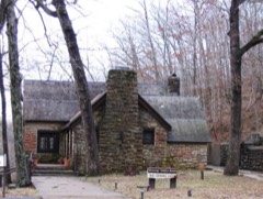 Big Spring Historic Districtlisted 1981
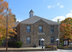 Carter County Courthouselisted 2022
Population over time
2 figuresVan Buren fell from 819 to 747 between 2010 and 2020. These are the recorded population figures Wikidata holds for this place, reached through the Geographic Names Information System number this page is keyed on rather than by name, so they belong to this place and not to another of the same name. Most are census counts, but not all are: an early figure may be a founding or settlement estimate, and an estimate published within five years of a census is left out. The change column is computed, and is left blank where more than 20 years separate a figure from the one before it, because a gap that long is not a change between two counts.
| Year | People | Change |
|---|---|---|
| 2010 | 819 | |
| 2020 | 747 | -72 (-9%) |
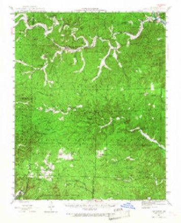
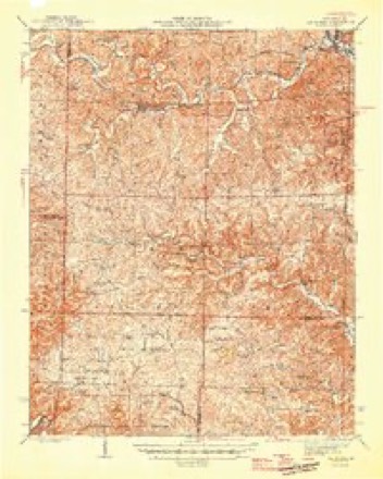
Topographic sheets covering this place
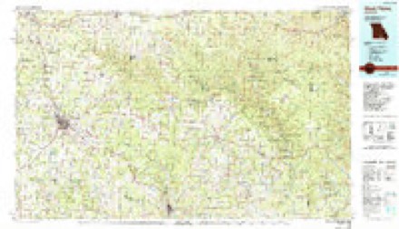
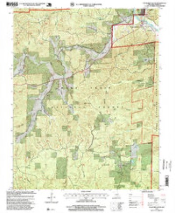
8 surveys from 13 printed sheetsMatched by testing this settlement's coordinate against the published boundary of every sheet in the United States Geological Survey's historical collection. Each opens the scanned sheet at the Survey.
- 1944 USGS Van Buren quadrangle1:62500, 2 printings
- 1946 USGS Van Buren quadrangle1:62500, 2 printings
- 1957 USGS Poplar Bluff quadrangle1:250000, 3 printings
- 1959 USGS Poplar Bluff quadrangle1:250000
- 1960 USGS Poplar Bluff quadrangle1:250000
- 1968 USGS Van Buren South quadrangle1:24000
- 1984 USGS West Plains quadrangle1:100000, 2 printings
- 1997 USGS Van Buren South quadrangle1:24000
Fires near this place
68 since 1992Regional context, not property-specific evidence. The federal wildfire occurrence database lists 68 fires within 5 miles of Van Buren between 1992 and 2019, burning about 708 acres in total. None started naturally. 27 were recorded as arson. Distance is straight-line from the map coordinates, so a fire counted here may appear on a neighbouring settlement's page as well.
| Reported cause | Fires |
|---|---|
| Arson/incendiarism | 27 |
| Debris and open burning | 23 |
| Missing data/not specified/undetermined | 13 |
| Recreation and ceremony | 3 |
| Equipment and vehicle use | 2 |
The most recent of them, most recent first, with the day each was reported and the service that recorded it.
| Date | Cause | Size | Reported by | Name on the report |
|---|---|---|---|---|
| 28 July 2011 | Missing data/not specified/undetermined | under an acre | Ozark National Scenic River | FREE STORE |
| 22 July 1997 | Missing data/not specified/undetermined | 1.0 acres | Missouri Department of Conservation | not named |
| 7 June 2000 | Debris and open burning | 4.0 acres | Missouri Department of Conservation | not named |
| 5 May 2008 | Arson/incendiarism | 1.0 acres | Mark Twain National Forest | BLUE RIDGE |
| 1 May 1997 | Debris and open burning | 10 acres | Missouri Department of Conservation | not named |
| 7 April 1992 | Debris and open burning | 2.0 acres | Missouri Department of Conservation | not named |
| 5 April 2003 | Arson/incendiarism | under an acre | Mark Twain National Forest | BLUE RIDGE ROAD FIRE |
| 5 April 2002 | Arson/incendiarism | 46 acres | Missouri Department of Conservation | not named |
Settlements close enough to share some of these fires:
Mines and quarries near this place
5 within 5 milesRegional context, not property-specific evidence. The federal mineral resources record lists 5 workings within 5 miles of Van Buren: 5 past producers. None of them still produces. What was taken out: Stone, Crushed/Broken, Sand and Gravel, Construction, Granite. Distance is straight-line from the map coordinates, so a quarry counted here may appear on a neighbouring settlement's page as well.
Storms near this place
60 of 105 shownRegional context, not property-specific evidence. The National Weather Service names Van Buren in 105 storm reports between 1994 and 2025: 37 hail, 33 thunderstorm wind, 15 flash flood, 13 flood. The reports record 1 death and 8 injuries. Each account below is quoted exactly as the forecast office filed it, from the NOAA Storm Events Database, and each date opens the federal record of that event.
| When | Event | Place named | Harm | What the report says |
|---|---|---|---|---|
| June 2019 | Thunderstorm Wind | Van Buren | 1 killed, 2 hurt, $20,000 | Within the Ozark National Scenic Riverways, a tree fell on a boat on the Current River. The boat was traveling downstream in the vicinity of the Waymeyer Shute river access point. The 22-year-old male driver of the boat was killed, and two passengers in their 20's were moderately injured. The injured parties were from the local area and were treated at a local hospital. In the same general vicinity, trees and large tree limbs were down on the north end of M Highway. |
| April 2002 | Tornado (F4) | Van Buren | 2 hurt, $15,000,000 | The tornado damage path began on the west side of Van Buren, right along the Current River, and crossed U.S. Route 60 very close to the Current River bridge. Two businesses in Van Buren, a lodge and a restaurant, were heavily damaged by F-2 intensity winds. The tornado travelled southeast across hilly and forested terrain until reaching the community of Ellsinore. Damage on the south side of Ellsinore was severe, where about 7 businesses were destroyed. Most of the damage at Ellsinore, which was inflicted by F-4 intensity winds, occurred along and near U.S. Highway 60. Across Carter County, 13 homes were destroyed and 12 homes suffered major damage. The tornado then moved into the Mark Twain National Forest and crossed into Butler County north of Highway 60. |
| July 2021 | Lightning | Van Buren | 2 hurt | Two persons were struck by lightning while recreating on the Current River. |
| July 1998 | Lightning | Van Buren | 2 hurt | Two river enthusiasts were injured by lightning on the Current River. |
| May 2017 | Flood | Van Buren | $10,000,000 | A catastrophic flood on the Current River inflicted very heavy damage to Van Buren and the surrounding riverbank areas. The river crested over 8 feet above the record crest. Several hours before midnight on May 1, the river crested at 37.20 feet on the Van Buren river gage. The old record was 29.00 feet, set in March of 1904. About 238 homes were damaged or destroyed, about half of which were seasonal vacation homes. Whole houses were swept downriver. About 30 businesses were flooded. A large percentage of flood victims were evacuated to temporary shelters in Van Buren. The sheriff department in Van Buren literally floated about 100 feet off its foundation. Floodwaters were more than eight feet deep in the county courthouse. At least 30 water rescues were conducted by the Missouri State Highway Patrol and the National Park Service. A dusk-to-dawn curfew was enacted for residents of the city of Van Buren. Cell phone service was knocked out for a large portion of the area. The governor of Missouri toured the Van Buren area. The governor credited first responders with saving hundreds of lives by boat during the severe but relatively short-lived flood. Damage to public property, including roads and bridges, was estimated around 7 million dollars. |
| March 2008 | Flood | Van Buren | $700,000 | Moderate flooding of the Current River occurred. At the Van Buren gage, the river crested at 25.71 feet on March 20 at 1 A.M. CDT. Flood stage there is 20 feet, and moderate flooding begins at 23 feet. This flood crest ranked as the fifth highest crest in over 100 years of records. Some flooding occurred in low sections of Van Buren. Water flowing from Factory Hollow and Walker Hollow contributed to the flooding in Van Buren. About a half dozen homes homes were flooded in Van Buren and southeast of town. The water depth in the homes was generally eight inches or less. Sandbagging protected some homes and businesses, and a local hotel assisted with sheltering. The library was flooded to a depth of 6 to 8 inches. Floodwaters reached the back door of the Carter County courthouse. Sandbags were placed around the courthouse and the new justice center. Water was pumped out of the justice center. The river rose almost to the porch of the lower level of The Landing, a landmark inn along the scenic river. Furniture was moved from lower level rooms as a precaution. Damage occurred in Big Spring Park, where at least one small building was washed from its location. |
| June 2014 | Flash Flood | Van Buren | $300,000 | Major flash flooding occurred in Fremont, where numerous evacuations were conducted and cars were flooded due to flash flooding of Pike Creek. Motorists were rescued from vehicles that were swept away by floodwaters on U.S. Highway 60 near Fremont. In addition, portions of Route Y and Route M were closed. Numerous roads were damaged, and a few roads were washed out and closed. Several dozen homes were flooded in Fremont and the surrounding area. About ten of those homes appeared to be a total loss. Home propane tanks floated down creeks and rivers. A large farm tractor was overturned by floodwaters and washed onto a roadway. Camping areas were inundated in the Van Buren area. At least 15 to 20 people were evacuated, and the Red Cross was assisting victims. |
| February 2019 | Flash Flood | Van Buren | $100,000 | Water rescues were reported in Van Buren. Some buildings were flooded, including the fire department in Van Buren. Emergency management personnel reported flash flooding of creeks and roads. Several roads were closed, and low water bridges were impassable. Rainfall rates were estimated by radar up to an inch per hour. A mesonet station on the Current River measured a daily rainfall of 3.38 inches. |
| March 1996 | Hail | Van Buren | $50,000 | no account filed |
| July 2016 | Flash Flood | Van Buren | $40,000 | Water was over portions of roads in the Big Springs area. Some roads were damaged, including County Road 227. |
| May 1999 | Thunderstorm Wind | Van Buren | $30,000 | A house trailer sustained heavy damage in Ellsinore. Numerous trees were down in Van Buren. |
| August 2011 | Thunderstorm Wind | Van Buren | $25,000 | In Van Buren, a large tree was blown down at the county courthouse. In Eastwood, trees were blown down in town, shingles were blown off roofs, and a roof was ripped off a front porch and blown over the house into the back yard. Tree damage was reported at various other locations near these communities. |
| April 1999 | Thunderstorm Wind | Van Buren | $20,000 | A mobile home was overturned along Highway 60. |
| May 1996 | Thunderstorm Wind | Van Buren | $20,000 | no account filed |
| August 2019 | Thunderstorm Wind | Van Buren | $15,000 | A tall tree was down on a home. A non-shingle protective layer of roofing was blown off an inn along the Current River. |
| July 2025 | Thunderstorm Wind | South Van Buren | $10,000 | Thunderstorm winds blew down several trees and some power lines near the intersection of Hwy C and Hwy 60 southwest of Van Buren. |
| July 2022 | Thunderstorm Wind | Van Buren | $10,000 | Two trees were down along Route M to the northwest of Van Buren. Roof damage occurred to a business in Van Buren. |
| June 2013 | Thunderstorm Wind | Van Buren | $10,000 | A few trees and numerous tree limbs were blown down countywide. M Highway was blocked by a tree near Van Buren. |
| September 2012 | Thunderstorm Wind | Van Buren | $10,000 | Power lines and tree limbs were blown down. |
| June 2011 | Thunderstorm Wind | Van Buren | $10,000 | Trees were blown down in the community. |
| August 2007 | Thunderstorm Wind | Van Buren | $8,000 | In south Van Buren, extensive tree damage occurred at a campground and adjacent private property. A canoe trailer was blown over. |
| July 2022 | Thunderstorm Wind | Van Buren | $6,000 | Trees and power lines were down on County Road 125 south of U.S. Highway 60. A large tree was blocking part of State Route C. Other tree damage occurred near the intersection of State Route C and County Road 3280. |
| July 2018 | Thunderstorm Wind | Van Buren | $5,000 | Tree damage and power outages were reported throughout the community. Law enforcement estimated a wind gust to 60 mph just southeast of town. |
| August 2018 | Thunderstorm Wind | Van Buren | $5,000 | The National Park Service reported trees were down on State Route Z in the Ozark National Scenic Riverways area. |
| May 2017 | Thunderstorm Wind | Van Buren | $5,000 | Several trees were blown down around town. Power was out to several homes and businesses, including the county sheriff department. |
| May 2016 | Thunderstorm Wind | Van Buren | $5,000 | A few large tree limbs were blown down. Much of Van Buren was without power. |
| April 2011 | Flood | Van Buren | $5,000 | Minor flooding occurred on the Current River. At Van Buren, the river crested at 21.14 feet. Flood stage is 20 feet. A few homes were evacuated, mainly due to flooded access roads to the houses. Riverfront Park in Van Buren was flooded. |
| October 2010 | Thunderstorm Wind | Van Buren | $5,000 | Trees were down across a few county roads in western Carter County. The roads were blocked and impassable. |
| May 1994 | Thunderstorm Wind | Van Buren | $5,000 | Hail covered the ground north of Fremont and large tree limbs were blown down north of Van Buren. |
| August 2021 | Thunderstorm Wind | Van Buren | $4,000 | Trees were downed on D Highway. |
| April 2002 | Hail | Van Buren | $4,000 | Dime to quarter size hail dented patrol cars. |
| February 2001 | Thunderstorm Wind | Van Buren | $4,000 | Utility company personnel reported some tree and power line damage across the county. |
| July 2025 | Thunderstorm Wind | Van Buren | $3,000 | Thunderstorm winds blew down three trees near the intersection of Highway D and Jason Avenue just north of Van Buren. |
| July 2021 | Thunderstorm Wind | Van Buren | $3,000 | A couple of large trees were down, and several tree limbs from three to four inches in diameter were down. |
| May 2000 | Thunderstorm Wind | Van Buren | $3,000 | A few trees were down along B Highway. |
| July 1998 | Thunderstorm Wind | Van Buren | $3,000 | Numerous trees were downed in Van Buren. |
| July 2023 | Thunderstorm Wind | Van Buren | $2,000 | A large tree limb was down along Highway 60 near Van Buren. Four miles north of Van Buren, several large tree limbs were down. |
| April 2022 | Thunderstorm Wind | Van Buren | $2,000 | Tree limbs from two to three inches in diameter were down. This supercell thunderstorm also produced large hail from Van Buren east-northeast along Highway 60. |
| July 2006 | Flash Flood | Van Buren | $2,000 | Thunderstorms with periods of heavy rainfall over a couple of days saturated the ground, leading to flash flooding. A local newspaper reported more than five inches of rain fell in about two hours. Flash flooding was mostly in the South Van Buren area, in the vicinity of U.S. Highway 60. Two lanes of U.S. Highway 60 under construction west of Van Buren were overrun with water and debris which flowed across the roadway. Fast-moving floodwater covered Highway 103 in South Van Buren. |
| May 2021 | Thunderstorm Wind | Van Buren | $1,000 | A medium-size live tree was blown down across a road. |
| September 2005 | Thunderstorm Wind | Van Buren | $1,000 | A couple of trees were blown down, including one on a power line. |
| June 1994 | Thunderstorm Wind | Van Buren | $500 | The Van Buren Police Department reported 0.75-inch diameter hail covered the ground at Fremont with wind damage to large trees near Van Buren. |
| April 1994 | Hail | Van Buren | $50 | no account filed |
| March 2025 | Hail | Van Buren | - | Hail to the size of quarters fell along Highway M four miles north of Van Buren. |
| May 2025 | Hail | Van Buren | - | Hail up to the size of quarters fell in Van Buren. |
| May 2025 | Hail | Van Buren | - | Very large hail associated with an eastward moving supercell in Carter County produced 2.5 inch hail on Hwy M northwest of Van Buren and 2 inch hail near the intersection of Hwy U and US-60. |
| August 2025 | Hail | Van Buren | - | Along with quarter size hail (measured), the storm also produced wind gusts estimated at 50-55 mph. |
| May 2024 | Flash Flood | Van Buren | - | Water covered roads in Van Buren, including some that do not normally flood. Radar estimated rainfall was up to 3-5 inches for the late afternoon into the evening, though those values are overestimates due to hail contamination. |
| May 2024 | Flood | Van Buren | - | Flooding was reported in Van Buren and to the north on Hwy D in Carter County. One hour rainfall peaked at roughly one inch at 0515CST. |
| November 2024 | Flash Flood | Van Buren | - | Multiple roads flooded in Van Buren. Radar estimated rainfall overnight into the morning was around 1.5 to 2.5 inches. |
| November 2024 | Flood | Van Buren | - | Minor flooding occurred along the Current River at Van Buren with mainly bottomland and surrounding low-lying areas inundated. |
| April 2023 | Hail | Van Buren | - | Two separate reports of dime to quarter-size hail were received from Van Buren. |
| April 2022 | Hail | Van Buren | - | A severe thunderstorm tracked roughly along U.S. Highway 60 through much of Carter County. Quarter-size hail fell in Van Buren. Golf ball size hail was observed near the junction of U.S. Highway 60 and Highway 21N, several miles east-northeast of Van Buren. |
| May 2022 | Flood | Van Buren | - | Minor flooding of streets and small streams was reported. |
| August 2022 | Flash Flood | Van Buren | - | Some streets in and near Van Buren were flooded. |
| January 2021 | Flood | Van Buren | - | Low water crossings were full. Water was over a couple of streets in Van Buren. |
| December 2021 | Flood | South Van Buren | - | Emergency management officials reported some lesser travelled roads were impassable, mainly access roads to camping areas. Low water crossings on these roads were flooded. |
| May 2020 | Flash Flood | Van Buren | - | Several low water crossings were flooded from rapidly rising creeks. |
| July 2020 | Flash Flood | Van Buren | - | Flash flooding of several low water crossings was reported in and north of Van Buren. |
| October 2020 | Flood | Van Buren | - | Several low water crossings were becoming impassable. |
Nearest settlements
The eight closest, with where each one stands in the county. Distances are straight-line, computed from the Geographic Names Information System coordinates.
| Map | Place | Distance | Sheets |
|---|---|---|---|
| South Van Buren | 0.5 miles | 13 | |
| Chicopee | 0.9 miles | 13 | |
| House Creek | 3.0 miles | 20 | |
| Chilton | 6.6 miles | 12 | |
| Keeney Corner | 7.1 miles | 17 | |
| Eastwood | 7.3 miles | 13 | |
| Fremont | 8.5 miles | 14 | |
| Crites Corner | 10.6 miles | 11 |
Elsewhere
Matched on this settlement's Geographic Names Information System number rather than its name, so it cannot be a different place of the same name in another state.
| Wikipedia article on Van Buren | An encyclopaedic summary. Its text is share-alike, so it is linked here rather than copied. |
| Wikidata item Q961281 | The structured record the population and elevation above come from. Public domain (CC0). |
Provenance
This settlement is recorded in the Geographic Names Information System as feature 752687. The sheet list is computed by point-in-boundary test against the United States Geological Survey's historical topographic inventory. Both are works of the United States government and carry no copyright under 17 U.S.C. 105.
Wildfire. Short, Karen C. 2022. Spatial wildfire occurrence data for the United States, 1992-2020 [FPA_FOD_20221014]. 6th Edition. Fort Collins, CO: Forest Service Research Data Archive. https://doi.org/10.2737/RDS-2013-0009.6 Collected with United States Government funding and usable without additional permissions or fees.
Mines and quarries. USGS Mineral Resources Data System (MRDS) https://mrdata.usgs.gov/mrds/ A work of the United States government, no copyright under 17 U.S.C. 105.
Storms. NOAA National Centers for Environmental Information, Storm Events Database https://www.ncei.noaa.gov/stormevents/ A work of the United States government, no copyright under 17 U.S.C. 105. Narratives are quoted verbatim from the National Weather Service report and are not edited or summarised.