 Block
Cornelia, Missouri
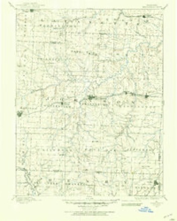
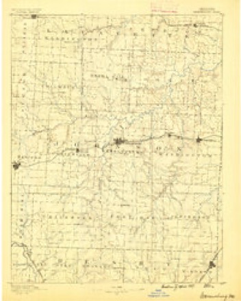
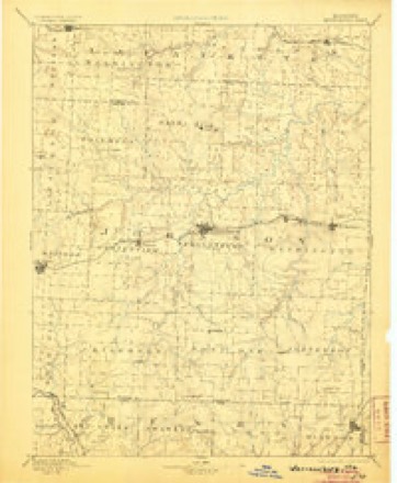
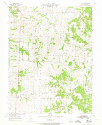
20 topographic sheets cover this place, the earliest surveyed in 1885 and the latest in 1983. It stands in Post Oak Township. It lies in ZIP code area 64093. The Survey maps it on the Cornelia quadrangle.
Topographic sheets covering this place
10 surveys from 20 printed sheetsMatched by testing this settlement's coordinate against the published boundary of every sheet in the United States Geological Survey's historical collection. Each opens the scanned sheet at the Survey.
- 1885 USGS Warrensburg quadrangle1:125000
- 1887 USGS Warrensburg quadrangle1:125000
- 1894 USGS Warrensburg quadrangle1:125000, 5 printings
- 1947 USGS Jefferson City quadrangle1:250000
- 1954 USGS Jefferson City quadrangle1:250000, 2 printings
- 1955 USGS Cornelia quadrangle1:24000, 3 printings
- 1955 USGS Jefferson City quadrangle1:250000, 4 printings
- 1958 USGS Jefferson City quadrangle1:250000
- 1959 USGS Jefferson City quadrangle1:250000
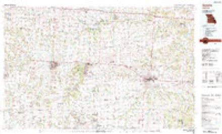
- 1983 USGS Sedalia quadrangle1:100000





In the county-history sources
6,939 words on this townshipThe History of Johnson County, Missouri : Including a Reliable History of the Townships, Cities, and Towns, Together with a Map of the County; a Condensed History of Missouri; the State Constitution; an Abstract of the Most Important Laws; the Physical Features of the County; the Early Settlers and Pioneers; the Political and War History; the Religious and Educational History...statistics and Miscellaneous Matters, Etc., Etc, published 1881 names this settlement in its chapter on Post Oak Township. These are the passages that mention it, exactly as the scans read.
Among the enterprising farmers and public-spirited citizens of Post Oak township is Mr. Abner Grinstead. He is a man of idividuality and gener¬ ous impulses towards all persons with whom he associates. Reared in Missouri, he may well be taken as a fair representative of that character so much admired in public and private life. On February 26, 1829, Mad¬ ison county, Kentucky, he was born ; but his parents removed to Calla¬ way county, Missouri, when he was only eighteen' months old. In about three years thereafter they removed to Pettis county, where most of young Grinstead's boyhood days were spent, during a small portion of which time he attended the district school in his own neighborhood. He was married to Miss Charity A. Wells, daughter of Col. Ransom Wells, November 17, 1853. The names of their children are as follows: Mary Alice, now wife of Paschal Henshaw, living in Vernon county; Jesse Ran¬ som, and Abner Rector. By industry and economy Mr. Grinstead has accumulated a good property. He owns 260 acres of land, 205 of which are under excellent cultivation. An orchard of about three acres of bear¬ ing apple and peach trees, a fine house with barn and adjacent buildings, a flock of fifty to one hundred sheep, sixty head of hogs, 110 acres of corn, a large herd of cattle, and every facility for operating his farm, are among the resources which contribute to his wealth and enjoyment. When Mr. Grinstead first came to this township, he purchased land near the present site of Cornelia, but soon after removed to his present residence. Newton Chrisman entered the eighty acres of government land where Mr. G. now lives. The father of our subject, Jesse C. Grinstead, was born in Decem¬ ber, 1798, near Richmond, Virginia. Although a mere boy he served m the last war with Great Britain, being stationed for a time at Norfolk. He now draws pension as a veteran soldier of that war. The »vife of this aged pioneer is also living with her husband, in Pettis county. It is remarkable how they have withstood the toil and experience of so many years, and still live to see their descendants respected, prosperous and happv.
The worthy subject of this sketch was born Aug. 2, 1799. He married Siny P. Payton, daughter of John Payton, in Wilson county, Tenn., Nov. 13, 1823. For about two years after marriage they resided in Ruther¬ ford county, then removed to Henry county, where they remained about three years, and then returned to Wilson county, where they resided five years. In the spring of 1833, Mr. Warnick, with his family, started on the 16th day of April, for the state of Missouri, and arrived near Lexing¬ ton in May. In the fall of the same year, he made a permanent settle¬ ment near the head waters of Post Oak Creek, about two miles south¬ west of the present village of Cornelia. Soon after settling here, the , Osage Indians committed frequent depredations in the vicinity, and the militia were called out to drive the savages back upon their reservation. There were only three companies in Johnson county, and the captains were, James Warnick, John Ramsey and Capt. McCarty. The Indians were captured and removed beyond the settlements, after which the militia were disbanded. Going to mill in those early days was a diffi¬ cult task, necessitating a journey to Grand River, twenty miles, or to Lexington, forty miles away, and then perhaps being compelled to wait from one to three days for his turn. During his prime of physical man¬ hood, Mr. Warnick not only made an imposing soldierly appearance, but possessed the qualities of a good officer; accordingly at one of the general musters held under the old militia law, he was elected Major of the regi¬ ment, and this was the origin of his present title. Maj. Warnick was called at one time into north Missouri, to aid in driving the troublesome Mormons from the state. The names of his eight children are: Robert N., Nancy Elizabeth, John P., William S., Margaret F., Matilda Jane,. James H. and Siny E. Every.member of this large and highly respected family is still living, the four sons living in the immediate neighborhood of their father, in the north part of Post Oak township. His wife departed this life Dec. 28, 1876, at the ripe age of 71 years. She was in many respects a remarkable woman, having shared with her husband all the privations and toils of a pioneer life, reared a large and useful family, was the sunshine and joy of the household, a kind mother, loving wife, and an exemplarv Christian. Maj. W. has been a consistent member of the Cum¬ berland Presbyterian church for upwards of sixty years, and what is remarkable, his children and their children as soon as they have advanced to maturity, have united with the same Christian denomination. The direct lineal descendants of this worthy pair have reached the number of one hnndred, and what is a source of greatest satisfaction in his declining years, is that they have become among the most respected and worthy citizens of the township and county. Maj. Warnick is now living with his son James H., and although his bodily vigor is somewhat impaired by many years of active labor and usefulness, his mental faclities are still strong, and he enjoys the society of friends and fluently converses upon the scenes of early days in Post Oak and Johnson county. Under his observation, and to a great extent under his care and influence, has grown up the Christian community, the social and political standing of his own township, and the county at large. May the worthy example which this sturdy Christian pioneer character of morethan four score years has left, be the attainment of all who shall follow him. Probably no man has been more thoroughly identified with, or more generally known in the early affairs of Post Oak township, than Maj. Warnick, and no family of greater influence than the Warnick family.
" On petition it is ordered by the court, that a new township be formed off of the south end of Warrensburg township, to be known and designated by the following territorial boundaries, and be called Post Oak township, to-wit: Beginning at the southwest corner of Warrensburg township, then east to the southeast corner of said township, thence north to the middle of township number forty-five, thence west to where said line strikes the west prong of Post Oak, thence down said creek to the mouth of a branch called Briar, thence up the main fork of said branch to where it intersects the present line of Warrensburg and Jackson townships, thence with present line of Warrensburg township to the beginning. The place of holding elections in said township to be at the residence of the widow King. Ordered February 14, 1849." postmaster at Cornelia, was born in Schuyler county, Missouri, February 17, 1856. He followed agricultural pursuits until within the past year. In 1876 he moved to Johnson county and settled at Burnett Station. He lived two years in Henry county, then returned to Johnson county in 1879, and in the fall of 1881 he engaged in the mercantile business at Cornelia, and was appointed postmaster. Mr. Baker is a gentlemanly and efficient post¬ master, also an enterprising business man. He has an interest in the black¬ smith shop of the village. Was married November 28, 1876, in Chariton county, Missouri, to Miss Burellia G. Lewis.
Machine-read from a century-old scan, so expect the errors a machine makes: misspelled names, dropped words, stray characters.
Read the whole chapter on Post Oak Township - it names this place 6 more 6 times.
Fires near this place
38 since 2003Regional context, not property-specific evidence. The federal wildfire occurrence database lists 38 fires within 5 miles of Cornelia between 2003 and 2020, burning about 101 acres in total. 2 started naturally. 1 was recorded as arson. Distance is straight-line from the map coordinates, so a fire counted here may appear on a neighbouring settlement's page as well.
| Reported cause | Fires |
|---|---|
| Missing data/not specified/undetermined | 20 |
| Debris and open burning | 12 |
| Recreation and ceremony | 2 |
| Natural | 2 |
| Equipment and vehicle use | 1 |
| Arson/incendiarism | 1 |
The most recent of them, most recent first, with the day each was reported and the service that recorded it.
| Date | Cause | Size | Reported by | Name on the report |
|---|---|---|---|---|
| 4 August 2003 | Missing data/not specified/undetermined | under an acre | Missouri State Fire Marshal's Office | not named |
| 3 August 2003 | Missing data/not specified/undetermined | 3.0 acres | Missouri State Fire Marshal's Office | not named |
| 22 August 2003 | Natural | 1.0 acres | Missouri State Fire Marshal's Office | not named |
| 21 August 2003 | Natural | 1.0 acres | Missouri State Fire Marshal's Office | not named |
| 18 August 2003 | Recreation and ceremony | 3.0 acres | Missouri State Fire Marshal's Office | not named |
| 13 August 2003 | Missing data/not specified/undetermined | under an acre | Missouri State Fire Marshal's Office | not named |
| 17 June 2003 | Arson/incendiarism | under an acre | Missouri State Fire Marshal's Office | not named |
| 8 May 2018 | Debris and open burning | 2.2 acres | Missouri Department of Conservation | 176994-05130-05082018-1054 |
Settlements close enough to share some of these fires:
Mines and quarries near this place
10 within 5 milesRegional context, not property-specific evidence. The federal mineral resources record lists 10 workings within 5 miles of Cornelia: 7 past producers, 2 producers, 1 unknown. 2 still produce. What was taken out: Stone, Crushed/Broken. Distance is straight-line from the map coordinates, so a quarry counted here may appear on a neighbouring settlement's page as well.
| Where | Site | Commodity | Status | Recorded |
|---|---|---|---|---|
| Leeton Qsuarry | Stone, Crushed/Broken | Unknown | ||
| Marr Quarry & Mill | Stone, Crushed/Broken | Past Producer | ||
| Unknown - Ls. | Stone, Crushed/Broken | Past Producer | ||
| Unknown - Ls. | Stone, Crushed/Broken | Past Producer | ||
| Unknown - Ls. | Stone, Crushed/Broken | Past Producer | ||
| Unknown - Ls. | Stone, Crushed/Broken | Past Producer | ||
| Unknown - Ls. | Stone, Crushed/Broken | Past Producer | ||
| Unknown - Ls. | Stone, Crushed/Broken | Past Producer | ||
| Warrensburg Quarry | Stone, Crushed/Broken | Producer | ||
| Warrensburg Quarry - Plant | Stone, Crushed/Broken | Producer |
Storms near this place
9 since 2009Regional context, not property-specific evidence. The National Weather Service names Cornelia in 9 storm reports between 2009 and 2023: 8 hail, 1 flash flood. No death or injury is recorded in these reports. Each account below is quoted exactly as the forecast office filed it, from the NOAA Storm Events Database, and each date opens the federal record of that event.
| When | Event | Place named | Harm | What the report says |
|---|---|---|---|---|
| August 2017 | Flash Flood | Cornelia | - | Water was reported over the road south of Warrensburg on HWY 13, about 1/4 mile south of SE MO PP Road. |
| May 2016 | Hail | Cornelia | - | The USAF observer at Whiteman AFB reported tennis ball sized hail. |
| April 2023 | Hail | Cornelia | - | no account filed |
| March 2018 | Hail | Cornelia | - | no account filed |
| December 2017 | Hail | Cornelia | - | no account filed |
| October 2014 | Hail | Cornelia | - | no account filed |
| May 2012 | Hail | Cornelia | - | no account filed |
| May 2010 | Hail | Cornelia | - | no account filed |
| June 2009 | Hail | Cornelia | - | no account filed |
Nearest settlements
The eight closest, with where each one stands in the county. Distances are straight-line, computed from the Geographic Names Information System coordinates.
| Map | Place | Distance | Sheets |
|---|---|---|---|
| Bowmansville | 4.5 miles | 20 | |
| Leeton | 4.8 miles | 19 | |
| Post Oak | 5.2 miles | 19 | |
| Pertle Springs | 6.2 miles | 20 | |
| Old Chilhowee | 6.4 miles | 19 | |
| Bristle Ridge | 6.5 miles | 20 | |
| Burtville | 6.8 miles | 19 | |
| Henrietta | 7.0 miles | 19 |
Provenance
This settlement is recorded in the Geographic Names Information System as feature 729726. The sheet list is computed by point-in-boundary test against the United States Geological Survey's historical topographic inventory. Both are works of the United States government and carry no copyright under 17 U.S.C. 105.
Wildfire. Short, Karen C. 2022. Spatial wildfire occurrence data for the United States, 1992-2020 [FPA_FOD_20221014]. 6th Edition. Fort Collins, CO: Forest Service Research Data Archive. https://doi.org/10.2737/RDS-2013-0009.6 Collected with United States Government funding and usable without additional permissions or fees.
Mines and quarries. USGS Mineral Resources Data System (MRDS) https://mrdata.usgs.gov/mrds/ A work of the United States government, no copyright under 17 U.S.C. 105.
Storms. NOAA National Centers for Environmental Information, Storm Events Database https://www.ncei.noaa.gov/stormevents/ A work of the United States government, no copyright under 17 U.S.C. 105. Narratives are quoted verbatim from the National Weather Service report and are not edited or summarised.