 Block
Craig, Missouri
13 topographic sheets cover this place, the earliest surveyed in 1920 and the latest in 1986. It stands in Union Township. It lies in ZIP code area 64437. The Survey maps it on the Craig quadrangle. 105 people lived here at the 2020 count. It stands 869 feet above sea level.
Population over time
2 figuresCraig fell from 248 to 105 between 2010 and 2020. These are the recorded population figures Wikidata holds for this place, reached through the Geographic Names Information System number this page is keyed on rather than by name, so they belong to this place and not to another of the same name. Most are census counts, but not all are: an early figure may be a founding or settlement estimate, and an estimate published within five years of a census is left out. The change column is computed, and is left blank where more than 20 years separate a figure from the one before it, because a gap that long is not a change between two counts.
| Year | People | Change |
|---|---|---|
| 2010 | 248 | |
| 2020 | 105 | -143 (-58%) |
Topographic sheets covering this place
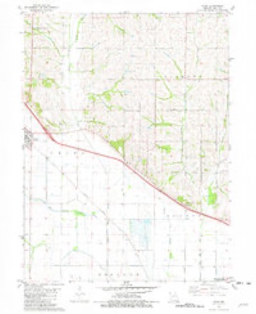
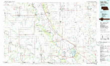
6 surveys from 13 printed sheetsMatched by testing this settlement's coordinate against the published boundary of every sheet in the United States Geological Survey's historical collection. Each opens the scanned sheet at the Survey.
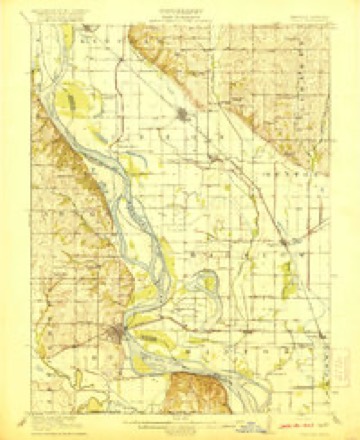
- 1920 USGS Craig quadrangle1:62500, 5 printings
- 1955 USGS Nebraska City quadrangle1:250000, 3 printings
- 1957 USGS Nebraska City quadrangle1:250000
- 1958 USGS Nebraska City quadrangle1:250000
- 1981 USGS Craig quadrangle1:24000
- 1986 USGS Falls City quadrangle1:100000, 2 printings
In the county-history sources
4,352 words on this townshipHistory of Holt County, Missouri : from the Time of the Platte Purchase to the End of the Year 1916 : Preceded by a Short History of Missouri : Supplemented by Biographical Sketches of Prominent Citizens, published 1917 names this settlement in its chapter on Union Township. These are the passages that mention it, exactly as the scans read.
The original settlers of the grove were W. A. and Abraham Sharpe, who came from Bracken County, Kentucky, in the fall of 1841, and settled in their present homes in that locality. John Wise also came in the same year. Jacob Rugh came from Pennsylvania, in 1842, and settled in Sharpe's Grove. In the same year came Joseph Scott, Daniel Hoghan, and J. Kelzi. Daniel David, of Indiana, later a prominent citizen of the town of Oregon, and Charles David, his son, once a merchant of Craig, settled in what is now Union Township, in 1843. In the same year came Joseph Scott, Samuel Thompson and A. McDonald, who died many years ago. They also were among the earliest of those who settled in the grove.
Passage source: History of Holt County, Missouri : from the Time of the Platte Purchase to the End of the Year 1916 : Preceded by a Short History of Missouri : Supplemented by Biographical Sketches of Prominent Citizens, published 1917.
The first church erected within the present limits of Union Township was built by the Christians, in 1877. It is a frame building 40x60 feet in extent. It stands near the northwest corner of the southwest quarter of section 35, about four miles south of the town of Craig, and within one-half mile of the southern boundary of the township. It is named, in honor of Joshua Kelso, "The Kelso Church." The two acres of land attached to this church was deeded to the same by Calvin Guilliams. The congregation was organized by Elder Kelsey. In 1879 the Methodist Episcopal Church, South, was permitted to occupy the building when not required for the services of the owners of the same.
Passage source: History of Holt County, Missouri : from the Time of the Platte Purchase to the End of the Year 1916 : Preceded by a Short History of Missouri : Supplemented by Biographical Sketches of Prominent Citizens, published 1917.
Three miles west of Craig, the Evangelical Lutheran Church, a frame building, 22x36 feet in extent, was erected in 1877, at a cost of $400. The congregation was organized with ten members. The first minister of this church was Rev. C. F. Scholz. He effected the organization and remained in charge till November, 1881, when he was succeeded by Rev. C. H. Leutsch.
Passage source: History of Holt County, Missouri : from the Time of the Platte Purchase to the End of the Year 1916 : Preceded by a Short History of Missouri : Supplemented by Biographical Sketches of Prominent Citizens, published 1917.
Machine-read from a century-old scan, so expect the errors a machine makes: misspelled names, dropped words, stray characters.
Read the whole chapter on Union Township - it names this place 33 more 33 times.
Fires near this place
1 since 2019Regional context, not property-specific evidence. The federal wildfire occurrence database lists 1 fire within 5 miles of Craig in 2019, burning under an acre in total. None started naturally. None was recorded as arson. Distance is straight-line from the map coordinates, so a fire counted here may appear on a neighbouring settlement's page as well.
| Reported cause | Fires |
|---|---|
| Missing data/not specified/undetermined | 1 |
The most recent of them, most recent first, with the day each was reported and the service that recorded it.
| Date | Cause | Size | Reported by | Name on the report |
|---|---|---|---|---|
| 8 June 2019 | Missing data/not specified/undetermined | under an acre | Missouri Department of Conservation | 179099-00307-06082019-0157 |
Mines and quarries near this place
1 within 5 milesRegional context, not property-specific evidence. The federal mineral resources record lists 1 working within 5 miles of Craig: 1 past producer. None of them still produces. What was taken out: Sand and Gravel, Construction. Distance is straight-line from the map coordinates, so a quarry counted here may appear on a neighbouring settlement's page as well.
| Where | Site | Commodity | Status | Recorded |
|---|---|---|---|---|
| Unk | Sand and Gravel, Construction | Past Producer |
Storms near this place
30 since 1999Regional context, not property-specific evidence. The National Weather Service names Craig in 30 storm reports between 1999 and 2024: 14 hail, 11 thunderstorm wind, 2 tornado, 2 flash flood. No death or injury is recorded in these reports. Each account below is quoted exactly as the forecast office filed it, from the NOAA Storm Events Database, and each date opens the federal record of that event.
| When | Event | Place named | Harm | What the report says |
|---|---|---|---|---|
| March 2019 | Flash Flood | Craig | $100,000 | A levee near Craig, MO was compromised and water rushed into the town of Craig. The town was inundated under several inches of water for several days. This incident was part of the larger massive and widespread flooding along the Missouri River due to snow melt and heavy rain in the Northern Plains. Note: The dollar value assigned to this incident is likely inaccurate due to the full extent of the impacts not being known. |
| May 2004 | Tornado (F1) | Craig | $5,000 | This F1 tornado damaged one barn and crops and was the first tornado of the day from this supercell thunderstorm. |
| June 2008 | Tornado (EF0) | Craig | $2,000 | An EF0 tornado touched down 1 mile west of Craig at 1855CST, and then moved northeast and dissipated 1.3 miles north of Craig at 1858CST. The Rear Flank Downdraft associated with the parrent super cell thunderstorm, blew two tractor trailers over on Interstate 29 near mile marker 92. One truck driver had to be extricated from the truck, but no injuries were reported. |
| May 2004 | Hail | Craig | $2,000 | no account filed |
| June 2004 | Thunderstorm Wind | Craig | $1,000 | 10 inch tree limbs down on shed. |
| April 2024 | Hail | Craig | - | Quarter size hail reported along Hwy 59 near the Holt and Atchison County Line. |
| October 2024 | Thunderstorm Wind | Craig | - | Downed power lines and power outages in the Craig area. |
| October 2024 | Thunderstorm Wind | Craig | - | Portions of school building torn off. |
| October 2024 | Thunderstorm Wind | Craig | - | Social media photos of multiple buildings damaged on business property in Craig. Portions of buildings and other loose property fell onto or were blown into and damaged farm vehicles and equipment. |
| October 2024 | Thunderstorm Wind | Craig | - | Several reports of downed power poles in northern Holt County, with widespread outages. |
| October 2024 | Thunderstorm Wind | Craig | - | Report of a semi overturned on I-29 near Craig. |
| May 2024 | Thunderstorm Wind | Craig | - | Estimated 60 mph wind gusts along Interstate 29 northwest of Mound City. Law enforcement also reports a tractor-trailer was blown over. |
| July 2021 | Thunderstorm Wind | Craig | - | Several large tree limbs were down. Power poles were down. Grain bins were toppled, and an equipment shed collapsed. Several vehicles were also damaged. |
| June 2021 | Flash Flood | Craig | - | Interstate 29 was closed between mile marker 84 and mile marker 92 due to water running over the road. |
| July 2016 | Thunderstorm Wind | Craig | - | Large trees were reported down in the city of Craig. City was without power for a period of time. |
| June 2011 | Thunderstorm Wind | Craig | - | Trees and power lines were reported down. Thunderstorm wind gusts were estimated up to 60 mph. |
| June 2008 | Flood | Craig | - | Highway 111 west of Craig was reported closed due to a levee break. |
| June 2004 | Thunderstorm Wind | Craig | - | 6 inch tree limbs reported down. |
| July 2015 | Hail | Craig | - | no account filed |
| April 2014 | Hail | Craig | - | no account filed |
| April 2011 | Hail | Craig | - | no account filed |
| April 2010 | Hail | Craig | - | no account filed |
| June 2009 | Hail | Craig | - | no account filed |
| June 2009 | Hail | Craig | - | no account filed |
| May 2006 | Hail | Craig | - | no account filed |
| May 2004 | Hail | Craig | - | no account filed |
| May 2004 | Hail | Craig | - | no account filed |
| April 2003 | Hail | Craig | - | no account filed |
| May 2002 | Hail | Craig | - | no account filed |
| May 1999 | Hail | Craig | - | no account filed |
Nearest settlements
The eight closest, with where each one stands in the county. Distances are straight-line, computed from the Geographic Names Information System coordinates.
| Map | Place | Distance | Sheets |
|---|---|---|---|
| Corning | 5.7 miles | 14 | |
| Bigelow | 7.2 miles | 13 | |
| Big Lake | 7.9 miles | 13 | |
| Mound City | 8.6 miles | 11 | |
| Fortescue | 10.2 miles | 13 | |
| Napier | 11.7 miles | 13 | |
| Kings Grove (historical) | 13.5 miles | 11 | |
| Campbell Corner | 15.6 miles | 11 |
Elsewhere
Matched on this settlement's Geographic Names Information System number rather than its name, so it cannot be a different place of the same name in another state.
| Wikipedia article on Craig | An encyclopaedic summary. Its text is share-alike, so it is linked here rather than copied. |
| Wikidata item Q964685 | The structured record the population and elevation above come from. Public domain (CC0). |
Provenance
This settlement is recorded in the Geographic Names Information System as feature 716455. The sheet list is computed by point-in-boundary test against the United States Geological Survey's historical topographic inventory. Both are works of the United States government and carry no copyright under 17 U.S.C. 105.
Wildfire. Short, Karen C. 2022. Spatial wildfire occurrence data for the United States, 1992-2020 [FPA_FOD_20221014]. 6th Edition. Fort Collins, CO: Forest Service Research Data Archive. https://doi.org/10.2737/RDS-2013-0009.6 Collected with United States Government funding and usable without additional permissions or fees.
Mines and quarries. USGS Mineral Resources Data System (MRDS) https://mrdata.usgs.gov/mrds/ A work of the United States government, no copyright under 17 U.S.C. 105.
Storms. NOAA National Centers for Environmental Information, Storm Events Database https://www.ncei.noaa.gov/stormevents/ A work of the United States government, no copyright under 17 U.S.C. 105. Narratives are quoted verbatim from the National Weather Service report and are not edited or summarised.