 Block
Corning, Missouri
14 topographic sheets cover this place, the earliest surveyed in 1920 and the latest in 1986. It stands in Lincoln Township. It lies in ZIP code area 64437. The Survey maps it on the Corning quadrangle. 3 people lived here at the 2020 count. It stands 876 feet above sea level.
On record in Corning
Buildings and businesses the archive holds for this place. Each opens its own page, with the source record it came from.
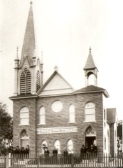
On the National Register 1 record
Population over time
2 figuresCorning fell from 15 to 3 between 2010 and 2020. These are the recorded population figures Wikidata holds for this place, reached through the Geographic Names Information System number this page is keyed on rather than by name, so they belong to this place and not to another of the same name. Most are census counts, but not all are: an early figure may be a founding or settlement estimate, and an estimate published within five years of a census is left out. The change column is computed, and is left blank where more than 20 years separate a figure from the one before it, because a gap that long is not a change between two counts.
| Year | People | Change |
|---|---|---|
| 2010 | 15 | |
| 2020 | 3 | -12 (-80%) |
Topographic sheets covering this place
6 surveys from 14 printed sheetsMatched by testing this settlement's coordinate against the published boundary of every sheet in the United States Geological Survey's historical collection. Each opens the scanned sheet at the Survey.
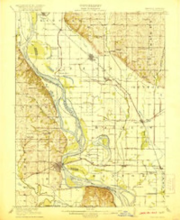
- 1920 USGS Craig quadrangle1:62500, 5 printings
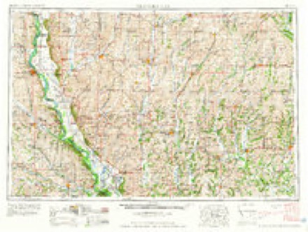
- 1955 USGS Nebraska City quadrangle1:250000, 3 printings
- 1957 USGS Nebraska City quadrangle1:250000
- 1958 USGS Nebraska City quadrangle1:250000
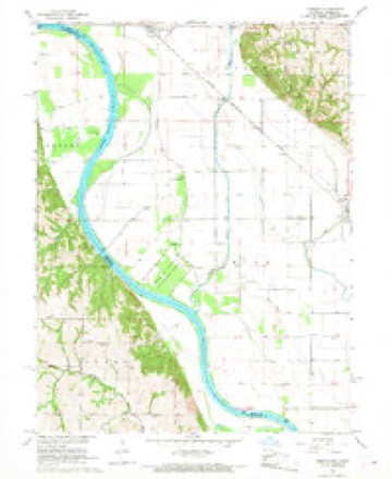
- 1966 USGS Corning quadrangle1:24000, 2 printings
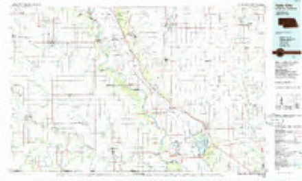
- 1986 USGS Falls City quadrangle1:100000, 2 printings
In the county-history sources
2,025 words on this townshipHistory of Holt County, Missouri : from the Time of the Platte Purchase to the End of the Year 1916 : Preceded by a Short History of Missouri : Supplemented by Biographical Sketches of Prominent Citizens, published 1917 names this settlement in its chapter on Lincoln Township. These are the passages that mention it, exactly as the scans read.
The first attempt to start a town in this part of the county was inaugurated by Henry Hemme, another Hanoverian, who settled in the country in 1844. This settlement, which was known as Hemme's Landing, was about two miles west of the site of the present town of Corning. Its site is now within the limits of the State of Nebraska, and the Missouri River flows within three-fourths of a mile of Corning, and considerably to the eastward of the spot where the old town once stood. At^ne time Hemme's Landing was one of the most important trading points between St. Joseph and Council Bluffs. The first merchant who sold goods at the landing was David Greer, who commenced business there in 1845. He was shortly after succeeded by Henry Hemme, who in 1847, gave place to Vernile Thompson. In 1848, Robert Hawke bought out Thompson.
Passage source: History of Holt County, Missouri : from the Time of the Platte Purchase to the End of the Year 1916 : Preceded by a Short History of Missouri : Supplemented by Biographical Sketches of Prominent Citizens, published 1917.
This town, the most northern of Holt County, and less than one mile south of the line of Atchison County, was laid out in the fall of 1868. Its original site occupied the northwest quarter of the northeast quarter of section 30, township 63, range 40. Martin's Addition, adjoining on the north, was laid out in the spring of 1869, by Horace Martin, of Crawford County, Ohio, a gentleman of distinguished scientific attainments, and long and honored member and colaborator of the Smithsonian Institute of Washington, D. C., and observer in the employ of the United States Signal Service. Mr. Martin was one of the earliest settlers of the town of Corning, having settled there in the month of October, 1868. The site of the town, which is in the bottom, about two miles westward of the bluff, is 893 feet above the level of the sea. It is 51 miles from St. Joseph, and 77 miles from Council Bluffs. During the period of the flood of 1881, Corning suffered severely from the overflow.
Passage source: History of Holt County, Missouri : from the Time of the Platte Purchase to the End of the Year 1916 : Preceded by a Short History of Missouri : Supplemented by Biographical Sketches of Prominent Citizens, published 1917.
The German Reform Church, of Corning, a small frame building, was erected in 1878, at a cost of $900. Rev. T. Miller organized the church with a large membership. This included, with others, Peter Christen and wife, Fred Scheele and wife, Mrs. Roselius, William Bertram and wife, and William Ahlers and wife.
Passage source: History of Holt County, Missouri : from the Time of the Platte Purchase to the End of the Year 1916 : Preceded by a Short History of Missouri : Supplemented by Biographical Sketches of Prominent Citizens, published 1917.
Machine-read from a century-old scan, so expect the errors a machine makes: misspelled names, dropped words, stray characters.
Read the whole chapter on Lincoln Township - it names this place 15 more 15 times.
Fires near this place
10 since 2009Regional context, not property-specific evidence. The federal wildfire occurrence database lists 10 fires within 5 miles of Corning between 2009 and 2020, burning about 85 acres in total. None started naturally. None was recorded as arson. Distance is straight-line from the map coordinates, so a fire counted here may appear on a neighbouring settlement's page as well.
| Reported cause | Fires |
|---|---|
| Missing data/not specified/undetermined | 5 |
| Equipment and vehicle use | 3 |
| Debris and open burning | 2 |
The most recent of them, most recent first, with the day each was reported and the service that recorded it.
| Date | Cause | Size | Reported by | Name on the report |
|---|---|---|---|---|
| 26 September 2020 | Equipment and vehicle use | 8.2 acres | Missouri Department of Conservation | 230834-00307-09262020-1540 |
| 16 June 2020 | Missing data/not specified/undetermined | 1.5 acres | Missouri Department of Conservation | 210547-00307-06162020-1655 |
| 5 May 2018 | Debris and open burning | under an acre | Missouri Department of Conservation | 177633-00307-05052018-0258 |
| 20 April 2019 | Missing data/not specified/undetermined | 26 acres | Missouri Department of Conservation | 179095-00307-04202019-2346 |
| 1 April 2020 | Missing data/not specified/undetermined | 4.5 acres | Missouri Department of Conservation | 190359-00307-04012020-1735 |
| 31 March 2020 | Missing data/not specified/undetermined | 25 acres | Missouri Department of Conservation | 190358-00307-03312020-1700 |
| 1 December 2009 | Debris and open burning | 1.0 acres | Nebraska Forest Service | not named |
| 7 November 2018 | Equipment and vehicle use | 13 acres | Missouri Department of Conservation | 178133-00307-11072018-1854 |
Mines and quarries near this place
2 within 5 milesRegional context, not property-specific evidence. The federal mineral resources record lists 2 workings within 5 miles of Corning: 2 past producers. None of them still produces. What was taken out: Stone, Crushed/Broken, Sand and Gravel, Construction. Distance is straight-line from the map coordinates, so a quarry counted here may appear on a neighbouring settlement's page as well.
Storms near this place
13 since 1994Regional context, not property-specific evidence. The National Weather Service names Corning in 13 storm reports between 1994 and 2024: 6 hail, 4 thunderstorm wind, 2 flood, 1 tornado. No death or injury is recorded in these reports. Each account below is quoted exactly as the forecast office filed it, from the NOAA Storm Events Database, and each date opens the federal record of that event.
| When | Event | Place named | Harm | What the report says |
|---|---|---|---|---|
| June 2008 | Tornado (EF1) | Corning | $250,000 | This tornado developed in Richardson County, Nebraska, and tracked northeast crossing the Missouri River into Holt County in Missouri(see Storm Data for Nebraska, East, for more information on the beginning portion of this tornado in Nebraska)at 1849CST, 3.45 miles southwest of Corning. In Missouri, the most significant damage, rated EF1, was to several barns and out buildings, one residence, and two destroyed trailers. The tornado crossed into Atchison County at 1859CST, around 3.6 miles east of Corning. |
| March 2019 | Flood | Corning | $100,000 | Once the Missouri River started flooding on March 9, it remained in flood through the remainder of the month. The gauge in Rulo, Nebraska - along the west bank of the Missouri River - reached 28.14 feet on March 20 (preliminarily a new record). The flooding was caused by several rounds of heavy snow across the Northern Plains through the winter months, followed by a rapid warm-up and several days of heavy rain. The Missouri River Basin across the Northern Plains flooded with catastrophic consequences as numerous dams and levees failed. As the water flowed into the Missouri River upstream of Holt County, the river swelled and ultimately overwhelmed the levees along the river. Most the worst damage occurred near Craig, when a nearby levee failed and inundated the city with several inches of water. Local fields were also submerged, which delayed the growing season in the region. Several roads were washed away across Holt County, and I-29 from St. Joseph northward to the Iowa/Missouri border was closed until mid May. Note: The dollar valued assigned to this event is likely inaccurate as a full tally of the extent of the physical damages is unknown. The Missouri River remained in flood through the rest of the month, into April. |
| June 1994 | Thunderstorm Wind | Corning | $50,000 | Severe storms heavily damaged crops with tennis ball-size hail and downed trees and power lines. |
| April 1999 | Thunderstorm Wind | Corning | $25,000 | Semi truck blown over on I-29. |
| June 1994 | Hail | Corning | $5,000 | Severe storms heavily damaged crops with tennis ball-size hail and downed trees and power lines. |
| April 2024 | Hail | Corning | - | Half dollar size hail was reported in Corning. |
| May 2019 | Flood | Corning | - | Heavy spring rains caused ongoing flooding along the Missouri River to Continue through the month. Some locations along the Missouri River experienced major flooding at times during the month. Damage estimates from roads washed out and crop damage are unknown at this time. |
| July 2016 | Thunderstorm Wind | Corning | - | An 18-wheel rig flipped onto its side near Corning on Interstate 29. The interstate was closed to clean up the incident. |
| May 2001 | Thunderstorm Wind | Corning | - | Public reported large trees down. |
| June 2010 | Hail | Corning | - | no account filed |
| March 2009 | Hail | Corning | - | no account filed |
| February 2000 | Hail | Corning | - | no account filed |
| May 1996 | Hail | Corning | - | no account filed |
Nearest settlements
The eight closest, with where each one stands in the county. Distances are straight-line, computed from the Geographic Names Information System coordinates.
| Map | Place | Distance | Sheets |
|---|---|---|---|
| Craig | 5.7 miles | 13 | |
| Big Lake | 12.7 miles | 13 | |
| Bigelow | 12.9 miles | 13 | |
| Mound City | 14.3 miles | 11 | |
| Fortescue | 15.3 miles | 13 | |
| Napier | 17.3 miles | 13 | |
| Kings Grove (historical) | 17.5 miles | 11 | |
| Maitland | 20.4 miles | 11 |
Elsewhere
Matched on this settlement's Geographic Names Information System number rather than its name, so it cannot be a different place of the same name in another state.
| Wikipedia article on Corning | An encyclopaedic summary. Its text is share-alike, so it is linked here rather than copied. |
| Wikidata item Q954633 | The structured record the population and elevation above come from. Public domain (CC0). |
Provenance
This settlement is recorded in the Geographic Names Information System as feature 716327. The sheet list is computed by point-in-boundary test against the United States Geological Survey's historical topographic inventory. Both are works of the United States government and carry no copyright under 17 U.S.C. 105.
Wildfire. Short, Karen C. 2022. Spatial wildfire occurrence data for the United States, 1992-2020 [FPA_FOD_20221014]. 6th Edition. Fort Collins, CO: Forest Service Research Data Archive. https://doi.org/10.2737/RDS-2013-0009.6 Collected with United States Government funding and usable without additional permissions or fees.
Mines and quarries. USGS Mineral Resources Data System (MRDS) https://mrdata.usgs.gov/mrds/ A work of the United States government, no copyright under 17 U.S.C. 105.
Storms. NOAA National Centers for Environmental Information, Storm Events Database https://www.ncei.noaa.gov/stormevents/ A work of the United States government, no copyright under 17 U.S.C. 105. Narratives are quoted verbatim from the National Weather Service report and are not edited or summarised.