 Block
Ellsinore, Missouri
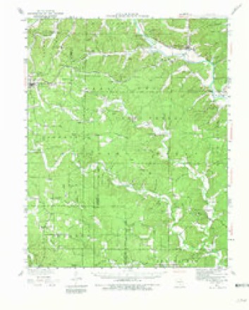
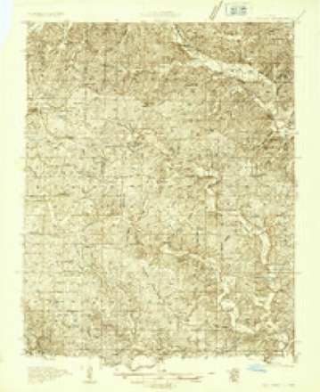
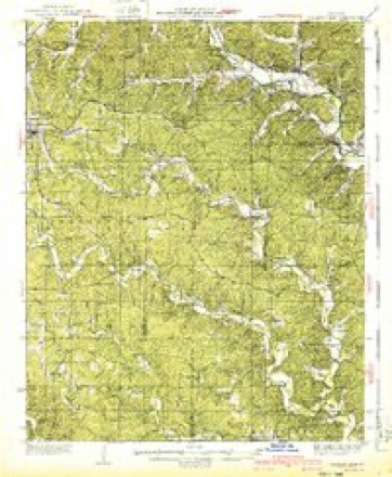
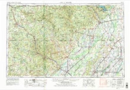
13 topographic sheets cover this place, the earliest surveyed in 1934 and the latest in 1983. It stands in Johnson Township. It lies in ZIP code area 63937. The Survey maps it on the Ellsinore quadrangle. 416 people lived here at the 2020 count. It stands 745 feet above sea level.
Research this city
Population over time
2 figuresEllsinore fell from 446 to 416 between 2010 and 2020. These are the recorded population figures Wikidata holds for this place, reached through the Geographic Names Information System number this page is keyed on rather than by name, so they belong to this place and not to another of the same name. Most are census counts, but not all are: an early figure may be a founding or settlement estimate, and an estimate published within five years of a census is left out. The change column is computed, and is left blank where more than 20 years separate a figure from the one before it, because a gap that long is not a change between two counts.
| Year | People | Change |
|---|---|---|
| 2010 | 446 | |
| 2020 | 416 | -30 (-7%) |
Topographic sheets covering this place
8 surveys from 13 printed sheetsMatched by testing this settlement's coordinate against the published boundary of every sheet in the United States Geological Survey's historical collection. Each opens the scanned sheet at the Survey.
- 1934 USGS Williamsville quadrangle1:62500, 3 printings
- 1934 USGS Williamsville quadrangle1:48000
- 1940 USGS Williamsville quadrangle1:62500, 2 printings
- 1957 USGS Poplar Bluff quadrangle1:250000, 3 printings
- 1959 USGS Poplar Bluff quadrangle1:250000
- 1960 USGS Poplar Bluff quadrangle1:250000
- 1980 USGS Ellsinore quadrangle1:24000
- 1983 USGS Poplar Bluff quadrangle1:100000
Fires near this place
55 since 1992Regional context, not property-specific evidence. The federal wildfire occurrence database lists 55 fires within 5 miles of Ellsinore between 1992 and 2020, burning about 1,744 acres in total. 1 started naturally. 14 were recorded as arson. Distance is straight-line from the map coordinates, so a fire counted here may appear on a neighbouring settlement's page as well.
| Reported cause | Fires |
|---|---|
| Debris and open burning | 21 |
| Arson/incendiarism | 14 |
| Missing data/not specified/undetermined | 9 |
| Equipment and vehicle use | 7 |
| Natural | 1 |
| Recreation and ceremony | 1 |
| Smoking | 1 |
| Power generation/transmission/distribution | 1 |
The most recent of them, most recent first, with the day each was reported and the service that recorded it.
| Date | Cause | Size | Reported by | Name on the report |
|---|---|---|---|---|
| 4 September 1999 | Equipment and vehicle use | 4.0 acres | Mark Twain National Forest | OTIS |
| 26 September 2004 | Debris and open burning | 1.0 acres | Mark Twain National Forest | LOG CABIN FIRE |
| 21 September 2000 | Debris and open burning | 1.0 acres | Missouri Department of Conservation | not named |
| 19 September 2000 | Missing data/not specified/undetermined | 5.0 acres | Mark Twain National Forest | DD FIRE |
| 28 August 2007 | Arson/incendiarism | 102 acres | Mark Twain National Forest | SOUTHFORK |
| 19 August 2006 | Debris and open burning | 1.5 acres | Mark Twain National Forest | APRILS FOOLS 2 |
| 19 August 1993 | Arson/incendiarism | 2.0 acres | Missouri Department of Conservation | not named |
| 17 August 2000 | Missing data/not specified/undetermined | 40 acres | Missouri Department of Conservation | not named |
Settlements close enough to share some of these fires:
Mines and quarries near this place
10 of 14 shownRegional context, not property-specific evidence. The federal mineral resources record lists 14 workings within 5 miles of Ellsinore: 9 past producers, 3 prospects, 1 unknown, 1 occurrence. None of them still produces. What was taken out: Iron. Distance is straight-line from the map coordinates, so a quarry counted here may appear on a neighbouring settlement's page as well.
| Where | Site | Commodity | Status | Recorded |
|---|---|---|---|---|
| Crescent Mine | Iron | Past Producer | ||
| Crommer & Mcpherson Bank | Iron | Prospect | ||
| Devils Kitchen Mine | Iron | Past Producer | ||
| Hutchinson Mine | Iron | Past Producer | ||
| Kime & Hartley Prospect | Iron | Prospect | ||
| Malin Mine | Iron | Past Producer | ||
| Moreland Bank | Iron | Occurrence | ||
| Orchard Mine Pit # 1 | Iron | Past Producer | ||
| Orchard Mine Pit # 2 | Iron | Past Producer | ||
| Orchard Mine Pit # 5 | Iron | Past Producer |
Storms near this place
60 of 63 shownRegional context, not property-specific evidence. The National Weather Service names Ellsinore in 63 storm reports between 1994 and 2024: 24 hail, 14 thunderstorm wind, 10 flood, 5 flash flood. The reports record 1 death and 5 injuries. Each account below is quoted exactly as the forecast office filed it, from the NOAA Storm Events Database, and each date opens the federal record of that event.
| When | Event | Place named | Harm | What the report says |
|---|---|---|---|---|
| March 2006 | Flash Flood | Ellsinore | 1 killed, $25,000 | Flash flooding of Ten Mile Creek caused the death of a 57-year-old man. The man drowned when the flat bed truck he was driving was swept off the road as he was attempting to cross the creek. The incident occurred on a private gravel road off Highway B. The truck was swept downstream about 50 yards and overturned in the creek, resting upside down. The body was recovered still in the truck. The incident was estimated to have happened around 6 A.M. CST when he attempted to drive across the creek to a hog barn. |
| April 2004 | Tornado (F2) | Ellsinore | 5 hurt, $600,000 | The tornado touched down about one mile south of the intersection of U.S. Highway 60 and County Highway 233 in eastern Carter County. The tornado tracked north-northeast, passing only about a mile west of the town of Ellsinore. The tornado damage path ended on County Road 365 less than one half mile before reaching the Wayne County line. Peak winds in the tornado were estimated at 150 MPH. Most of the injured were in a mobile home on the north side of U.S. Highway 60. Their mobile home was picked up and thrown into some trees. One person was critically injured. The critically injured person was paralyzed when her back and neck was broken, and she was airlifted to a St. Louis area hospital. Another person received a broken arm, and most of the remaining injuries were scrapes and cuts. The tornado destroyed a total of three mobile homes, a storage facility, and numerous sheds. Two homes and one business were severely damaged. Numerous vehicles were damaged. |
| April 2011 | Flash Flood | Ellsinore | $60,000 | Five feet of water was running across the intersection of Highway H and County Road 327. Washed out trees were in the roadway. Sections of County Road 327 were washed out. |
| May 2017 | Flash Flood | Ellsinore | $50,000 | Flash flooding of two creeks in Ellsinore reached into some homes. In Van Buren, up to four inches of water was observed flowing across a street. |
| April 2017 | Flash Flood | Ellsinore | $50,000 | Flash flooding of creeks was reported throughout the county. Emergency management officials conducted evacuations of residents near creeks in parts of Fremont. Numerous water rescues were conducted, especially from around Van Buren to Fremont. About five miles south of Ellsinore, Highway K was closed north of Highway B due to flooding. |
| June 1995 | Tornado (F0) | Ellsinore | $40,000 | A tornado downed trees along N Highway. |
| March 1996 | Hail | Ellsinore | $30,000 | no account filed |
| July 2023 | Lightning | Ellsinore | $20,000 | Lightning set a barn on fire. |
| March 1996 | Thunderstorm Wind | Ellsinore | $20,000 | no account filed |
| April 2023 | Tornado (EF0) | Ellsinore | $10,000 | This was the start of the tornado track as determined by an aerial survey from the USDA Forest Service. Trees were uprooted. Peak winds were estimated near 85 mph in this very short section of track in Carter County. The tornado quickly entered Wayne County in a highly forested area. |
| March 2020 | Tornado (EF0) | Ellsinore | $5,000 | A few trees and tree limbs were blown down along the brief track that crossed Highway B. Peak winds were estimated near 75 mph based on a NWS damage survey. |
| June 2019 | Flood | Ellsinore | $5,000 | Four to five inches of water was over the roadway at the intersection of FF Highway and County Road 327. Flooding was reported in Van Buren. |
| July 2016 | Thunderstorm Wind | Ellsinore | $5,000 | Some trees were blown down around the Ellsinore area. |
| April 2011 | Thunderstorm Wind | Ellsinore | $5,000 | A feeder line between Ellsinore and Van Buren was knocked down. |
| October 2010 | Thunderstorm Wind | Ellsinore | $5,000 | Trees were down across a few county roads at various locations in the eastern part of Carter County. |
| May 2011 | Thunderstorm Wind | Ellsinore | $3,000 | Small trees were knocked down. |
| January 2000 | Thunderstorm Wind | Ellsinore | $3,000 | Trees were blown down. |
| July 2022 | Thunderstorm Wind | Ellsinore | $2,000 | Two trees were down near County Road 327 and Highway H. |
| June 2019 | Thunderstorm Wind | Ellsinore | $2,000 | A couple of trees were down on Highway B between Highway 21 and U.S. Highway 60. |
| August 2011 | Thunderstorm Wind | Ellsinore | $2,000 | A couple of small trees were blown down. |
| August 2024 | Thunderstorm Wind | Ellsinore | $1,000 | Media relayed a report of a tree blown down north of Ellsinore by downdraft winds. A personal weather station measured a 57 mph wind gust. |
| September 2022 | Hail | Ellsinore | $1,000 | Quarter-size hail was reported just west of Ellsinore. Half-dollar size hail broke a house window in Ellsinore. |
| August 2021 | Thunderstorm Wind | Ellsinore | $1,000 | A tree was down on V Highway just outside Ellsinore. A car crashed into the downed tree. |
| April 1994 | Thunderstorm Wind | Ellsinore | $500 | The county sheriff reported the tops of trees blown off. |
| April 2021 | Hail | Ellsinore | - | Hail covered the ground. |
| September 2020 | Flood | Ellsinore | - | Emergency management personnel submitted pictures of street flooding in Van Buren and water flowing over a low water crossing near Van Buren. A city street in Ellsinore was closed at a low water crossing bridge due to flooding. |
| November 2019 | Flood | Ellsinore | - | Three low water crossings were impassable. The storm total rainfall was 3.13 inches at Ellsinore. |
| March 2018 | Hail | Ellsinore | - | Dime-sized hail was reported at the junction of U.S. Highway 60 and State Route 21, and then east to Ellsinore. |
| May 2018 | Funnel Cloud | Ellsinore | - | The funnel cloud was reported by law enforcement northwest of town. |
| March 2017 | Hail | Ellsinore | - | Golf-ball size hail fell from a supercell thunderstorm that produced the funnel cloud near Hunter. |
| March 2017 | Flood | Ellsinore | - | Nearly a foot of water was over U.S. Highway 60 at Ellsinore. Water was reported over a few roads in Van Buren and Ellsinore, as well as a few rural county roads. |
| May 2016 | Thunderstorm Wind | Ellsinore | - | A trained spotter reported winds gusted to 60 mph. |
| June 2016 | Flood | Ellsinore | - | A trained spotter reported 3.25 inches of rain fell in 90 minutes. Creeks were out of their banks. |
| September 2016 | Flood | Ellsinore | - | A trained spotter reported 3.2 inches of rain in 45 minutes near Ellsinore. There was standing water in low-lying areas. |
| August 2016 | Flood | Ellsinore | - | Widespread flooding of low-lying areas was reported due to several rounds of thunderstorms over the previous few days. Numerous low water crossings and secondary roads were underwater. A lane of Route Z near Chilton was closed due to flooding. K Highway was closed. A trained spotter near Ellsinore measured a storm-total rainfall of 17.56 inches from the early morning of August 12th to the early morning of August 16th. The majority of the rain fell on on the 13th and 14th. |
| March 2015 | Flood | Ellsinore | - | The storm-total rainfall was 4.32 inches at Ellsinore. Route K was closed by flooding of Ten Mile Creek. |
| September 2015 | Heavy Rain | Ellsinore | - | A trained spotter reported 4.10 inches of rain fell from thunderstorms within 18 hours. |
| January 2013 | Heavy Rain | Ellsinore | - | The 24-hour rainfall total was 4.00 inches. |
| December 2013 | Flood | Ellsinore | - | Several roads were closed, including sections of Highways K, M, and Z. Carter County Road 259 was flooded by the Little Black Creek. |
| May 2013 | Heavy Rain | Ellsinore | - | Several county roads were closed due to flooding in eastern Carter County. K Highway was closed off of B Highway. |
| February 2012 | Hail | Ellsinore | - | Ping-pong ball size hail occurred along Highway V in town. |
| May 2011 | Hail | Ellsinore | - | Hail of varying sizes was reported. The largest hail was the size of golf balls, which occurred in the path of the tornado that passed just east of Ellsinore. A person in the path of the tornado stated they were collecting some hailstones to place in the freezer when the tornado came into view. The sound of the tornado was familiar, since a tornado rated EF-4 struck the same area in 2002. The person's house lost most of its roof. |
| April 2011 | Flash Flood | Ellsinore | - | Water rescues were taking place on the south side of Ellsinore. |
| April 2011 | Thunderstorm Wind | Ellsinore | - | A trained spotter estimated a wind gust from 60 to 65 mph. |
| April 2010 | Funnel Cloud | Ellsinore | - | A trained spotter reported a funnel cloud off Highway N. |
| December 2009 | Flood | Ellsinore | - | A few state roads were closed due to flooding. State Route K was closed just north of Route B. State Route M was closed seven miles north of U.S. Highway 60. State Route Z was closed two miles south of Route 103. |
| April 2021 | Hail | Ellsinore | - | no account filed |
| March 2020 | Hail | Ellsinore | - | no account filed |
| April 2018 | Hail | Ellsinore | - | no account filed |
| June 2018 | Hail | Ellsinore | - | no account filed |
| April 2013 | Hail | Ellsinore | - | no account filed |
| April 2011 | Hail | Ellsinore | - | no account filed |
| May 2011 | Hail | Ellsinore | - | no account filed |
| August 2009 | Hail | Ellsinore | - | no account filed |
| April 2006 | Hail | Ellsinore | - | no account filed |
| June 2005 | Hail | Ellsinore | - | no account filed |
| October 2001 | Hail | Ellsinore | - | no account filed |
| September 2001 | Hail | Ellsinore | - | no account filed |
| May 2000 | Hail | Ellsinore | - | no account filed |
| August 2000 | Hail | Ellsinore | - | no account filed |
Nearest settlements
The eight closest, with where each one stands in the county. Distances are straight-line, computed from the Geographic Names Information System coordinates.
| Map | Place | Distance | Sheets |
|---|---|---|---|
| Crites Corner | 4.2 miles | 11 | |
| Hunter | 6.2 miles | 11 | |
| Homestead (historical) | 8.1 miles | 14 | |
| Grandin | 8.3 miles | 11 | |
| Chilton | 9.3 miles | 12 | |
| Keeney Corner | 12.5 miles | 17 | |
| Chicopee | 14.2 miles | 13 | |
| South Van Buren | 14.6 miles | 13 |
Elsewhere
Matched on this settlement's Geographic Names Information System number rather than its name, so it cannot be a different place of the same name in another state.
| Wikipedia article on Ellsinore | An encyclopaedic summary. Its text is share-alike, so it is linked here rather than copied. |
| Wikidata item Q956795 | The structured record the population and elevation above come from. Public domain (CC0). |
Provenance
This settlement is recorded in the Geographic Names Information System as feature 749825. The sheet list is computed by point-in-boundary test against the United States Geological Survey's historical topographic inventory. Both are works of the United States government and carry no copyright under 17 U.S.C. 105.
Wildfire. Short, Karen C. 2022. Spatial wildfire occurrence data for the United States, 1992-2020 [FPA_FOD_20221014]. 6th Edition. Fort Collins, CO: Forest Service Research Data Archive. https://doi.org/10.2737/RDS-2013-0009.6 Collected with United States Government funding and usable without additional permissions or fees.
Mines and quarries. USGS Mineral Resources Data System (MRDS) https://mrdata.usgs.gov/mrds/ A work of the United States government, no copyright under 17 U.S.C. 105.
Storms. NOAA National Centers for Environmental Information, Storm Events Database https://www.ncei.noaa.gov/stormevents/ A work of the United States government, no copyright under 17 U.S.C. 105. Narratives are quoted verbatim from the National Weather Service report and are not edited or summarised.