 Block
Fremont, Missouri
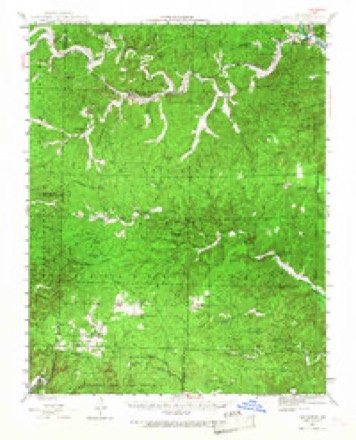
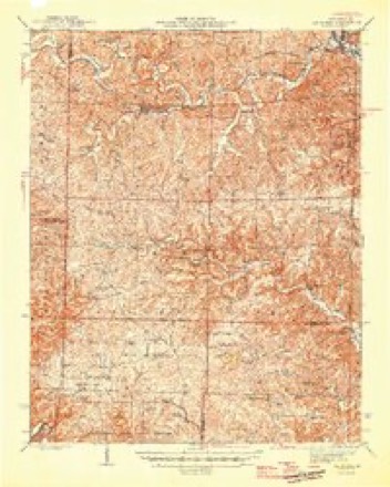
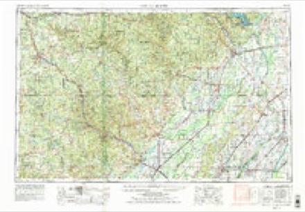
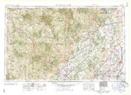
14 topographic sheets cover this place, the earliest surveyed in 1944 and the latest in 1997. It stands in Pike Township. It lies in ZIP code area 63941. It lies near Springfield Hollow. The Survey maps it on the Fremont quadrangle.
Topographic sheets covering this place
8 surveys from 14 printed sheetsMatched by testing this settlement's coordinate against the published boundary of every sheet in the United States Geological Survey's historical collection. Each opens the scanned sheet at the Survey.
- 1944 USGS Van Buren quadrangle1:62500, 2 printings
- 1946 USGS Van Buren quadrangle1:62500, 2 printings
- 1957 USGS Poplar Bluff quadrangle1:250000, 3 printings
- 1959 USGS Poplar Bluff quadrangle1:250000
- 1960 USGS Poplar Bluff quadrangle1:250000
- 1968 USGS Fremont quadrangle1:24000, 2 printings
- 1984 USGS West Plains quadrangle1:100000, 2 printings
- 1997 USGS Fremont quadrangle1:24000
Fires near this place
62 since 1993Regional context, not property-specific evidence. The federal wildfire occurrence database lists 62 fires within 5 miles of Fremont between 1993 and 2020, burning about 2,154 acres in total. None started naturally. 37 were recorded as arson. Distance is straight-line from the map coordinates, so a fire counted here may appear on a neighbouring settlement's page as well.
| Reported cause | Fires |
|---|---|
| Arson/incendiarism | 37 |
| Debris and open burning | 14 |
| Missing data/not specified/undetermined | 8 |
| Power generation/transmission/distribution | 2 |
| Recreation and ceremony | 1 |
The most recent of them, most recent first, with the day each was reported and the service that recorded it.
| Date | Cause | Size | Reported by | Name on the report |
|---|---|---|---|---|
| 24 September 1995 | Missing data/not specified/undetermined | under an acre | Mark Twain National Forest | SECESH |
| 29 August 1999 | Debris and open burning | 15 acres | Mark Twain National Forest | DRY VALLEY |
| 29 August 1995 | Arson/incendiarism | 4.0 acres | Mark Twain National Forest | CRISPY WORM |
| 24 August 1998 | Arson/incendiarism | 2.0 acres | Mark Twain National Forest | BENNETT |
| 17 August 2010 | Arson/incendiarism | 1.5 acres | Mark Twain National Forest | FROSTY TOWER FIRE |
| 9 May 1997 | Arson/incendiarism | 25 acres | Mark Twain National Forest | PINE KNOT AGAIN |
| 8 May 1993 | Debris and open burning | 3.0 acres | Mark Twain National Forest | not named |
| 28 May 2012 | Power generation/transmission/distribution | 1.9 acres | Mark Twain National Forest | HOSKINS |
Settlements close enough to share some of these fires:
Mines and quarries near this place
5 within 5 milesRegional context, not property-specific evidence. The federal mineral resources record lists 5 workings within 5 miles of Fremont: 4 past producers, 1 prospect. None of them still produces. What was taken out: Iron, Manganese. Distance is straight-line from the map coordinates, so a quarry counted here may appear on a neighbouring settlement's page as well.
| Where | Site | Commodity | Status | Recorded |
|---|---|---|---|---|
| Snyder Mine | Iron, Manganese | Past Producer | ||
| Carter Co Milling & Merc Co Bank | Iron | Prospect | ||
| Holland Mine | Iron | Past Producer | ||
| Midco Iron Furnace | Iron | Past Producer | ||
| Unknown | Iron | Past Producer |
Storms near this place
29 since 1994Regional context, not property-specific evidence. The National Weather Service names Fremont in 29 storm reports between 1994 and 2025: 13 hail, 8 thunderstorm wind, 5 flash flood, 2 tornado. No death or injury is recorded in these reports. Each account below is quoted exactly as the forecast office filed it, from the NOAA Storm Events Database, and each date opens the federal record of that event.
| When | Event | Place named | Harm | What the report says |
|---|---|---|---|---|
| March 2025 | Tornado (EF3) | Fremont | $2,000,000 | An EF-3 tornado tore a path of destruction across western and northern parts of Carter County. This tornado started just northeast of Brandsville in Oregon County, then moved northeast clipping the southeast corner of Shannon County and then into Carter County southwest of Fremont. Significant tree damage occurred along Green Mountain Road with hundreds of trees uprooted or snapped, along with at least a couple trees that were debarked. A steel trailer was picked up and lofted several hundred yards. Several homes were completely destroyed along the path from Green Mountain Road and northeast towards the town of Fremont and further north along County Highway Y. The tornado continued northeast and produced additional tree damage along Highway M and Highway D as it moved into far northern Carter County. It then crossed into Reynolds County to the southwest of Grady. The estimated peak wind was 165 mph. The total path length of the tornado was just over 58 miles. |
| March 2008 | Flood | Fremont | $300,000 | Major flooding was responsible for numerous water rescues. Van Buren police and Carter County sheriff personnel rescued 10 to 20 people. Two people were trapped in a camper trailer floating on Highway D near Van Buren. Two other people got in trouble trying to rescue them. Another six people were rescued from Hurricane Creek. Both the rescuers and the victims required additional help when the rescue boat flipped over. At least one or two bridges were washed out in eastern parts of the county. Severe road washouts were reported in western parts of the county. Countywide, at least 17 homes were damaged, and one was destroyed. Eight businesses were damaged. |
| July 2016 | Thunderstorm Wind | Fremont | $40,000 | Numerous trees were blown down across the county, including the Van Buren area. A power line was down in Van Buren. The county sheriff department received 50 to 60 calls regarding downed trees. |
| May 2020 | Thunderstorm Wind | Fremont | $30,000 | Numerous trees were down across the county. People were trapped by falling trees in a campground near Van Buren. Power outages were reported. |
| May 2024 | Thunderstorm Wind | Fremont | $25,000 | A storm survey determined a very large area of enhanced winds downed hundreds of trees, knocking down powerlines, and produced minor damage to a few structures in northwestern Carter County. Peak winds were evaluated at 90 mph. Damage started north of Fremont and fanned out east and south into Van Buren and much of northwestern Carter County. The event appears to be the result of a long track tornadic supercell transitioning to a more linear structure. |
| August 2011 | Thunderstorm Wind | Fremont | $10,000 | Trees were blown down in and around Fremont. |
| May 2020 | Thunderstorm Wind | Fremont | $5,000 | Trees were blown down across J Highway about six miles south of U.S. Highway 60. |
| July 2018 | Thunderstorm Wind | Fremont | $3,000 | A few large trees were blown down. The county emergency manager estimated winds were about 60 mph. |
| April 2010 | Thunderstorm Wind | Fremont | $3,000 | A small area of tree damage measured about 300 by 200 yards. Most of the damaged trees were soft white pines. A few trees were snapped six to eight feet off the ground. The damaged trees were less than one-half mile south of U.S. Highway 60 in the Mark Twain National Forest. |
| November 1998 | Thunderstorm Wind | Fremont | $3,000 | Power lines and a tree were blown down. |
| May 2024 | Tornado (EF0) | Fremont | $1,000 | An eyewitness report spotted a tornado that briefly touched down north of U.S. 60 to the west of County Rd 3277, approximately 5 miles WSW of Van Buren. Drone footage observed some tree damage in this area. |
| May 1994 | Hail | Fremont | $500 | Hail covered the ground north of Fremont and large tree limbs were blown down north of Van Buren. |
| March 2025 | Hail | Fremont | - | Hail slightly larger than golf ball size fell west of Fremont near the Shannon County line. |
| May 2025 | Hail | Fremont | - | Hail to the size of nickels and quarters fell in Fremont. |
| May 2025 | Hail | Fremont | - | EM relayed a fire department report of hail measured to nickel size 3 miles west of Fremont. |
| March 2023 | Flash Flood | Fremont | - | Low water crossings across the county were flooded with one to two feet of water. |
| May 2020 | Flash Flood | Fremont | - | Numerous low-water crossings were flooded across the county. |
| January 2020 | Flash Flood | Fremont | - | Several roads were closed across the county due to water over them, including portions of Routes Z, K, and M. A cocorahs observer several miles northwest of Ellsinore measured 3.64 inches in a 24-hour period. |
| June 2020 | Flash Flood | Fremont | - | Numerous low water crossings were flooded west and southwest of Van Buren. Flash flooding was reported along Pike Creek in the Fremont area. |
| August 2019 | Hail | Fremont | - | Quarter-size hail was mixed in with a lot of pea to half-inch size hail. |
| May 2018 | Hail | Fremont | - | The hail was reported near the intersection of U.S. Highway 60 and Highway Y. |
| April 2007 | Hail | Fremont | - | Golf-ball size hail was reported throughout the community of Freemont. Most of the hail was nickel size. |
| June 1997 | Flash Flood | Fremont | - | A cluster of thunderstorms with torrential rain produced around 2 inches per hour, according to radar estimates near Fremont. Another storm developed near Ellsinore and remained stationary for a couple of hours, producing an estimated 3 to 4 inches of rain, |
| June 1994 | Hail | Fremont | - | The Van Buren Police Department reported 0.75-inch diameter hail covered the ground at Fremont with wind damage to large trees near Van Buren. |
| March 2006 | Hail | Fremont | - | no account filed |
| March 2003 | Hail | Fremont | - | no account filed |
| April 2003 | Hail | Fremont | - | no account filed |
| May 2002 | Hail | Fremont | - | no account filed |
| July 1996 | Hail | Fremont | - | no account filed |
Nearest settlements
The eight closest, with where each one stands in the county. Distances are straight-line, computed from the Geographic Names Information System coordinates.
| Map | Place | Distance | Sheets |
|---|---|---|---|
| House Creek | 7.0 miles | 20 | |
| Eastwood | 8.2 miles | 13 | |
| South Van Buren | 8.4 miles | 13 | |
| Van Buren | 8.5 miles | 13 | |
| Chicopee | 8.7 miles | 13 | |
| Barren (historical) | 11.7 miles | 15 | |
| Chilton | 12.9 miles | 12 | |
| Keeney Corner | 15.4 miles | 17 |
Provenance
This settlement is recorded in the Geographic Names Information System as feature 749997. The sheet list is computed by point-in-boundary test against the United States Geological Survey's historical topographic inventory. Both are works of the United States government and carry no copyright under 17 U.S.C. 105.
Wildfire. Short, Karen C. 2022. Spatial wildfire occurrence data for the United States, 1992-2020 [FPA_FOD_20221014]. 6th Edition. Fort Collins, CO: Forest Service Research Data Archive. https://doi.org/10.2737/RDS-2013-0009.6 Collected with United States Government funding and usable without additional permissions or fees.
Mines and quarries. USGS Mineral Resources Data System (MRDS) https://mrdata.usgs.gov/mrds/ A work of the United States government, no copyright under 17 U.S.C. 105.
Storms. NOAA National Centers for Environmental Information, Storm Events Database https://www.ncei.noaa.gov/stormevents/ A work of the United States government, no copyright under 17 U.S.C. 105. Narratives are quoted verbatim from the National Weather Service report and are not edited or summarised.