 Block
Graham, Missouri
11 topographic sheets cover this place, the earliest surveyed in 1926 and the latest in 1986. It stands in Hughes Township. It lies in ZIP code area 64455. The Survey maps it on the Maitland quadrangle. 147 people lived here at the 2020 count. It stands 951 feet above sea level.
On record in Graham
Buildings and businesses the archive holds for this place. Each opens its own page, with the source record it came from.
On the National Register 1 record
- Simpson's Collegelisted 1978
Population over time
2 figuresGraham fell from 171 to 147 between 2010 and 2020. These are the recorded population figures Wikidata holds for this place, reached through the Geographic Names Information System number this page is keyed on rather than by name, so they belong to this place and not to another of the same name. Most are census counts, but not all are: an early figure may be a founding or settlement estimate, and an estimate published within five years of a census is left out. The change column is computed, and is left blank where more than 20 years separate a figure from the one before it, because a gap that long is not a change between two counts.
| Year | People | Change |
|---|---|---|
| 2010 | 171 | |
| 2020 | 147 | -24 (-14%) |
Topographic sheets covering this place
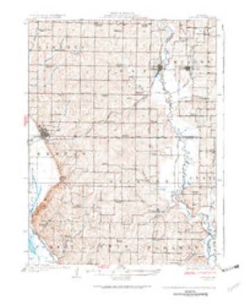
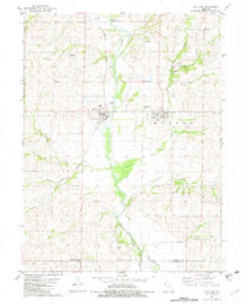
6 surveys from 11 printed sheetsMatched by testing this settlement's coordinate against the published boundary of every sheet in the United States Geological Survey's historical collection. Each opens the scanned sheet at the Survey.
- 1926 USGS Maitland quadrangle1:62500, 3 printings
- 1955 USGS Nebraska City quadrangle1:250000, 3 printings
- 1957 USGS Nebraska City quadrangle1:250000
- 1958 USGS Nebraska City quadrangle1:250000
- 1981 USGS Maitland quadrangle1:24000
- 1986 USGS Falls City quadrangle1:100000, 2 printings
What happened here
An account from the chapter on Hughes township. The inset identifies its exact source book and publication year.
A Tradition
Tradition says that the Elkhorn creek of this township derived its name from the fact of a very large elk having been killed at an early date near the stream, and his horns were placed by the huntsman in the branches of a tree and remained there several years, giving rise to the name of Elkhorn to that part of the country, and later, when naming streams, this creek took its name from these immense horns.
In the county-history sources
2,967 words on this townshipPast and Present of Nodaway County, Missouri, published 1910 names this settlement in its chapter on Hughes Township. These are the passages that mention it, exactly as the scans read.
From an able, interesting, public address given at Graham, July 4, 1879, by Dr. J. W. Morgan, the following extracts are taken, as they contain valu¬ able early settlement facts concerning Hughes township and as such should be preserved in book form :
Passage source: Past and Present of Nodaway County, Missouri, published 1910.
In 1843-4 Andrew Brown bought the Hogan land and built a small mill on the Elkhorn, just east of Brown's spring. This was a great relief, as it was nearby, though even then men and boys rode twelve to fifteen miles on a sack of corn laid across the horse, and returned home the same day, feeling that it was a small job going to mill. Andrew Brown afterward laid out the town of Graham, calling it Jacksonville. In 1858 or 1859 the Missouri Legislature changed the name to Graham, so that the town and postoffice would be the same. In 1845 ^ie Bridgewater mills were built by Moore & Cock, which was indeed a valuable acquisition.
Passage source: Past and Present of Nodaway County, Missouri, published 1910.
The only town within Hughes township is Graham, situated eighteen miles from Maryville, two miles east of the Nodaway river and upon Elkhorn creek. It was laid out in 1856 by Andrew Brown, and originally con¬ sisted of four blocks,, but in 1858 Brown laid out an addition. About the same date Linville addition to Graham was platted by Abraham and Henry Linville. In 1858 there were but two stores, dealers in general merchandise, one kept by Burns & White and the other by McFadden & Daugherty. Brand & Welch conducted a drug store and Dr. W. H. Woodard ran a hotel. At that day, as well as for years before, there was a grist and saw-mill operated by Wilson & Brown. This mill first directed the public's notice toward Graham.
Passage source: Past and Present of Nodaway County, Missouri, published 1910.
Machine-read from a century-old scan, so expect the errors a machine makes: misspelled names, dropped words, stray characters.
Read the whole chapter on Hughes Township - it names this place 5 more 5 times.
Mines and quarries near this place
10 of 11 shownRegional context, not property-specific evidence. The federal mineral resources record lists 11 workings within 5 miles of Graham: 9 past producers, 2 producers. 2 still produce. What was taken out: Sand and Gravel, Construction, Stone, Crushed/Broken. Distance is straight-line from the map coordinates, so a quarry counted here may appear on a neighbouring settlement's page as well.
| Where | Site | Commodity | Status | Recorded |
|---|---|---|---|---|
| Frank Quarry | Stone, Crushed/Broken | Past Producer | ||
| Graham Quarry | Stone, Crushed/Broken | Producer | ||
| Maitland Quarry | Stone, Crushed/Broken | Producer | ||
| Unk | Stone, Crushed/Broken | Past Producer | ||
| Unk | Sand and Gravel, Construction | Past Producer | ||
| Unk | Sand and Gravel, Construction | Past Producer | ||
| Unk | Sand and Gravel, Construction | Past Producer | ||
| Unk | Sand and Gravel, Construction | Past Producer | ||
| Unk | Sand and Gravel, Construction | Past Producer | ||
| Unk | Sand and Gravel, Construction | Past Producer |
Storms near this place
18 since 1993Regional context, not property-specific evidence. The National Weather Service names Graham in 18 storm reports between 1993 and 2023: 7 hail, 7 thunderstorm wind, 3 tornado, 1 flash flood. No death or injury is recorded in these reports. Each account below is quoted exactly as the forecast office filed it, from the NOAA Storm Events Database, and each date opens the federal record of that event.
| When | Event | Place named | Harm | What the report says |
|---|---|---|---|---|
| June 1995 | Thunderstorm Wind | Graham | $2,000 | Severe thunderstorms moved through the county with wind gusts up to 60 mph. Trees were knocked down south of Graham, partially blocking Route Y. |
| May 2018 | Thunderstorm Wind | Graham | - | Four power poles and farm equipment was tipped over. This was reported at HWY H south of HWY A near Graham. |
| July 2015 | Thunderstorm Wind | Graham | - | On a metal building system, the roof was pulled up from the walls. |
| September 2014 | Tornado (EF0) | Graham | - | This is a continuation of the tornado that formed west of Maitland in Holt County. The tornado moved over the city of Graham, but only caused minor tree and power line damage. |
| June 2014 | Thunderstorm Wind | Graham | - | Power lines down along route A. |
| August 2007 | Thunderstorm Wind | Graham | - | Eight to ten inch tree limbs down. |
| June 2005 | Flash Flood | Graham | - | Up to 5 inches of water flowing over Route A. |
| May 2004 | Tornado (F0) | Graham | - | Brief tornado touchdown documented by storm chasers. |
| May 2001 | Tornado (F0) | Graham | - | Trained spotter reported brief tornado touchdown to the south of Graham. There were no injuries or damage reported. |
| July 1999 | Thunderstorm Wind | Graham | - | Several trees were reported downed. |
| June 1998 | Hail | Graham | - | Dime-size hail was reported by a storm spotter 3.5 miles south of Graham. |
| April 2023 | Hail | Graham | - | no account filed |
| May 2014 | Hail | Graham | - | no account filed |
| July 2003 | Hail | Graham | - | no account filed |
| July 2003 | Hail | Graham | - | no account filed |
| July 2002 | Thunderstorm Wind | Graham | - | no account filed |
| May 2001 | Hail | Graham | - | no account filed |
| September 1993 | Hail | Graham | - | no account filed |
Nearest settlements
The eight closest, with where each one stands in the county. Distances are straight-line, computed from the Geographic Names Information System coordinates.
| Map | Place | Distance | Sheets |
|---|---|---|---|
| Skidmore | 6.5 miles | 14 | |
| Whitecloud | 7.4 miles | 12 | |
| Pumpkin Center | 9.0 miles | 12 | |
| Bell Grove | 9.6 miles | 11 | |
| Barnard | 11.4 miles | 12 | |
| Arkoe | 11.8 miles | 11 | |
| Quitman | 12.1 miles | 14 | |
| Maryville | 13.3 miles | 11 |
Elsewhere
Matched on this settlement's Geographic Names Information System number rather than its name, so it cannot be a different place of the same name in another state.
| Wikipedia article on Graham | An encyclopaedic summary. Its text is share-alike, so it is linked here rather than copied. |
| Wikidata item Q958127 | The structured record the population and elevation above come from. Public domain (CC0). |
Provenance
This settlement is recorded in the Geographic Names Information System as feature 730107. The sheet list is computed by point-in-boundary test against the United States Geological Survey's historical topographic inventory. Both are works of the United States government and carry no copyright under 17 U.S.C. 105.
Mines and quarries. USGS Mineral Resources Data System (MRDS) https://mrdata.usgs.gov/mrds/ A work of the United States government, no copyright under 17 U.S.C. 105.
Storms. NOAA National Centers for Environmental Information, Storm Events Database https://www.ncei.noaa.gov/stormevents/ A work of the United States government, no copyright under 17 U.S.C. 105. Narratives are quoted verbatim from the National Weather Service report and are not edited or summarised.