 Block
Marshall, Missouri
18 topographic sheets cover this place, the earliest surveyed in 1890 and the latest in 1982. It stands in Marshall Township. It lies in ZIP code area 65340. The Survey maps it on the Marshall South quadrangle. 13,806 people lived here at the 2020 count. It stands 764 feet above sea level.
Research this city
On record in Marshall
Buildings and businesses the archive holds for this place. Each opens its own page, with the source record it came from.
On the National Register 10 records
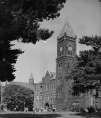 Baity Halllisted 1986
 Buckner Houselisted 1984
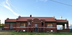 Chicago and Alton Depotlisted 1979
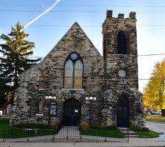 First Presbyterian Churchlisted 1977
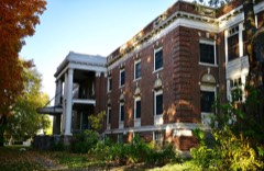 Fitzgibbon Hospitallisted 2012
 Saline County Courthouselisted 1977
- Free Will Baptist Church of Pennytownlisted 1988
- Mt. Carmel Historic Districtlisted 2009
- Van Meter State Park Combination Buildinglisted 1985
- Van Meter State Park Shelter Buildinglisted 1985
Population over time
2 figuresMarshall grew from 13,065 to 13,806 between 2010 and 2020. These are the recorded population figures Wikidata holds for this place, reached through the Geographic Names Information System number this page is keyed on rather than by name, so they belong to this place and not to another of the same name. Most are census counts, but not all are: an early figure may be a founding or settlement estimate, and an estimate published within five years of a census is left out. The change column is computed, and is left blank where more than 20 years separate a figure from the one before it, because a gap that long is not a change between two counts.
| Year | People | Change |
|---|---|---|
| 2010 | 13,065 | |
| 2020 | 13,806 | +741 (+6%) |
Topographic sheets covering this place
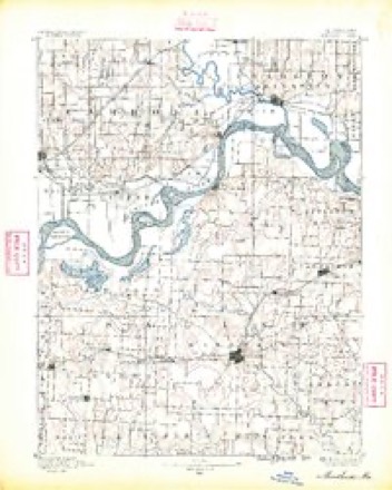
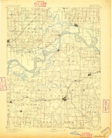
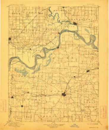
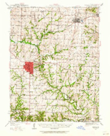
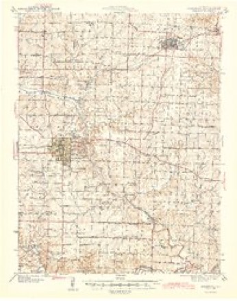
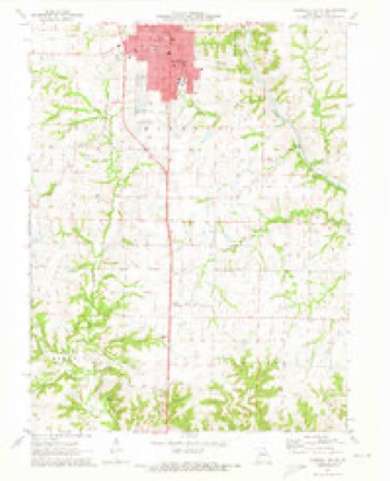
11 surveys from 18 printed sheetsMatched by testing this settlement's coordinate against the published boundary of every sheet in the United States Geological Survey's historical collection. Each opens the scanned sheet at the Survey.
- 1890 USGS Marshall quadrangle1:125000
- 1892 USGS Marshall quadrangle1:125000
- 1901 USGS Marshall quadrangle1:125000, 5 printings
- 1940 USGS Marshall quadrangle1:62500
- 1944 USGS Marshall quadrangle1:62500, 2 printings
- 1953 USGS Moberly quadrangle1:250000
- 1954 USGS Moberly quadrangle1:250000, 3 printings
- 1957 USGS Moberly quadrangle1:250000
- 1960 USGS Moberly quadrangle1:250000
- 1971 USGS Marshall South quadrangle1:24000
- 1982 USGS Marshall quadrangle1:100000




In the county-history sources
3,425 words on this townshipHistory of Saline County, Missouri, Carefully Written and Compiled from the Most Authentic Official and Private Sources ... with a Condensed History of Missouri; the State Constitution; a Military Record of Its Volunteers in Either Army of the Great Civil War ... Biographical Sketches of Prominent Men .., published 1881 names this settlement in its chapter on Marshall Township. These are the passages that mention it, exactly as the scans read.
The first physicians were Drs. Lawton and Hicks. Lawton went to Booneville, and from thence to St. Louis, where he died. Hicks died in Marshall, as has been often stated, in 1849, of cholera. The first attorneys were Ramage, Trigg, McNutt, Shepherd, and Bryant.
The first cemetery used was the burying ground of Jerry Odell, north and east of the main part of town. In about 1857, Col. Geo. W. Allen established one, now to be seen between the Chicago & Alton railroad depot and the business portion of town. This was used during the war, and here the soldiers who died at Marshall were buried. Near this is the place where Dr. Benson and Flannigan were shot. This ground is fast being occupied. Houses are being built and gardens are growing over the dust of those buried there, and doubtless in fifty years from this date, when the next history of Saline county is written, the historian shall write of the mammoth business enterprises carried on and the gigantic business houses established upon the site of the second burying ground of Marshall.
Since the war, Marshall has greatly^ improved, especially since the completion of the Chicago and Alton railroad, in 1868. It now has a population of over 3,000. It has a fine public school building, a good colored school building, and has an excellent corps of teachers. Its churches are mentioned elsewhere. Two large steam flouring mills, a grain elevator, and a good variety of business houses, add greatly to the prosperity of the place.
Machine-read from a century-old scan, so expect the errors a machine makes: misspelled names, dropped words, stray characters.
Read the whole chapter on Marshall Township - it names this place 9 more 9 times.
Fires near this place
1 since 2011Regional context, not property-specific evidence. The federal wildfire occurrence database lists 1 fire within 5 miles of Marshall in 2011, burning about 5 acres in total. None started naturally. None was recorded as arson. Distance is straight-line from the map coordinates, so a fire counted here may appear on a neighbouring settlement's page as well.
| Reported cause | Fires |
|---|---|
| Missing data/not specified/undetermined | 1 |
The most recent of them, most recent first, with the day each was reported and the service that recorded it.
| Date | Cause | Size | Reported by | Name on the report |
|---|---|---|---|---|
| 13 April 2011 | Missing data/not specified/undetermined | 5.0 acres | Missouri Department of Conservation | not named |
Settlements close enough to share some of these fires:
Mines and quarries near this place
2 within 5 milesRegional context, not property-specific evidence. The federal mineral resources record lists 2 workings within 5 miles of Marshall: 2 past producers. None of them still produces. What was taken out: Stone, Crushed/Broken, Sand and Gravel, Construction. Distance is straight-line from the map coordinates, so a quarry counted here may appear on a neighbouring settlement's page as well.
| Where | Site | Commodity | Status | Recorded |
|---|---|---|---|---|
| Branham Quarry | Stone, Crushed/Broken | Past Producer | ||
| Unknown - S+G | Sand and Gravel, Construction | Past Producer |
Storms near this place
60 of 79 shownRegional context, not property-specific evidence. The National Weather Service names Marshall in 79 storm reports between 1993 and 2025: 44 hail, 25 thunderstorm wind, 6 flash flood, 3 tornado. No death or injury is recorded in these reports. Each account below is quoted exactly as the forecast office filed it, from the NOAA Storm Events Database, and each date opens the federal record of that event.
| When | Event | Place named | Harm | What the report says |
|---|---|---|---|---|
| August 2004 | Flash Flood | Marshall | $300,000 | 4 to 6 inches of rain produced widespread flash flooding in the Marshall area. Several water rescues and several homes and businesses suffered water damage. Damage to roads and bridges as well. Flowing water was 3 to 4 feet deep on Route YY. |
| March 2006 | Tornado (F3) | Marshall | $75,000 | Tornado touched down 6 miles south of Marshall at 2028 CST. It traveled east-northeast and for a time paralleled another tornado to the north before the first one occluded. Little damage was noted along the track until it neared the Howard county line. The tornado merged with another tornado near the Missouri River and quickly produced F3 damage to a farmstead. The tornado then entered Howard county 4 miles north of Arrow Rock at 2046 CST. |
| June 1994 | Tornado (F0) | Marshall | $50,000 | A tornado touched down briefly at a farm and tore part of the roof off three machine sheds. One other building was slightly damaged and two silos were bent or dented. A roll of field tile was lifted from its original position and tossed 100 yards to the west, while the storm was moving southeast. |
| June 1999 | Thunderstorm Wind | Marshall | $25,000 | Power lines and trees were downed in the town of Marshall. |
| May 2014 | Tornado (EF1) | Marshall | $10,000 | The third and final tornado from this survey formed just north of Marshall, Missouri. While the tornado was very wide, it did not damage any structures that would suggest it was stronger than EF-1. Generally it impacted trees and power lines in the rural areas of Saline County and a few farm structures. The tornado dissipated just east of Marshall, Missouri about 20 minutes after is formed. |
| April 2011 | Thunderstorm Wind | Marshall | $10,000 | A tree was reported to have blown onto a car on Lincoln Avenue. A grain bin was also reported damaged. Thunderstorm wind gusts were estimated up to 70 mph. |
| June 1994 | Thunderstorm Wind | Marshall | $5,000 | Large trees and power lines were knocked down on the north side of town. |
| April 1993 | Hail | Marshall | $5,000 | no account filed |
| July 2006 | Thunderstorm Wind | Marshall | $1,000 | Trees and power lines down. |
| September 2001 | Thunderstorm Wind | Marshall | $1,000 | Numerous trees and power lines reported down. |
| June 2025 | Thunderstorm Wind | Marshall | - | Downed wires and power outages near County Road 111 near Marshall. |
| June 2025 | Thunderstorm Wind | Marshall | - | Social media reports and photos of trees down in Marshall. |
| August 2024 | Thunderstorm Wind | Marshall | - | Social media report and photos of downed trees and limbs from thunderstorm outflow in Marshall. Time based on social media report and confirmed from radar. |
| March 2018 | Flood | Marshall | - | Part of a railroad track was washed out in Marshall. |
| July 2017 | Thunderstorm Wind | Marshall | - | A large tree was down near Marshall. |
| May 2016 | Hail | Marshall | - | This report was gathered via social media. The picture on Twitter showed a hail stone nearly one-half the size of a cassette tape. |
| May 2016 | Thunderstorm Wind | Marshall | - | A light pole was reported down as a result of strong thunderstorm wind gusts. |
| June 2015 | Thunderstorm Wind | Marshall | - | AWOS station in Marshall reported a 61 mph wind gust. |
| May 2014 | Thunderstorm Wind | Marshall | - | Several large trees and power lines down along Highway 240 between Marshall and Slater. Likely caused by rear flank downdraft. |
| May 2014 | Thunderstorm Wind | Marshall | - | A storm chaser recorded a 113 mph wind associated with the rear flank downdraft of the tornadic storm near Marshall. |
| May 2014 | Thunderstorm Wind | Marshall | - | Roof damage with shingles off and multiple large trees down or uprooted 5 miles east of Marshall. Likely caused by rear flank downdraft. |
| July 2014 | Thunderstorm Wind | Marshall | - | Power lines were reported down near Marshall, Missouri. |
| April 2011 | Thunderstorm Wind | Marshall | - | Thunderstorm wind gust was measured at 70 mph. |
| June 2009 | Thunderstorm Wind | Marshall | - | A large tree was reported down and blocking Highway 41. |
| July 2008 | Flash Flood | Marshall | - | Water was reported flowing over the road, northeast of the intersection of Highway 65 and Highway H, and Highway 65 near Malta Bend. |
| January 2005 | Flash Flood | Marshall | - | Water over Highway 65 due to heavy rains. |
| June 2005 | Flash Flood | Marshall | - | Low lying spots on Highway 65 under water. |
| August 2005 | Flash Flood | Marshall | - | 3 to 5 inches of rain across the area produced flash flooding on several roads. |
| July 2004 | Thunderstorm Wind | Marshall | - | Large tree limbs down with power outages reported. |
| May 2003 | Flash Flood | Marshall | - | Flooding on various roads in county. |
| January 1999 | Hail | Marshall | - | Dime-size hail in Marshall |
| June 1998 | Thunderstorm Wind | Marshall | - | The Saline County Sheriff's Office reported a large tree blown down across a railroad track 10 miles north of Marshall. |
| June 1998 | Thunderstorm Wind | Marshall | - | The Marshall Police department reported numerous trees and power lines down as a result of the thunderstorm winds. Marshall PD estimated wind gusts to 60 MPH while a local radio station reported wind gusts to 53 MPH in Marshall. |
| June 1995 | Thunderstorm Wind | Marshall | - | The sheriff's office in Marshall reported a wind gust to 60 mph. |
| July 1995 | Thunderstorm Wind | Marshall | - | Thunderstorm winds gusted to 65 mph in Marshall. |
| April 2016 | Hail | Marshall | - | no account filed |
| April 2016 | Hail | Marshall | - | no account filed |
| May 2016 | Hail | Marshall | - | no account filed |
| May 2016 | Hail | Marshall | - | no account filed |
| May 2016 | Hail | Marshall | - | no account filed |
| June 2015 | Hail | Marshall | - | no account filed |
| June 2015 | Hail | Marshall | - | no account filed |
| June 2015 | Hail | Marshall | - | no account filed |
| June 2015 | Hail | Marshall | - | no account filed |
| June 2015 | Hail | Marshall | - | no account filed |
| June 2015 | Hail | Marshall | - | no account filed |
| June 2015 | Hail | Marshall | - | no account filed |
| June 2015 | Hail | Marshall | - | no account filed |
| April 2015 | Hail | Marshall | - | no account filed |
| September 2014 | Hail | Marshall | - | no account filed |
| March 2014 | Hail | Marshall | - | no account filed |
| April 2014 | Hail | Marshall | - | no account filed |
| June 2009 | Hail | Marshall | - | no account filed |
| May 2005 | Hail | Marshall | - | no account filed |
| May 2004 | Hail | Marshall | - | no account filed |
| August 2004 | Hail | Marshall | - | no account filed |
| August 2004 | Hail | Marshall | - | no account filed |
| August 2004 | Hail | Marshall | - | no account filed |
| April 2003 | Hail | Marshall | - | no account filed |
| May 2003 | Hail | Marshall | - | no account filed |
Nearest settlements
The eight closest, with where each one stands in the county. Distances are straight-line, computed from the Geographic Names Information System coordinates.
| Map | Place | Distance | Sheets |
|---|---|---|---|
| Montague Hill | 2.4 miles | 19 | |
| Wilton Springs | 5.2 miles | 18 | |
| Shackleford | 5.3 miles | 16 | |
| Stanhope | 5.6 miles | 16 | |
| Norton | 6.0 miles | 19 | |
| Blosser (historical) | 6.7 miles | 16 | |
| Orearville | 7.3 miles | 18 | |
| Fairville | 7.6 miles | 19 |
Elsewhere
Matched on this settlement's Geographic Names Information System number rather than its name, so it cannot be a different place of the same name in another state.
| Wikipedia article on Marshall | An encyclopaedic summary. Its text is share-alike, so it is linked here rather than copied. |
| Wikidata item Q954882 | The structured record the population and elevation above come from. Public domain (CC0). |
Provenance
This settlement is recorded in the Geographic Names Information System as feature 721900. The sheet list is computed by point-in-boundary test against the United States Geological Survey's historical topographic inventory. Both are works of the United States government and carry no copyright under 17 U.S.C. 105.
Wildfire. Short, Karen C. 2022. Spatial wildfire occurrence data for the United States, 1992-2020 [FPA_FOD_20221014]. 6th Edition. Fort Collins, CO: Forest Service Research Data Archive. https://doi.org/10.2737/RDS-2013-0009.6 Collected with United States Government funding and usable without additional permissions or fees.
Mines and quarries. USGS Mineral Resources Data System (MRDS) https://mrdata.usgs.gov/mrds/ A work of the United States government, no copyright under 17 U.S.C. 105.
Storms. NOAA National Centers for Environmental Information, Storm Events Database https://www.ncei.noaa.gov/stormevents/ A work of the United States government, no copyright under 17 U.S.C. 105. Narratives are quoted verbatim from the National Weather Service report and are not edited or summarised.