 Block
Nevada, Missouri
21 topographic sheets cover this place, the earliest surveyed in 1886 and the latest in 1991. It stands in Center Township. It lies in ZIP code area 64772. It stands on Willow Branch. The Survey maps it on the Nevada quadrangle. 8,212 people lived here at the 2020 count. It stands 873 feet above sea level.
Research this city
On record in Nevada
Buildings and businesses the archive holds for this place. Each opens its own page, with the source record it came from.
On the National Register 3 records
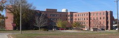 Infirmary Building, Missouri State Hospital Number 3listed 2005
 Vernon County Courthouselisted 1997
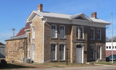 Vernon County Jail, Sheriff's House and Officelisted 1977
Population over time
2 figuresNevada fell from 8,386 to 8,212 between 2010 and 2020. These are the recorded population figures Wikidata holds for this place, reached through the Geographic Names Information System number this page is keyed on rather than by name, so they belong to this place and not to another of the same name. Most are census counts, but not all are: an early figure may be a founding or settlement estimate, and an estimate published within five years of a census is left out. The change column is computed, and is left blank where more than 20 years separate a figure from the one before it, because a gap that long is not a change between two counts.
| Year | People | Change |
|---|---|---|
| 2010 | 8,386 | |
| 2020 | 8,212 | -174 (-2%) |
Topographic sheets covering this place
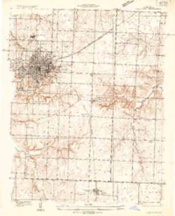
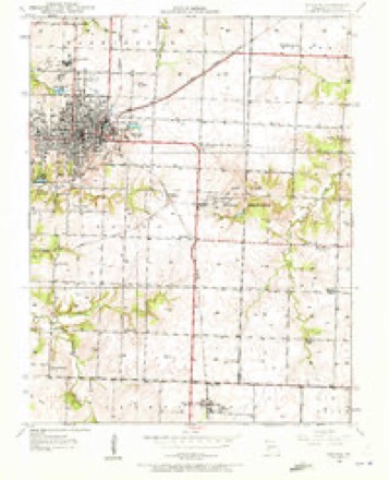
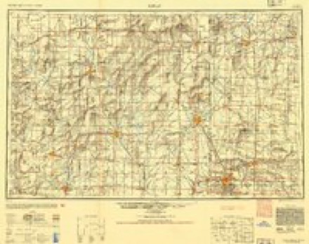
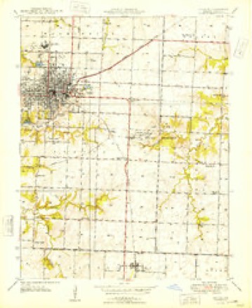
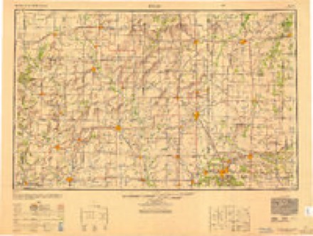
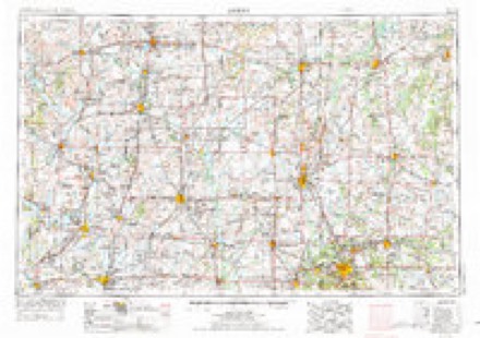
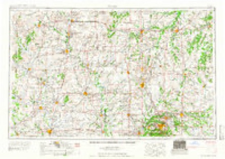
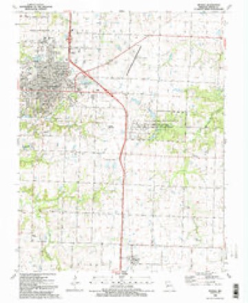
13 surveys from 21 printed sheetsMatched by testing this settlement's coordinate against the published boundary of every sheet in the United States Geological Survey's historical collection. Each opens the scanned sheet at the Survey.
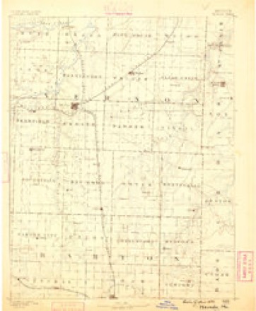
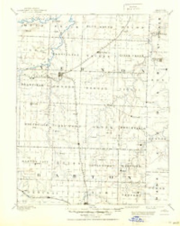
- 1886 USGS Nevada quadrangle1:125000
- 1894 USGS Nevada quadrangle1:125000, 5 printings
- 1933 USGS Camp Clark quadrangle1:24000
- 1933 USGS Nevada quadrangle1:24000, 2 printings
- 1947 USGS Joplin quadrangle1:250000
- 1948 USGS Nevada quadrangle1:24000
- 1949 USGS Joplin quadrangle1:250000
- 1954 USGS Joplin quadrangle1:250000, 3 printings
- 1958 USGS Joplin quadrangle1:250000
- 1959 USGS Joplin quadrangle1:250000
- 1986 USGS Nevada quadrangle1:100000
- 1991 USGS Nevada quadrangle1:100000
- 1991 USGS Nevada quadrangle1:24000, 2 printings
In the county-history sources
1,488 words on this townshipHistory of Vernon County, Missouri : Past and Present, Including an Account of the Cities, Towns and Villages of the County, published 1911 names this settlement in its chapter on Center Township. These are the passages that mention it, exactly as the scans read.
South of Nevada, and almost adjoining the town, most valu¬ able quarries of blue sandstone have been opened. The stone is well adapted for ornamental work of various kinds and much of it is in use in the asylum and in other buildings. It is but reasonable to conclude that this stone is to be found else¬ where, since the general variety to which it belongs (hydraulic sandstone) is frequently to be seen. There are numerous ex¬ posures of sandstone along the streams, notably on the western border of Nevada, on the Ft. Scott road.
Passage source: History of Vernon County, Missouri : Past and Present, Including an Account of the Cities, Towns and Villages of the County, published 1911.
Coal lias been found in the northwest quarter of the town¬ ship. The belief that natural gas exists under the surface near Nevada is not sufficiently general and strong as yet to induce speculative capitalists to bore for it. The greater portion of the coal consumed in Nevada is brought from other parts of the county. Near Nevada a gravel bed exists as a depth of sixteen feet, and that in this bed logs and sticks have been found in digging wells. South of Nevada, on Birch branch, is a good mineral spring.
Passage source: History of Vernon County, Missouri : Past and Present, Including an Account of the Cities, Towns and Villages of the County, published 1911.
The first actual settlers in Center township were John Hale and Jesse Anderson, who came directly from Pulaski county here in the fall of 1840. Hale located about three miles west and north of where is now the public square in Nevada, and Anderson built his cabin a little east of the southwest corner of the fair grounds. At the same time a man named Swearingen settled on the asylum grounds, his house standing a short dis¬ tance west of the site of the main building; he was from Inde¬ pendence, Jackson county. In a year or two Swearingen sold
Passage source: History of Vernon County, Missouri : Past and Present, Including an Account of the Cities, Towns and Villages of the County, published 1911.
Machine-read from a century-old scan, so expect the errors a machine makes: misspelled names, dropped words, stray characters.
Read the whole chapter on Center Township - it names this place 6 more 6 times.
Fires near this place
11 since 2003Regional context, not property-specific evidence. The federal wildfire occurrence database lists 11 fires within 5 miles of Nevada between 2003 and 2020, burning about 334 acres in total. None started naturally. 1 was recorded as arson. Distance is straight-line from the map coordinates, so a fire counted here may appear on a neighbouring settlement's page as well.
| Reported cause | Fires |
|---|---|
| Missing data/not specified/undetermined | 8 |
| Debris and open burning | 2 |
| Arson/incendiarism | 1 |
The most recent of them, most recent first, with the day each was reported and the service that recorded it.
| Date | Cause | Size | Reported by | Name on the report |
|---|---|---|---|---|
| 21 August 2012 | Missing data/not specified/undetermined | 118 acres | Missouri Department of Conservation | DEERFIELD |
| 20 August 2003 | Debris and open burning | 10 acres | Missouri State Fire Marshal's Office | not named |
| 4 July 2003 | Arson/incendiarism | 1.0 acres | Missouri State Fire Marshal's Office | not named |
| 21 July 2003 | Missing data/not specified/undetermined | under an acre | Missouri State Fire Marshal's Office | not named |
| 30 June 2003 | Missing data/not specified/undetermined | under an acre | Missouri State Fire Marshal's Office | not named |
| 27 May 2003 | Missing data/not specified/undetermined | under an acre | Missouri State Fire Marshal's Office | not named |
| 16 March 2015 | Debris and open burning | 200 acres | Missouri Department of Conservation | 122116-10867-03162015-1640 |
| 11 March 2015 | Missing data/not specified/undetermined | 1.0 acres | Missouri Department of Conservation | 122113-10867-03112015-1425 |
Settlements close enough to share some of these fires:
Mines and quarries near this place
5 within 5 milesRegional context, not property-specific evidence. The federal mineral resources record lists 5 workings within 5 miles of Nevada: 4 past producers, 1 producer. 1 still produces. What was taken out: Stone, Crushed/Broken, Clay, Lead. Distance is straight-line from the map coordinates, so a quarry counted here may appear on a neighbouring settlement's page as well.
| Where | Site | Commodity | Status | Recorded |
|---|---|---|---|---|
| Prairie Diggings | Lead | Past Producer | ||
| Unknown - Clay & Shale | Clay | Past Producer | ||
| Gilfillian Quarry | Stone, Crushed/Broken | Past Producer | ||
| Nevada Limestone Quarry | Stone, Crushed/Broken | Past Producer | ||
| White Rock Quarry and Mill | Stone, Crushed/Broken | Producer |
Storms near this place
60 of 142 shownRegional context, not property-specific evidence. The National Weather Service names Nevada in 142 storm reports between 1994 and 2026: 66 thunderstorm wind, 47 hail, 17 flash flood, 6 heavy rain. The reports record 9 injuries. Each account below is quoted exactly as the forecast office filed it, from the NOAA Storm Events Database, and each date opens the federal record of that event.
| When | Event | Place named | Harm | What the report says |
|---|---|---|---|---|
| May 1995 | Tornado (F3) | Nevada | 9 hurt, $7,000,000 | A tornado destroyed homes and buildings to the west of Nevada, then heavily damaged brick buildings within the city. The tornado weakened as it tracked east northeast towards Dederick, but was still strong enough to uproot trees and destroy outbuildings. Witnesses reported extremely heavy rain with the tornadoes passage. The 3M industrial plant on the east side of Nevada recorded an 107 mph wind with the event. |
| June 1999 | Thunderstorm Wind | Nevada | $75,000 | no account filed |
| July 2015 | Thunderstorm Wind | Nevada | $50,000 | A large tree fell into a house near Quail Road and Highway BB. The tree fell through the living room trapping a person in the home. |
| April 1994 | Thunderstorm Wind | Nevada | $50,000 | A warehouse at a furniture store was nearly demolished with an estimated $30,000 worth of damage. Numerous trees were also blown down along Highway 54. |
| June 1998 | Thunderstorm Wind | Nevada | $50,000 | no account filed |
| July 2015 | Thunderstorm Wind | Nevada | $25,000 | A large tree feel through a home near Quail Road and Highway BB about 2 miles south of Nevada. |
| June 2001 | Thunderstorm Wind | Nevada | $25,000 | no account filed |
| September 2010 | Flash Flood | Nevada | $20,000 | A low water bridge was washed out at the intersection of Tally Bend Road and County Road 1700. |
| May 2002 | Lightning | Nevada | $18,000 | no account filed |
| June 2019 | Thunderstorm Wind | Nevada | $12,000 | Trees and power lines were reported down. |
| June 2025 | Thunderstorm Wind | Nevada | $10,000 | Multiple trees down and roads blocked in Nevada, Missouri. |
| June 2017 | Thunderstorm Wind | Nevada | $10,000 | A large tree was blown down on west Walnut Street in Nevada. Another tree fell on a house. |
| July 2011 | Thunderstorm Wind | Nevada | $10,000 | Several power lines reported down on Cedar Street as the result of large, falling tree limbs. |
| September 2010 | Thunderstorm Wind | Nevada | $10,000 | Several large tree limbs were reported down on power lines which caused temporary outages on the northwest side of the city. |
| June 2008 | Thunderstorm Wind | Nevada | $10,000 | Thunderstorm wind gusts knocked down several trees and power lines near Nevada. |
| June 2008 | Thunderstorm Wind | Nevada | $10,000 | Numerous power lines and trees were blown down from thunderstorm wind gusts. |
| June 1999 | Thunderstorm Wind | Nevada | $10,000 | no account filed |
| May 2007 | Thunderstorm Wind | Nevada | $8,000 | Severe thunderstorm wind gusts damaged the roof of a frame home. |
| August 2015 | Thunderstorm Wind | Nevada | $5,000 | Several large tree limbs and power lines were blown down across the northwestern portions of the city of Nevada. |
| April 2012 | Flash Flood | Nevada | $5,000 | A section of Panama Road was washed out. |
| September 2012 | Thunderstorm Wind | Nevada | $5,000 | A tree fell on a house. |
| September 2012 | Thunderstorm Wind | Nevada | $5,000 | A tree fell on a house. |
| June 2008 | Thunderstorm Wind | Nevada | $5,000 | Several trees and power lines were downed from thunderstorm wind gusts. |
| June 1994 | Thunderstorm Wind | Nevada | $5,000 | The Nevada Police Department reported 60 MPH wind gusts with power outages and trees down. |
| June 1994 | Thunderstorm Wind | Nevada | $5,000 | The Eldorado Springs Police Department reported large trees down with wind gusts estimated at 60 mph. Skywarn spotters also reported windows blown out of house. |
| July 2002 | Thunderstorm Wind | Nevada | $5,000 | no account filed |
| May 1999 | Thunderstorm Wind | Nevada | $5,000 | no account filed |
| June 1998 | Thunderstorm Wind | Nevada | $5,000 | no account filed |
| June 1997 | Thunderstorm Wind | Nevada | $5,000 | no account filed |
| August 1997 | Thunderstorm Wind | Nevada | $3,000 | Thunderstorm winds damaged two hangers at the Nevada Municipal Airport. Parts of a metal door were tore off of one and walls of another were damaged. |
| February 2012 | Thunderstorm Wind | Nevada | $2,000 | A Subway restaurant suffered minor damage in Nevada. |
| March 2017 | Thunderstorm Wind | Nevada | $1,000 | A tracker trailer was blown off Interstate 49 near the Bellamy exit south of Nevada. |
| October 2017 | Thunderstorm Wind | Nevada | $1,000 | A power line was blown down in Nevada. A pick up truck pulling a twenty foot trailer was blown off the road into the median about two miles south of Nevada. |
| July 2014 | Thunderstorm Wind | Nevada | $1,000 | A highway sign was blown over and blocked Highway 54. |
| May 2012 | Thunderstorm Wind | Nevada | $1,000 | A large elm tree and power line were blown down. |
| July 2011 | Thunderstorm Wind | Nevada | $1,000 | A tree and powerline was downed. |
| August 2009 | Thunderstorm Wind | Nevada | $1,000 | Large limbs and power lines were blown down. |
| April 1994 | Hail | Nevada | $500 | no account filed |
| April 1994 | Hail | Nevada | $50 | no account filed |
| April 1994 | Hail | Nevada | $50 | no account filed |
| April 2026 | Hail | Nevada | - | Hail up to ping pong balls in size were reported. |
| April 2026 | Hail | Nevada | - | Hail to the size of hen eggs was reported. |
| April 2025 | Hail | Nevada | - | Penny sized hail was reported. |
| May 2025 | Flash Flood | Nevada | - | Reports of flooding in Nevada. |
| May 2025 | Heavy Rain | Nevada | - | Report of 4.82 inches of rainfall that occurred in the last 6 hours. |
| May 2025 | Heavy Rain | Nevada | - | CoCoRaHS station measured a 24 hour rainfall total of 4.84 inches. |
| May 2025 | Heavy Rain | Nevada | - | A Co-op observer measured a 24 hour rainfall total of 4.70 inches. |
| July 2025 | Thunderstorm Wind | Nevada | - | Wind gust measuring 60 mph wind were recorded on a home weather station. Hail up to penny size was also reported. |
| July 2025 | Thunderstorm Wind | Nevada | - | Several large 2-3 inch diameter branches were reported down. |
| April 2024 | Flood | Nevada | - | Heavy rainfall allowed the Marmaton River to impact Highway 54 for a time closing lanes of traffic. |
| August 2024 | Heavy Rain | Nevada | - | The Mesonet station FW7458 in Nevada measured 2.07 inches of storm total rainfall. |
| May 2023 | Hail | Nevada | - | Half dollar sized hail was reported in a mostly rural area. |
| May 2023 | Hail | Nevada | - | Golf ball sized hail was reported in a mainly rural area. |
| May 2023 | Hail | Nevada | - | Penny sized hail was reported. |
| July 2023 | Thunderstorm Wind | Nevada | - | The Mesonet station at Monett recorded a wind gust of 60 mph. |
| July 2023 | Thunderstorm Wind | Nevada | - | The AWOS at the Nevada airport recorded a 63 mph wind gust. |
| July 2023 | Thunderstorm Wind | Nevada | - | The Mesonet station at the Nevada City Hall recorded a 74 mph wind gust. |
| April 2022 | Hail | Nevada | - | Quarter sized hail was reported via social media. |
| May 2020 | Thunderstorm Wind | Nevada | - | A tree was reported down over the road near the interchange of 1400 and Rebel Roads. |
| May 2019 | Heavy Rain | Nevada | - | A co-op observer reported a 24-hr rainfall accumulation of 4.37 inches. |
Nearest settlements
The eight closest, with where each one stands in the county. Distances are straight-line, computed from the Geographic Names Information System coordinates.
| Map | Place | Distance | Sheets |
|---|---|---|---|
| Nassau Junction | 2.2 miles | 21 | |
| Dean Ford | 3.4 miles | 20 | |
| Hong | 5.1 miles | 20 | |
| Ellis | 5.1 miles | 21 | |
| Bristow | 5.3 miles | 21 | |
| Milo | 6.3 miles | 21 | |
| Temple (historical) | 6.5 miles | 20 | |
| Moundville | 7.3 miles | 21 |
Elsewhere
Matched on this settlement's Geographic Names Information System number rather than its name, so it cannot be a different place of the same name in another state.
| Wikipedia article on Nevada | An encyclopaedic summary. Its text is share-alike, so it is linked here rather than copied. |
| Wikidata item Q959584 | The structured record the population and elevation above come from. Public domain (CC0). |
Provenance
This settlement is recorded in the Geographic Names Information System as feature 729934. The sheet list is computed by point-in-boundary test against the United States Geological Survey's historical topographic inventory. Both are works of the United States government and carry no copyright under 17 U.S.C. 105.
Wildfire. Short, Karen C. 2022. Spatial wildfire occurrence data for the United States, 1992-2020 [FPA_FOD_20221014]. 6th Edition. Fort Collins, CO: Forest Service Research Data Archive. https://doi.org/10.2737/RDS-2013-0009.6 Collected with United States Government funding and usable without additional permissions or fees.
Mines and quarries. USGS Mineral Resources Data System (MRDS) https://mrdata.usgs.gov/mrds/ A work of the United States government, no copyright under 17 U.S.C. 105.
Storms. NOAA National Centers for Environmental Information, Storm Events Database https://www.ncei.noaa.gov/stormevents/ A work of the United States government, no copyright under 17 U.S.C. 105. Narratives are quoted verbatim from the National Weather Service report and are not edited or summarised.